Skip to content
  • Categories
  • Recent
  • Popular
  • Support
  • MyRoute-app
Collapse
Brand Logo

MRA Community Forum

  1. Home
  2. The MyRoute-app
  3. [App] Problems, Bugs and other Issues
  4. Many problems navigating my route

Many problems navigating my route

Scheduled Pinned Locked Moved [App] Problems, Bugs and other Issues
18 Posts 9 Posters 278 Views 3 Watching
  • Oldest to Newest
  • Newest to Oldest
  • Most Votes
Reply
  • Reply as topic
Log in to reply
This topic has been deleted. Only users with topic management privileges can see it.
  • Gianluca 0undefined Offline
    Gianluca 0undefined Offline
    Gianluca 0
    wrote last edited by
    #1

    I made a 3 days journey with my son. I planned the track carefully, but using MRA with AA device (Carpuride) it became a nightmare.
    It drove me in not planned places, and route in navigating mode appared different from the one planned.
    It has been very confusing and frustrating, and also some dangerous because taking away attention from the road to the screen.
    At second day I decided to export gpx and use it with Osm And and I went all the reamining kilometers smoothly.
    Also I noticed that phone was much more hot than usual in navigating and that the section "Next turn" was often just searching.
    I restarted phone and carpuride, i also re installed MRA app on the phone without solve the issue.
    I need to understand if I made a mistake somewhere in planning o other, if is it a bug of current version of MRA o whatever.
    Next month I have to go for a week on european roads and have to decide if use MRA, that I like most, other Android app (i.e. Osm And Pro) or use the old school but sure working TomTom.
    My phone is a Vivo V50 (Android 16), Carpuride 602BS they are both updated at last available patch.
    Thank you for every help you can give me.

    You can check out anytime you like, but you can never leave.

    Currently BMW R1200 RS "Gertrud", TomTom Ride, Carpuride 602BS, Vivo V50 5G.

    1 Reply Last reply
    0
    • Hubert Thoringundefined Online
      Hubert Thoringundefined Online
      Hubert Thoring
      Valued contributor
      wrote last edited by Hubert Thoring
      #2

      @Gianluca-0

      Question: to your own basic settings!

      • has it ever worked well without Android Auto (AA)?

      • has it already worked well on the mobile phone itself without any problems?

      • Was there a change between offline and online?

      Often it is due to the coupling between MRA and AA or also to the settings for navigation !!

      VG Hubert
      Beta Test "Next App" dazu die Hardware .
      iPad 9. Gen iOS 26.5.2/ iPhone 16e iOS 26.5.2/ Navi iPhone Xr iOS 18.7.9 / PC mit MS Win11 /❗️MyRoute-App im Cradel und Remotek-One❗️ Info zu MRA & Remotek One

      Gianluca 0undefined 1 Reply Last reply
      1
      • Hubert Thoringundefined Online
        Hubert Thoringundefined Online
        Hubert Thoring
        Valued contributor
        wrote last edited by
        #3

        @gianluca-0

        Could you set the route to public and then share the link here?

        VG Hubert
        Beta Test "Next App" dazu die Hardware .
        iPad 9. Gen iOS 26.5.2/ iPhone 16e iOS 26.5.2/ Navi iPhone Xr iOS 18.7.9 / PC mit MS Win11 /❗️MyRoute-App im Cradel und Remotek-One❗️ Info zu MRA & Remotek One

        1 Reply Last reply
        1
        • Hubert Thoringundefined Hubert Thoring

          @Gianluca-0

          Question: to your own basic settings!

          • has it ever worked well without Android Auto (AA)?

          • has it already worked well on the mobile phone itself without any problems?

          • Was there a change between offline and online?

          Often it is due to the coupling between MRA and AA or also to the settings for navigation !!

          Gianluca 0undefined Offline
          Gianluca 0undefined Offline
          Gianluca 0
          wrote last edited by
          #4

          @Hubert-Thoring thank you
          I always used it with AA, 'couse the goal is not to leave the phone on bike's steer, keeping it dry and always with me, see bigger and brighter, use the stick present on my bike to use device without taking away hands while driving.
          But other times, also if in shorter tours, I used to navigate my routes without issues. Just phone became quite hot and visible battery draining. But nont so evident as this time: it was so hot to be bothering and the battery usage was huge.
          I belive I alwayse used it online.

          The route is public and is this:
          https://www.myrouteapp.com/it/social/route/13852451?mode=share

          Thank you

          Gianluca

          You can check out anytime you like, but you can never leave.

          Currently BMW R1200 RS "Gertrud", TomTom Ride, Carpuride 602BS, Vivo V50 5G.

          1 Reply Last reply
          0
          • Christian Feursteinundefined Offline
            Christian Feursteinundefined Offline
            Christian Feurstein
            wrote last edited by
            #5

            @gianluca-0

            wondering which setting you have used during your route planning? Standard or TomTom or HERE?

            2026-07-21 14_03_25-Einstellungen.jpg

            1 Reply Last reply
            1
            • Gianluca 0undefined Offline
              Gianluca 0undefined Offline
              Gianluca 0
              wrote last edited by
              #6

              Tom tom or Here, I don't remember.
              I can't reply quickly 'cause I have to wait one hour between a post and another. How can I earn reputation points? Do it depends by number of posts?

              You can check out anytime you like, but you can never leave.

              Currently BMW R1200 RS "Gertrud", TomTom Ride, Carpuride 602BS, Vivo V50 5G.

              1 Reply Last reply
              4
              • Marinus van Deudekomundefined Offline
                Marinus van Deudekomundefined Offline
                Marinus van Deudekom
                RouteXpert
                wrote last edited by
                #7

                Of the export gpx worked well with Osmand its probably the case that you've planned the route using the OSM map. Could you check that. And like already stated please the route's url here and make shure it's set to public so we can help you

                Honda Goldwing GL1500,
                Honda Silverwing GL 650
                DMD2 T865X 8 inch Android tablet using MRA next for navigation
                Garmin XT sold
                Samsung S24FE mounted on a Quadlock and using Android Auto in my car

                1 Reply Last reply
                1
                • Leike Lodiersundefined Offline
                  Leike Lodiersundefined Offline
                  Leike Lodiers
                  wrote last edited by Leike Lodiers
                  #8

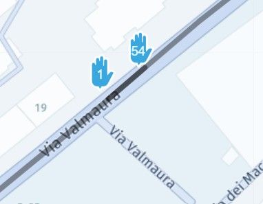
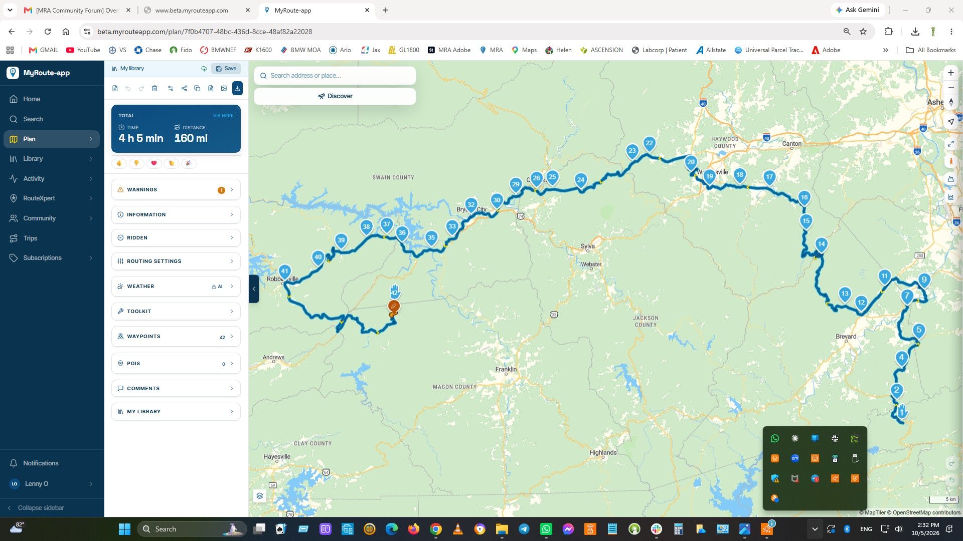
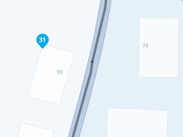
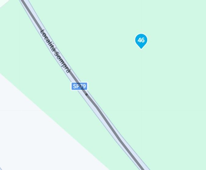
                  Do you use the free version of MRA or the gold version?? When using the free version you only have access to the OSM card. When i lock at you're route lots of waypoints are not placed on the road but next to the road or even further. When planning check you're waypoint if they are placed correct. Don't put you're start and finish point so close together. Put you're starting point further up the road so you ride to you're starting point and the gps makes no mistakes in seeing the wrong point or missing it and keeps sending you back.
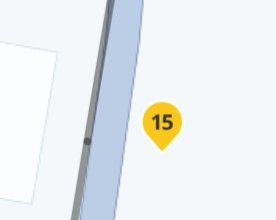
                  03d68ea7-6130-40b7-a7f0-01077beb2317-image.jpeg

                  dd818d4e-379e-425d-85dd-ae3c1b420b8a-image.jpeg

                  1b11f1de-f0eb-4cc1-8681-cc1bfe93f755-image.jpeg

                  ce366e00-3891-4634-82ae-179be7dc4b09-image.jpeg

                  R1250GS. Started with a Zumo 550, BMW nav IV, Carpe-iter and now Chigee met MRA app.

                  Gianluca 0undefined 1 Reply Last reply
                  0
                  • Hubert Thoringundefined Online
                    Hubert Thoringundefined Online
                    Hubert Thoring
                    Valued contributor
                    wrote last edited by Hubert Thoring
                    #9

                    @gianluca-0
                    What @leike-lodiers writes is very important and should definitely be taken into account.

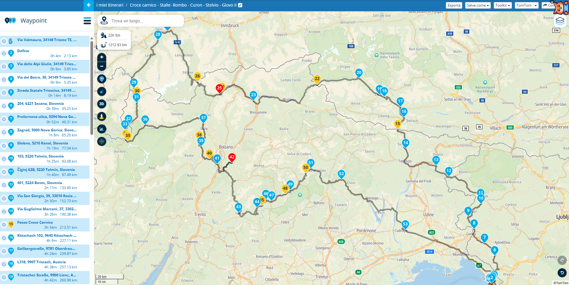
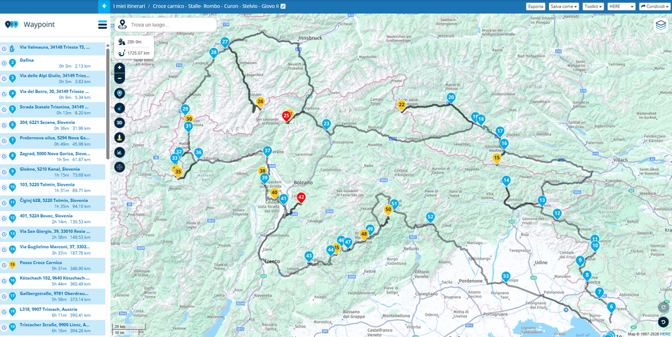
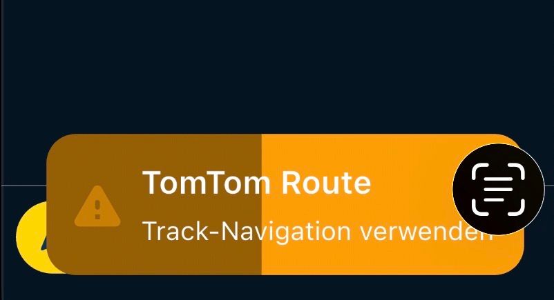
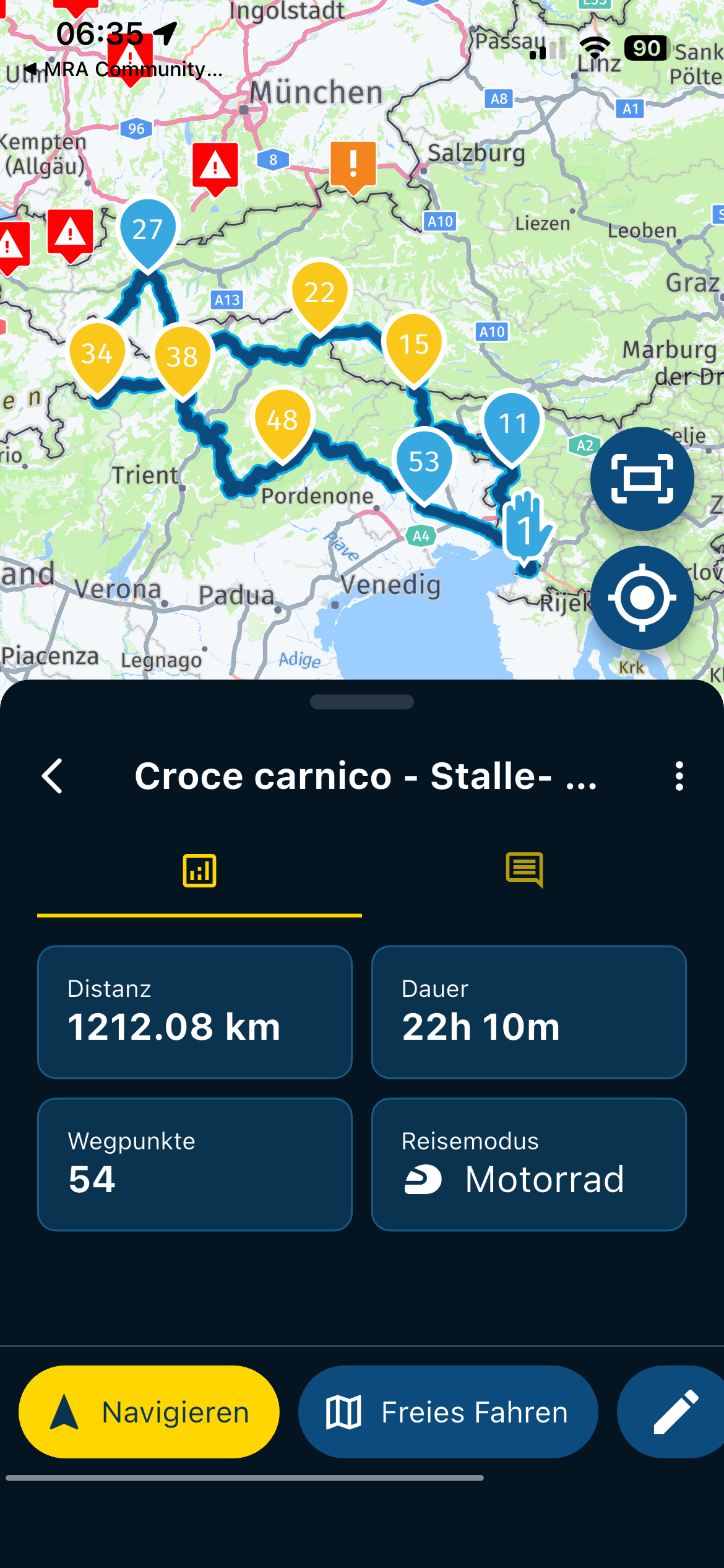
                    The route is planned in TomTom algorithms, the window s. Image comes when starting the navigation on my mobile phone, so it leads to the fact that it is actively navigated as a route track, traffic data is also missing.

                    Please switch to Here algorithm, then it will be navigated correctly.

                    And please do not let the route navigate over such a long distance, divide it into 3-4 sections.
                    IMG_0412.jpeg

                    From experience, I would basically divide such a long route. I think on 3-4 sections especially in the mountains 300km a day is enough.

                    • In my planning, the routes at 300km have approx. 50 -70 waypoints (WP) or Sharping Point (SP)

                    • It helps to always set a point safely in the direction of travel at certain turns

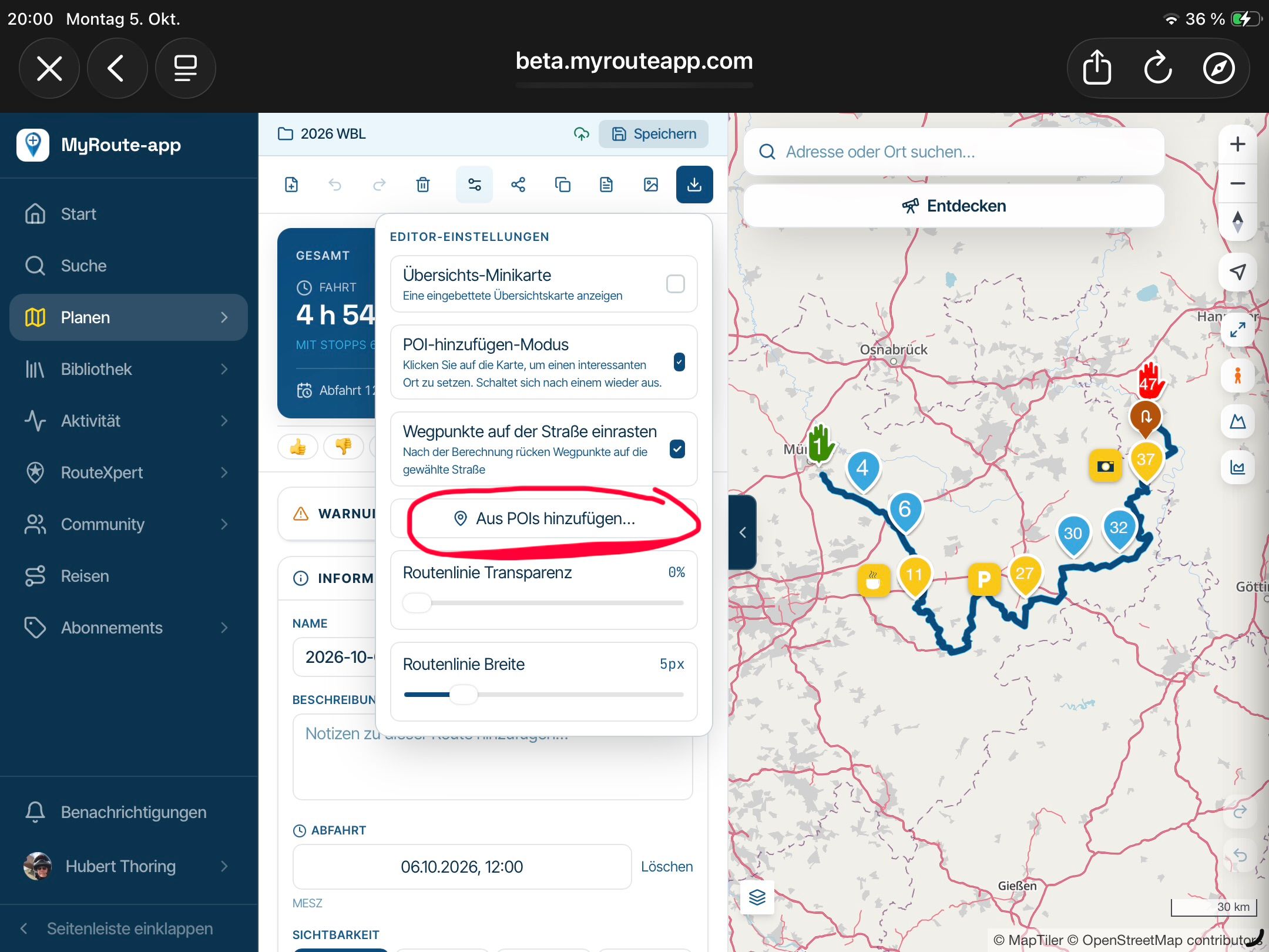
                    • Check WP on the Here map, should always be on a road !!

                    IMG_0409.png

                    VG Hubert
                    Beta Test "Next App" dazu die Hardware .
                    iPad 9. Gen iOS 26.5.2/ iPhone 16e iOS 26.5.2/ Navi iPhone Xr iOS 18.7.9 / PC mit MS Win11 /❗️MyRoute-App im Cradel und Remotek-One❗️ Info zu MRA & Remotek One

                    Gianluca 0undefined 1 Reply Last reply
                    0
                    • Leike Lodiersundefined Leike Lodiers

                      Do you use the free version of MRA or the gold version?? When using the free version you only have access to the OSM card. When i lock at you're route lots of waypoints are not placed on the road but next to the road or even further. When planning check you're waypoint if they are placed correct. Don't put you're start and finish point so close together. Put you're starting point further up the road so you ride to you're starting point and the gps makes no mistakes in seeing the wrong point or missing it and keeps sending you back.
                      03d68ea7-6130-40b7-a7f0-01077beb2317-image.jpeg

                      dd818d4e-379e-425d-85dd-ae3c1b420b8a-image.jpeg

                      1b11f1de-f0eb-4cc1-8681-cc1bfe93f755-image.jpeg

                      ce366e00-3891-4634-82ae-179be7dc4b09-image.jpeg

                      Gianluca 0undefined Offline
                      Gianluca 0undefined Offline
                      Gianluca 0
                      wrote last edited by
                      #10

                      @Leike-Lodiers thank you for answer.
                      I have gold subscription.
                      The problems I had were far away from start/finish point. The fact is that te route planned at a certain point, became different from the one saved, with some deviations kilometers away and then back on the same (wrong) road. Sorry, I didn't screenshot them. Yesterday I tried again to put in navigation mode and the problem did't appear.
                      Next time I will look at with attention where waypoint are placed, surely. And i will be sure to use Here maps in planning.

                      PS: what about Cheegee on your BMW bike?

                      You can check out anytime you like, but you can never leave.

                      Currently BMW R1200 RS "Gertrud", TomTom Ride, Carpuride 602BS, Vivo V50 5G.

                      Leike Lodiersundefined 1 Reply Last reply
                      0
                      • Hubert Thoringundefined Hubert Thoring

                        @gianluca-0
                        What @leike-lodiers writes is very important and should definitely be taken into account.

                        The route is planned in TomTom algorithms, the window s. Image comes when starting the navigation on my mobile phone, so it leads to the fact that it is actively navigated as a route track, traffic data is also missing.

                        Please switch to Here algorithm, then it will be navigated correctly.

                        And please do not let the route navigate over such a long distance, divide it into 3-4 sections.
                        IMG_0412.jpeg

                        From experience, I would basically divide such a long route. I think on 3-4 sections especially in the mountains 300km a day is enough.

                        • In my planning, the routes at 300km have approx. 50 -70 waypoints (WP) or Sharping Point (SP)

                        • It helps to always set a point safely in the direction of travel at certain turns

                        • Check WP on the Here map, should always be on a road !!
                        IMG_0409.png

                        Gianluca 0undefined Offline
                        Gianluca 0undefined Offline
                        Gianluca 0
                        wrote last edited by
                        #11

                        Hi, thanks for answering.
                        "And please do not let the route navigate over such a long distance, divide it into 3-4 sections." -> ok, I will do this way. But may I know the technical reason? Is it lighter to elaborate for the phone?

                        "Please switch to Here algorithm, then it will be navigated correctly." -> you mean when I plan or also navigating? When I open "Route Lab" to plan, I receive the message that the route creation mode works only with Tomtom or Here maps, maybe I choosed Tomtom this time. On the phone I can't choose the map on which navigate, just the theme of it, is it right?
                        I never used shaping points, I didn't ever know them existence... I have to search something about.

                        Thank you again

                        You can check out anytime you like, but you can never leave.

                        Currently BMW R1200 RS "Gertrud", TomTom Ride, Carpuride 602BS, Vivo V50 5G.

                        Nick Carthewundefined 1 Reply Last reply
                        0
                        • Gianluca 0undefined Gianluca 0

                          Hi, thanks for answering.
                          "And please do not let the route navigate over such a long distance, divide it into 3-4 sections." -> ok, I will do this way. But may I know the technical reason? Is it lighter to elaborate for the phone?

                          "Please switch to Here algorithm, then it will be navigated correctly." -> you mean when I plan or also navigating? When I open "Route Lab" to plan, I receive the message that the route creation mode works only with Tomtom or Here maps, maybe I choosed Tomtom this time. On the phone I can't choose the map on which navigate, just the theme of it, is it right?
                          I never used shaping points, I didn't ever know them existence... I have to search something about.

                          Thank you again

                          Nick Carthewundefined Offline
                          Nick Carthewundefined Offline
                          Nick Carthew
                          RouteXpert
                          wrote last edited by Nick Carthew
                          #12

                          @Gianluca-0
                          It is important to use the correct planning map for your navigation device.

                          Each planning map comes with its own set of algorithms embedded within the map data to calculate which roads to use.

                          The algorithms are unique to each planning map.

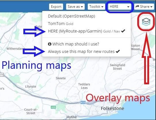
                          So if you use MRA Navigation Next you should use the HERE planning map.

                          After choosing the HERE planning map you can also click Always use this map for new routes to set the HERE map as your default planning map.

                          From now on all new routes will be created using the HERE planning map.

                          My screenshot below shows the planning map from HERE is selected and also the option to Always use this map for new routes.

                          The overlay maps are separate to the planning maps and have no effect on route calculations.

                          Think of them as clear sheets with extra information that you place over the top of the planning map.

                          The planning map underneath does all of the route calculations.

                          So with the HERE planning map selected you can then use any of the overlay maps.

                          If you do not see the same blue menu bar with the planning maps that is shown in my screenshot, click Page menu first and then all of the same options will be available to you.
                          bce75500-eac2-40f2-9b52-91d3d10b3807-image.jpeg

                          Always willing to help if I can.
                          Triumph Tiger 1200 XRT called Tina.
                          MRA Navigation Next and SilverFox BJ8

                          Gianluca 0undefined 1 Reply Last reply
                          2
                          • Nick Carthewundefined Nick Carthew

                            @Gianluca-0
                            It is important to use the correct planning map for your navigation device.

                            Each planning map comes with its own set of algorithms embedded within the map data to calculate which roads to use.

                            The algorithms are unique to each planning map.

                            So if you use MRA Navigation Next you should use the HERE planning map.

                            After choosing the HERE planning map you can also click Always use this map for new routes to set the HERE map as your default planning map.

                            From now on all new routes will be created using the HERE planning map.

                            My screenshot below shows the planning map from HERE is selected and also the option to Always use this map for new routes.

                            The overlay maps are separate to the planning maps and have no effect on route calculations.

                            Think of them as clear sheets with extra information that you place over the top of the planning map.

                            The planning map underneath does all of the route calculations.

                            So with the HERE planning map selected you can then use any of the overlay maps.

                            If you do not see the same blue menu bar with the planning maps that is shown in my screenshot, click Page menu first and then all of the same options will be available to you.

                            bce75500-eac2-40f2-9b52-91d3d10b3807-image.jpeg

                            Gianluca 0undefined Offline
                            Gianluca 0undefined Offline
                            Gianluca 0
                            wrote last edited by Gianluca 0
                            #13

                            @Nick-Carthew sooooo clear!
                            Thank you!

                            I imagine that "Tomtom" option is to be used if you are going to export the route to a tomtom navigator.

                            You can check out anytime you like, but you can never leave.

                            Currently BMW R1200 RS "Gertrud", TomTom Ride, Carpuride 602BS, Vivo V50 5G.

                            Nick Carthewundefined 1 Reply Last reply
                            0
                            • Gianluca 0undefined Gianluca 0

                              @Leike-Lodiers thank you for answer.
                              I have gold subscription.
                              The problems I had were far away from start/finish point. The fact is that te route planned at a certain point, became different from the one saved, with some deviations kilometers away and then back on the same (wrong) road. Sorry, I didn't screenshot them. Yesterday I tried again to put in navigation mode and the problem did't appear.
                              Next time I will look at with attention where waypoint are placed, surely. And i will be sure to use Here maps in planning.

                              PS: what about Cheegee on your BMW bike?

                              Leike Lodiersundefined Offline
                              Leike Lodiersundefined Offline
                              Leike Lodiers
                              wrote last edited by
                              #14

                              @Gianluca-0 what about chigee? Works fine for me until now. Have it about 1000km now. Have to get used to handle the bmw wheel for operating chigee.

                              R1250GS. Started with a Zumo 550, BMW nav IV, Carpe-iter and now Chigee met MRA app.

                              1 Reply Last reply
                              1
                              • Gianluca 0undefined Gianluca 0

                                @Nick-Carthew sooooo clear!
                                Thank you!

                                I imagine that "Tomtom" option is to be used if you are going to export the route to a tomtom navigator.

                                Nick Carthewundefined Offline
                                Nick Carthewundefined Offline
                                Nick Carthew
                                RouteXpert
                                wrote last edited by
                                #15

                                @Gianluca-0 [said](/post/

                                I imagine that "Tomtom" option is to be used if you are going to export the route to a tomtom navigator.

                                Correct, also some BMW navigation devices use the TomTom map.

                                Always willing to help if I can.
                                Triumph Tiger 1200 XRT called Tina.
                                MRA Navigation Next and SilverFox BJ8

                                1 Reply Last reply
                                0
                                • Mzokkundefined Offline
                                  Mzokkundefined Offline
                                  Mzokk
                                  wrote last edited by
                                  #16

                                  The MRA route planner and OSMand do indeed work very well together. I use MyRoute app most of the time for navigation, but do occasionally use OSMand for motorcycle navigation using Android Auto on my Africa Twin. OSMand follows the track of the route not the route itself so rarely goes "wrong". However, the track does not include "Via Points" on a route designed using MRA and provides no option to skip a portion of the route automatically or otherwise as it is following the track not a series of waypoints. I'd imagine you've maybe gone astray in your route planning somewhere or there are specific issues with the mix of hardware in use? I've been using the navigation app with AA on my Africa twin for over a year now in preference to my Garmin Zumo XT with very few navigation issues.

                                  1 Reply Last reply
                                  0
                                  • paul69undefined Offline
                                    paul69undefined Offline
                                    paul69
                                    wrote last edited by
                                    #17

                                    hi @gianluca-0
                                    this looks like a very nice route, albeit very long for single route.
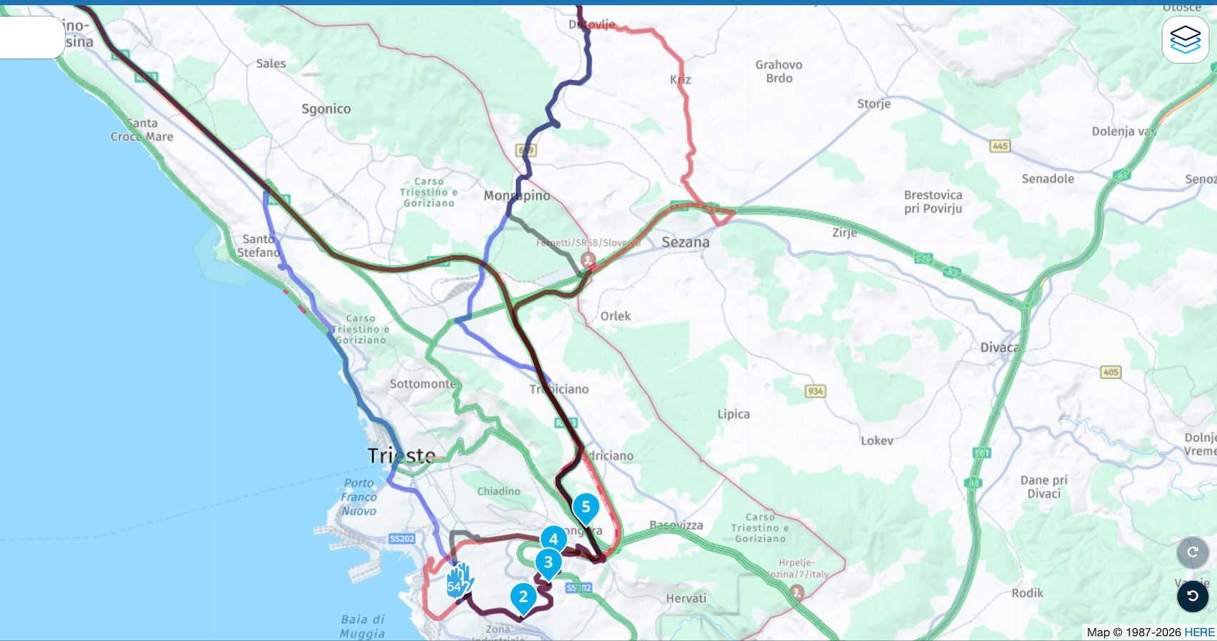
                                    as a small example I looked at the Trieste area of your map and if you look at the screen shot you will observe the many different routes available with Here, OSM and Tom Tom,
                                    when I plan a long route I always use the compare tool to see of there are any other possible ways I could be routed. I would then add more shaping points to force the route to the way I want, some will say this is excessive, but it works for me and I very rarely if at all stray from my original planned route, except for the dreaded umleitung of course.
                                    Screenshot 2026-07-21 at 18.45.08.png

                                    to achieve, we must first attempt ✌️
                                    K1600 GTL
                                    Oukitel RT3
                                    iPhone 13 Pro, carpuride 702b

                                    1 Reply Last reply
                                    0
                                    • Lenny Oundefined Offline
                                      Lenny Oundefined Offline
                                      Lenny O
                                      wrote last edited by
                                      #18

                                      And do no forget to test "disable seasonal closures" to see if it changes the route mileage and takes a different pass...

                                      Positive emotions are worth every penny ;)

                                      1 Reply Last reply
                                      0

                                      Hello! It looks like you're interested in this conversation, but you don't have an account yet.

                                      Getting fed up of having to scroll through the same posts each visit? When you register for an account, you'll always come back to exactly where you were before, and choose to be notified of new replies (either via email, or push notification). You'll also be able to save bookmarks and upvote posts to show your appreciation to other community members.

                                      With your input, this post could be even better 💗

                                      Register Login

                                      Reply
                                      • Reply as topic
                                      Log in to reply
                                      • Oldest to Newest
                                      • Newest to Oldest
                                      • Most Votes


                                      ACTIVE USERS
                                      Leike Lodiersundefined
                                      Leike Lodiers
                                      Nick Carthewundefined
                                      Nick Carthew
                                      Lenny Oundefined
                                      Lenny O
                                      paul69undefined
                                      paul69
                                      Mzokkundefined
                                      Mzokk
                                      Marinus van Deudekomundefined
                                      Marinus van Deudekom
                                      Gianluca 0undefined
                                      Gianluca 0
                                      Hubert Thoringundefined
                                      Hubert Thoring
                                      Christian Feursteinundefined
                                      Christian Feurstein
                                      POPULAR TOPICS
                                      • Map overlay indicating the road's (known) speed limit?
                                        Jaspal Bhatti 0undefined
                                        Jaspal Bhatti 0
                                        4
                                        13
                                        149

                                      • Many problems navigating my route
                                        Lenny Oundefined
                                        Lenny O
                                        0
                                        18
                                        278

                                      • Repeat the last instruction?
                                        Lenny Oundefined
                                        Lenny O
                                        0
                                        5
                                        105

                                      • v5.2 (473) Feedback
                                        M. Schrijverundefined
                                        M. Schrijver
                                        1
                                        12
                                        280

                                      • Restart route: option to navigatie to nearest point on route
                                        Gerard Wullinkundefined
                                        Gerard Wullink
                                        0
                                        20
                                        486

                                      • Location always on, why?
                                        Leike Lodiersundefined
                                        Leike Lodiers
                                        0
                                        5
                                        135

                                      • Unknown symbol
                                        Travellexxieundefined
                                        Travellexxie
                                        0
                                        9
                                        319

                                      • exporteren naar xt2
                                        Mzokkundefined
                                        Mzokk
                                        0
                                        3
                                        49

                                      MY GROUPS
                                      • Login

                                      • Login or register to search.
                                      • First post
                                        Last post
                                      0
                                      • Categories
                                      • Recent
                                      • Popular
                                      • Support
                                      • MyRoute-app