Skip to content
  • 1k Topics
    9k Posts
    @Aggelos-Minoudis have you set aan avoidance of hiways active
  • 2k Topics
    20k Posts
    @Adrian-Avram, It does. If the upload did not work, you will see a small up-arrow in the profile icon, until it resolves itself. One problem though, which I experienced myself last week, is the addition of extra pictures. The ones you did not take with the built in camera app, but decide to pick from your own gallery. That seems to only work if you do that just before uploading. All pictures I attached during the day did not get uploaded on multiple occasions. Besides that, there is no means of adding those pictures after you uploaded the tracklog. Hopefully that will be added some day too.
  • 2k Topics
    16k Posts
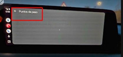
    @cd130 Reported here same problem: https://forum.myrouteapp.com/topic/11357/mra-5.2.1-486-carplay-display-issue-when-route-started-on-iphone
  • Open discussion for things regarding the entire forum

    2k 11k
    2k Topics
    11k Posts
    @white.mouse Het is niet zo'n big issue. Het viel me op en ben es gaan neuzen. Maar zo mis je wel een mooi fotolocatie Heb het ondertussen ook al gerapporteerd.
  • For all your questions regarding exporting from MyRoute-app to your navigation system

    19 131
    19 Topics
    131 Posts
    As far as I can tell, gpx1.2 from MRA removes shaping points (in Garmin speak), but includes route point extensions. Those are generated as the result of routing calculations. They are in the same locations as track points would be if you exported a track generated from the route. Route point extensions are ignored on route recalculation however. That means an imported gpx 1.2 route will look just fine on import, but if it is recalculated, only the via points(Via points,stopping points known as Waypoints in Garmin speak with a flag), will be used in the recalculation. How close the recalculated route will be to the original route depends on differences between MRA and the zumo in terms of maps, routing algorithm and user settings for preferences (e.g. shortest vs fastest route) and avoidances (e.g. highways, tolls, ...). I have an XT rather than an XT2 and experimented recently with (GPX1.2) automatic recalculation switched on and the unit came up with some weird recalculations to the next Via Point but only to this point, it did not seem to recalculate the route beyond the next via point. Generally speaking I used the GPX 1.1 file type and to ensure that the XT followed the exact route I wanted I also run the track beneath the route to identify any deviations. This gives the flexibility of using shaping points to enable automatic recalculation if desired, but requires great care to be taken in route design and many shaping points to ensure the route is "pinned" to the intended roads. There are proponents of both types of file routing GPX1.1 and 1.2 neither is right or wrong try both and you will find out which method suits you best. For me I've pretty much "had it" with Garmin navigators (having used them for 22 years) and use MRA for navigation and my XT for backup, viewing a track of the route and for proximity alerted custom POI's. Garmin hardware is still great but their routing algorithms and software ecosystems for motorcycling are now a mess.....in my opinion obviously.
  • Announcements regarding our community

    100 1k
    100 Topics
    1k Posts
    enjoy the country side. hope it isn't raining cats and dogs
  • Share your personal stories

    183 1k
    183 Topics
    1k Posts
    Dit is SUPER!, ongelooflijk hoe jullie met zo'n kleine groep mensen dat voor elkaar krijgen. Voor allemaal super bedankt en in dit geval Cor-Jan
  • Discuss MyRoute-app functionalities for recreation vehicles (RV)

    29 299
    29 Topics
    299 Posts
    Ik ben niet meer te helpen, ik ben reddeloos verloren
  • Your digital maintenance shed. Get in touch with other users to solve issues and help eachother

    2k 15k
    2k Topics
    15k Posts
    No new posts.
  • Introduce yourself to the rest of the MRA community and get to know new users

    317 2k
    317 Topics
    2k Posts
    @Apatrida-2-0 Cuando lo uses, no querrás cambiar. Es el mejor planificador y conjuntamente con su navegador, no tiene rival. Ya hace tiempo que lo uso y ni siquiera exporto los GPX para tenerlos por si he de usar otro navegador... porque no lo he necesitado (por ahora). Saludos, y nos vemos en la carretera (perdon @b0hd1 por el plagio )
  • Here you can share your favorite routes & tracks for others to use

    403 3k
    403 Topics
    3k Posts
    @Edwin_M Thank you for sharing our Tool Edwin! Good to hear you like it.
  • Weekly blog by community management

    21 191
    21 Topics
    191 Posts
    @Lynchy67 It is on the list for major maintenance of the website, just like being able to export multiple routes in one go. Please be patient.
  • Share your travel stories here

    49 180
    49 Topics
    180 Posts
    @Garry-Davis exactly, that would have been my second advice, but you are one step ahead. You can choose your beloved app, to count a route to the petrolstation
  • A digital showroom where there's a spot for every ride in the community

    24 94
    24 Topics
    94 Posts
    Hi ! So, the bad news is that Transfagarasan is still closed for now, but it should be opened in the next two weeks. You can check the live cam from time to time: https://www.roxy-world.ro/webcam-transfagarasan Good news is that Transalpina was opened about 5 days ago, some of my friends went there already and confirmed this. Enjoy Romania !
ACTIVE USERS POPULAR TOPICS MY GROUPS