@paul69 @dave-j-0 I just finished a 10 day, 4900mi trip using Carpuride (starting the route directly from Carpuride each time). For the most part, I have to say, it worked well. I did, however, experience the exact issue you both describe. Usually exiting and restarting the route on the Carpuride fixed it.
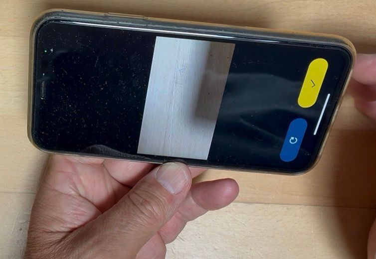
Then, with only 100mi left of the trip, the entire thing crashed and when the screen came back on, the direction/distance etc were there, but NO MAP. I also had Tracklog on, which continued to work.
When I opened the app on the phone, everything appeared normal - this did not translate to the Carpuride. Side Note - EVERY other nav app worked as expected, it was only the MRA App that did not - clear indication something went awry with the app and not the Carpuride (which I'm sure a lot of comments will point to as the issue - it was not).
Once I rebooted the iphone and Carpuride (likely didn't need to reboot this, but I did anyway), everything displayed and functioned as expected.