Skip to content
  • 1k Topics
    9k Posts
    Alfred Schrittwieser
    geprobeerd in edge , juist hetzelfde
  • 2k Topics
    20k Posts
    Brian McG
    @paul69 the idea of it being the maps is only a guess not a fact you would need to do some testing before & after updating the maps to prove it
  • 2k Topics
    16k Posts
    Hubert Thoring
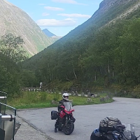
    Yes, we have already driven about 300 km each for two days with the latest version V5.2.1(488), runs very well in the mobile phone applications so in the MRA... Thank you for that —- Ja wir sind jetzt schon zwei Tage jeweils ca. 300 km mit der neusten Version V5.2.1(488) gefahren, läuft sehr gut in der Handy Anwendungen also in der MRA… Danke dafür [image: 1785786128819-img_0676.jpeg]
  • Open discussion for things regarding the entire forum

    2k 11k
    2k Topics
    11k Posts
    BrandonCameron
    Go to your Routelab account page and change the language to Italian. Then click on Support and you'll see the manuals are in Italian as well. Small warning while you're in there: it took me ages to get into my Routelab account at all last summer. I was on the road, and hotel and campsite wifi kept dying halfway through the login — I was convinced my account was broken. It was the network, not the site. Put a VPN on the laptop with an endpoint back home and it loaded first try, every time since. Picking one took longer than fixing the problem though, most reviews are just marketing. The roundup on https://kiesly.nl was the only one that actually compared them on speed and stability. Handy if you plan routes from abroad.
  • For all your questions regarding exporting from MyRoute-app to your navigation system

    21 277
    21 Topics
    277 Posts
    John S Parry
    @mzokk Thanks for your comprehensive response. You clearly have a grasp of "in the weeds internals" that I don't possess. I'm more of a "test and observe" kind of route planner. I look for instances of repeated routing behavior (both success and failures) across different terrain scenarios. I have multiple IBA (Iron Butt Association) awards where routing precision and mapping accuracy couldn't be compromised. I also lead multi-day rides across technical terrain in the US with very experienced riders who will not tolerate following "bad" routing. I bring this up not to beat my chest, but to indicate my required standards for building routes. With respect, your response is filled with a lot of "ifs, and buts". I'm not challenging what you presented as anything other than real possibilities. What I am saying is that in my years of creating hundreds of routes using OSM for export to Garmin devices (XT, XT3) I have never encountered any of the behaviors you outlined. I wish I had so that I could pick your brain for further understanding. I'm glad that you brought up the Zumo XT Forum. It's probably the best resource for learning everything XT out there. The main characters in the forum are incredibly knowledgeable. "jfheath" in particular has been very helpful in my XT learning journey. But even there, I sometimes scratch my head with some of the XT behaviors discussed. I have personally never experienced the infamous RUT behavior. That's over a 5-years period of continuous XT/XT3 route planning. Ironically, if you read through the forum, a couple of the regulars have sheepishly admitted they haven't experienced the behavior either. Again, this isn't questioning that it can happen, but it's clearly not a global pervasive problem. Going back to HERE, I agree that in a perfect world that you would use the same maps for development that are used in execution. So within MRA, why not just use HERE? If you didn't see my discussion on HERE map inaccuracies, start with the route below: https://www.myrouteapp.com/route/open/14129162 Open this OSM route up, and compare with HERE. You'll quickly see that the HERE cartography has the road deviating in a completely wrong location. I can't imagine a more serious vendor map sin than not getting a road location right. Beyond this specific HERE snafu, there are several other MRA HERE flaws that I find unacceptable: Too much of a lag time in recognizing closed roads that are now open. Showing roads open that have been closed sometimes for years. Calculating random route off/on deviations where the Freeway/Interstate continues straight, sometimes for hours. I can go on, but I'll spare you..... Given all this, for me, it's a matter of picking your poison. I can use HERE for development and know I'll get randomly tripped up, probably at the most inopportune time. Or instead use OSM, which has proven through extensive actual use to be reliable. Just my thoughts on the matter.......
  • Announcements regarding our community

    100 1k
    100 Topics
    1k Posts
    Leike Lodiers
    enjoy the country side. hope it isn't raining cats and dogs
  • Share your personal stories

    184 1k
    184 Topics
    1k Posts
    Hubert Thoring
    Die App mach so viel Spaß, Danke dafür, jetzt die 5. Tour jeweils ca. 200 - 300 km / Tag. Die Track - Bild Funktion ist [image: 1786038251162-img_0725.jpeg] [image: 1786038491155-img_0727.png]
  • Discuss MyRoute-app functionalities for recreation vehicles (RV)

    30 300
    30 Topics
    300 Posts
    De Ploey Georges
    Zijn er groepen die camperroutes hebben op gpx via MRA
  • Your digital maintenance shed. Get in touch with other users to solve issues and help eachother

    2k 15k
    2k Topics
    15k Posts
    No new posts.
  • Introduce yourself to the rest of the MRA community and get to know new users

    318 2k
    318 Topics
    2k Posts
    LennyO
    Welcome! Hope your trip goes smoothly! Enjoy!
  • Here you can share your favorite routes & tracks for others to use

    404 3k
    404 Topics
    3k Posts
    richtea999
    I know the area of the first two well, and they look very good to me. Just rode 1/3rd of route 1 this afternoon! And I like the info waypoints. Only one minor comment: some of the waypoints are just in front of a vital turn (route 1 waypoints 7 & 45, for example). I worry that the waypoint announcement might clash with the turn instruction (if people are using audio). Both have waypoints after the junction, so 7 & 45 (and any similar pre-junction ones) might be redundant.
  • Weekly blog by community management

    21 191
    21 Topics
    191 Posts
    Hans van de Ven MR.MRA
    @Lynchy67 It is on the list for major maintenance of the website, just like being able to export multiple routes in one go. Please be patient.
  • Share your travel stories here

    49 180
    49 Topics
    180 Posts
    Travellexxie
    @Garry-Davis exactly, that would have been my second advice, but you are one step ahead. You can choose your beloved app, to count a route to the petrolstation
  • A digital showroom where there's a spot for every ride in the community

    24 94
    24 Topics
    94 Posts
    Adrian Avram
    Hi ! So, the bad news is that Transfagarasan is still closed for now, but it should be opened in the next two weeks. You can check the live cam from time to time: https://www.roxy-world.ro/webcam-transfagarasan Good news is that Transalpina was opened about 5 days ago, some of my friends went there already and confirmed this. Enjoy Romania !
ACTIVE USERS POPULAR TOPICS MY GROUPS