Skip to content

[Web] Suggestions and Discussion

631 Topics 4.2k Posts
  • Scrolling Through Waypoints

    25
    0 Votes
    25 Posts
    13k Views
    JP d
    @Brian-McG I wonder if it's an issue with Oneplus then... Thanks for letting me know you had an issue but then it stopped. Mine started with 4.4.0. Don't know what changed.
  • Making minor side roads easier to see

    6
    0 Votes
    6 Posts
    2k Views
    Brian McG
    @Nick-Carthew I do love when you can see a conversation thread with the discussion just being a bit out of sync & a little at cross purposes this post is in the "[Web] Suggestions and Discussion" section when @ian-davies-2 is asking about "a way to make these side roads bigger, brighter and easier to see while route planning" but he "forgot to mention its on the phone." as the original question is asking about maps & planning in the phone MRA Routeplanner, the map options that Ian may be interested in are those in the Menu > Map Style [image: 05d63a70-43d3-44cc-9a4d-805138a467a6-image.png] @ian-davies-2 you may be disappointed, none of the choices give a really really clear contrast for the small unclassified roads
  • Full MyRoute-App CarPlay Map Integration in central instrument cluster

    7
    4
    0 Votes
    7 Posts
    3k Views
    Con Hennekens
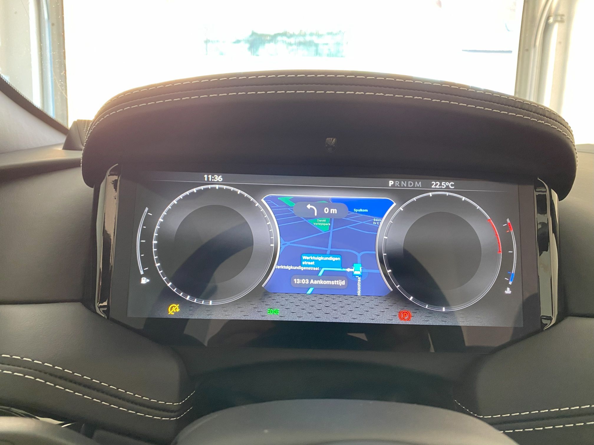
    @Nick-Carthew said in Full MyRoute-App CarPlay Map Integration in central instrument cluster: I thought that when you bought an Aston Martin, it comes with a bikini wearing girl sitting in the passenger seat reading you instructions from a map. I've seen it in 007. Well that actually would explain the price...
  • Is there any plan to allow the stitching together of tracks?

    7
    0 Votes
    7 Posts
    2k Views
    martin-phogel.de
    I have had the same idea (riding the MSD) on my radar for some time now. When following suggested trips, I always prefer tracks over routes as they stick closer to the original intention or, even better, use tracklogs - I like the idea of following someone's traces. @Richard-18 said in Is there any plan to allow the stitching together of tracks?: To do that, I need to convert the tracks into routes. The MSD Webpage includes links to all MSD parts, which lead to routes provided by Kurviger. Where did you get the tracks? @Richard-18 said in Is there any plan to allow the stitching together of tracks?: ...my question as to whether MyRoute’s owners had any plans to add ‘track stitching together’ in some future update. If they don’t and / or or people don’t see too much of a value in it. Even if editing tracks may not be part of a core planning task in MRA (where planning focuses on routes), MRA offers track navigation as well, and there are some capabilities for maintaining tracklogs. Therefore, IMHO, basic features such as splitting and merging tracks would be conceivable.
  • Finishvlag en andere icoontjes

    Moved
    5
    0 Votes
    5 Posts
    2k Views
    Hans Baars
    Thanks all. I knew the suggestions, however I like a |Finish flag at the end of the route. However I use now a red hand to suggest this is the end.
  • MRA Gpx Routes to a BMW Connected Ride Unit.

    Moved
    3
    0 Votes
    3 Posts
    1k Views
    Tony 13
    does not help you, but I do not have that problem. After importing the GPX1.1(route, track) I get 3 options. Import as a track, or as waypoints, or as support points. All seem to work but I prefer the waypoint option. I am using a Samsung S20. I usually have less than 15 points on a route.
  • GPX-Datei (Route) mit Wepunkten und deren Bezeichnung in MR-App importieren

    30
    0 Votes
    30 Posts
    12k Views
    Sacha Nowak
    @Lex.Kloet.RX Danke für deine Info! So hatte ich es erwartet und erhofft.
  • Afstand bij het plannen van een toeristische route

    7
    1 Votes
    7 Posts
    2k Views
    EMW-motorridders
    Ik zit in de creatieve sector en met creativiteit vind ik wel mooie routes, maar MRA helpt mij aardig vooruit de met routegenerator om het voorbereidend werk te doen. Maximaal aantal bochten en grootste hoogtes, het vermijden van snelwegen, tolwegen, carpooling en ook wel grote wegen. Ik laat het uittekenen volgens de denkpatronen van TomTom.. Daarna ga ik zelf aan de slag en ga de routepunten automatisch laten vermeerderen, met name 1 waypoint om de 5 km. Ik start ook de vergelijkingsmodus met denkpatronen van Here. Dan ga ik verschillende onderliggende mappen raadplegen zoals Michelin, Google Maps Hhybride enzovoort. Interessant is ook de Open Cyclo Maps erbij te nemen, want toegeven fietsers en mountainbikes rijden ook wel door mooie landschappen en dat kan inspirerend werken. Ik ga ook soms piepen bij de concurrentie, namelijk onze Vlaamse routeplanner RouteYou uit Gent. Het vraagt wat werk, maar als je inzoomt met OSM, zie je ook de mooie kastelen, monumenten, kerken, uitzicht punten en parken in de buurt van de route. Soms kan je ook do door de velden of wijngaarden of bossen rijden : de dirty roads. De TET-paden of ACT-paden raadplegen geeft weer andere inzichten. Je zou een Waypoint-Generator kunnen ontwikkelen dat een scenic route of rondrit opstelt op basis van bijvoorbeeld wijngaarden of kastelen in de Loire streek of de beste uitzichtpunten vanuit je startpunt. Langs rivieren of langs kustlijn of Romaanse kerken of de whisky route in Schotland (kan gevaarlijk zijn) Dankzij super software, want ik gebruik niet graag het woord artificiële intelligentie, kan je hiermee ook aan de slag. Er is met de motorfiets al zoveel te ontdekken in Europa dat je eigenlijk nooit tweemaal dezelfde route hoeft te rijden binnen de ons omringende landen. En inderdaad, zoals hier gezegd is, kan dat lokale bevolking ook tips geven: ik heb het al meegemaakt met Italiaanse boswachters in de bergen. En dan zijn er ook die vele onverhardeimin of meer vlakke wegen met waterplassen en kleine geulen zonder over rotsblokken en boomstammen te moeten rijden met die zware Allroad motorfiets.

  • Routes delen en bewerken

    2
    0 Votes
    2 Posts
    785 Views
    Con Hennekens
    Nee, in de huidige Web Applicatie is dat helaas niet mogelijk.
  • MRA_Routeplanner - difference between Track and Route-Track?

    11
    2
    0 Votes
    11 Posts
    4k Views
    Con Hennekens
    @Guzzist said in MRA_Routeplanner - difference between Track and Route-Track?: For me, there is no difference between self recorded Tracklogs to Track. I guess we don't agree on this one... I would hate my ordently managed routes to be spoiled by tracklogs. You can however save a tracklog as gpx, and re-import it as a route-track. Otr just import received tracklogs as route-track instead of tracklog. This way you will find them amongst your routes.
  • Themen für Online Stammtisch für MRA Routenplanung

    22
    -1 Votes
    22 Posts
    11k Views
    RainerT
    das scheint mir ein interssantes Problem für den Stammtisch https://forum.myrouteapp.com/post/68296 RT
  • From Route to Track?

    13
    1 Votes
    13 Posts
    4k Views
    Con Hennekens
    @Brian-McG and @Brett-Bartick and @M.-Schrijver, to add to the confusion I recently learned that since some recent version low resolution tracks are being included to routes. So, my previous claim from about half a year a go is not really valid anymore. Fact is that nowadays, when navigating "track-as-route", you indeed get a track that should look like it was originally planned, instead of being calculated at the time of starting it in navigation. Personally I indeed saw an increase of sync-time that could be explained by this, but I have no clue as to when that started.
  • Automatisch routepunten plaatsen bij verschuiven kaart uitzetten

    3
    0 Votes
    3 Posts
    1k Views
    Marinus van Deudekom
    @Timo-7 als je op de kaart komt komt daar een vormingspunt. Als je de linker muisknop vasthoudt verschuift de kaart en komt er geen vormingspunt
  • Trip Planning - Overlay Mark Up

    12
    0 Votes
    12 Posts
    4k Views
    Steve James
    Just incase anyone is interested, my latest work around is to use Google's mymaps, to overlay annotation on a google maps background with goolemaps functionality. You can share the overlay with others. I've added a screenshot of the overall, plus a couple of 'zoom ins'. Note you can add information to the points, if you look at the ferry port icon that I added, I have been able to link to the ferry sailings schedule. All useful stuff in the early stages of planning, especially if sharing. It's a shame that I can't select the overlay to be visible when planning on myrouteapp. To do it this way would make implementation easier. [image: Screenshot 2025-08-04 at 13.32.19.png] [image: Screenshot 2025-08-04 at 13.32.47.png] [image: Screenshot 2025-08-04 at 13.33.11.png] Steve
  • Routes van vrienden bekijken

    5
    0 Votes
    5 Posts
    2k Views
    Marinus van Deudekom
    @Niels-Elferink selecteer je vriend en klik dan rechtsboven op paginamenu. Dan kun je op routes klikken, that was easy
  • How do I find routes from RouteExperts

    15
    1
    0 Votes
    15 Posts
    4k Views
    Travellexxie
    And here it is https://www.myrouteapp.com/route/open/5768789
  • KInda upset with this

    Locked
    9
    1 Votes
    9 Posts
    2k Views
    Corjan Meijerink
    If you never had any issues with contacting support just assume it's busy (which it is) and you will get a reply shortly (which you will) I absolutely do not appreciate your tone in this message. We do our best every single day to satisfy all customers. Meaning that when you create a ticket on Sunday morning in the middle of Holiday season, it might just take a bit longer. can't even get a response on a ticket I send in, why? Because they know they have problem That's just complete and utter bullshit. Currently thousands of users are using our app to extreme satisfaction. This thread will be locked.
  • Animate - show distance with the red dot

    10
    0 Votes
    10 Posts
    3k Views
    Alex reds
    @Wallace-Shackleton To verify, just check the kilometers on the waypoint list on the left — the first 200 are written out, and for the rest, the calculation isn’t that difficult (200–400–600). Alternatively, but only with the Gold subscription, you can use the calculator for the distance between two points.[image: MRA.png]
  • Waypoint /shaping point placement

    11
    0 Votes
    11 Posts
    3k Views
    RainerT
    Deep.com translation: Troubleshooting checklist V2.0 To rule out possible operating errors and better identify the fault or problem, it would be helpful to answer these questions. This will give other participants a better overview for developing further steps or a possible solution. Copy the checklist, there is a button top right MRA Web Planning (planning on a PC, tablet, etc. via a browser) [ ] Which subscription do you have? (Basic, Silver, Gold) [ ] Which routing engine was used? (OSM, TomTom, Here, preferred), not overlay map [ ] What is checked in Toolkit Avoid, preferred none [ ] Which vehicle was planned for? (Car, motorcycle, other) [ ] Which options were set (winding/fastest/shortest), preferred none MRA Navigation App (everything on a smartphone, tablet, etc. via the app) [ ] Do you have a Navigation Next subscription? [ ] What hardware, what smartphone is used? (Brand, model) [ ] What operating system does the smartphone run on? (iOS, Android) [ ] What software version is on it? (If not current) [ ] Do you use Android Auto and/or Apple CarPlay? [ ] Which display unit is used for this? (Carpuride/vehicle/other) [ ] Which connection is used? (USB cable or wireless) [ ] What are the navigation settings? (*See post by Hubert Thoring) [ ] Route calculation [ ] Traffic settings [ ] Navigation function [ ] Route validation, opt. [ ] Track navigation [ ] Offline maps [ ] Which avoidance options were used? (Highway, toll road, etc.) [ ] MRA Navigation app route planning [ ] Was a route or track used? [ ] Was the route/track taken from web planning (route directory)? [ ] Navigate as a route or as a track [ ] Was A to B destination planning used? [ ] Which options were used (including curve options)? [ ] Was a round trip planned, including options? [ ] Settings on the smartphone [ ] How are the permissions for the app set? [ ] Location permanently allowed? [ ] Messages/notifications allowed? [ ] Online or offline mode, maps downloaded? [ ] Describe the problem or your question in more detail. _____________________________ [ ] Add screenshots if possible. _____________________________ [ ] The link to the route file may also be helpful. _____________________________ *Contribution by Hubert Thoring https://forum.myrouteapp.com/topic/9564/mra-basis-einstellungen-empfehlenswert Translated with DeepL.com (free version)
  • rode lijnen

    2
    0 Votes
    2 Posts
    896 Views
    Rob Verhoeff
    @goos-doornewaard lees deze post: https://forum.myrouteapp.com/topic/9487/scenic-routing-routexpert-library-improvements?_=1753646691908
ACTIVE USERS POPULAR TOPICS MY GROUPS