Skip to content

[Web] Problems, Bugs and other Issues

711 Topics 5.1k Posts
  • Routenpunkt nachträglich einfügen

    11
    0 Votes
    11 Posts
    2k Views
    @Jörgen Hallo Jürgen, das verschieben von z.B. WP45 auf die Stelle z.B. WP20 als vom Favorit ja ans Ende hier WP45 gesetzt dann an Platz z.B. WP20 zu verschieben ist aber mit dem zweiten Klick nicht getan, Du musst ihn verschieben und das geht nich mit klicken sondern halten und im Menü nach oben schieben. Oder kenne ich da die eine hilfreiche Klick Funktion noch gar nicht , dann zweige es wies leichter geht. Bei vielen Punkten ist das so schon sehr mühsam
  • Routeplanner options - twisty and height - where have they gone?

    8
    0 Votes
    8 Posts
    2k Views
    @Con-Hennekens Thanks, Con. I've not really used the new approach enough to judge whether it's better. But I'm about to!
  • function EXPAND

    35
    2
    0 Votes
    35 Posts
    14k Views
    @Erdna I also use "route as track" navigation a lot. The main reason is the lack of a "curviness" option with HERE, so I use TT or OSM for planning instead. My routes have 3-5 VIAs and a handful of SPs, and I let the routing engine do its job. As all these roads are typically routable with HERE as well, there's hardly any difference when it comes to navigating the route (as track). And if so, it's easily manageable - the same applies to some erratic behaviour that occurs from time to time (very rarely). It may depend on the areas you're riding, but in my case, this works very well. Have a great riding season as well!
  • Favoriten Verwaltung

    7
    2
    3 Votes
    7 Posts
    2k Views
    @MotorradTeam-Mannheim, Die Favorit Punkte werden sicherlich ein interessanter Punkt in dem zukünftigen großen Web-Planer-Update sein. Aber wann das allerdings zu sehen sein wird, ist noch nicht bekannt.
  • Problemas con la actualizacion 4.4

    1
    0 Votes
    1 Posts
    325 Views
    No one has replied
  • Différences de calcul entre Tom Tom et Here

    3
    0 Votes
    3 Posts
    805 Views
    TomTom a une méthode de calcul différente de celle de Garmin, de sorte que les itinéraires ne correspondent pas toujours. Les routes sinueuses et les différences en altitude sont typiques de TomTom, mais la version Gold de MRA vous permet de choisir la méthode de calcul de TomTom. Vous pouvez également comparer l'itinéraire de TomTom avec celui de Here. S'ils sont différents, vous devez déplacer stratégiquement quelques points intermédiaires jusqu'à ce que les deux itinéraires correspondent. Dans la plupart des cas, cela fonctionne, mais parfois ce n'est pas le cas ! Dans ce cas, vous devez faire preuve d'un peu d'ingéniosité pour faire correspondre les deux calculs. Il arrive qu'un itinéraire soit inexistant pour l'un des deux ou que la sens de la circulation n'ait pas encore été ajusté. Les cartographes devraient également actualiser au maximum les informations récentes.
  • Scenic tour A/R info

    5
    0 Votes
    5 Posts
    1k Views
    These calculations are not done with HERE @Lex.Kloet.RX Reporting them there, will not help. @Corrado-Miniati-0 please create a support ticket: myrouteapp.com/support and indicate where the issue occurred. Ideally recreate it with a route from the Routeplanner (select OSM map, set avoid options and show the wrong road is taken).
  • What function does this icon perform?

    12
    0 Votes
    12 Posts
    3k Views
    All very clear, many thanks for the feedback
  • Issue: Round trip u-turns

    9
    1
    0 Votes
    9 Posts
    2k Views
    To provide another curve
  • height missing?

    4
    1
    0 Votes
    4 Posts
    995 Views
    I you planned een scenic route, and you pickup one ( red, green or blue ), then you use it : waypoints appears ! Romove the waypoints where you want to choose BOCHTIG or/and HOOGTES in TomTom's way of calculation. At that moment you will see more turns and heights between to points !
  • Problèmes d'affichage sur écran

    7
    0 Votes
    7 Posts
    2k Views
    Oui, j'ai déjà redémarré l'ordinateur, l'écran, mise à jour de l'ordinateur, ... Il me reste à voir le câble de liaison écran / ordinateur
  • Tracklog omzetten naar route geeft veel verschillen

    17
    0 Votes
    17 Posts
    4k Views
    Bouke bedankt voor je reactie, ik denk dat dat voor nu de beste manier is.
  • Waypoints (Again!)

    9
    0 Votes
    9 Posts
    2k Views
    @Guzzist Thanks for your advice. I will look further into these options shortly.
  • This topic is deleted!

    1
    1
    0 Votes
    1 Posts
    1 Views
    No one has replied
  • MRA - weird "detour" created

    7
    2
    0 Votes
    7 Posts
    1k Views
    @Brian-McG, that confirms my thought, thanks for looking it up. @ginogino said in MRA - weird "detour" created: During the journey, the app gives me a voice description of the waypoint so that I can take the right road. You mean the left road? Yeah, sometimes you must be creative.
  • This is driving me mad!

    6
    3
    -1 Votes
    6 Posts
    2k Views
    A quick and dirty solution ist to declare this part to off-road. So it is a straight line and there is no walking/driving around. RT
  • Probleem met exporteren naar sd kaart garmin

    4
    0 Votes
    4 Posts
    852 Views
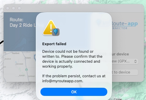
    Kijk eens op de site van JaVaWa, das iemand die best wel wat knowhow heedt van dit soort zaken: https://www.javawa.nl/ Ik heb het idee dat jet meer te maken heeft met de combi Garmin en Mac en niet zozeer MRA.
  • 0 Votes
    10 Posts
    3k Views
    Thank you all for the help. I often take multi day rides with numerous routes fairly close together. I still think being able to join routes where you want to rather than at just the end or the beginning would be very useful.
  • 0 Votes
    2 Posts
    494 Views
    Probleem wordt onderzocht!
  • Avoid blocked road

    12
    2
    0 Votes
    12 Posts
    3k Views
    OpenStreetMap is not a map-maker, it is your task to make the map. So, thank you to the guys, who made this work for all of us. Without being paid. RT
ACTIVE USERS POPULAR TOPICS MY GROUPS