"Route as Track" wird nicht wie geplant navigiert
-
Moin zusammen,
ich probiere gerade wieder einmal ein bisschen mit OSM herum; dabei ist mir Folgendes aufgefallen: Ich plane eine Route mit OSM und lasse mir als Vergleich die Berechnung mit HERE anzeigen
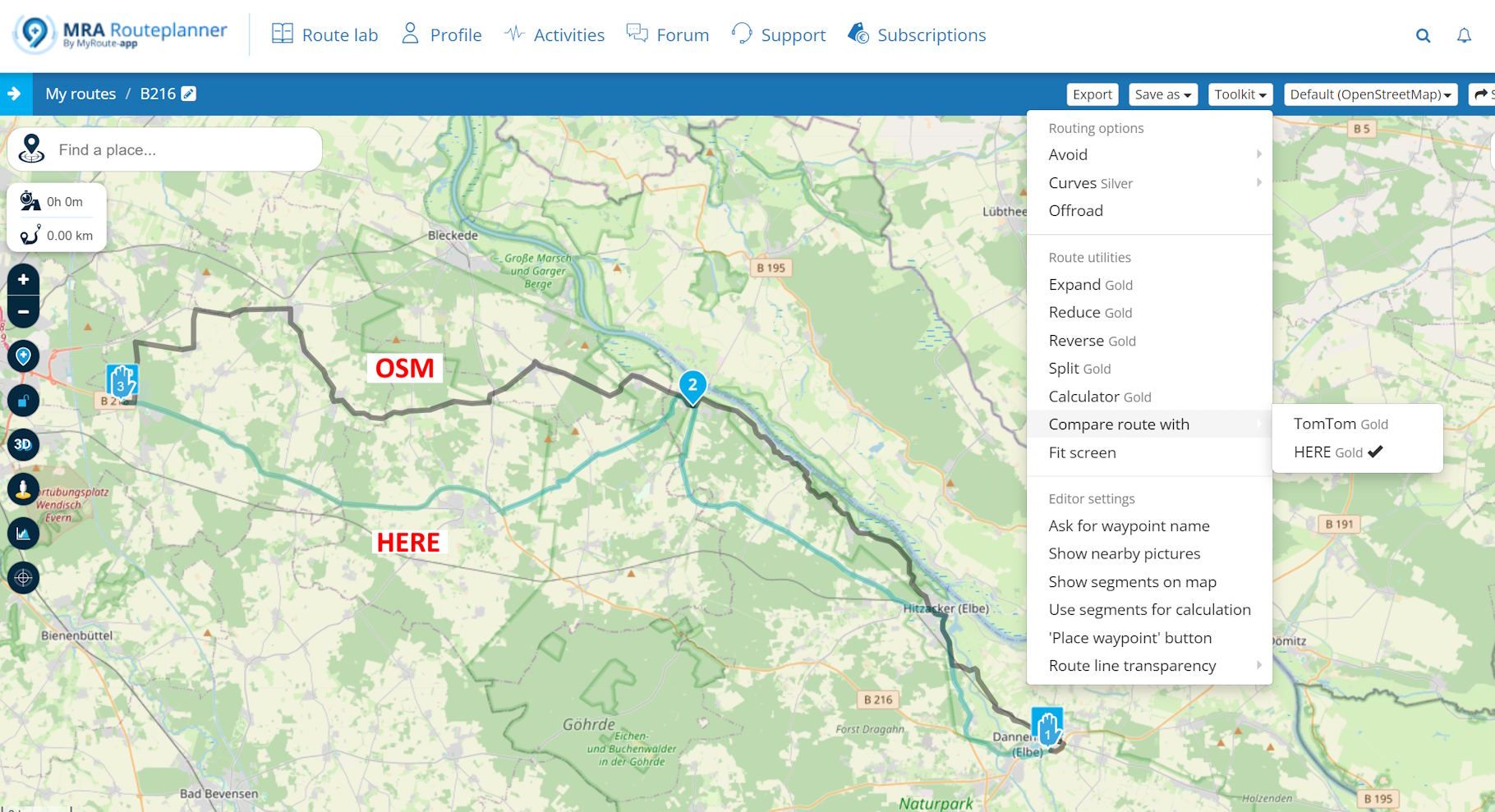
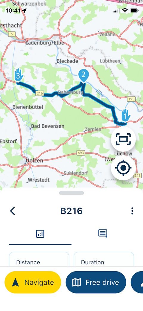
Wenn ich diese Route in MRA NN zur Navigation aufrufe ("Route as Track" ist aktiviert, habe ich mehrfach kontrolliert), wird allerdings nicht die mit OSM geplante Variante, sondern die HERE-Variante navigiert - das kann man gut daran erkennen, dass bei OSM nicht die B216 genutzt wird, bei HERE aber sehr wohl:
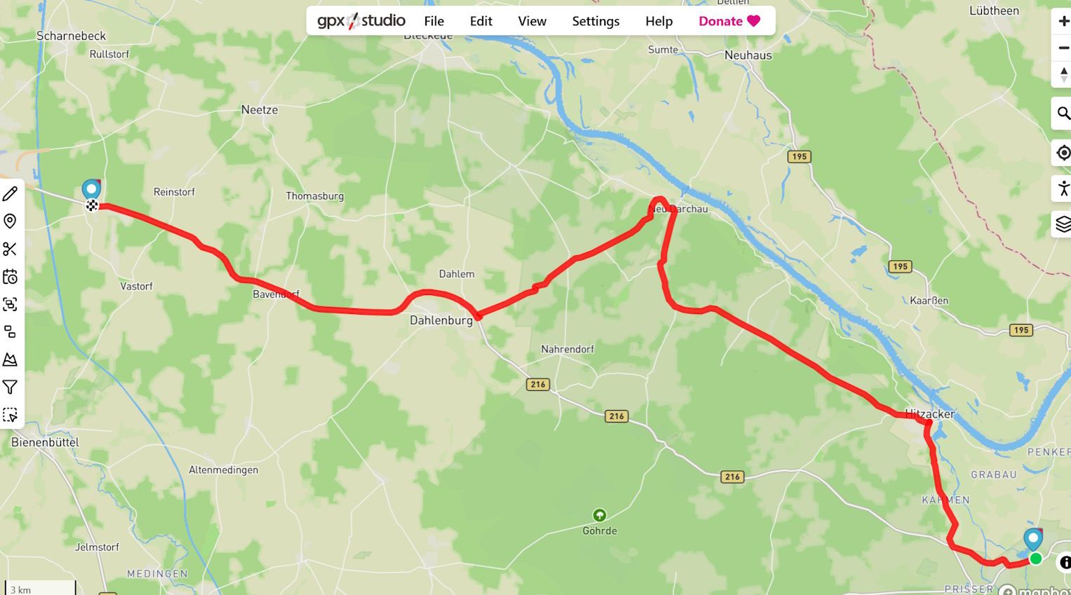
Den selben Effekt habe ich, wenn die die Route als "gpx1.1 (track, POI)" exportiere und dann z.B. in gpx.studio öffne: offensichtlich wird die HERE-Version exportiert, nicht die OSM-Version:
Hat jemand dafür eine Erklärung?
Hier der Link zur geplanten Route:
https://www.myrouteapp.com/en/social/route/12947658?mode=share
-
MRA NN verwendet die HERE-Karte, daher werden Ihnen dieselben Straßen angezeigt. Dies gilt auch für die Navigation als Track, da der HERE-Algorithmus sich vom OSM-Algorithmus unterscheidet.
MRA NN uses the HERE map, this is why you see the same roads used. Even when navigating as a track because the HERE algorithm is different to the OSM algorithm.
Always willing to help if I can.
Triumph Tiger 1200 XRT called Tina.
MRA Navigation Next and SilverFox BJ8 -
Hast du denn die mit OSM erstellte Route in die Here-Karte konvertiert (durch Auffüllen mit WP)?
Hast du Segmente? bei OSM benutzt?
-
Weil MRA NN die Here Karte benutzt, wird die OSM Route nicht beim navigieren benutzt. Du kannst aber mit Zwischepunkte die Here Karte auf die OSM Karte ziehen, sodass beide identisch sind. Dann fährst du die OSM Route auf Here Karte.
-
MRA NN verwendet die HERE-Karte, daher werden Ihnen dieselben Straßen angezeigt. Dies gilt auch für die Navigation als Track, da der HERE-Algorithmus sich vom OSM-Algorithmus unterscheidet.
MRA NN uses the HERE map, this is why you see the same roads used. Even when navigating as a track because the HERE algorithm is different to the OSM algorithm.
Hi @Nick-Carthew,
I used this feature a lot, and it always worked this way:
- I create a route using OSM, which creates a (simplified) trackline that is stored along with the route
- When opening for navigation "Route as track", MRA NN shows this trackline (white) and calculates an additional route with HERE (blue) on top of the original trackline
- As long as the original trackline is calculable with HERE, white and blue have the same shape.
Do you agree?
However, in this example, I can't see a white line, and the blue line is the "native" HERE route, ignoring the original trackline calculated with OSM.
And when I export ("save as gpx 1.1 track, POI") the OSM route from the web planner, the "native" HERE route is exported instead of the OSM version.
So, what's going on here?
P.S.: Sorry for writing in German initially; this post was meant for "Self Service DE."
-
Could someone please change the title to “Route as track" isn't navigating as planned?
Thanks. -
Warum wechselst du jetzt auf Englisch?
Hardware
iPhone 12 pro (iOS 26.2.1)
iPad (7.Gen.) 18.7.3
Oukitel RT3 Pro (Andr. 14)
Wireless CarPlay mit (Elebest C650)
Wired CarPlay (SEAT Arona - 2021)
MRA Workshops in Deutsch sind hier zu finden -
@Jörgen said in "Route as Track" wird nicht wie geplant navigiert:
Warum wechselst du jetzt auf Englisch?
Mein Verständnis der Etikette hier ist, dass man in den "allgemeinen Kategorien" nach Möglichkeit Beiträge auf Englisch verfassen sollte und für Beiträge in anderen Sprachen die jeweiligen "Self Service" Kategorien verwenden sollte. Ich hatte diesen Beitrag ursprünglich in "Self Service DE" posten wollen, habe mich dann aber bei der Auswahl der Kategorie vertan.
Oder mache ich das zu kompliziert? Ist es grundsätzlich egal, welche Sprache man verwendet?
-
Ja, eigentlich ist es egal, welche Sprache. Es gibt aber die (scheinbar nicht allseits bekannte) Regel, die Antworten in derselben Sprache fortzuführen, in der der Themen-Ersteller angefangen hat.
Damit Beiträge nicht Englisch, Niederländisch, Deutsch und Französisch enthalten.Hardware
iPhone 12 pro (iOS 26.2.1)
iPad (7.Gen.) 18.7.3
Oukitel RT3 Pro (Andr. 14)
Wireless CarPlay mit (Elebest C650)
Wired CarPlay (SEAT Arona - 2021)
MRA Workshops in Deutsch sind hier zu finden -
Ja, eigentlich ist es egal, welche Sprache. Es gibt aber die (scheinbar nicht allseits bekannte) Regel, die Antworten in derselben Sprache fortzuführen, in der der Themen-Ersteller angefangen hat.
Damit Beiträge nicht Englisch, Niederländisch, Deutsch und Französisch enthalten.@Jörgen said in "Route as Track" wird nicht wie geplant navigiert:
die Antworten in derselben Sprache fortzuführen, in der der Themen-Ersteller angefangen hat.
Ahh, ok, Danke! Das war mir tatsächlich nicht bekannt. Wieder etwas gelernt!
-
Ich habe heute noch einmal einen Test mit einer anderen Route durchgeführt – dasselbe Ergebnis.
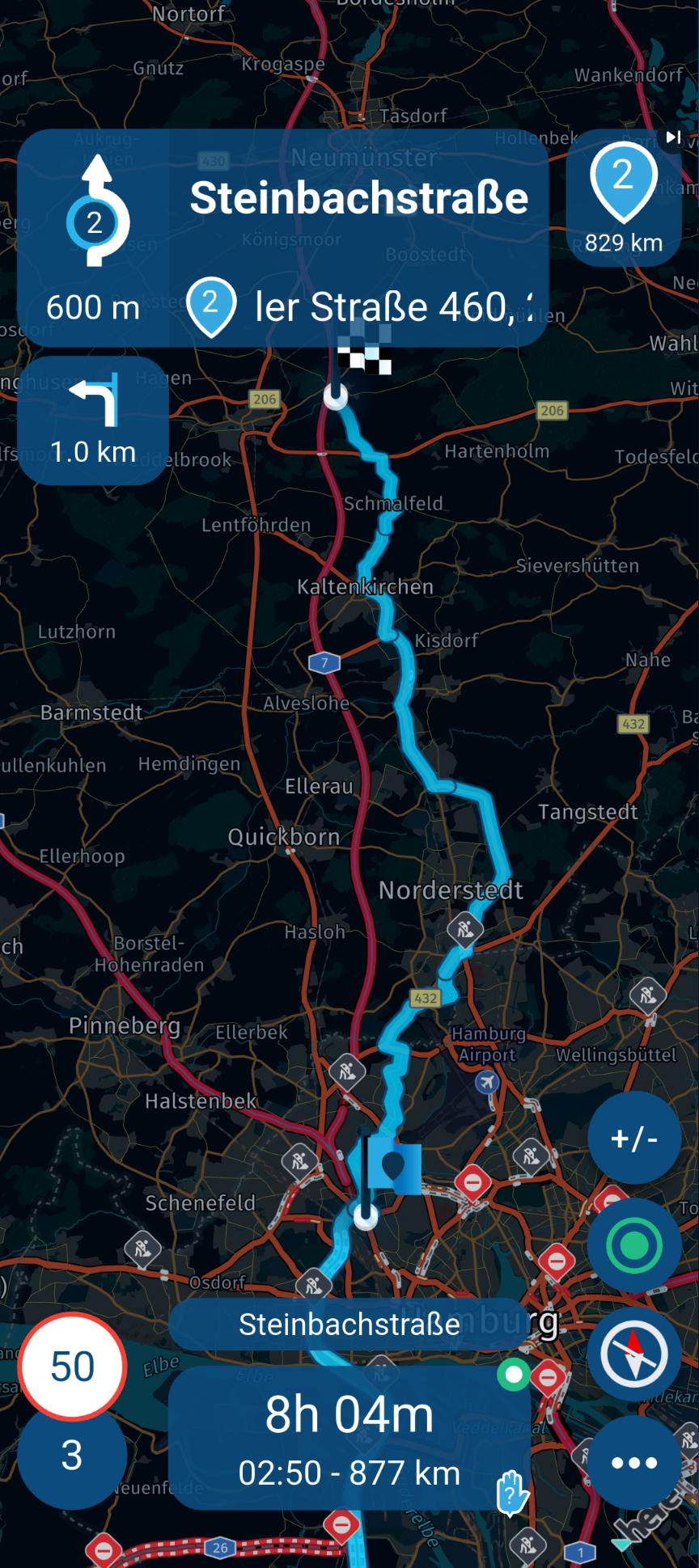
https://www.myrouteapp.com/en/social/route/12968571?mode=shareKönnte bitte jemand ausprobieren, diese Route, so wie in OSM geplant, in MRA NN mit "Route as Track" zu navigieren (graue Linie)?
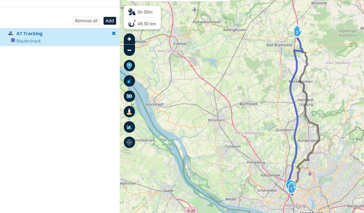
Ich bekomme das nicht hin,es wird immer die Strecke über die A7 gewählt; also offensichtlich die Route, die mit HERE berechnet wird. Das ist auch das Ergebnis, wenn ich meine mit OSM geplante Route als (gpx 1.1 track, POI) exportiere (blaue Linie).
Danke für eure Hilfe.
-
Ich habe heute noch einmal einen Test mit einer anderen Route durchgeführt – dasselbe Ergebnis.
https://www.myrouteapp.com/en/social/route/12968571?mode=shareKönnte bitte jemand ausprobieren, diese Route, so wie in OSM geplant, in MRA NN mit "Route as Track" zu navigieren (graue Linie)?
Ich bekomme das nicht hin,es wird immer die Strecke über die A7 gewählt; also offensichtlich die Route, die mit HERE berechnet wird. Das ist auch das Ergebnis, wenn ich meine mit OSM geplante Route als (gpx 1.1 track, POI) exportiere (blaue Linie).
Danke für eure Hilfe.
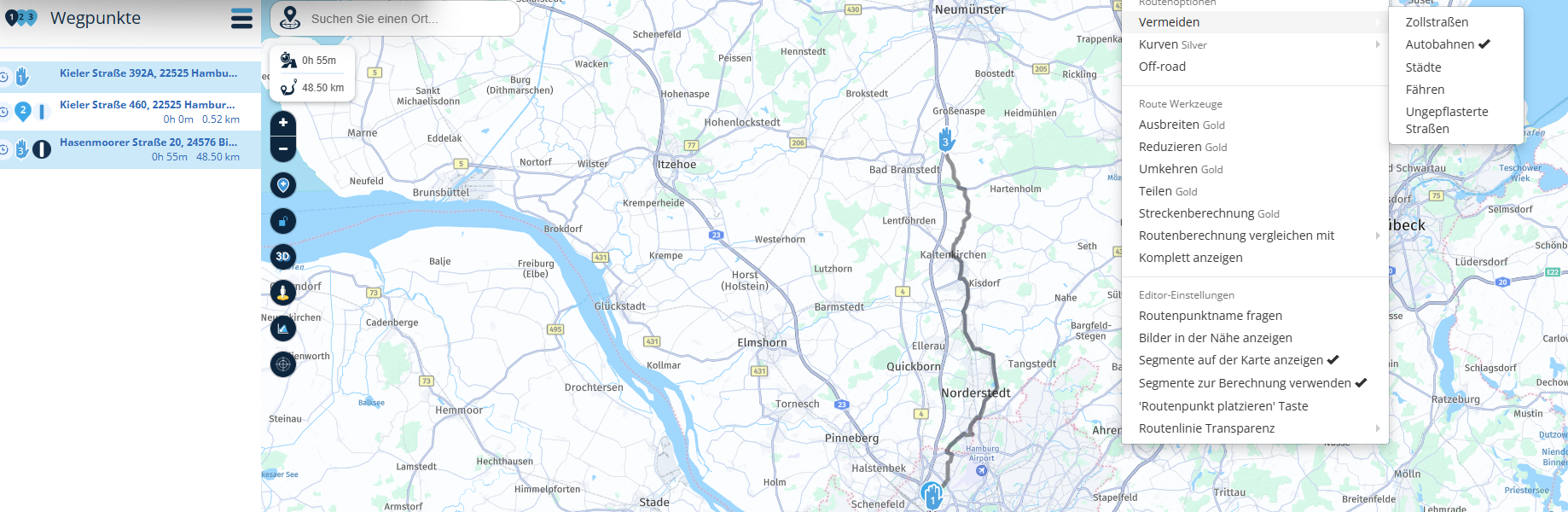
@Martin-Wilcke Wenn ich im Routenlabor vermeiden AB auswähle , dann kann ich Deine gewünschte Strecke teilweise als Track navigieren.
BMW R 1250 GS
MRA Navigation & SilverFox C1 Controller
DMD-NOR7E 7"
SPC Universal mount
Motorola Edge 40 "offline"
Sena SLR 3
Sena 50 R -
Ich habe heute noch einmal einen Test mit einer anderen Route durchgeführt – dasselbe Ergebnis.
https://www.myrouteapp.com/en/social/route/12968571?mode=shareKönnte bitte jemand ausprobieren, diese Route, so wie in OSM geplant, in MRA NN mit "Route as Track" zu navigieren (graue Linie)?
Ich bekomme das nicht hin,es wird immer die Strecke über die A7 gewählt; also offensichtlich die Route, die mit HERE berechnet wird. Das ist auch das Ergebnis, wenn ich meine mit OSM geplante Route als (gpx 1.1 track, POI) exportiere (blaue Linie).
Danke für eure Hilfe.
@Martin-Wilcke Bei diesem Beispiel habe ich "keine" Vermeidung der AB eingestellt, jedoch die Kurvigkeit der Segmente geändert.
-
@Martin-Wilcke Wenn ich im Routenlabor vermeiden AB auswähle , dann kann ich Deine gewünschte Strecke teilweise als Track navigieren.
@Peter-Zehentreiter
Ja, das geht. Aber das ist nicht der Punkt.Bis vor Kurzem konnte ich eine mit OSM geplante Routen mittels “Routes as tracks” exakt so navigieren. Das scheint nicht mehr zu funktionieren.
Und es war auch ganz sicher möglich, eine mit OSM geplante Route genau so als Track zu exportieren. Das geht auch nicht mehr.
Wird OSM gerade sukzessive in MRA abgeschaltet?
-
@Peter-Zehentreiter
Ja, das geht. Aber das ist nicht der Punkt.Bis vor Kurzem konnte ich eine mit OSM geplante Routen mittels “Routes as tracks” exakt so navigieren. Das scheint nicht mehr zu funktionieren.
Und es war auch ganz sicher möglich, eine mit OSM geplante Route genau so als Track zu exportieren. Das geht auch nicht mehr.
Wird OSM gerade sukzessive in MRA abgeschaltet?
@Martin-Wilcke said in "Route as Track" wird nicht wie geplant navigiert:
Wird OSM gerade sukzessive in MRA abgeschaltet?
Kann ich leider nicht beatworten........
-
Ich kann dein Problem noch nicht so ganz nachvollziehen.
Wenn ich deine Route nehme und das letzte Segment (was ja nur in OSM geht) kurvig gestalte und diese dann auf HERE-Karte umstelle, wird diese mit WP gefüllt und entspricht in etwa deiner Planung. So kann ich die dann auch in der Navigation Next abfahren.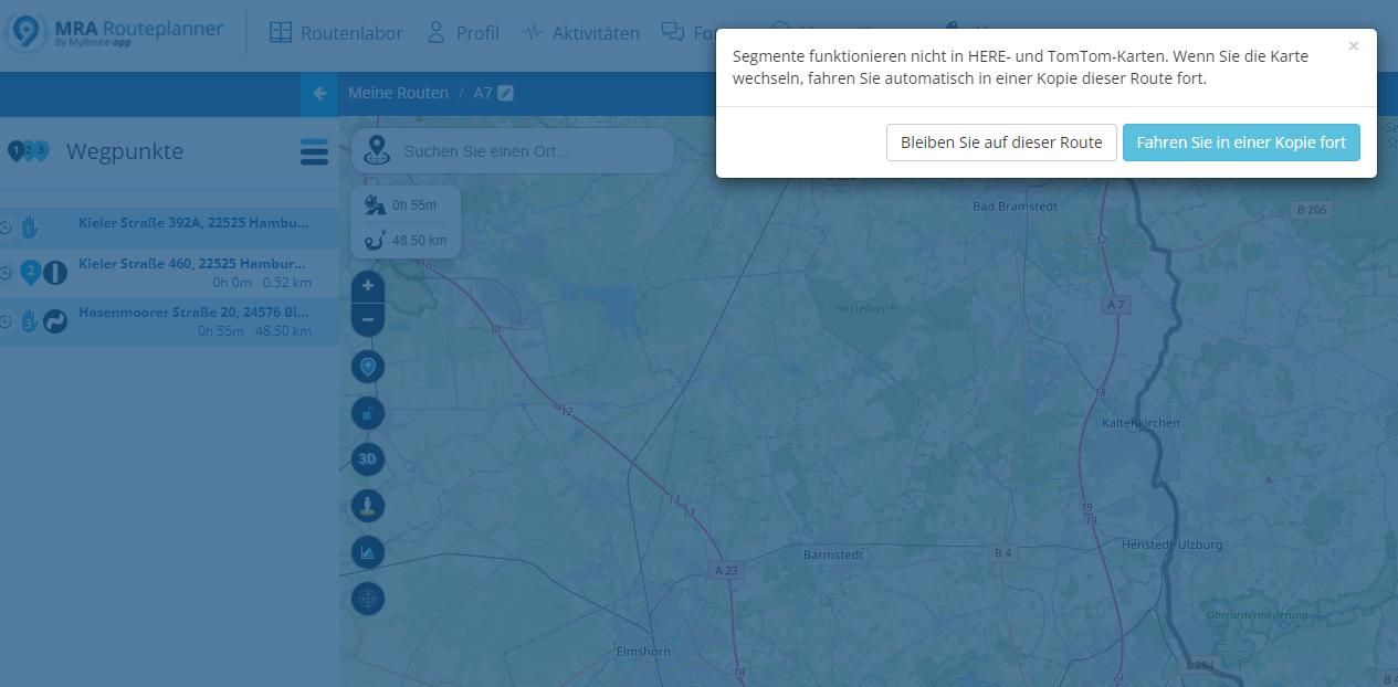
-
Ja, alles richtig. Mann kann durch verschiedene Maßnahmen, insbesondere das Setzen von zusätzlichen SPs, die Route so bearbeiten, dass der mit HERE gerechnete Verlauf dem mit OSM gerechneten entspricht.
Aber das alles ist nicht notwendig. Wenn man „Routes as Track“ bei der Navigation verwendet, kann man einfach eine Tour mit OSM planen und die dann genau so navigieren. Das ist ja das geniale an diesem Feature, dass man bei der Planung nicht auf HERE Rücksicht nehmen muss!
Genau das geht jetzt nicht mehr. Und ich kann die mit OSM geplante Route auch nicht als Track exportieren, um diesen dann z.B. mit DMD zu navigieren.
Es sieht so aus, als ob der mit OSM gerechnete Verlauf auf dem Bildschirm angezeigt, aber nicht in der Datenbank gespeichert wird. Also entweder ein Bug - oder das Feature ist abgeschaltet.
-
Ich habe noch ein bisschen weitergeforscht.
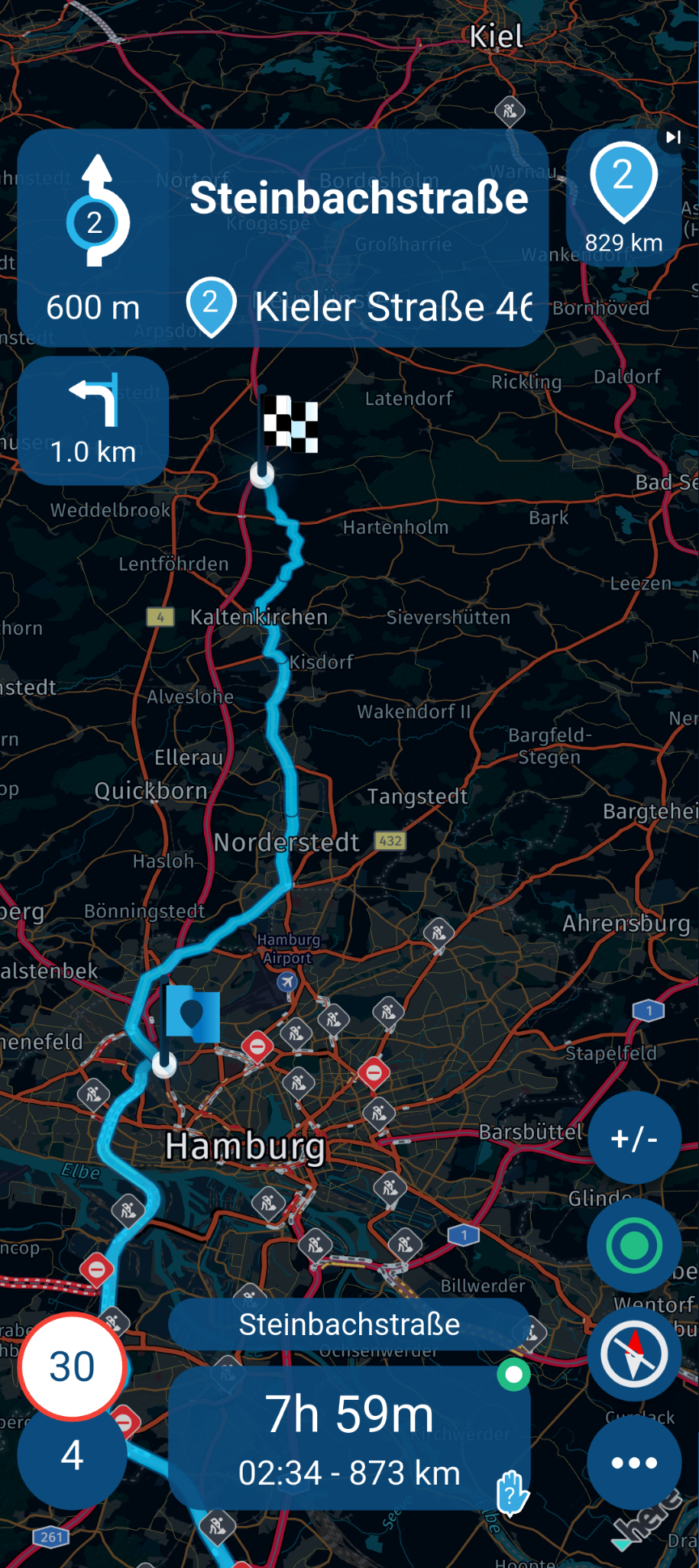
In dem Beispiel mit der A7 hatte ich OSM verwendet und "Curves = Average" eingestellt; dadurch wurde die Autobahn automatisch vermieden - aber diese Route wird, wie geschrieben, bei der Navigation nicht verwendet, sondern der Weg über die Autobahn.
Wenn ich aber "Avoid = Motorway" hinzufüge, klappt es: Die Route wird dann exakt so navigiert. Sehr seltsam.
Genauso seltsam ist, dass auch bei "Avoid = Toll Roads" ( ohne "Avoid = Motorway") der Weg nicht über die Autobahn genommen wird, obwohl die A7 keine "Toll Road" ist. Ich glaube, den Fehler hatten wir schon mal beschrieben.
Noch seltsamer ist, dass sowohl bei "Avoid = Motorway" als auch bei "Avoid = Toll Roads" die Autobahn vermieden wird, aber ein unterschiedlicher Streckenverlauf berechnet wird.
Ganz ehrlich: Die OSM-Implementierung im MRA Web-Planer ist nicht zu gebrauchen, und HERE ist für die Planung schöner Motorradstrecken überhaupt nicht geeignet.
Das ist schon ziemlich frustrierend. Ich werde meine Touren baw. mit anderen Apps planen - hoffen wir mal, dass der neue MRA Webplaner die ganze Wartezeit wirklich wert ist.
-
Hi, ich benutze zu 90 % meinen Instinkt und die Michelin-Karte, um schöne Streckenabschnitte zu finden. Die ganzen Automatismen funktionieren nie perfekt.
Eigen gesetzte WP sind immer noch besser.Hardware
iPhone 12 pro (iOS 26.2.1)
iPad (7.Gen.) 18.7.3
Oukitel RT3 Pro (Andr. 14)
Wireless CarPlay mit (Elebest C650)
Wired CarPlay (SEAT Arona - 2021)
MRA Workshops in Deutsch sind hier zu finden -
Hi, ich benutze zu 90 % meinen Instinkt und die Michelin-Karte, um schöne Streckenabschnitte zu finden. Die ganzen Automatismen funktionieren nie perfekt.
Eigen gesetzte WP sind immer noch besser.Ich weiß genau, was du meinst. Das ist wie früher, wo man eine hochwertige Papierkarte hatte und darauf eine Linie eingemalt hat. Das mache ich heute manchmal auch noch so, nur digital. Da brauche ich dann nur eine Software, die meine gemalte Linie auf die Straßen einrastet (oder manchmal eben auch nicht). Das ist für mich dann Trackplanung und da brauche ich überhaupt keine Routing Engine.
Manchmal liegt mein Fokus aber auf POIs, die ich ansteuern will, und den Weg dazwischen lasse ich mir durch eine gute Routen Engine ermitteln, wobei ich meine Präferenzen über Optionen einstellen kann. Das ist für mich dann Routenplanung. Ich dem Fall erwarte ich aber auch, dass die Routen Engine gut funktioniert und die Optionen halbwegs nachvollziehbar sind, sonst wird das ein Lottospiel. Und vor allem erwarte ich, dass ich die geplante Route dann auch so navigieren kann, wie ich mir das bei der Planung vorgestellt habe. Und genau das funktioniert mit OSM in MRA leider überhaupt nicht gut, das geht in anderen Apps erheblich besser.
Mein Eindruck ist, dass sich MRA immer mehr auf HERE konzentriert und möglicherweise für die Routenerstellung für Wohnmobile / Camper optimiert wird. Wir werden sehen, welche Möglichkeiten der neue Webplaner bietet und vor allem, wie das dann mit der Navigation zusammenspielt.
Hello! It looks like you're interested in this conversation, but you don't have an account yet.
Getting fed up of having to scroll through the same posts each visit? When you register for an account, you'll always come back to exactly where you were before, and choose to be notified of new replies (either via email, or push notification). You'll also be able to save bookmarks and upvote posts to show your appreciation to other community members.
With your input, this post could be even better 💗
Register Login-
0376.1k
-
314796
-
13570
-
7321.9k
-
016460
-
110214
-
0101.5k
-
017526