Straßensperrungen deutlicher darstellen
-
Wäre es möglich mögliche Straßensperrungen von Pässen in der Karte/Planung deutlicher darzustellen?
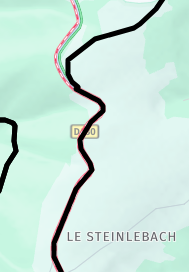
Es fand wohl in den letzten Wochen/Monaten schon mal eine Änderung statt, dass man sie jetzt schon als rote Bandierung sieht. Diese ist aber leider relativ schwer zu erkennen wenn bereits eine Route drüber verläuft. Fände ich persönlich super, da ich mich noch nicht so gut auskenne und weis wo Pässe sind die eventuell noch gesperrt sein könnten.
Mit freundlichen Grüßen
")
-
Wäre es möglich mögliche Straßensperrungen von Pässen in der Karte/Planung deutlicher darzustellen?
Es fand wohl in den letzten Wochen/Monaten schon mal eine Änderung statt, dass man sie jetzt schon als rote Bandierung sieht. Diese ist aber leider relativ schwer zu erkennen wenn bereits eine Route drüber verläuft. Fände ich persönlich super, da ich mich noch nicht so gut auskenne und weis wo Pässe sind die eventuell noch gesperrt sein könnten.
Mit freundlichen Grüßen
@Daniel-5a
Passen Sie im Toolkit die Transparenz der Routenlinie an.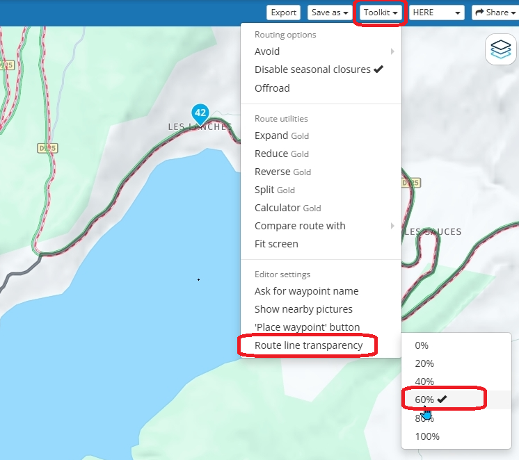
Always willing to help if I can.
Triumph Tiger 1200 XRT called Tina.
MRA Navigation Next and SilverFox BJ8 -
@Daniel-5a
Passen Sie im Toolkit die Transparenz der Routenlinie an.@Nick-Carthew ahh das ist natürlich auch Clever. Vielen Dank für den Tipp

-
@Daniel-5a
Passen Sie im Toolkit die Transparenz der Routenlinie an.@Nick-Carthew said in Straßensperrungen deutlicher darstellen:
@Daniel-5a
Passen Sie im Toolkit die Transparenz der Routenlinie an.Ich halte die schwarze Routen- oder Tracklinie generell sehr transparent, weil sonst der Straßentyp nicht mehr sichtbar ist. Mir ist das wichtig, weil ich eher kleine Straßen bevorzuge statt große Bundesstraßen. So kann ich bei der Planung leichter eingreifen und einen WP setzen, wenn mir die erzeugte Streckenführung nicht gefällt.
Hello! It looks like you're interested in this conversation, but you don't have an account yet.
Getting fed up of having to scroll through the same posts each visit? When you register for an account, you'll always come back to exactly where you were before, and choose to be notified of new replies (either via email, or push notification). You'll also be able to save bookmarks and upvote posts to show your appreciation to other community members.
With your input, this post could be even better 💗
Register Login-
010114
-
07172
-
05138
-
0636
-
05112
-
741548
-
0419
-
0432