Add Current Range to Route Tool Tip
-
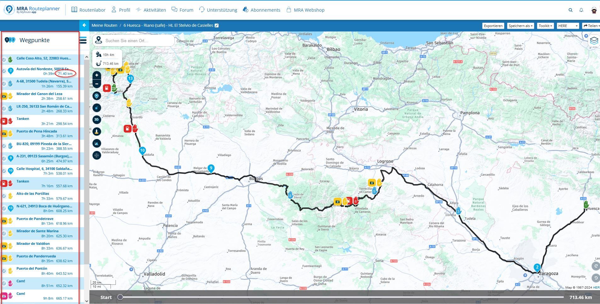
I do long distance motorcycle rides and scavenger hunt rallies. I normally start my planning by setting the start and destination for the day. This could be 1000 miles or more per day between start and finish waypoints. I then add gas stops based on the range of my gas tank.
It would be nice to have the range from start show up on the tool tip while hovering over the route or maybe in the slider bar at the bottom. Currently I have to drop a waypoint determine the range and delete the waypoint and add another.
If there is another way to achieve this please let me know.
-
I agree this would be a nice to have feature, very useful when planning Touring routes too.
-
Great idea. I want this too.
I normally "sketch out" routes with a few Via points and then go and add in extra shaping points later to hit specific roads, then I add in fuel stops.
I would love to be able to see on the route what the distance from start is automatically. I could then look at (for example), approximately 200 miles +/- 20, then zoom in on that region and select fuel POIs.
That would be very helpful.
-
I do long distance motorcycle rides and scavenger hunt rallies. I normally start my planning by setting the start and destination for the day. This could be 1000 miles or more per day between start and finish waypoints. I then add gas stops based on the range of my gas tank.
It would be nice to have the range from start show up on the tool tip while hovering over the route or maybe in the slider bar at the bottom. Currently I have to drop a waypoint determine the range and delete the waypoint and add another.
If there is another way to achieve this please let me know.
@Ronnie-Moore Cheers from Austria,
I don´t know if I get that correct, but the solution is already there...
I bet you do know the regular range, so why not plan the route and then use the left navigation panel to see at what waypoints a fuel stop would be needed? The work in looking for the fitting fuel station is exactly the same as if you would have a "range indicator"?
Regards,
André -
@Ronnie-Moore Cheers from Austria,
I don´t know if I get that correct, but the solution is already there...
I bet you do know the regular range, so why not plan the route and then use the left navigation panel to see at what waypoints a fuel stop would be needed? The work in looking for the fitting fuel station is exactly the same as if you would have a "range indicator"?
Regards,
André@Erdna The example you show has many waypoints. I'm wanting a start and end waypoint only and the ability to add the gas stops without any other waypoints. I could just add a bunch of waypoints to the route and try to determine the gas stops from there, but that is a lot more work. I'm thinking something similar to how Garmin Basecamp does it would be nice.
-
Hopefully the MRA team can implement this in the new route planner

-
I do long distance motorcycle rides and scavenger hunt rallies. I normally start my planning by setting the start and destination for the day. This could be 1000 miles or more per day between start and finish waypoints. I then add gas stops based on the range of my gas tank.
It would be nice to have the range from start show up on the tool tip while hovering over the route or maybe in the slider bar at the bottom. Currently I have to drop a waypoint determine the range and delete the waypoint and add another.
If there is another way to achieve this please let me know.
@Ronnie-Moore Great suggestion!
-
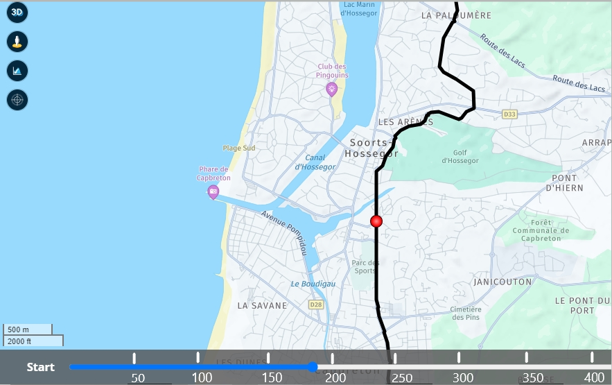
A scale on the bottom bar is all that is required
Always willing to help if I can.
Triumph Tiger 1200 XRT called Tina.
MRA Navigation Next and SilverFox BJ8 -
A scale on the bottom bar is all that is required
@Nick-Carthew, now THAT is a great and simple idea!
-
A scale on the bottom bar is all that is required
@Nick-Carthew Correct!
-
A scale on the bottom bar is all that is required
@Nick-Carthew Brilliant idea.
-
I like the idea too.
Not only for gas stations useful.
The bar a bit smaller or switchable.
Hello! It looks like you're interested in this conversation, but you don't have an account yet.
Getting fed up of having to scroll through the same posts each visit? When you register for an account, you'll always come back to exactly where you were before, and choose to be notified of new replies (either via email, or push notification). You'll also be able to save bookmarks and upvote posts to show your appreciation to other community members.
With your input, this post could be even better 💗
Register Login-
7673.2k
-
019514
-
09119
-
05159
-
-15181
-
314886
-
0274
-
115758

