Assign a via point/waypoint number
-
@Corrado-Miniati-0 I have got your point, because I do planning for journeys similar.
The system knows about the routepoint numbers and is using it for sorting the items in the list. Also the number is populated in the list item.
May it would be possible, to get the populated number as editable. I see: manual sorting of a long list will then become quicker. -
"May it would be possible, to get the populated number as editable".
This is exactly my propose to Corjan. -
"May it would be possible, to get the populated number as editable".
This is exactly my propose to Corjan.Hi @Corrado-Miniati-0 to me your method of planning a route is a bit unusual, it is not the regular way routes are planned in MRA hence why your having the pain of reordering your points
I am not saying your method is wrong it is just not the regular way of using MRA for creating a routeOne suggestion that might ease your pain could be to type the coordinates of your points into a CSV file via a text editor or Excel
You can then upload these points into MRA as Points of Interest (POI)
You then start adding route (waypoints) next to each of the POI in the order you wish
Then you can delete remove the POI's & your left with the route you wantjust a suggestion that may be a little less painful
BlackView BV7100, Android 12
Navigate "Routes as Tracks" in Offline mode with Offline Maps
No Wifi, no internet, no interruptions, works well -
Hi @Corrado-Miniati-0 to me your method of planning a route is a bit unusual, it is not the regular way routes are planned in MRA hence why your having the pain of reordering your points
I am not saying your method is wrong it is just not the regular way of using MRA for creating a routeOne suggestion that might ease your pain could be to type the coordinates of your points into a CSV file via a text editor or Excel
You can then upload these points into MRA as Points of Interest (POI)
You then start adding route (waypoints) next to each of the POI in the order you wish
Then you can delete remove the POI's & your left with the route you wantjust a suggestion that may be a little less painful
@Brian-McG that is exactly, what I wanted to type, but I was stuck in a big portion if French fries with Dutch mayonaise and homemade peanutbuttersauce. Or, as we call it in the Netherlands a "patatje oorlog" or fries at war


-
@Brian McG:
It may be that my planning system is unusual, but I've always found it convenient to plan this way.
Thanks for your suggestion, too; it's very clever, but even this way involves extra work outside of MRA, and it's probably not faster than moving waypoints from the list directly into MRA. -
@Brian McG:
It may be that my planning system is unusual, but I've always found it convenient to plan this way.
Thanks for your suggestion, too; it's very clever, but even this way involves extra work outside of MRA, and it's probably not faster than moving waypoints from the list directly into MRA.@Corrado-Miniati-0 sorry you do not see the advantages of the method I proposed
I do not think it is extra work,
currently you type in the coordinates in MRA, in the proposed method you type them in Excel & just import the csv
so now you are in the same state as you would be with your current methodwith your method you now have to sort the order of all your points
with the proposed method all you have to do is click next to each of the POI in the order you wish the route to be
IMO it would be a lot faster & a lot easier than your current method, especially if you have a large number of pointsI hope you try it & see, there are other advantages to having your points captured in a POI list
-
Thanks so much for your support.
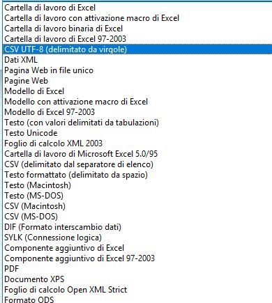
I tried, but it doesn't work. Could you please show me how to set the coordinates in Excel and what CSV format you choose for saving?
-
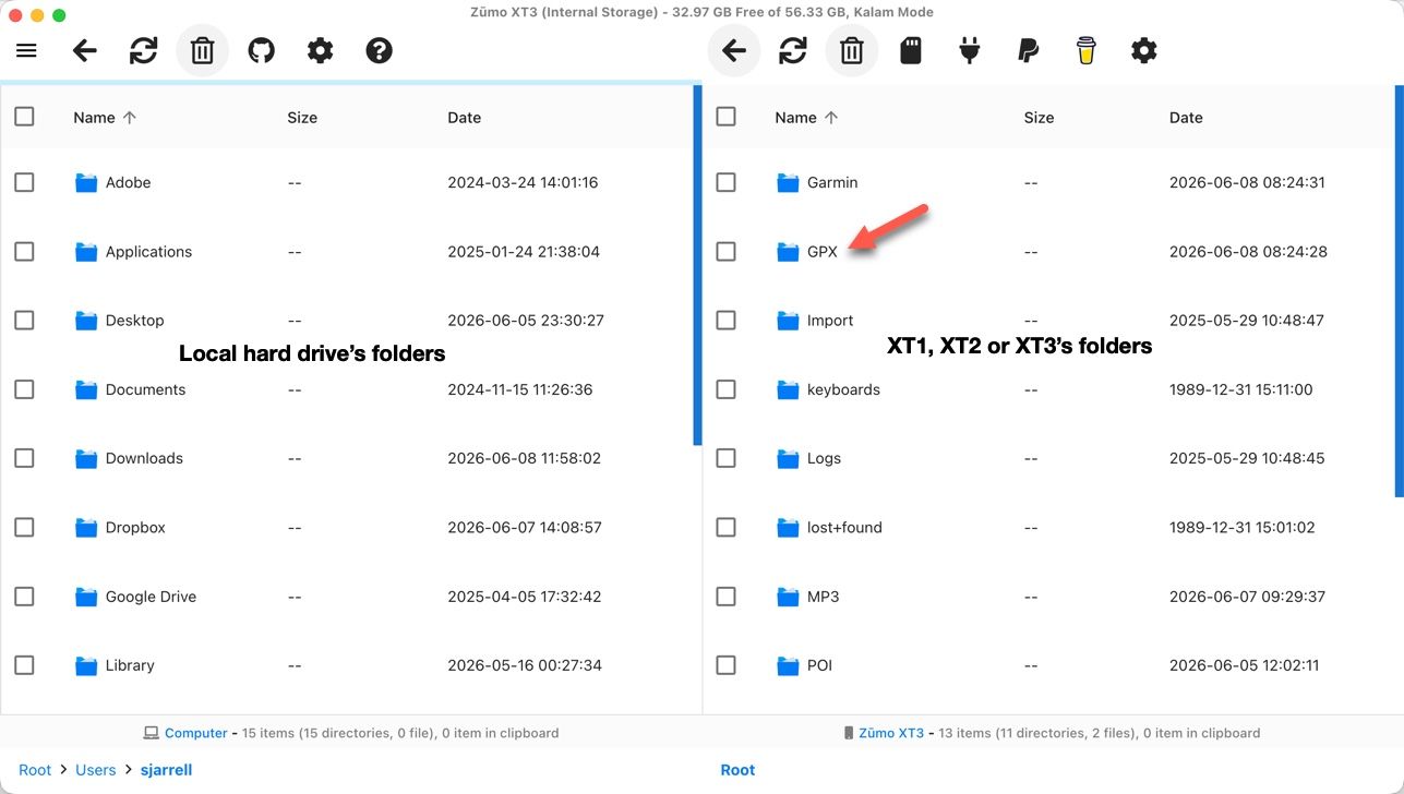
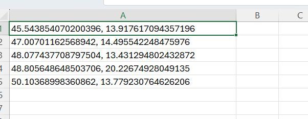
Your CSV need to be Long, Lat and a description of the POI.
Here's one of mine.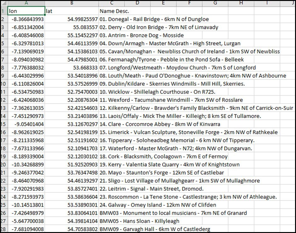
-
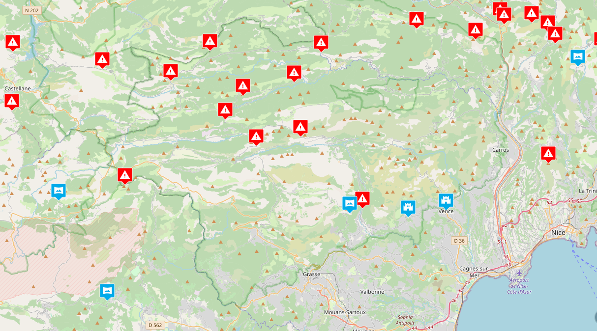
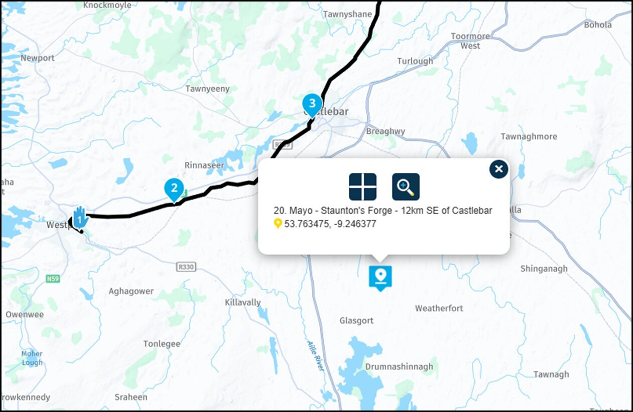
This is what the uploaded POI's look like.
-
This post is deleted!
-
I discovered that MRA doesn't display POIs from csv file if they're imported as lat-lon instead of lon-lat.
My Google Maps displays them as lat-lon, and in Excel I have to reverse the parameters. Why?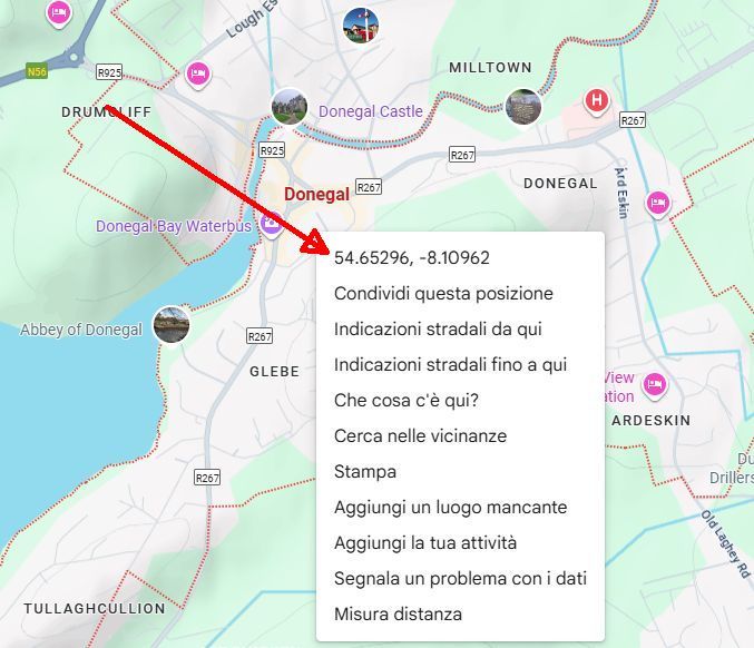
However, there is an alternative method, but it would be appreciated if MRA allowed renaming the waypoint positions.
-
I discovered that MRA doesn't display POIs from csv file if they're imported as lat-lon instead of lon-lat.
My Google Maps displays them as lat-lon, and in Excel I have to reverse the parameters. Why?However, there is an alternative method, but it would be appreciated if MRA allowed renaming the waypoint positions.
@Corrado-Miniati-0 the easy way to understand the format is to create a map / route in MRA with some POI's
then save the route as a CSV
you can then inspect the csv & replicate the format
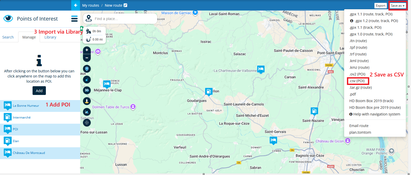
when you create your own custom CSV to import your points, import it via the Library tab
you will need to zoom into >=10km to see the imported POI'syes the lon-lat v lat-lon is an oddity of MRA, I dont know why, maybe it is a dutch thing

the points will be displayed just not in the part of the world you are expecting to find them
-
Thanks, maybe Corjan could check if the lat-lon vs lon-lat theme is a bug
-
It definitely is not a bug
")
Do I find it logical for a user perspective? No.
Will I change it? No. Mainly because everyone using this is now used to that.I do know the origin of these things.
Lat / lon is preferred by humans but I don’t know why. Lon / lat is however mathematically the correct order Longitude representing the horizontal (x) axis and Latitude the vertical (y) axis. -
It definitely is not a bug
Do I find it logical for a user perspective? No.
Will I change it? No. Mainly because everyone using this is now used to that.I do know the origin of these things.
Lat / lon is preferred by humans but I don’t know why. Lon / lat is however mathematically the correct order Longitude representing the horizontal (x) axis and Latitude the vertical (y) axis.@Corjan-Meijerink said in Assign a via point/waypoint number:
...Lon / Lat is however mathematically the correct order
Longitude representing the horizontal (x) axis and Latitude the vertical (y) axis.uhh, I believe it's not 100% correct explained.
- The geographical length, also called longitude (international abbreviation long or LON), describes the position east or west of a defined (arbitrarily defined) north-south line, the zero meridian. It's following the vertical earth axis.
- The geographical latitude, also called geodetic lat or (international abbreviation Lat. or LAT), describes the position north or south of a defined line round the earth, parallel to the Earth's horizontal equator.
But the rest, Corjan - you may know better than me

-
Also if you search for an address and what to add that to the route is will always be added at the end. So then you need to drag to the correct position.
I agree that a shorter way to edit the position of the point in the route would be a good functionality
-
In my case, but I think for many if not all users, it would be a very significant update.
-
I discovered that MRA doesn't display POIs from csv file if they're imported as lat-lon instead of lon-lat.
My Google Maps displays them as lat-lon, and in Excel I have to reverse the parameters. Why?However, there is an alternative method, but it would be appreciated if MRA allowed renaming the waypoint positions.
@Corrado-Miniati-0 said in Assign a via point/waypoint number:
I discovered that MRA doesn't display POIs from csv file if they're imported as lat-lon instead of lon-lat.
My Google Maps displays them as lat-lon, and in Excel I have to reverse the parameters. Why?However, there is an alternative method, but it would be appreciated if MRA allowed renaming the waypoint positions.
If you look at an exported KML file the lat/lon is reversed when exported, so the display in Google is different as the exported file.
-
@Bert, thanks for the explanation.
Unfortunately, the current inconvenience remains. -
@Bert, thanks for the explanation.
Unfortunately, the current inconvenience remains.@Corrado-Miniati-0 said in Assign a via point/waypoint number:
@Bert, thanks for the explanation.
Unfortunately, the current inconvenience remains.yes, I agree.
Hello! It looks like you're interested in this conversation, but you don't have an account yet.
Getting fed up of having to scroll through the same posts each visit? When you register for an account, you'll always come back to exactly where you were before, and choose to be notified of new replies (either via email, or push notification). You'll also be able to save bookmarks and upvote posts to show your appreciation to other community members.
With your input, this post could be even better 💗
Register Login-
13566
-
0366.1k
-
7321.9k
-
016457
-
110207
-
017516
-
312783
-
0220