



Skip to content
  • 1 Votes
    5 Posts
    161 Views
    Stevedo 6 0
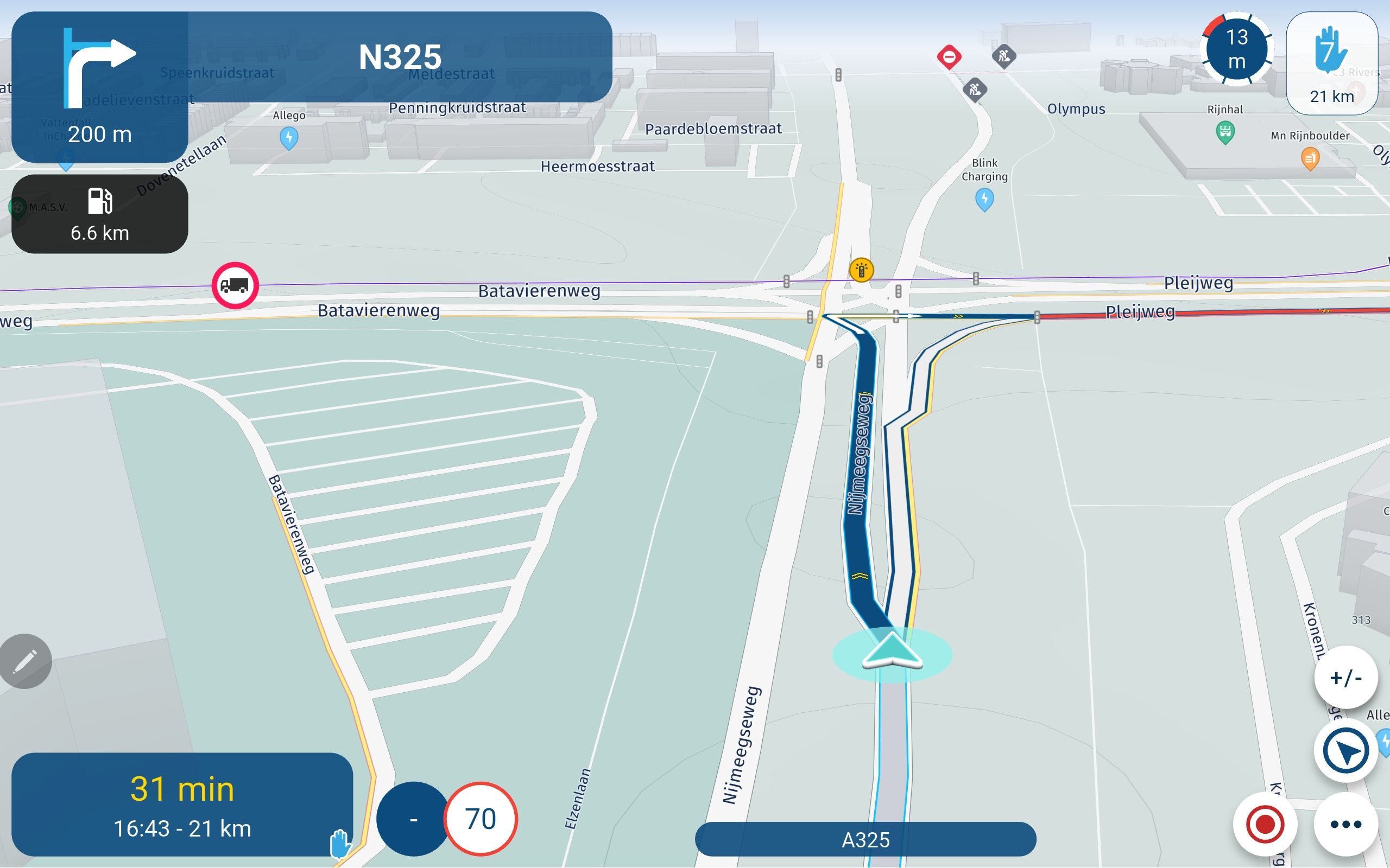
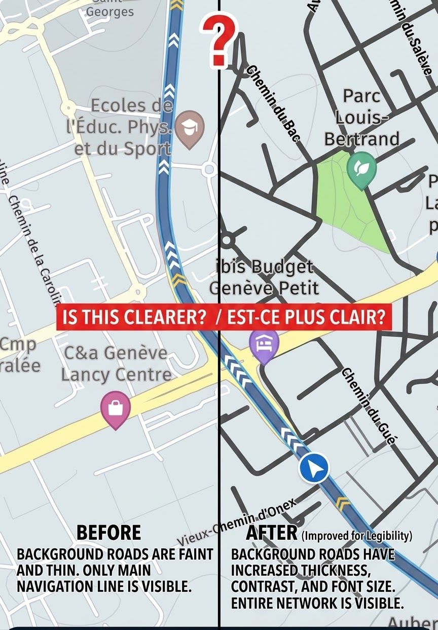
    I agree with all the sentiments that this needs to be addressed. I think the best way to address this is not via a txt file but by a number of profiles that can be configured by the end user. These profiles would be configured in the online planner and synchronised to the app for navigation. The end user can then select the most appropriate profile for their current situation. So for example, I might configure a profile for use on my bike where I use a ruggedised phone for navigation. In my car I have a built-in Android Auto/Carplay device which would use a different profile. For my camper I have a different set of requirements and therefore a different profile. The key is that I as the end user can define, easily save and then select the best profile for my scenario. Settings would include, but certainly not limited to: map colours, road colours, contrast, route colour, line width and opacity, map scaling, zoom level at which POI's appear (by category), etc etc. This way you can set a "sensible" default that can be used, probably by a majority of users, but also give "power" users the opportunity to customise their navigation experience. We all use different devices in different environments, some are colour blind or have other visual impairments and others have very strong preferences. The development team will never be able to accommodate all of these scenarios so give the end user the option to choose.
  • 0 Votes
    1 Posts
    613 Views
    No one has replied
  • 3 Votes
    36 Posts
    21k Views
    Tom Brady
    @Nick-Carthew thanks Nick, it's a strange one as there is no lag on Google maps, TTGo or Sygic. I'll keep messing around with the settings to try to solve it as the integrated native of the app with the excellent planner appeals to me.
  • 0 Votes
    5 Posts
    3k Views
    Rob Verhoeff
    @TomOnTour No... It's a feature that's gonna be inplemented. But I don't know when.
  • 0 Votes
    4 Posts
    57 Views
    MyRoute-app community
    Thanks for the suggestion @L-Spijker-0 While on the route-planning end I would completely agree with you that TomTom is a hard requirement, we'll definitely not be including TomTom routing in our initial release (and honestly, likely all future releases) of the MRA Navigation Next application. As @Steve-Lynch mentioned, we're using HERE as the basis for the premium sat-nav-esque "Navigation" part of "MRA Navigation Next". That isn't to say that TomTom map layers won't be possible. For those that don't know: map-layers are the way the map looks, including things like labels and colours.
  • 1 Votes
    2 Posts
    62 Views
    Tim  Thompson
    So it appears that I got an answer about my observations on #1 and #2 here... Navigation with waypoints It appears that my observations were correct. I'm good with #1. Disappointed with #2. On the upside, it appears that #2 is going to be addressed in Next. Great. As to #3, assuming that my observations were correct, I hope it will also be addressed in Next.
  • 0 Votes
    4 Posts
    2k Views
    Steve Lynch
    @Paul-Slater-0 There are hundreds of phone holders that will do the job. I use the XGrip and Ram Mount Clamp below. Like you I have a Garmin (XT) but I also like to run a phone as well when on tours as I do have a MRA Navigation subscription. I find it useful as a back up and also for the waypoint colours. For my Samsung S10 I have a full front and rear cover for when it rains. I hope you find a suitable solution and have a fantastic trip in France. [image: 1658679408592-ram-mount-and-xgrip.png]
ACTIVE USERS POPULAR TOPICS MY GROUPS