Skip to content
  • Categories
  • Recent
  • Popular
  • Support
  • MyRoute-app
Collapse
Brand Logo

MRA Community Forum

  1. Home
  2. The MyRoute-app
  3. [App] Problems, Bugs and other Issues
  4. V5.1.0 - 462 New altitude/heading shows incorrect Data

V5.1.0 - 462 New altitude/heading shows incorrect Data

Scheduled Pinned Locked Moved [App] Problems, Bugs and other Issues
13 Posts 6 Posters 195 Views 5 Watching
  • Oldest to Newest
  • Newest to Oldest
  • Most Votes
Reply
  • Reply as topic
Log in to reply
This topic has been deleted. Only users with topic management privileges can see it.
  • Reinhard Punzundefined Offline
    Reinhard Punzundefined Offline
    Reinhard Punz
    wrote last edited by
    #2

    Note: The displayed altitude is approximately 50 meters too high. Sometimes only 45 meters.

    1 Reply Last reply
    0
    • Reinhard Punzundefined Offline
      Reinhard Punzundefined Offline
      Reinhard Punz
      wrote last edited by
      #3

      Note: The displayed altitude is approximately 50 meters too high. Sometimes only 45 meters.

      1 Reply Last reply
      0
      • Mzokkundefined Offline
        Mzokkundefined Offline
        Mzokk
        wrote last edited by
        #4

        Standard GPS satellites don’t track your height from the actual ground (valleys, mountains). They measure your distance from a theoretical, mathematical model of the Earth called an ellipsoid. Your phone then has to translate that to "Mean Sea Level" using a gravity model, which can easily throw off calculations by hundreds of feet. In short your phone is not that accurate on the vertical plane. Even specific GPS devices such as Garmin are only accurate to +/- 30m unless they also take data from a topographic database which triangulates horizontal position with a topographical datum. My phone is a 60m out using MRA or OSMand (reading high) and my Zumo XT usually under or over reads by 20-30m

        1 Reply Last reply
        0
        • Mzokkundefined Offline
          Mzokkundefined Offline
          Mzokk
          wrote last edited by
          #5

          Oh and strangely it can be accurate at higher elevations. I was using MRA on a trip on Saturday crossing a pass at 448m and it was reading 447M passing the datum point??

          1 Reply Last reply
          0
          • Mzokkundefined Offline
            Mzokkundefined Offline
            Mzokk
            wrote last edited by Mzokk
            #6

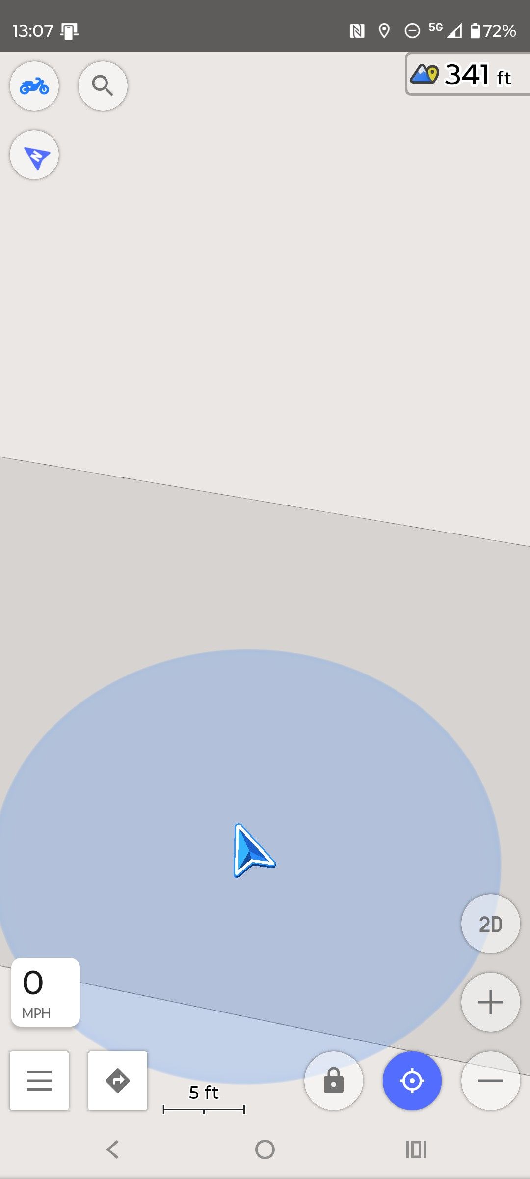
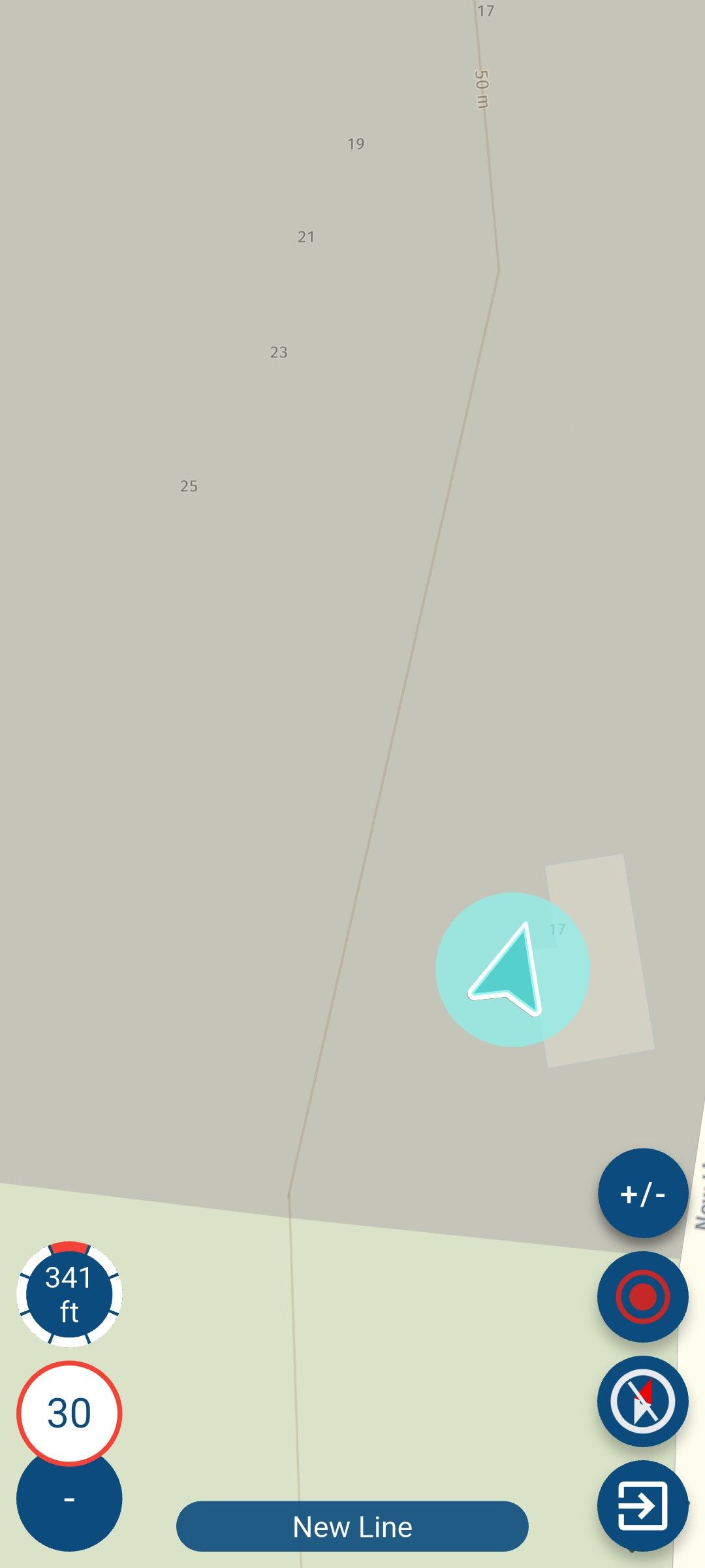
            I did a little experiment with this. My house is just below a 50m contour line. My phone using MRA gives 341ft or 104M.
            07e9184a-8270-474f-8212-54e40340381b-image.jpeg

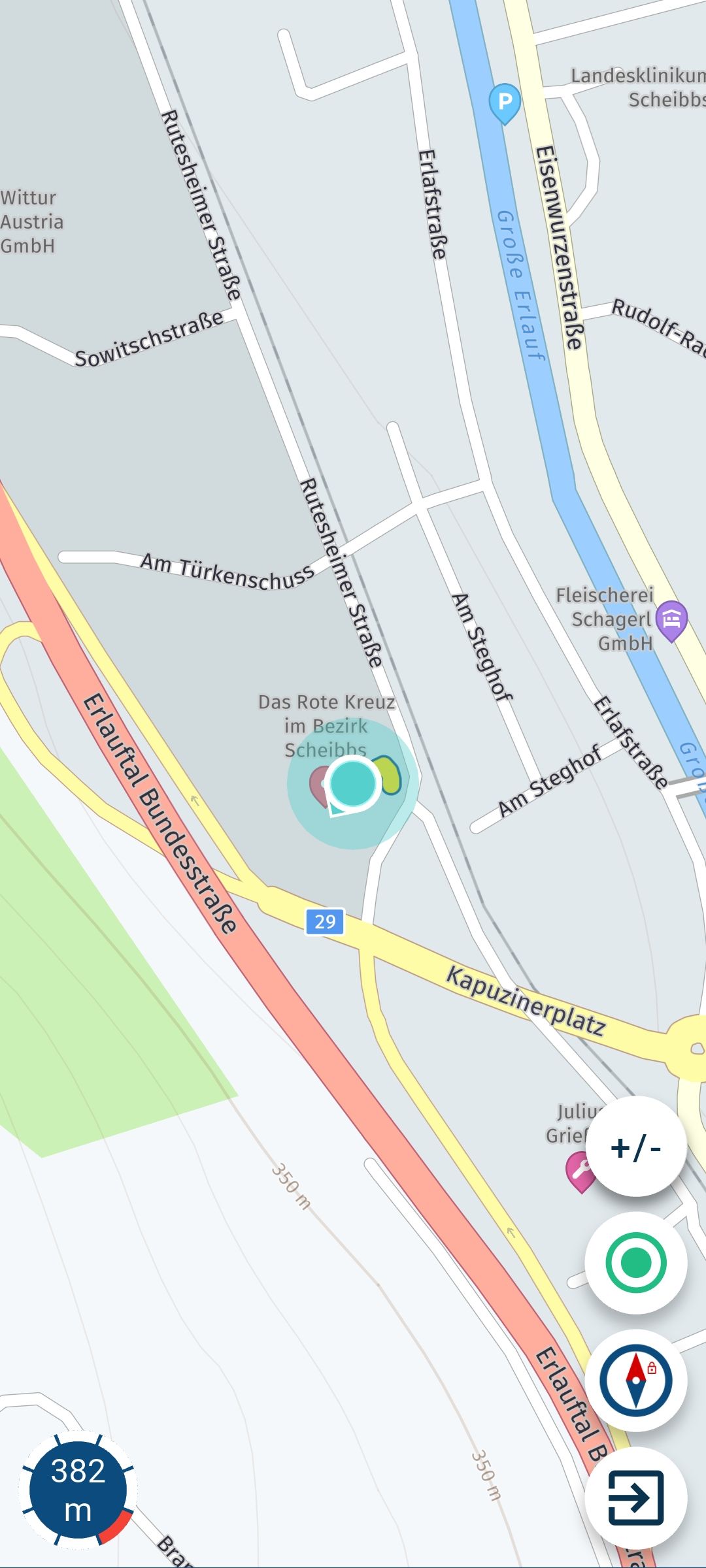
            Same with OSMand.

            47c284ca-5f1a-4fb9-955f-ba021c3bf3af-image.jpeg

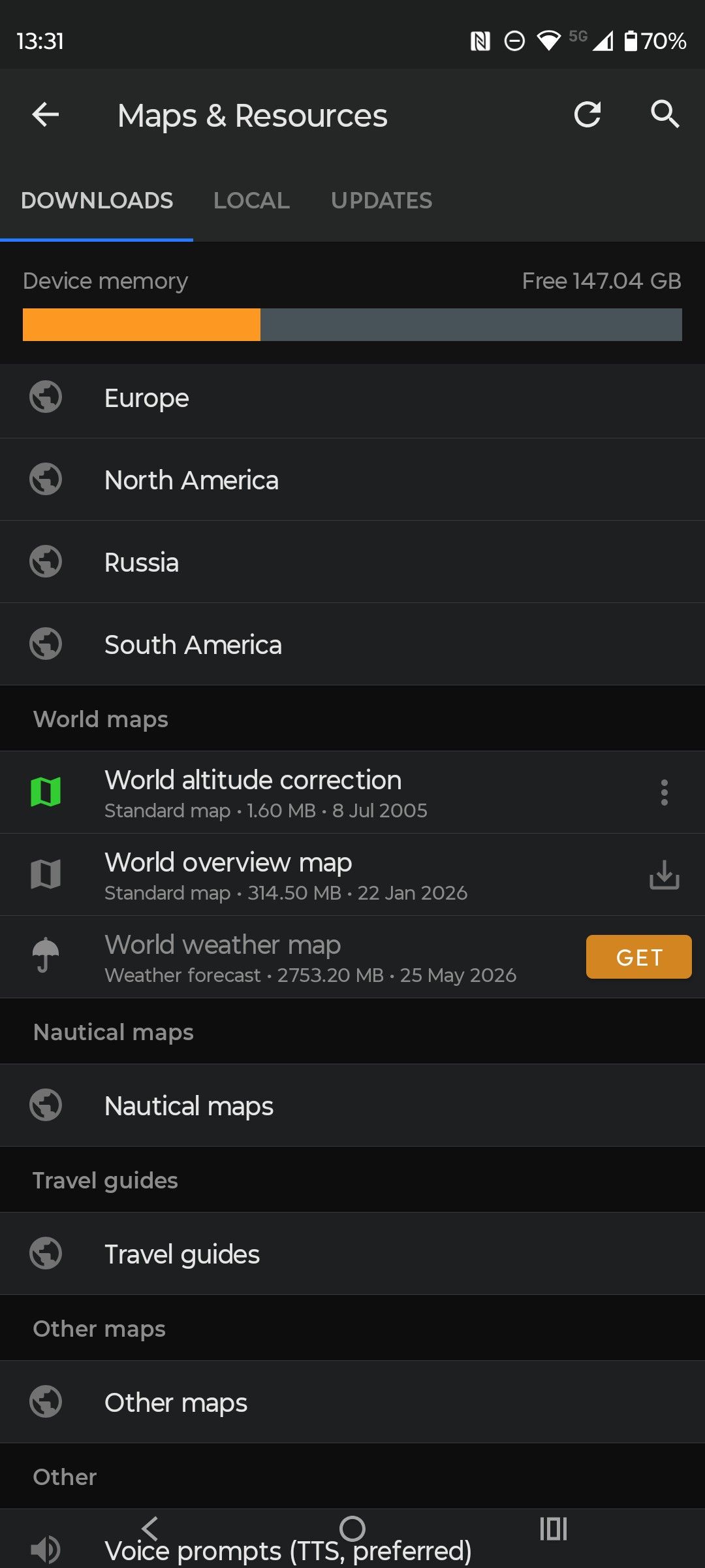
            In OSMand you can download a correction file "World Altitude Correction"
            4682ebb0-0a34-4b12-a684-e27bdbb84ca5-image.jpeg

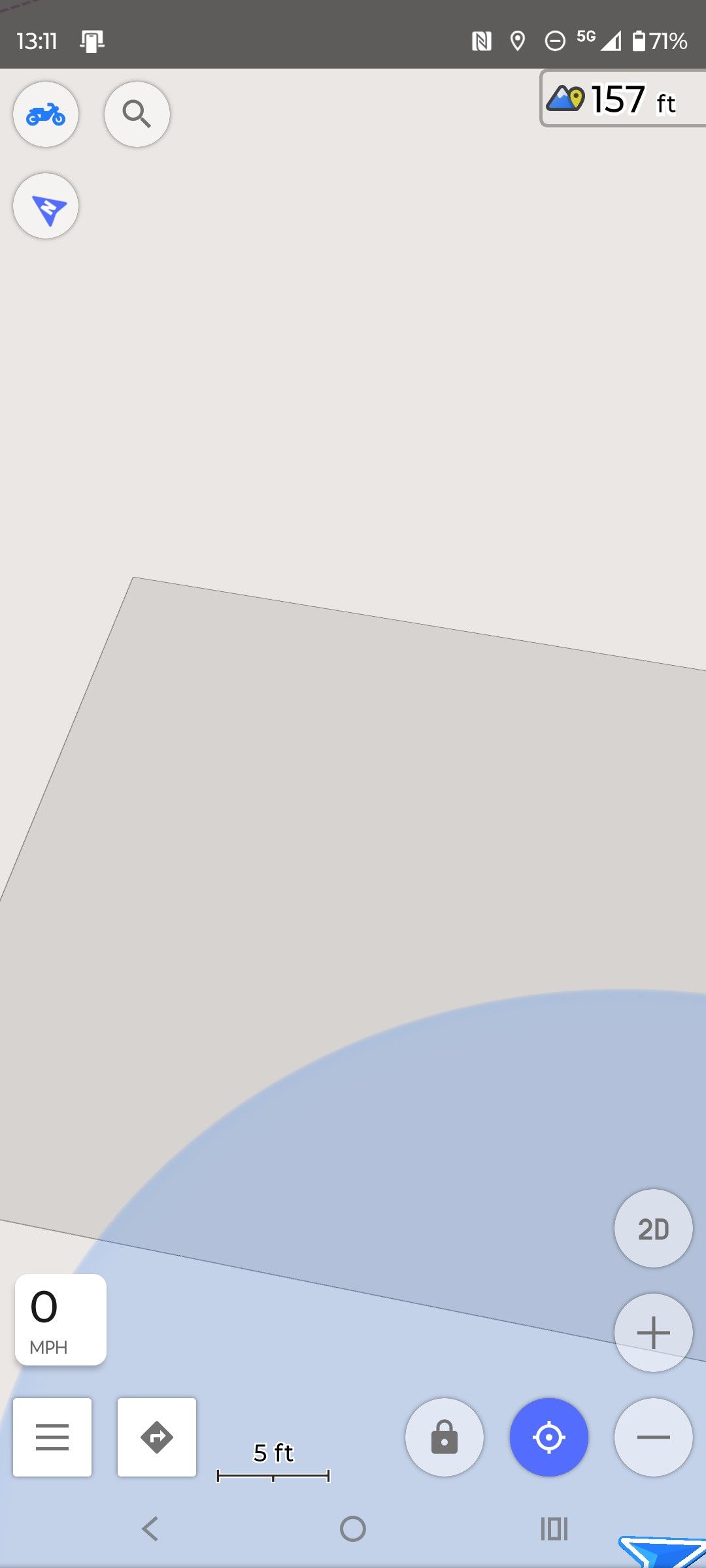
            This puts me at 157ft or 48M which would be within + or - 3m of my actual elevation.
            324154c7-789f-4c80-bfc7-96f5fb80e52d-image.jpeg

            Might be worth building in the correction file somewhere?

            1 Reply Last reply
            1
            • Jörgenundefined Offline
              Jörgenundefined Offline
              Jörgen
              Valued contributor
              wrote last edited by
              #7

              I noticed also that a correction of about -50 m is necessary.

              Hardware
              iPhone 12 pro (iOS 26.2.1)
              iPad (7.Gen.) 18.7.3
              Oukitel RT3 Pro (Andr. 14)
              Wireless CarPlay mit (Elebest C650)
              Wired CarPlay (SEAT Arona - 2021)
              MRA Workshops in Deutsch sind hier zu finden

              1 Reply Last reply
              0
              • Jörgenundefined Offline
                Jörgenundefined Offline
                Jörgen
                Valued contributor
                wrote last edited by
                #8

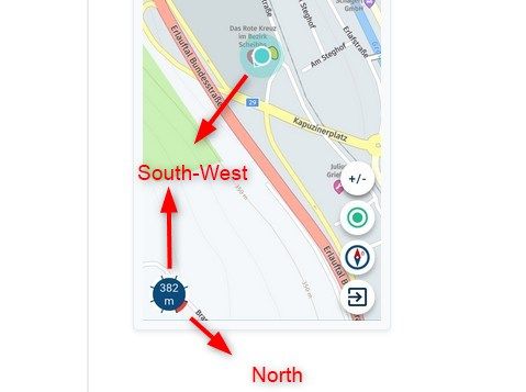
                Regarding the Noth segment display, I believe it was always correct.

                Hardware
                iPhone 12 pro (iOS 26.2.1)
                iPad (7.Gen.) 18.7.3
                Oukitel RT3 Pro (Andr. 14)
                Wireless CarPlay mit (Elebest C650)
                Wired CarPlay (SEAT Arona - 2021)
                MRA Workshops in Deutsch sind hier zu finden

                1 Reply Last reply
                0
                • Guzzistundefined Offline
                  Guzzistundefined Offline
                  Guzzist
                  Valued contributor
                  wrote last edited by
                  #9

                  I compared several apps and GPX Tools. Only OsmAnd Shows the correct value (at my home base in southern part of Germany.

                  Nothing is impossible ;-)
                  In past: GARMIN Zumo 210->GARMIN Zumo 395->GARMIN XT=> now: DMD T865-X + MyRoute-App, LocusMaps, OsmAnd.
                  In past: GARMIN MapSource ->GARMIN BaseCamp->Tyre->Kurviger->Calimoto=> now: MRA-Routplanner.

                  1 Reply Last reply
                  0
                  • Rob Verhoeffundefined Offline
                    Rob Verhoeffundefined Offline
                    Rob Verhoeff
                    Alpha tester
                    wrote last edited by
                    #10

                    It’s just a nice extra feature! It’s not like your life depends on the altitude display shown by the navigation system. I see it as a fun gimmick. Whether I’m driving at sea level or at 1500 meters in mountainous terrain, it’s simply fun to see — nothing more. And I believe that’s exactly how this functionality was intended: nothing more and nothing less. Apparently, some phones handle it better than others.

                    BMW K1600GT-P (2013) | Nolan N100-5 with Sena 30K
                    iOS on iPhone 13 & 16 (mounted on Quadlock or AliExpress extention on BMW-cradle)
                    Apple CarPlay in VW T-Roc
                    Routelab on MacBook Air & iMac (Tahoe & Ventura)

                    Guzzistundefined Mzokkundefined 2 Replies Last reply
                    1
                    • Rob Verhoeffundefined Rob Verhoeff

                      It’s just a nice extra feature! It’s not like your life depends on the altitude display shown by the navigation system. I see it as a fun gimmick. Whether I’m driving at sea level or at 1500 meters in mountainous terrain, it’s simply fun to see — nothing more. And I believe that’s exactly how this functionality was intended: nothing more and nothing less. Apparently, some phones handle it better than others.

                      Guzzistundefined Offline
                      Guzzistundefined Offline
                      Guzzist
                      Valued contributor
                      wrote last edited by
                      #11

                      @Rob-Verhoeff I totally agree with you Rob. It was just this discussion, which let me check just at home, because I know the hight there 😊

                      Nothing is impossible ;-)
                      In past: GARMIN Zumo 210->GARMIN Zumo 395->GARMIN XT=> now: DMD T865-X + MyRoute-App, LocusMaps, OsmAnd.
                      In past: GARMIN MapSource ->GARMIN BaseCamp->Tyre->Kurviger->Calimoto=> now: MRA-Routplanner.

                      1 Reply Last reply
                      0
                      • Rob Verhoeffundefined Rob Verhoeff

                        It’s just a nice extra feature! It’s not like your life depends on the altitude display shown by the navigation system. I see it as a fun gimmick. Whether I’m driving at sea level or at 1500 meters in mountainous terrain, it’s simply fun to see — nothing more. And I believe that’s exactly how this functionality was intended: nothing more and nothing less. Apparently, some phones handle it better than others.

                        Mzokkundefined Offline
                        Mzokkundefined Offline
                        Mzokk
                        wrote last edited by Mzokk
                        #12

                        @Rob-Verhoeff Agree also. Just a fun thing. Elevation isn't even critical when hill walking. I'm more of a map and old Silva compass person for that activity. I have started to use OSMand a bit whilst walking.......its a slippery slope (sorry couldn't resist) 😊

                        1 Reply Last reply
                        0
                        • Bouke Entundefined Offline
                          Bouke Entundefined Offline
                          Bouke Ent
                          wrote last edited by
                          #13

                          In The Netherlands our level is based on NAP. GPS level is based on a globel level. for yhe netherlands it is arround a 40 meter differance then our NAP.

                          1 Reply Last reply
                          0

                          Hello! It looks like you're interested in this conversation, but you don't have an account yet.

                          Getting fed up of having to scroll through the same posts each visit? When you register for an account, you'll always come back to exactly where you were before, and choose to be notified of new replies (either via email, or push notification). You'll also be able to save bookmarks and upvote posts to show your appreciation to other community members.

                          With your input, this post could be even better 💗

                          Register Login
                          Reply
                          • Reply as topic
                          Log in to reply
                          • Oldest to Newest
                          • Newest to Oldest
                          • Most Votes


                          ACTIVE USERS
                          Bouke Entundefined
                          Bouke Ent
                          Rob Verhoeffundefined
                          Rob Verhoeff
                          Guzzistundefined
                          Guzzist
                          Mzokkundefined
                          Mzokk
                          Jörgenundefined
                          Jörgen
                          Reinhard Punzundefined
                          Reinhard Punz
                          POPULAR TOPICS
                          • V5.1.0 - 462 New altitude/heading shows incorrect Data
                            Bouke Entundefined
                            Bouke Ent
                            0
                            13
                            195

                          • Live Map Updates
                            Marinus van Deudekomundefined
                            Marinus van Deudekom
                            1
                            9
                            124

                          • Best way to set my Garmin Zumo XT to play well with the MRA?
                            Mzokkundefined
                            Mzokk
                            0
                            9
                            131

                          • Navigation arrow still not stable
                            Corjan Meijerinkundefined
                            Corjan Meijerink
                            1
                            8
                            195

                          • Seasonal closures affect not only seasonal road closures (mountain passes and the like) but also closures due to roadworks. This is why the route takes you through the closure even during planning, even though Here is actually aware of it.
                            Herman Veldhuizenundefined
                            Herman Veldhuizen
                            3
                            8
                            223

                          • My route app
                            Hub 1undefined
                            Hub 1
                            0
                            5
                            78

                          • Being instructed to turn off at each next Junction
                            John B 1undefined
                            John B 1
                            0
                            6
                            130

                          • Jack from Netherlands
                            Leike Lodiersundefined
                            Leike Lodiers
                            1
                            4
                            102

                          MY GROUPS
                          • Login

                          • Login or register to search.
                          • First post
                            Last post
                          0
                          • Categories
                          • Recent
                          • Popular
                          • Support
                          • MyRoute-app