Improve Favorite POI management (visibility, categories, icons)
-
Thank you for sharing your suggestions. Such suggestions have been made several times before. Hopefully, this topic will soon receive the attention it deserves from the developers. It would take MRA to an even higher level. I’m keeping my fingers crossed along with you

-
You are not the first with this suggestion (try search), I am sure the Developers work on this. One comment, you mix up Favorites and POIs, these are two different things.
-
I know. I’ve already searched the forum and noticed that requests related to favorites have been circulating since 2021, 2022, 2023, 2024, and even in 2025.
I work in IT and web application development, and I genuinely believe that even just one week of dedicated development could lead to significant improvements. This makes me think that not much time has been invested in this feature so far.
That’s why I decided to bring it up again, to refocus attention on favorites, while also adding a few suggestions, such as the ability to view favorites directly on the map. I find this feature extremely useful, and it’s currently missing.
I read that categorizing favorites seems to be a challenge for developers, so I proposed using tags as a simpler and more flexible alternative.
I’m aware that POIs and favorites are two separate things.
POI management could also be improved, but that might be the subject of a future request. For now, I wanted to focus exclusively on favorites. -
I agree.

-
Hi everyone,
I use MyRoute-app — both on desktop and mobile — and I really appreciate the ability to save Favorite POIs for future trip planning.
However, I think the Favorite POI system could be improved to make route planning easier and more organized.Here are some suggestions I’d like to propose:
-
Show favorites on the map
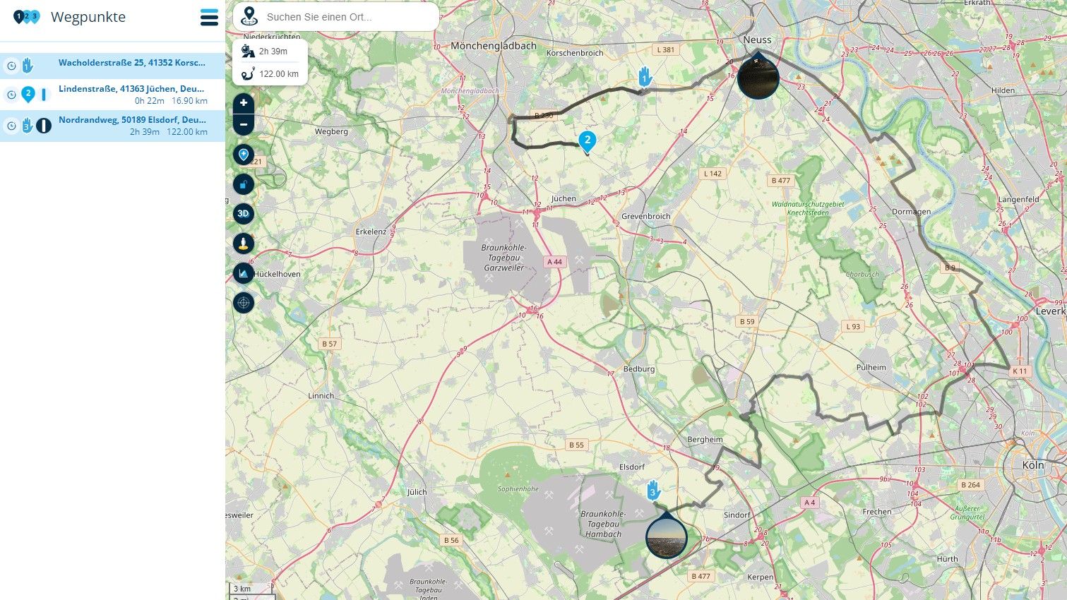
It would be great if Favorite POIs could be visible on the map, similar to how it works in TomTom Planner.
Ideally, there should be a toggle to show/hide them, both in the web planner and the mobile app. -
Categories or tags
I know the request to categorize POIs has been made before.
Maybe full-blown categories are technically complex — but adding a simple tag system could be a more feasible solution.
For example, allowing users to assign tags like “Hotel”, “Pass”, “Food Stop”, etc., and then filter by tag when needed. -
More icons
The current icon set is quite limited. A wider selection of icons (e.g. hotel, tent, parking, mountain pass, binoculars) would help visually distinguish different types of POIs at a glance. -
Better management interface
A more advanced interface for managing Favorites would be welcome — including batch editing, filtering, sorting, and grouping by tag. -
Sharing Favorites (future idea)
As a future enhancement, it could be nice to share public categories or tag groups of favorites — like “Offroad Tracks”, “Mountain Passes”, etc. This would allow collaboration between users or communities.
I understand some of these ideas may be more complex to implement, but even starting with just map visibility, tagging, and more icons would already make a big difference.
What do you think? Do other users feel the same need?
Thanks in advance — and happy riding!
@Roberto-Ar, in short: treat Favorites like Personal POI categories.
I am just an enthusiastic MRA user, and hope you will be one too!
Most motorcycle problems are caused by the nut that connects the handlebar to the saddle.
Check out RideSleepRepeat.eu, a biker community for sharing stays across Europe
-
-
@Roberto-Ar, in short: treat Favorites like Personal POI categories.
@Con-Hennekens Exactly
")
-
I'd like to add my vote for this. I think POIs are not well implemented in MRA. Look for example at Google MyMaps which has a very nice system for managing what they call waypoints..I can add photos from the web, notes, all kinds of things. I use this feature a great deal to keep track of places I might want to visit on a future trip.
There is no real counterpart to that feature in MRA and it makes planning a ride with places I might like to see that are close to but not ON the route very difficult.
@Stephan-Dornberg said in Improve Favorite POI management (visibility, categories, icons):
I'd like to add my vote for this. I think POIs are not well implemented in MRA. Look for example at Google MyMaps which has a very nice system for managing what they call waypoints..I can add photos from the web, notes, all kinds of things. I use this feature a great deal to keep track of places I might want to visit on a future trip.
There is no real counterpart to that feature in MRA and it makes planning a ride with places I might like to see that are close to but not ON the route very difficult.
I think you cannot compare myMaps with a routeplanner like MRA, these are 2 different things: MyMaps is a application for POI's, MRA is a route planner. you cannot plan routes in MyMaps.
I think Mymaps is nice but I prever uMap.
This is based on openstreetmap and you can directly download in CSV, GPX and GeoJson.
MyMaps only in KML which you have to convert again to use in MRA.
You can download any layer directly as GPX or even filter.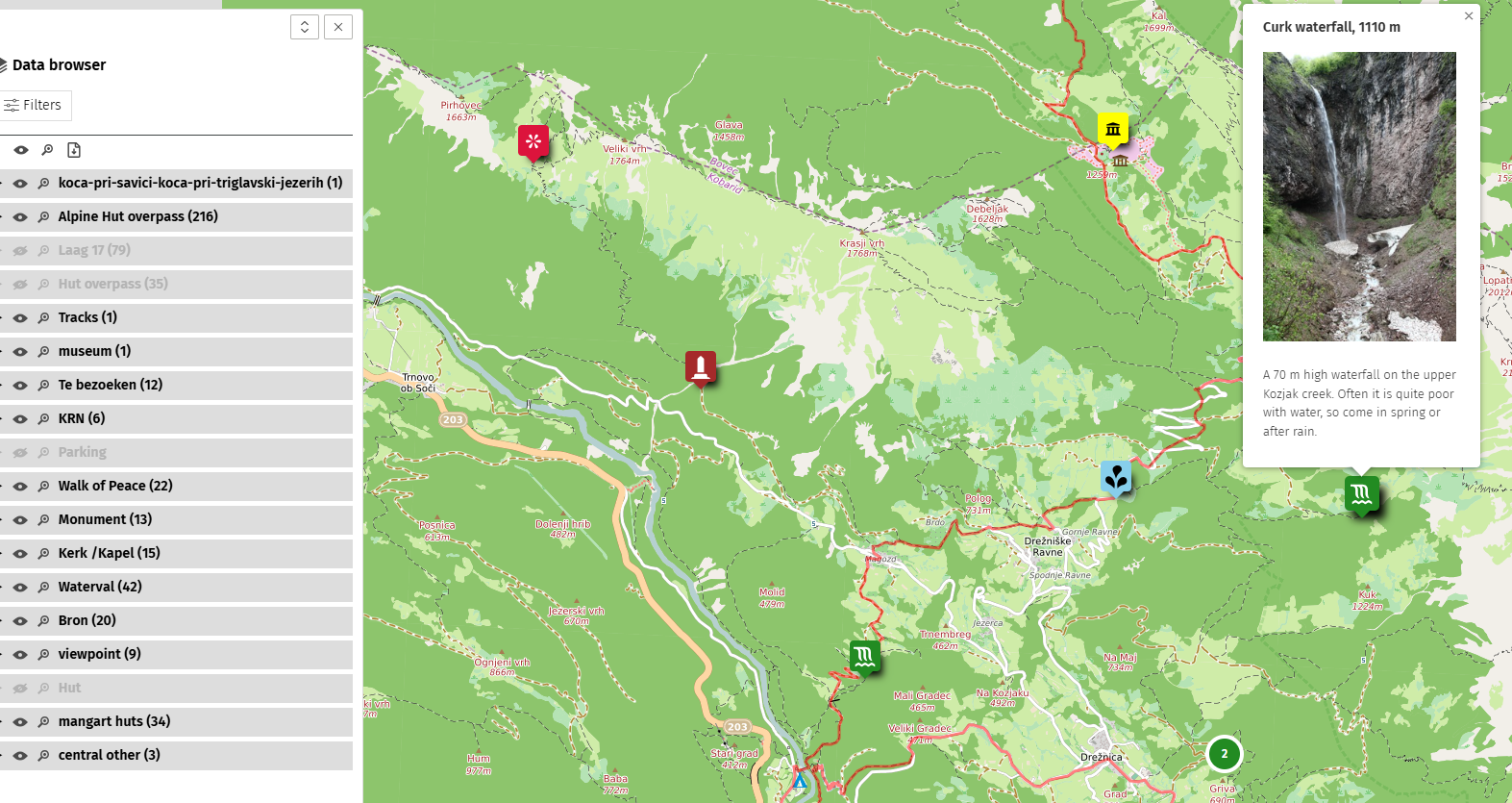
Here a sample of the MOHO Hotels and Tourenfahrer Hotels in Umap
http://u.osmfr.org/m/1274476/You can even use overpass-turbo to get a every Openstreetmap item out of Openstreetmap as POI real time.
Here is a sample of all the hotels and campings in Slovenia downloaded directly from openstreetmap on the moment you open de map.
http://u.osmfr.org/m/1271586/Only downside is that you must have a Github or Openstreetmap account to access Umap.
I agree that POI's are (to) limited in MRA but with Umap and some tools I made to get data from the Internet I have a nice workaround.
-
@Stephan-Dornberg said in Improve Favorite POI management (visibility, categories, icons):
I'd like to add my vote for this. I think POIs are not well implemented in MRA. Look for example at Google MyMaps which has a very nice system for managing what they call waypoints..I can add photos from the web, notes, all kinds of things. I use this feature a great deal to keep track of places I might want to visit on a future trip.
There is no real counterpart to that feature in MRA and it makes planning a ride with places I might like to see that are close to but not ON the route very difficult.
I think you cannot compare myMaps with a routeplanner like MRA, these are 2 different things: MyMaps is a application for POI's, MRA is a route planner. you cannot plan routes in MyMaps.
I think Mymaps is nice but I prever uMap.
This is based on openstreetmap and you can directly download in CSV, GPX and GeoJson.
MyMaps only in KML which you have to convert again to use in MRA.
You can download any layer directly as GPX or even filter.Here a sample of the MOHO Hotels and Tourenfahrer Hotels in Umap
http://u.osmfr.org/m/1274476/You can even use overpass-turbo to get a every Openstreetmap item out of Openstreetmap as POI real time.
Here is a sample of all the hotels and campings in Slovenia downloaded directly from openstreetmap on the moment you open de map.
http://u.osmfr.org/m/1271586/Only downside is that you must have a Github or Openstreetmap account to access Umap.
I agree that POI's are (to) limited in MRA but with Umap and some tools I made to get data from the Internet I have a nice workaround.
WOW - never heard of uMap before, what a great tool!
I'm familiar with Overpass and quickly created a dynamic layer with OSM picnic sites:
Works great so far. There is one thing I haven't figured out: is there a way to assign a value for a sym tag when exporting this layer as GPX, for example <sym>picnic</sym>?
-
WOW - never heard of uMap before, what a great tool!
I'm familiar with Overpass and quickly created a dynamic layer with OSM picnic sites:
Works great so far. There is one thing I haven't figured out: is there a way to assign a value for a sym tag when exporting this layer as GPX, for example <sym>picnic</sym>?
@Martin-Wilcke
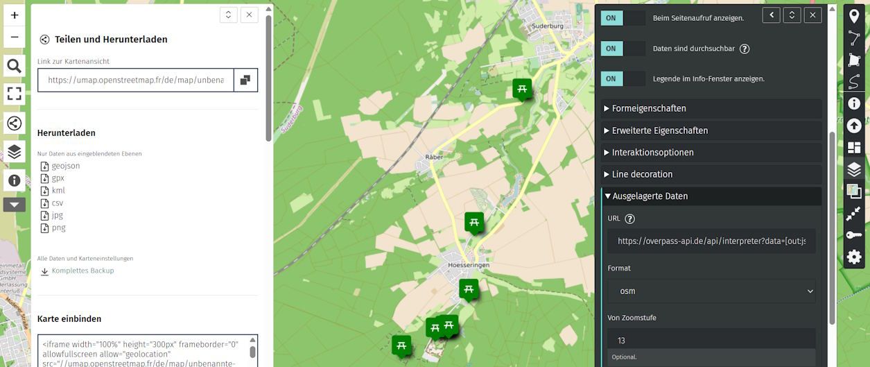
I am still exploring all the posibilities from uMap, documentation is not up to date I am afraid.
It seems that the asigned symbols are not exported ( mostly the exports are fields that every navigation program can read.
You can edit and add new field inside the program, but not everything is exported.
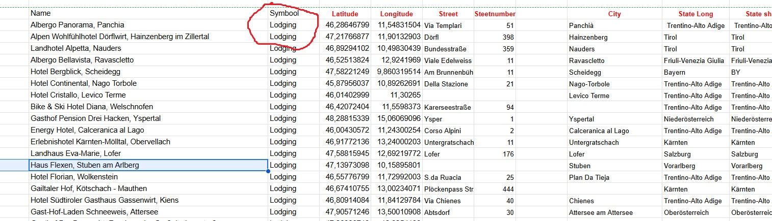
See the marked field in the screenshot.
![alt text]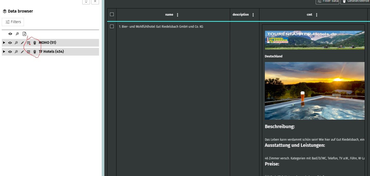
I build some tools in Excel/Google sheets to geo-reference the POI's with Google and add fields to it, so I export the file as CSV from Umap, edit it in Excel and add fields that are know to my Garmin like the symbol field and export it from Excel to a GPX file with additional fields my Garmin can read.
See the screenshot below for the edited MoHo GPX import.
-
@Martin-Wilcke
I am still exploring all the posibilities from uMap, documentation is not up to date I am afraid.
It seems that the asigned symbols are not exported ( mostly the exports are fields that every navigation program can read.
You can edit and add new field inside the program, but not everything is exported.
See the marked field in the screenshot.
![alt text]I build some tools in Excel/Google sheets to geo-reference the POI's with Google and add fields to it, so I export the file as CSV from Umap, edit it in Excel and add fields that are know to my Garmin like the symbol field and export it from Excel to a GPX file with additional fields my Garmin can read.
See the screenshot below for the edited MoHo GPX import.
Ok, thanks.
Enhancing data with another tool, like Excel, is an option. However, I will dig deeper into uMap and maybe find a solution.
Exporting a sym tag for <wpt> is key for my usage. That's one of the features I really would like to have with MRA.
-
@Martin-Wilcke
If you find it let me know.Exporting symbols from MRA is also on my wishlist.
If I can do it in Excel with my limited knowledge of programming, it should not be a to bigger problem for a professional programmer
-
Ich kann mich dem Thema "Verbesserung der POIs nur anschließen. Ich hätte ein paar zusätzliche Vorschläge:
- Die verwalteten POIs nicht in einer Route speichern, sondern unabhängig davon in einer eigenen POI Datei.
- Beim Erstellen von POIs soll es die Möglichkeit geben, diese einer bestimmten Gruppe zuzuweisen, ähnlich wie es jetzt schon in der POI Bibliothek aussieht.
- Die POIs sollen auch verwaltet werden können, ohne dass man eine Route öffnen muss.
- Importiere POIs sollen bearbeitet/verwaltet werden können. Sie ein- oder auszublenden ist zu wenig.
- Die POIs sollen auch exportiert werden können.
Gibt es Informationen darüber, ob die Umgestaltung der POI Verwaltung in Planung ist? Ich habe im Forum leider nichts gefunden.
Derweil bleibe ich hoffnungsfroh und danke schon im Voraus für eine Antwort.
@Reinhard-Punz Please try to use the same language that the topic is using, this makes it easier for all to follow. Thanks
-
@Roberto-Ar, in short: treat Favorites like Personal POI categories.
@Con-Hennekens said in Improve Favorite POI management (visibility, categories, icons):
@Roberto-Ar, in short: treat Favorites like Personal POI categories.
Is there a way of showing the Favorites in the map when planning routes (like the POIs)?
-
No, favourites can only be accessed and viewed individually after they have been activated.
-
@Con-Hennekens said in Improve Favorite POI management (visibility, categories, icons):
@Roberto-Ar, in short: treat Favorites like Personal POI categories.
Is there a way of showing the Favorites in the map when planning routes (like the POIs)?
@Bjorn-Bjornstad As @Jörgen said, no. Think of favourites as bookmarks to help you quickly find a favourite location. Once a favourite is shown on the screen you can add it as a route point.
Hello! It looks like you're interested in this conversation, but you don't have an account yet.
Getting fed up of having to scroll through the same posts each visit? When you register for an account, you'll always come back to exactly where you were before, and choose to be notified of new replies (either via email, or push notification). You'll also be able to save bookmarks and upvote posts to show your appreciation to other community members.
With your input, this post could be even better 💗
Register Login-
27101
-
220245
-
0895
-
05213
-
025
-
0786
-
08347
-
618519