Points of Interest - display options.
-
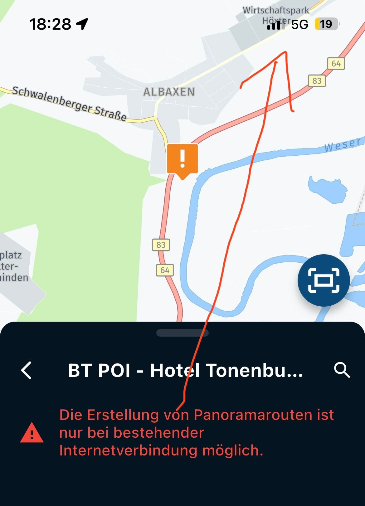
Currently it appears that Points of Interest only appear at a certain zoom level. It would be really helpful to be able to toggle them to "always display" or to adjust the zoom level that they appear when working on a specific route.
This is needed for motorcycle rally events where the bonuses are distributed over very large areas. Currently I cannot use MRA to plan my route due to this limitation.
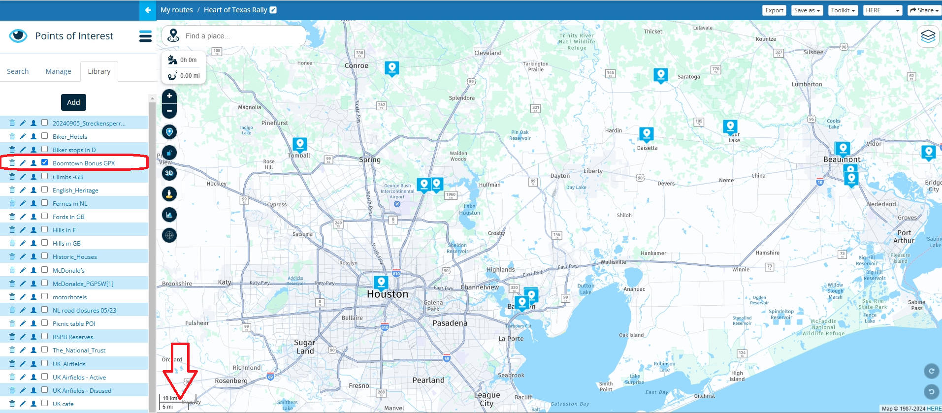
Example POI list from the Heart of Texas Rally - there is no way to display them all on the screen at once due to their distance apart:
[https://39274969-bf2d-473a-bfb2-a77da99626ae.filesusr.com/ugd/f60a22_bde67812d28c4612a2de1a2c0ecceebf.gpx?dn=Boomtown Bonus GPX.gpx](link url) -
Currently it appears that Points of Interest only appear at a certain zoom level. It would be really helpful to be able to toggle them to "always display" or to adjust the zoom level that they appear when working on a specific route.
This is needed for motorcycle rally events where the bonuses are distributed over very large areas. Currently I cannot use MRA to plan my route due to this limitation.
Example POI list from the Heart of Texas Rally - there is no way to display them all on the screen at once due to their distance apart:
[https://39274969-bf2d-473a-bfb2-a77da99626ae.filesusr.com/ugd/f60a22_bde67812d28c4612a2de1a2c0ecceebf.gpx?dn=Boomtown Bonus GPX.gpx](link url)@Edward-h said in Points of Interest - display options.:
Heart of Texas Rally
Currently your own POI files are visible at a 5 mile zoom range. So I do understand your request to see POIs and a lesser zoom level.
Always willing to help if I can.
Triumph Tiger 1200 XRT called Tina.
MRA Navigation Next and SilverFox BJ8 -
@Edward-h said in Points of Interest - display options.:
Heart of Texas Rally
Currently your own POI files are visible at a 5 mile zoom range. So I do understand your request to see POIs and a lesser zoom level.
@Nick-Carthew Sorry for the confusion. I want to see the POIs when zoomed out further so that I can see all the POIs on the map at one time.
Right now, they disappear when you zoom out. There's no way to see all the POIs at once (and that is just a Texas Rally - in something like the IBR you'd want to see the entire nation's POIs at the same time).
-
@Nick-Carthew Sorry for the confusion. I want to see the POIs when zoomed out further so that I can see all the POIs on the map at one time.
Right now, they disappear when you zoom out. There's no way to see all the POIs at once (and that is just a Texas Rally - in something like the IBR you'd want to see the entire nation's POIs at the same time).
@Edward-W No confusion. I fully understand and agree with your request. I merely posted a map with your POIs to demonstrate.
Always willing to help if I can.
Triumph Tiger 1200 XRT called Tina.
MRA Navigation Next and SilverFox BJ8 -
@Edward-W No confusion. I fully understand and agree with your request. I merely posted a map with your POIs to demonstrate.
@Nick-Carthew I, too, would find it very helpful to have custom POIs be visible at every zoom level while navigating via MRA (the smartphone app). But what would elevate their usefulness even more, in my opinion, would be the possibility to add explanatory text and/or a picture rather than just a title. These metadata should show up once a custom POI is tapped, and there should be a bottom to "navigate to here". So, basically, a custom POI would GUI-wise behave a lot like a shaping point, yet would not be connected to/part of the route unless the user opts to actually go there. The use case I have in mind here is curating a collection of good restaurants close to a via point (say, the hotel) whilest planning, so that there are several options readily available when traveling - but choosing to ignore (some or all of) them doesn't interfere with the planned route.
VOGE DS 900 X: AA with Carpuride W702 (via Samsung S22 Ultra)
Royal Alloy TG 300 S: Mounted Samsung S22 Ultra
Skoda Citigo: AA with Carpuride W903 (via Samsung S22 Ultra) -
@Nick-Carthew I, too, would find it very helpful to have custom POIs be visible at every zoom level while navigating via MRA (the smartphone app). But what would elevate their usefulness even more, in my opinion, would be the possibility to add explanatory text and/or a picture rather than just a title. These metadata should show up once a custom POI is tapped, and there should be a bottom to "navigate to here". So, basically, a custom POI would GUI-wise behave a lot like a shaping point, yet would not be connected to/part of the route unless the user opts to actually go there. The use case I have in mind here is curating a collection of good restaurants close to a via point (say, the hotel) whilest planning, so that there are several options readily available when traveling - but choosing to ignore (some or all of) them doesn't interfere with the planned route.
@peha said in Points of Interest - display options.:
@Nick-Carthew I, too, would find it very helpful to have custom POIs be visible at every zoom level while navigating via MRA (the smartphone app). But what would elevate their usefulness even more, in my opinion, would be the possibility to add explanatory text and/or a picture rather than just a title. These metadata should show up once a custom POI is tapped, and there should be a bottom to "navigate to here". So, basically, a custom POI would GUI-wise behave a lot like a shaping point, yet would not be connected to/part of the route unless the user opts to actually go there. The use case I have in mind here is curating a collection of good restaurants close to a via point (say, the hotel) whilest planning, so that there are several options readily available when traveling - but choosing to ignore (some or all of) them doesn't interfere with the planned route.
I think you are reffering to the App and not the Routeplanner where this part of the Forum is for.
Garmin has the GPI format for this, it would mean you have to program something like that and implement it in the program. Looks like a lot of work and I believe no one has reversed enginered that format yet succesfully. -
@peha said in Points of Interest - display options.:
@Nick-Carthew I, too, would find it very helpful to have custom POIs be visible at every zoom level while navigating via MRA (the smartphone app). But what would elevate their usefulness even more, in my opinion, would be the possibility to add explanatory text and/or a picture rather than just a title. These metadata should show up once a custom POI is tapped, and there should be a bottom to "navigate to here". So, basically, a custom POI would GUI-wise behave a lot like a shaping point, yet would not be connected to/part of the route unless the user opts to actually go there. The use case I have in mind here is curating a collection of good restaurants close to a via point (say, the hotel) whilest planning, so that there are several options readily available when traveling - but choosing to ignore (some or all of) them doesn't interfere with the planned route.
I think you are reffering to the App and not the Routeplanner where this part of the Forum is for.
Garmin has the GPI format for this, it would mean you have to program something like that and implement it in the program. Looks like a lot of work and I believe no one has reversed enginered that format yet succesfully.@BertM I'm definitely referring to the route planner. When planning out bonus locations for a rally route, I need to be able to see POIs. Peha's point would make it even better! I'd love to put details into the POIs (point value, hours of availability, etc) and then when planning my route be able to click on the POI and add/remove it from my route to see the time impact.
-
@BertM I'm definitely referring to the route planner. When planning out bonus locations for a rally route, I need to be able to see POIs. Peha's point would make it even better! I'd love to put details into the POIs (point value, hours of availability, etc) and then when planning my route be able to click on the POI and add/remove it from my route to see the time impact.
I was quoting @peha
I understand what you mean, but implementing would not be easy.
If you make your own POI you can do that. ( but the zoomlevel will be limited in MRA as I also noticed)
Calculating between routepoints can be done in MRA.
As MRA is a turn by turn navigation program it is not the most suitable one for Rallies I think. -
@peha said in Points of Interest - display options.:
@Nick-Carthew I, too, would find it very helpful to have custom POIs be visible at every zoom level while navigating via MRA (the smartphone app). But what would elevate their usefulness even more, in my opinion, would be the possibility to add explanatory text and/or a picture rather than just a title. These metadata should show up once a custom POI is tapped, and there should be a bottom to "navigate to here". So, basically, a custom POI would GUI-wise behave a lot like a shaping point, yet would not be connected to/part of the route unless the user opts to actually go there. The use case I have in mind here is curating a collection of good restaurants close to a via point (say, the hotel) whilest planning, so that there are several options readily available when traveling - but choosing to ignore (some or all of) them doesn't interfere with the planned route.
I think you are reffering to the App and not the Routeplanner where this part of the Forum is for.
Garmin has the GPI format for this, it would mean you have to program something like that and implement it in the program. Looks like a lot of work and I believe no one has reversed enginered that format yet succesfully.I think you are reffering to the App and not the Routeplanner where this part of the Forum is for.
@BertM Sorry, I phrased this misleadingly, as I now realize. I meant: Have the website support the creation/manipulation of custom POIs (as described) plus have the MRA smartphone app support routes that have these accordingly in the way I also described.
Hello! It looks like you're interested in this conversation, but you don't have an account yet.
Getting fed up of having to scroll through the same posts each visit? When you register for an account, you'll always come back to exactly where you were before, and choose to be notified of new replies (either via email, or push notification). You'll also be able to save bookmarks and upvote posts to show your appreciation to other community members.
With your input, this post could be even better 💗
Register Login-
014191
-
0606.5k
-
1906.1k
-
0536
-
011180
-
024732
-
0350
-
255612.9k