Experience with MRA through Swiss Alps, Dolomites, Austrian Alps
-
Hello everyone,
I’d like to share my experience with the MyRoute App (version 4.3.9 – downgraded from 4.4.0, which was completely unusable on my device due to severe lag; I opened a ticket but received no solution) during a trip through Austria, Switzerland, and Italy, covering some of the most scenic alpine passes.
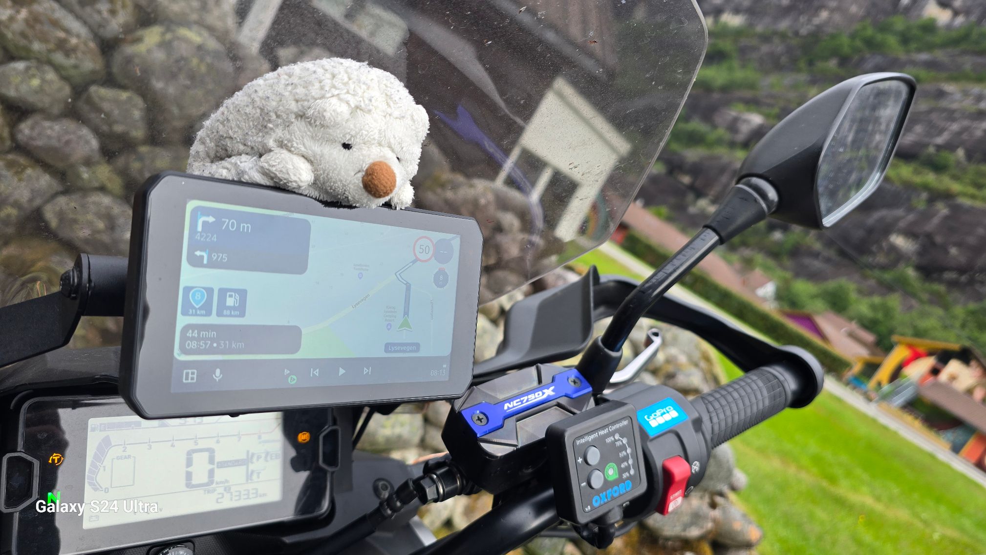
I started from Alba Iulia, Romania, with the route loaded into the app and trip recording enabled. Everything went smoothly at first, until our first fuel stop. When restarting the motorcycle and the smart display (Chigee AIO-5), the app froze. After some trial and error, I figured out that after each stop I had to completely close the app on my phone and reopen it before riding off, resuming both trip recording and navigation.
This worked for a while, but as we made more frequent stops, I would often forget to restart the app, so I gave up on recording the trip. Luckily, my bike is connected to a Sizzapp device, which automatically tracks and records my routes in GPX format, which I can later download from the Sizzapp app. I continued using MyRoute App for navigation only, which worked flawlessly. I would leave the app running on my phone during fuel stops, and when restarting the bike, I simply tapped "Resume navigation" on the Android Auto screen — and everything continued perfectly.
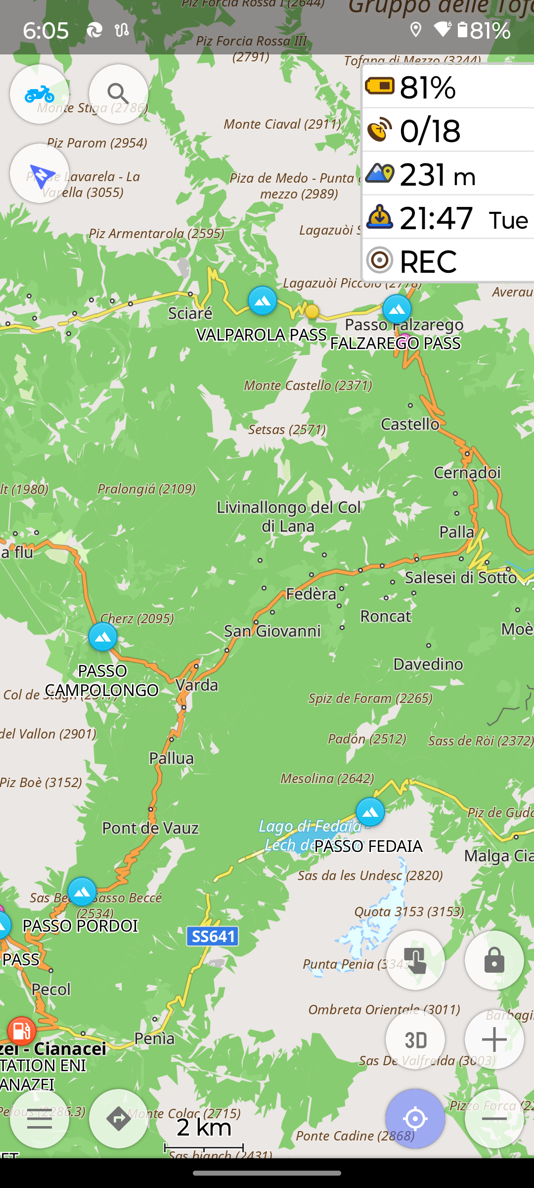
One major issue I encountered was with tunnels. In an Austrian tunnel, I missed an exit leading to another part of the highway (also within a tunnel), because the navigation froze and the location cursor stopped moving once GPS signal was lost. As a workaround for the next tunnels, I switched to OsmAnd, using a GPX file exported from MyRoute App. OsmAnd handles tunnels differently: after GPS signal is lost, the cursor continues to move at the last known speed, which allows uninterrupted navigation. If you maintain a steady speed, the GPS resumes smoothly after exiting the tunnel with no visible lag or navigation hiccups.
I went back to using MyRoute App until day seven of the trip, when bad weather forced me to plan a new route home while also trying to visit some of the attractions I had originally scheduled for later. I attempted to plan a new route using the app’s built-in planner. Unfortunately, this didn’t help at all because the POIs I had saved in the online planner on my PC were not visible in the mobile app, and I had no internet access to use the web version.
I had to switch back to OsmAnd, where I had the same POIs organized in folders and displayed directly on the map. Creating a new route was easy — I just selected the POIs as waypoints and continued navigating without any hassle.
In conclusion, the MyRoute App worked well for navigation (with no crashes or major bugs), except for the Android Auto restarts when recording routes, and the limitations in tunnels and offline POI access.
Best regards,
AdrianSamsung S24 Ultra and Motorola Thinkphone with Android Auto
MyRoute-APP (Planner+Navigation, GOLD Lifetime)
Honda NC750X (2021) with CHIGEE Aio-5 Play -
Hello everyone,
I’d like to share my experience with the MyRoute App (version 4.3.9 – downgraded from 4.4.0, which was completely unusable on my device due to severe lag; I opened a ticket but received no solution) during a trip through Austria, Switzerland, and Italy, covering some of the most scenic alpine passes.
I started from Alba Iulia, Romania, with the route loaded into the app and trip recording enabled. Everything went smoothly at first, until our first fuel stop. When restarting the motorcycle and the smart display (Chigee AIO-5), the app froze. After some trial and error, I figured out that after each stop I had to completely close the app on my phone and reopen it before riding off, resuming both trip recording and navigation.
This worked for a while, but as we made more frequent stops, I would often forget to restart the app, so I gave up on recording the trip. Luckily, my bike is connected to a Sizzapp device, which automatically tracks and records my routes in GPX format, which I can later download from the Sizzapp app. I continued using MyRoute App for navigation only, which worked flawlessly. I would leave the app running on my phone during fuel stops, and when restarting the bike, I simply tapped "Resume navigation" on the Android Auto screen — and everything continued perfectly.
One major issue I encountered was with tunnels. In an Austrian tunnel, I missed an exit leading to another part of the highway (also within a tunnel), because the navigation froze and the location cursor stopped moving once GPS signal was lost. As a workaround for the next tunnels, I switched to OsmAnd, using a GPX file exported from MyRoute App. OsmAnd handles tunnels differently: after GPS signal is lost, the cursor continues to move at the last known speed, which allows uninterrupted navigation. If you maintain a steady speed, the GPS resumes smoothly after exiting the tunnel with no visible lag or navigation hiccups.
I went back to using MyRoute App until day seven of the trip, when bad weather forced me to plan a new route home while also trying to visit some of the attractions I had originally scheduled for later. I attempted to plan a new route using the app’s built-in planner. Unfortunately, this didn’t help at all because the POIs I had saved in the online planner on my PC were not visible in the mobile app, and I had no internet access to use the web version.
I had to switch back to OsmAnd, where I had the same POIs organized in folders and displayed directly on the map. Creating a new route was easy — I just selected the POIs as waypoints and continued navigating without any hassle.
In conclusion, the MyRoute App worked well for navigation (with no crashes or major bugs), except for the Android Auto restarts when recording routes, and the limitations in tunnels and offline POI access.
@Adrian-Avram said in Experience with MRA through Swiss Alps, Dolomites, Austrian Alps:
I opened a ticket but received no solution
Be patient... it's holiday season!
🏍️ BMW K1600GT-P (2013) | Nolan N100-5 with Sena 30K
📱 iOS on iPhone 13 & 16 (mounted on Quadlock or AliExpress extention on BMW-cradle)
🚙 Apple CarPlay in VW T-Roc
💻 Routelab on MacBook Air & iMac (Tahoe & Ventura) -
"As a workaround for the next tunnels, I switched to OsmAnd, using a GPX file exported from MyRoute App. OsmAnd handles tunnels differently: after GPS signal is lost, the cursor continues to move at the last known speed, which allows uninterrupted navigation. If you maintain a steady speed, the GPS resumes smoothly after exiting the tunnel with no visible lag or navigation hiccups."
I hope they implement also this to MRA because i've had your same problem with some tunnel. -
Hello everyone,
I’d like to share my experience with the MyRoute App (version 4.3.9 – downgraded from 4.4.0, which was completely unusable on my device due to severe lag; I opened a ticket but received no solution) during a trip through Austria, Switzerland, and Italy, covering some of the most scenic alpine passes.
I started from Alba Iulia, Romania, with the route loaded into the app and trip recording enabled. Everything went smoothly at first, until our first fuel stop. When restarting the motorcycle and the smart display (Chigee AIO-5), the app froze. After some trial and error, I figured out that after each stop I had to completely close the app on my phone and reopen it before riding off, resuming both trip recording and navigation.
This worked for a while, but as we made more frequent stops, I would often forget to restart the app, so I gave up on recording the trip. Luckily, my bike is connected to a Sizzapp device, which automatically tracks and records my routes in GPX format, which I can later download from the Sizzapp app. I continued using MyRoute App for navigation only, which worked flawlessly. I would leave the app running on my phone during fuel stops, and when restarting the bike, I simply tapped "Resume navigation" on the Android Auto screen — and everything continued perfectly.
One major issue I encountered was with tunnels. In an Austrian tunnel, I missed an exit leading to another part of the highway (also within a tunnel), because the navigation froze and the location cursor stopped moving once GPS signal was lost. As a workaround for the next tunnels, I switched to OsmAnd, using a GPX file exported from MyRoute App. OsmAnd handles tunnels differently: after GPS signal is lost, the cursor continues to move at the last known speed, which allows uninterrupted navigation. If you maintain a steady speed, the GPS resumes smoothly after exiting the tunnel with no visible lag or navigation hiccups.
I went back to using MyRoute App until day seven of the trip, when bad weather forced me to plan a new route home while also trying to visit some of the attractions I had originally scheduled for later. I attempted to plan a new route using the app’s built-in planner. Unfortunately, this didn’t help at all because the POIs I had saved in the online planner on my PC were not visible in the mobile app, and I had no internet access to use the web version.
I had to switch back to OsmAnd, where I had the same POIs organized in folders and displayed directly on the map. Creating a new route was easy — I just selected the POIs as waypoints and continued navigating without any hassle.
In conclusion, the MyRoute App worked well for navigation (with no crashes or major bugs), except for the Android Auto restarts when recording routes, and the limitations in tunnels and offline POI access.
@Adrian-Avram said in Experience with MRA through Swiss Alps, Dolomites, Austrian Alps:
Hello everyone,
... I attempted to plan a new route using the app’s built-in planner. Unfortunately, this didn’t help at all because the POIs I had saved in the online planner on my PC were not visible in the mobile app, and I had no internet access to use the web version.You need to switch on "synchronise" in the App - in best way, select "all", not a single route. After planning a route on your PC (adding POIs into), immediately it will be synched to your mobile. As long as you are at home/hotel, both devices needs to connected to Internet.
Later, at your trip, you can re plan the route at your mobile and include some of the also synched POIs.
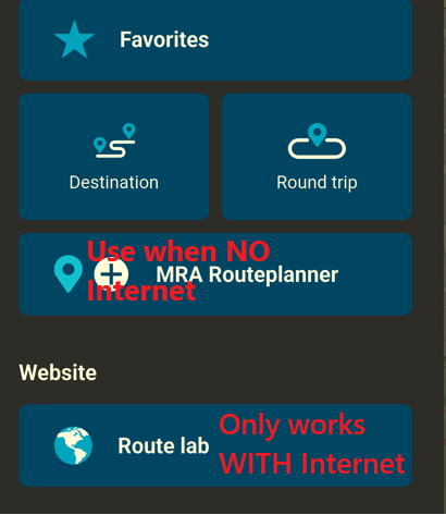
Personally, I feel more comfortable to use in App the "Route lab (webite) instead of using MRA Routeplanner. But for this, you need Internet connection.
Nothing is impossible ;-)
In past: GARMIN Zumo 210->GARMIN Zumo 395->GARMIN XT=> now: DMD T865-X + MyRoute-App, LocusMaps, OsmAnd.
In past: GARMIN MapSource ->GARMIN BaseCamp->Tyre->Kurviger->Calimoto=> now: MRA-Routplanner. -
@Adrian-Avram said in Experience with MRA through Swiss Alps, Dolomites, Austrian Alps:
I opened a ticket but received no solution
Be patient... it's holiday season!
@Rob-Verhoeff said in Experience with MRA through Swiss Alps, Dolomites, Austrian Alps:
Be patient... it's holiday season!
Patience is over ...I have those issues since version 4.4.0 was launched, before leaving on my trip in the Alps, which was planned since last year. Osmand saved the day, works perfectly and does exactly what I need it to do.
I will create routes using MRA web planner (since I bought the Gold membership) but run the routes using Osmand ... -
@Adrian-Avram said in Experience with MRA through Swiss Alps, Dolomites, Austrian Alps:
Hello everyone,
... I attempted to plan a new route using the app’s built-in planner. Unfortunately, this didn’t help at all because the POIs I had saved in the online planner on my PC were not visible in the mobile app, and I had no internet access to use the web version.You need to switch on "synchronise" in the App - in best way, select "all", not a single route. After planning a route on your PC (adding POIs into), immediately it will be synched to your mobile. As long as you are at home/hotel, both devices needs to connected to Internet.
Later, at your trip, you can re plan the route at your mobile and include some of the also synched POIs.
Personally, I feel more comfortable to use in App the "Route lab (webite) instead of using MRA Routeplanner. But for this, you need Internet connection.
@Guzzist I already synced everything. Try creating a new route on the mobile App, using a POI list that you have imported using the Web Planner !
Osmand has POI location categorized on folders after importing a POI list, and you can use them directly in the app, just click the next POI or add the POI as a waypoint, part of a route.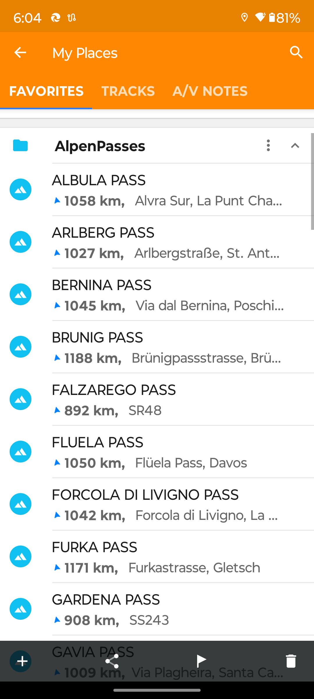
-
@Adrian-Avram said in Experience with MRA through Swiss Alps, Dolomites, Austrian Alps:
Hello everyone,
... I attempted to plan a new route using the app’s built-in planner. Unfortunately, this didn’t help at all because the POIs I had saved in the online planner on my PC were not visible in the mobile app, and I had no internet access to use the web version.You need to switch on "synchronise" in the App - in best way, select "all", not a single route. After planning a route on your PC (adding POIs into), immediately it will be synched to your mobile. As long as you are at home/hotel, both devices needs to connected to Internet.
Later, at your trip, you can re plan the route at your mobile and include some of the also synched POIs.
Personally, I feel more comfortable to use in App the "Route lab (webite) instead of using MRA Routeplanner. But for this, you need Internet connection.
@Guzzist said in Experience with MRA through Swiss Alps, Dolomites, Austrian Alps:
Personally, I feel more comfortable to use in App the "Route lab (webite) instead of using MRA Routeplanner.
Please let me know how will you change a route on the fly, with no internet acces in the Alps !
I am curious about your answer .....Best regards,
AdrianSamsung S24 Ultra and Motorola Thinkphone with Android Auto
MyRoute-APP (Planner+Navigation, GOLD Lifetime)
Honda NC750X (2021) with CHIGEE Aio-5 Play -
@Guzzist said in Experience with MRA through Swiss Alps, Dolomites, Austrian Alps:
Personally, I feel more comfortable to use in App the "Route lab (webite) instead of using MRA Routeplanner.
Please let me know how will you change a route on the fly, with no internet acces in the Alps !
I am curious about your answer .....@Adrian-Avram said in Experience with MRA through Swiss Alps, Dolomites, Austrian Alps:
@Guzzist said in Experience with MRA through Swiss Alps, Dolomites, Austrian Alps:
Personally, I feel more comfortable to use in App the "Route lab (webite) instead of using MRA Routeplanner.
Please let me know how will you change a route on the fly, with no internet acces in the Alps !
I am curious about your answer .....- open MyRoute-App on your mobile (while you are offline)
- open a route (which must be synched before, as you were at home/hotel, connected with internet)
- tap on the "pencil" icon
- another map view appears, showing the route with all route points
- tap on the yellow "+" icon, bottom in the middle - an new additional route point appears on the map in center position
- move the map until the new route point is on the map at the desired location
- tap the icon "add" bottom left
- tap the icon bottom left, which is now changed to "waypoints"
- tap and hold on a way point to move it to right sorting and close the list
- tap on bottom right icon "menue" and select "save" or "navigation"
Nothing is impossible ;-)
In past: GARMIN Zumo 210->GARMIN Zumo 395->GARMIN XT=> now: DMD T865-X + MyRoute-App, LocusMaps, OsmAnd.
In past: GARMIN MapSource ->GARMIN BaseCamp->Tyre->Kurviger->Calimoto=> now: MRA-Routplanner. -
@Adrian-Avram said in Experience with MRA through Swiss Alps, Dolomites, Austrian Alps:
@Guzzist said in Experience with MRA through Swiss Alps, Dolomites, Austrian Alps:
Personally, I feel more comfortable to use in App the "Route lab (webite) instead of using MRA Routeplanner.
Please let me know how will you change a route on the fly, with no internet acces in the Alps !
I am curious about your answer .....- open MyRoute-App on your mobile (while you are offline)
- open a route (which must be synched before, as you were at home/hotel, connected with internet)
- tap on the "pencil" icon
- another map view appears, showing the route with all route points
- tap on the yellow "+" icon, bottom in the middle - an new additional route point appears on the map in center position
- move the map until the new route point is on the map at the desired location
- tap the icon "add" bottom left
- tap the icon bottom left, which is now changed to "waypoints"
- tap and hold on a way point to move it to right sorting and close the list
- tap on bottom right icon "menue" and select "save" or "navigation"
@Guzzist I am talking about creating a NEW route ... Using the saved POI lists ... without internet,
said in Experience with MRA through Swiss Alps, Dolomites, Austrian Alps:
I feel more comfortable to use in App the "Route lab
Try that without internet !
Best regards,
AdrianSamsung S24 Ultra and Motorola Thinkphone with Android Auto
MyRoute-APP (Planner+Navigation, GOLD Lifetime)
Honda NC750X (2021) with CHIGEE Aio-5 Play -
@Guzzist I am talking about creating a NEW route ... Using the saved POI lists ... without internet,
said in Experience with MRA through Swiss Alps, Dolomites, Austrian Alps:
I feel more comfortable to use in App the "Route lab
Try that without internet !
@Adrian-Avram said in Experience with MRA through Swiss Alps, Dolomites, Austrian Alps:
@Guzzist I am talking about creating a NEW route ... Using the saved POI lists ... without internet...
oh sorry, unfortunately I overlooked that.
MyRoute-App does have different functionality as other Apps, like OsMand.
If you want to work offline, you need to download "offline maps" for all regions you want to drive, in forefront. As long as you have Internet connection. By downloading the map, all the internal POI will be included!
Later on, while you drive, you can stay offline.- In the App, tap in main menu on icon "Destination"
- you can search along internal POI (gas stations, hotels, etc. or p.e. typing the name of a pass)
- you can also select any Favorite, you have saved before -
but there is no way to select from self created POI (or uploaded list), but doesn't matter, because you can simply use the search entry - or enter your favorite passes in forefront as Favorite
Nothing is impossible ;-)
In past: GARMIN Zumo 210->GARMIN Zumo 395->GARMIN XT=> now: DMD T865-X + MyRoute-App, LocusMaps, OsmAnd.
In past: GARMIN MapSource ->GARMIN BaseCamp->Tyre->Kurviger->Calimoto=> now: MRA-Routplanner. -
@Adrian-Avram said in Experience with MRA through Swiss Alps, Dolomites, Austrian Alps:
@Guzzist I am talking about creating a NEW route ... Using the saved POI lists ... without internet...
oh sorry, unfortunately I overlooked that.
MyRoute-App does have different functionality as other Apps, like OsMand.
If you want to work offline, you need to download "offline maps" for all regions you want to drive, in forefront. As long as you have Internet connection. By downloading the map, all the internal POI will be included!
Later on, while you drive, you can stay offline.- In the App, tap in main menu on icon "Destination"
- you can search along internal POI (gas stations, hotels, etc. or p.e. typing the name of a pass)
- you can also select any Favorite, you have saved before -
but there is no way to select from self created POI (or uploaded list), but doesn't matter, because you can simply use the search entry - or enter your favorite passes in forefront as Favorite
@Guzzist I have full Europe downloaded offline. But still you cannot plan a new route using the in app web planner without internet. You can plan a route using the app Route Planner but you wont be able to see you saved POI lists ... so its useless if you want to create a new route on the fly using your saved POIs.
Best regards,
AdrianSamsung S24 Ultra and Motorola Thinkphone with Android Auto
MyRoute-APP (Planner+Navigation, GOLD Lifetime)
Honda NC750X (2021) with CHIGEE Aio-5 Play -
@Guzzist I have full Europe downloaded offline. But still you cannot plan a new route using the in app web planner without internet. You can plan a route using the app Route Planner but you wont be able to see you saved POI lists ... so its useless if you want to create a new route on the fly using your saved POIs.
@Adrian-Avram I think that you're being very unfair with the use of the word 'useless'!
The in-app route planner is designed for creating offline routes or adjusting routes 'on the fly'. Let's put things into perspective, if you want to plan a full tour using your POI list, wait until you get to your hotel room where, unless you're staying in a Bedouin tent in the middle of the Sahara, you'll have access to Wi-Fi.Always willing to help if I can.
Triumph Tiger 1200 XRT called Tina.
MRA Navigation Next and SilverFox BJ8 -
@Guzzist I am talking about creating a NEW route ... Using the saved POI lists ... without internet,
said in Experience with MRA through Swiss Alps, Dolomites, Austrian Alps:
I feel more comfortable to use in App the "Route lab
Try that without internet !
@Adrian-Avram said in Experience with MRA through Swiss Alps, Dolomites, Austrian Alps:
you cannot plan a new route using the in app web planner without internet.
I think you have pretty much answered your own question - a WEB planner is obviously not going to work without a connection to the internet!
@Adrian-Avram said in Experience with MRA through Swiss Alps, Dolomites, Austrian Alps:

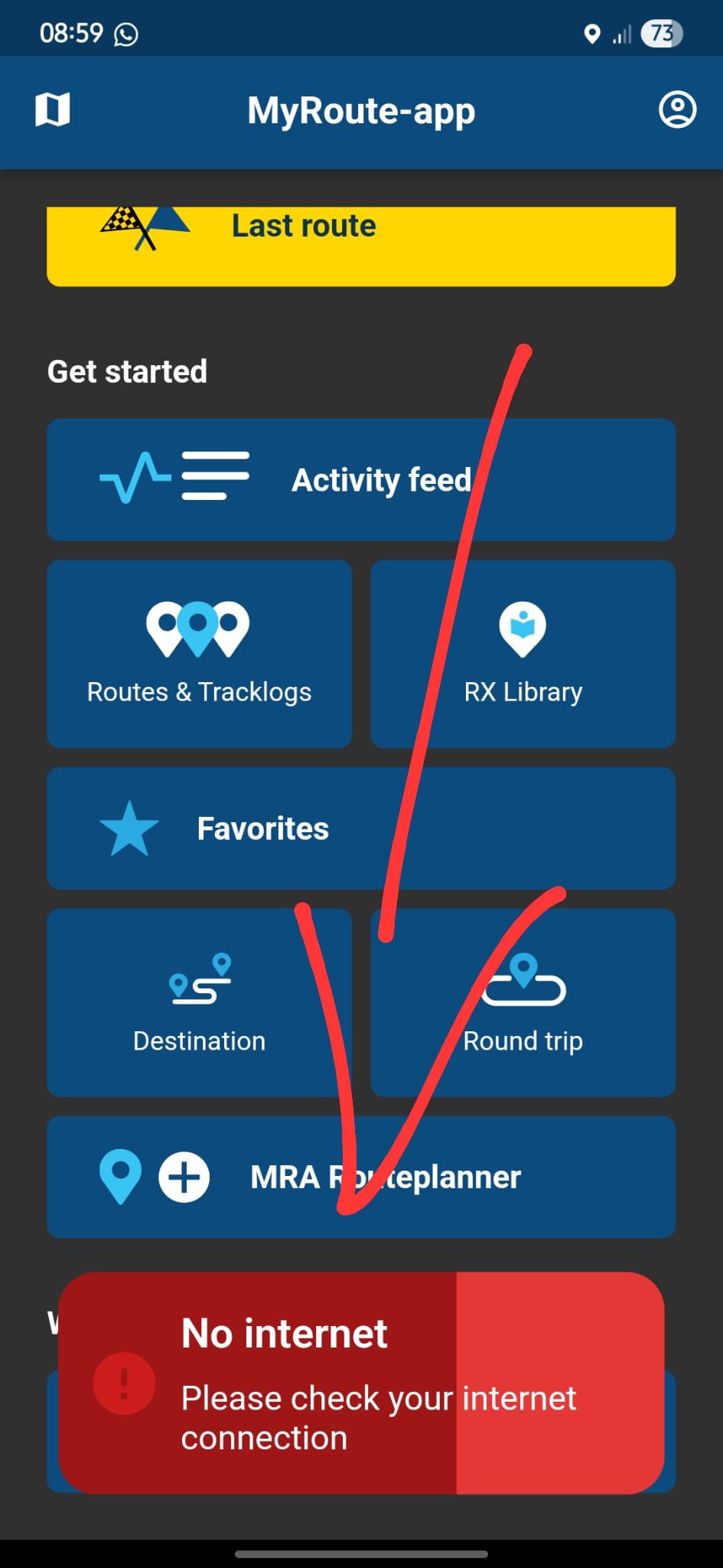
You get this red warning when you try to access the WEB planner when not connected to the internet because your not connected to the internet!!
You could try clicking the APP planner button which will allow you to plan a route completley OFFLINE instead of clicking the wrong WEB planner when your offline
It won't help with your POI issue but you could have made a polite sugesstion that such a feature would be nice to haveBlackView BV7100, Android 12
Navigate "Routes as Tracks" in Offline mode with Offline Maps
No Wifi, no internet, no interruptions, works well -
@Adrian-Avram I think that you're being very unfair with the use of the word 'useless'!
The in-app route planner is designed for creating offline routes or adjusting routes 'on the fly'. Let's put things into perspective, if you want to plan a full tour using your POI list, wait until you get to your hotel room where, unless you're staying in a Bedouin tent in the middle of the Sahara, you'll have access to Wi-Fi.@Nick-Carthew said in Experience with MRA through Swiss Alps, Dolomites, Austrian Alps:
I think that you're being very unfair with the use of the word 'useless'!
How should I call an app that doesnt let me see my saved POIs so I can create a custom route on the spot ? Maybe I should have write on notebook (with pen and paper) the coordinates for every POI and enter them manually .... So yes, it is useless in this case. It works perfectly it you stick to the planned route at home om the web planner, but if you want to improvise ... you are screwed.
Best regards,
AdrianSamsung S24 Ultra and Motorola Thinkphone with Android Auto
MyRoute-APP (Planner+Navigation, GOLD Lifetime)
Honda NC750X (2021) with CHIGEE Aio-5 Play -
@Adrian-Avram said in Experience with MRA through Swiss Alps, Dolomites, Austrian Alps:
you cannot plan a new route using the in app web planner without internet.
I think you have pretty much answered your own question - a WEB planner is obviously not going to work without a connection to the internet!
@Adrian-Avram said in Experience with MRA through Swiss Alps, Dolomites, Austrian Alps:
You get this red warning when you try to access the WEB planner when not connected to the internet because your not connected to the internet!!
You could try clicking the APP planner button which will allow you to plan a route completley OFFLINE instead of clicking the wrong WEB planner when your offline
It won't help with your POI issue but you could have made a polite sugesstion that such a feature would be nice to have@Brian-McG said in Experience with MRA through Swiss Alps, Dolomites, Austrian Alps:
It won't help with your POI issue but you could have made a polite sugesstion that such a feature would be nice to have
That suggestion was made an year ago !!! Pointless !
-
@Adrian-Avram said in Experience with MRA through Swiss Alps, Dolomites, Austrian Alps:
you cannot plan a new route using the in app web planner without internet.
I think you have pretty much answered your own question - a WEB planner is obviously not going to work without a connection to the internet!
@Adrian-Avram said in Experience with MRA through Swiss Alps, Dolomites, Austrian Alps:
You get this red warning when you try to access the WEB planner when not connected to the internet because your not connected to the internet!!
You could try clicking the APP planner button which will allow you to plan a route completley OFFLINE instead of clicking the wrong WEB planner when your offline
It won't help with your POI issue but you could have made a polite sugesstion that such a feature would be nice to have@Brian-McG said in Experience with MRA through Swiss Alps, Dolomites, Austrian Alps:
I think you have pretty much answered your own question - a WEB planner is obviously not going to work without a connection to the internet!
Clearly you have not read my discussion with @Guzzist !
Check the previous posts ! -
I just responded here too: https://forum.myrouteapp.com/post/67754
I am sorry about that UI lag issue It really is not directly caused by us and luckily not many users are impacted.
The Android Auto reconnect issue is indeed a very annoying one too!
I have experienced it but cannot ever reproduce it while developing and the logs are of no helpSorry you have these 2 issues which are rather annoying for us too!
The in-app planner works very nice but by design is way more simple to ensure offline capabilities and easy access. Might expand the features there further down the road
")
Regarding tunnel behavior: I'm in the Alps right now and was a while back too.
I've seen Google Maps stopping in the middle of a tunnel
I've seen Waze place us on top of the mountain
I've seen MyRoute-app stop updating positionsAll other 3 also worked flawlessly in other long tunnels. Hard to say!
Yes, our app also extrapolates the locations in tunnels (what all apps try to do). -
@Nick-Carthew said in Experience with MRA through Swiss Alps, Dolomites, Austrian Alps:
I think that you're being very unfair with the use of the word 'useless'!
How should I call an app that doesnt let me see my saved POIs so I can create a custom route on the spot ? Maybe I should have write on notebook (with pen and paper) the coordinates for every POI and enter them manually .... So yes, it is useless in this case. It works perfectly it you stick to the planned route at home om the web planner, but if you want to improvise ... you are screwed.
@Adrian-Avram said in Experience with MRA through Swiss Alps, Dolomites, Austrian Alps:
So yes, it is useless in this case. It works perfectly it you stick to the planned route at home om the web planner, but if you want to improvise ... you are screwed.
It is called PLANNER for a reason...
I am just an enthusiastic MRA user, and hope you will be one too!
Most motorcycle problems are caused by the nut that connects the handlebar to the saddle.
Check out RideSleepRepeat.eu, a biker community for sharing stays across Europe
-
@Adrian-Avram said in Experience with MRA through Swiss Alps, Dolomites, Austrian Alps:
So yes, it is useless in this case. It works perfectly it you stick to the planned route at home om the web planner, but if you want to improvise ... you are screwed.
It is called PLANNER for a reason...
@Con-Hennekens said in Experience with MRA through Swiss Alps, Dolomites, Austrian Alps:
It is called PLANNER for a reason...
I know ... But if you dont want to stick to the plan anymore or plan a new route using your saved POI list... you have to switch to another app, unfortunately ....
Hello! It looks like you're interested in this conversation, but you don't have an account yet.
Getting fed up of having to scroll through the same posts each visit? When you register for an account, you'll always come back to exactly where you were before, and choose to be notified of new replies (either via email, or push notification). You'll also be able to save bookmarks and upvote posts to show your appreciation to other community members.
With your input, this post could be even better 💗
Register Login-
41180
-
019709
-
1763.5k
-
0783
-
07103
-
2452
-
0364
-
010181