Some strange routing - Can someone explain?
-

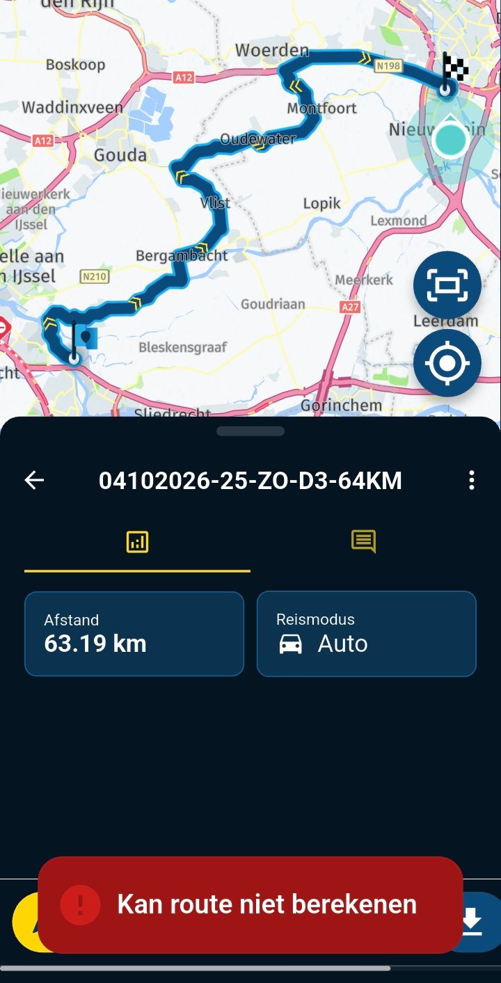
During a multi-day trip, while following one of the routes, we noticed that the route at some point took a completelty different turn from what was originally planned/drawn.
My usual suspect would be traffic or something of the sort, but upon review I find something in the map that I cannot explain.
When you look at the following route:
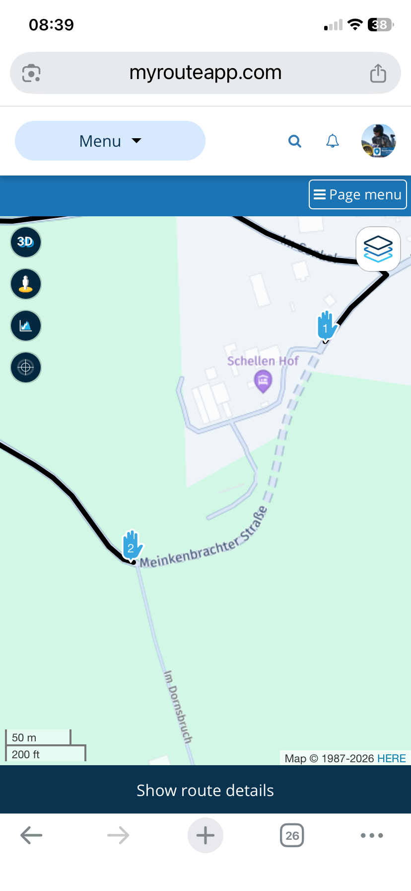
https://www.myrouteapp.com/route/open/14061871The Meinkenbrachter Straße between the two waypoints is not a solid line and even with seasonal closures disabled, it refuses to take this road instead taking a 14km detour. The Traffic layer is not showing anything on this stretch of road.
Also, turning to the Here Map Creator, I don't see this disrupted line or anything that would explain MRA not being able to use this in routing.
https://mapcreator.here.com/navlink:74809343/?l=51.2804,8.0844,17,normalI'm 100% sure that when I was planning our trip, the route did follow this road. (I have overlayed the route-track into this test-route)
Mostly for my understanding, for future planning/riding:
Does anyone have an idea what could be going on here? -
During a multi-day trip, while following one of the routes, we noticed that the route at some point took a completelty different turn from what was originally planned/drawn.
My usual suspect would be traffic or something of the sort, but upon review I find something in the map that I cannot explain.
When you look at the following route:
https://www.myrouteapp.com/route/open/14061871The Meinkenbrachter Straße between the two waypoints is not a solid line and even with seasonal closures disabled, it refuses to take this road instead taking a 14km detour. The Traffic layer is not showing anything on this stretch of road.
Also, turning to the Here Map Creator, I don't see this disrupted line or anything that would explain MRA not being able to use this in routing.
https://mapcreator.here.com/navlink:74809343/?l=51.2804,8.0844,17,normalI'm 100% sure that when I was planning our trip, the route did follow this road. (I have overlayed the route-track into this test-route)
Mostly for my understanding, for future planning/riding:
Does anyone have an idea what could be going on here?
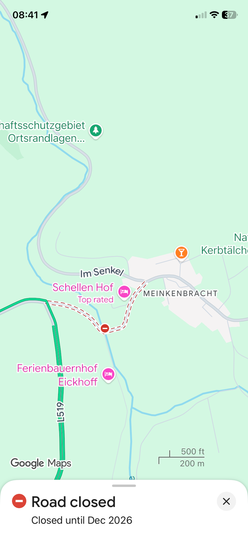
@Kirsten-De-Weerd The dashed line indicates that the road is closed because of road works.
If you look on Google Maps you’ll see the road is closed until December 2026
-
Ah, that makes sense then.
I can't remember if we did effectively ride there or not (following the track at that point), I don't record tracklogs while riding.Still doesn't fully explain why the visualization in MRA is different than what can be found in the Here Map Creator. Other road closures are usually shown on the traffic layer (and can be ignored by disabling seasonal closures in the toolkit).
-
Come to think of it, we probably did take the detour (which was not a punishment in itself
 )
)Goes to show, even if you check your routes as late as a week before departure, adventure is always lurking around the corner ...
-
Ah, that makes sense then.
I can't remember if we did effectively ride there or not (following the track at that point), I don't record tracklogs while riding.Still doesn't fully explain why the visualization in MRA is different than what can be found in the Here Map Creator. Other road closures are usually shown on the traffic layer (and can be ignored by disabling seasonal closures in the toolkit).
@Kirsten-De-Weerd I think that this is not showing on the traffic overlay map is because the HERE map believes that the road is under construction.
Hello! It looks like you're interested in this conversation, but you don't have an account yet.
Getting fed up of having to scroll through the same posts each visit? When you register for an account, you'll always come back to exactly where you were before, and choose to be notified of new replies (either via email, or push notification). You'll also be able to save bookmarks and upvote posts to show your appreciation to other community members.
With your input, this post could be even better 💗
Register Login-
018294
-
 036
036
-
 05157
05157
-
 51078.1k
-
 1334450
-
07346
-
3161.6k
-
110671