Is it possible to plan a walking route that doesn't rely on following roads
-
Is it possible to plan a walking route that doesn't force you to stick to roads, effectively cutting across parks, fields, following footpaths etc
MRA Gold Planner + App + Navigation Next user
Android Pixel 9 Pro XL
TomTomGo as backupKTM 1290 Super Adventure S
Quad Lock + Phone +Carpuride W702KTM 790 Duke
Quad Lock + Phone -
Is it possible to plan a walking route that doesn't force you to stick to roads, effectively cutting across parks, fields, following footpaths etc
@David-Rudgley The only method I can think of is setting every waypoint to "Offroad/Skip" via the waypoint menu.
I am not able to predict how your navigation will work when all waypoints are Offroad but okay, that is not your question :). -
It was more related to being able to plan a walking route and to get an idea of distance and timing and to look at the Route Track whilst on the walk to see if I'm deviating off course... I appreciate that my needs might go beyond the capabilities of the app, it's not a deal breaker, just my curiosity is it possible?
-
Is it possible to plan a walking route that doesn't force you to stick to roads, effectively cutting across parks, fields, following footpaths etc
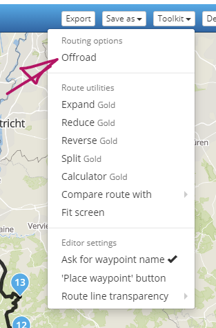
@David-Rudgley Maybe you could try this option in the toolkit
-
Is it possible to plan a walking route that doesn't force you to stick to roads, effectively cutting across parks, fields, following footpaths etc
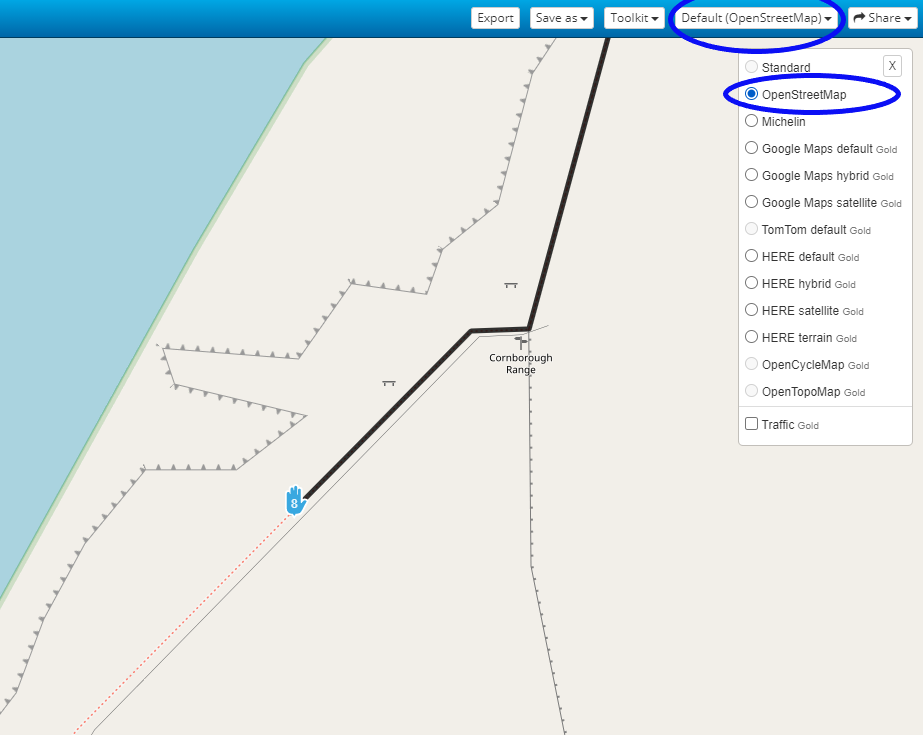
@David-Rudgley If you choose walking as the type of route (instead of driving or cycling) when you first create a new route. Then choose Default (OpenStreetMap) as your planning map and use the OpenStreetMap overlay. With this map overlay you can see footpaths when you fully zoom in. Then place your route points on the footpath.
Hello! It looks like you're interested in this conversation, but you don't have an account yet.
Getting fed up of having to scroll through the same posts each visit? When you register for an account, you'll always come back to exactly where you were before, and choose to be notified of new replies (either via email, or push notification). You'll also be able to save bookmarks and upvote posts to show your appreciation to other community members.
With your input, this post could be even better 💗
Register Login-
7673.2k
-
019513
-
09117
-
05155
-
314884
-
115757
-
0116