GPX Versions 1.1 vs 1.2 for Garmin Visually Explained
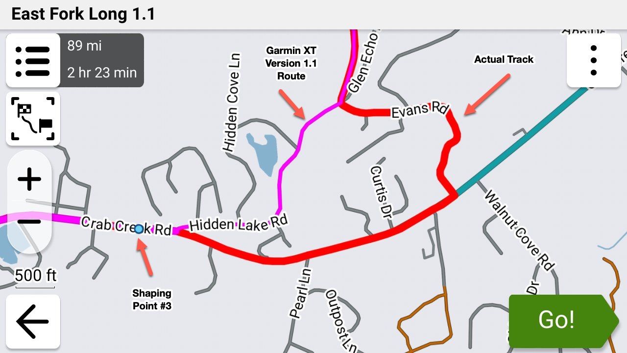
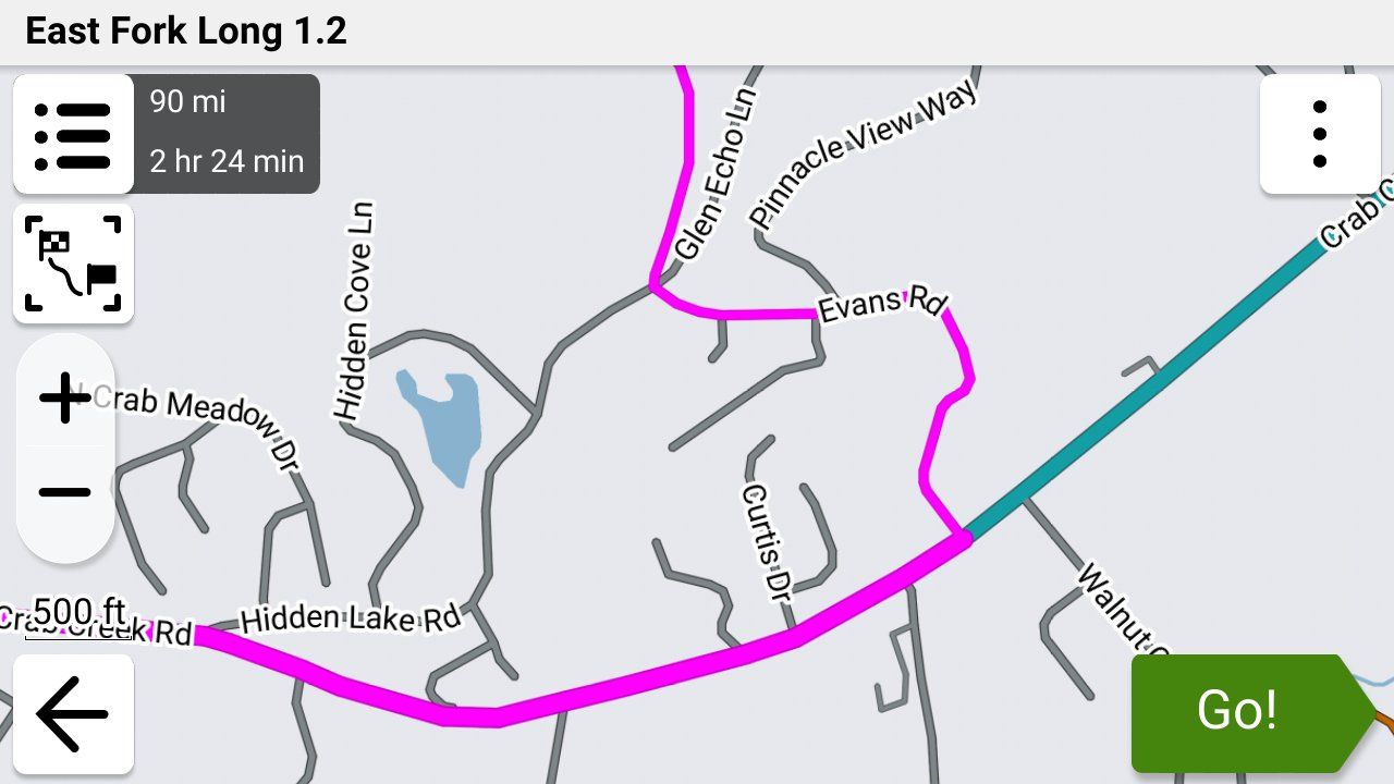
-

@mzokk On the XT/XT3, I have recalculation set to prompted and almost always select NO at decision time. Like with @steve-jarrell, I prefer to manually manage my own off-route scenarios. In experimenting with XT off-route recalculation ON, I haven't encountered anything fatal other that it tries to get you back to the exact point where the off-route began to start with. Where 1.2 does become a problem is where you modify your route with adding another Via Point using either the Search function or Up Ahead. That's easily remedied by instead starting a new route through Seach/Up-Ahead and then restarting your main route with "Closest Entry Point" after reaching the Seach/Up-Ahead destination. I've experimented with this probably a dozen times under slightly different scenarios, and it consistently works.
I understand that you have a different view of things with your route planning to accommodate optional loops and other anomalies. That's cool. But off-route recalculation with 1.2 does work if you understand how it works and the specific scenarios to avoid.
-
@mzokk On the XT/XT3, I have recalculation set to prompted and almost always select NO at decision time. Like with @steve-jarrell, I prefer to manually manage my own off-route scenarios. In experimenting with XT off-route recalculation ON, I haven't encountered anything fatal other that it tries to get you back to the exact point where the off-route began to start with. Where 1.2 does become a problem is where you modify your route with adding another Via Point using either the Search function or Up Ahead. That's easily remedied by instead starting a new route through Seach/Up-Ahead and then restarting your main route with "Closest Entry Point" after reaching the Seach/Up-Ahead destination. I've experimented with this probably a dozen times under slightly different scenarios, and it consistently works.
I understand that you have a different view of things with your route planning to accommodate optional loops and other anomalies. That's cool. But off-route recalculation with 1.2 does work if you understand how it works and the specific scenarios to avoid.

@John-S-Parry I've no issue with GPX 1.2 or switching off recalculation. But I can't get it to work with recalculation on, as demonstrated earlier in this thread when I ran a test. It could be user error and if it is I'd gladly hear a remedy as it would be a handier format to use in some scenarios.

-
@mzokk All of my 1.2 testing has been on the XT3. With recalculation ON, it consistently tries to route me back to the point where off-route started. That's what it's designed to do. If your XT isn't behaving the same, please explain what it's doing. I tried to figure that out from your earlier post but couldn't get what was going on.
My XT has been collecting dust for the past 2-months, and it was dead when I brought it out this morning. It's charging now, and I'll do an XT 1.2 off-route test tomorrow and share what happens.
-
@mzokk but I was wondering if, despite the break in the HERE mapping on MRA, the Zumo would have routed through it anyway. Can you remember if the break was also on the Zumo map? And maybe not such a stupid idea as OSM mapping is one of the detailed maps in the unit. How and why they are used, I do not know.
@john-s-parry during my testing and actually using a GPX1.2 route on the XT2 with auto-recalculation left on, sometimes it requested a U-turn or two if I carried on my diversion before changing its mind and calculating a way to get me back on the route ahead. And sometimes it would just go straight for the up-ahead re-join. It may go for the quickest option and also take into account one-way streets etc.
The only avoid option I have in the Zumo is unpaved roads. Everything else allowed. I hope the XT result is the same but I'm a little dubious.
-
@mzokk but I was wondering if, despite the break in the HERE mapping on MRA, the Zumo would have routed through it anyway. Can you remember if the break was also on the Zumo map? And maybe not such a stupid idea as OSM mapping is one of the detailed maps in the unit. How and why they are used, I do not know.
@john-s-parry during my testing and actually using a GPX1.2 route on the XT2 with auto-recalculation left on, sometimes it requested a U-turn or two if I carried on my diversion before changing its mind and calculating a way to get me back on the route ahead. And sometimes it would just go straight for the up-ahead re-join. It may go for the quickest option and also take into account one-way streets etc.
The only avoid option I have in the Zumo is unpaved roads. Everything else allowed. I hope the XT result is the same but I'm a little dubious.
@mzokk but I was wondering if, despite the break in the HERE mapping on MRA, the Zumo would have routed through it anyway. Can you remember if the break was also on the Zumo map? And maybe not such a stupid idea as OSM mapping is one of the detailed maps in the unit. How and why they are used, I do not know.
No the Zumo would not have routed through the gap. I was using Basecamp. The map on the unit and the computer were identical. The only way to get the Zumo to route past that section was to put the "Direct" section in.
-
Being a new guy here, I’ve been mostly quietly following this discussion. I’m going to dare to share a little perspective and some tidbits in the hope that it’s helpful.
With the current state of navigation, we can debate Here vs OSM, tracks vs routes, gpx 1.1 vs 1.2, etc.
There was a time when the world was flat and was lighted each day by Helios who drove a golden chariot across the sky from east to west. Later, the earth began to become round, although it wasn’t circumnavigated until Magellan sailed around it in the early 1500’s. Around the same time, Copernicus proposed that the sun was the center of the universe. Galileo Galilei advocated for Copernicus’ theory in the early 1600’s. That heresy caused him to spend his later years under house arrest. Back then, latitude could be determined from the stars if the night sky was clear but longitude was elusive until clockmaker John Harrison produced the marine chronometer in the mid 1700’s.
GPS didn't become operational until 1993 but wasn't available for civilian use in 1998.
Many of us, at least the older ones like me, used to find our way around with sometimes out of date paper maps.
Today we look at lines on a digital screen and think of them as physical roads. We look at a motorcycle icon on a SatNav and think of it as our current position. We have high expectations for modern electronics. In reality, none of it is exact, although most of it is close most of the time.
Below is a section of road according to a Here map (magenta line), and an OSM map (green line). I traveled that road tracking my position with a zumo XT2 (yellow line) and another GPS tracking device (blue line). Depending on tolerance, we might say that all four lines are “right”. We might also conclude that it is unclear whether any of them are “right”.
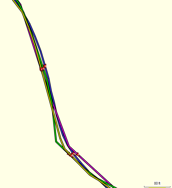
A SatNav calculates it position on a periodic (not continuous) basis from time signals sent by satellites. The number of dots on those lines depends on how frequently position is determined and recorded. More dots imply more precision, but that does not assure any greater accuracy. Under the best conditions, those positions are accurate within several feet (a few meters).
In some locations, these four lines might vary more significantly. The vast majority of the time, they are close enough to be useful. On the occasions when they vary enough to be confusing, I try to remind myself, if Magellan managed to figure it out, I probably can too.

Planning and then navigating with the same map, route preference and avoidance settings, and with software / devices using the same routing algorithms is, of course, most likely produce the most consistent results for us, but it’s not always that simple. For various reasons, one might want, for example, to plan with the MRA route planner and navigate with the Garmin zumo.
In the end, we each do what works best for us and adjust as we learn from our experience. There is no perfect answer that works for everyone every time.
A map is an attempt to project, onto a flat surface, the location of physical roads or paths that exist on a portion of the round earth. Modern maps are much better than the ones Magellan had, but they rarely perfect. They are often generated from multiple sources. A given source which is most accurate in one particular area might not be the most accurate in a different area. Here maps are based on multiple, licensed, professionally produced, and government maps. Garmin’s are supplemented with OSM map data [thus the inclusion of both copyright notices on the device info page of a zumo].
Zooming in on a digital map reveals that roads and paths are represented by straight lines.
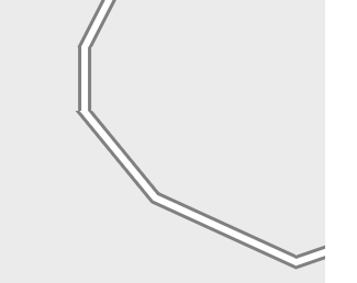
Each end of each straight line is a point, although the points are typically not visible. It requires more points to represent a curved road and fewer points to represent a straight road. There are also points at intersections.
Separate from those, when we click on a map to specify our desired stops (via points) and and other points we’d like to pass thorough (shaping points) we create “route points". Routing algorithms use the map’s points at intersections to find the best path(s) between our specified route points. Once the route is determined, all of the map’s points along the route can be used to draw the route along the road or path.
If a track is generated from the route, all of the map’s points along the route become track points. If a gpx 1.2 route is generated, those same points become route point extensions (aka hidden or ghost points). Track points and route point extensions are the exact same points. They are formatted and treated differently however. Once generated, a track will never change. If a route is fully recalculated, its route point extensions are discarded – the route is re-calculated using only the available route points (via and, if available, shaping points).
As a result, after import to another device, an MRA exported:
- track, with its many track points, will provide a very accurate representation of the MRA generated route, but it is fixed in place.
- gpx 1.2 route with the user specified via points and the route point extensions matching the track points, will provide the same very accurate representation of the MRA generated route as long as it is not fully recalculated. Unlike a track, it can be amended, to some degree, to support a Closest Entry Point navigation [re]start or an off-route calculation to get back onto the route without triggering a full recalculation.
- gpx 1.1 route with the user specified via and [relatively few] shaping points, but without the benefit of the [many] route point extensions, contains a less accurate representation of the MRA generated route. It will always be subject to route calculation and variation wherever it is imported.
- gpx 1.2 route will be the least accurate if it is fully recalculated since only via points will be available to the routing calculation.
-
Being a new guy here, I’ve been mostly quietly following this discussion. I’m going to dare to share a little perspective and some tidbits in the hope that it’s helpful.
With the current state of navigation, we can debate Here vs OSM, tracks vs routes, gpx 1.1 vs 1.2, etc.
There was a time when the world was flat and was lighted each day by Helios who drove a golden chariot across the sky from east to west. Later, the earth began to become round, although it wasn’t circumnavigated until Magellan sailed around it in the early 1500’s. Around the same time, Copernicus proposed that the sun was the center of the universe. Galileo Galilei advocated for Copernicus’ theory in the early 1600’s. That heresy caused him to spend his later years under house arrest. Back then, latitude could be determined from the stars if the night sky was clear but longitude was elusive until clockmaker John Harrison produced the marine chronometer in the mid 1700’s.
GPS didn't become operational until 1993 but wasn't available for civilian use in 1998.
Many of us, at least the older ones like me, used to find our way around with sometimes out of date paper maps.
Today we look at lines on a digital screen and think of them as physical roads. We look at a motorcycle icon on a SatNav and think of it as our current position. We have high expectations for modern electronics. In reality, none of it is exact, although most of it is close most of the time.
Below is a section of road according to a Here map (magenta line), and an OSM map (green line). I traveled that road tracking my position with a zumo XT2 (yellow line) and another GPS tracking device (blue line). Depending on tolerance, we might say that all four lines are “right”. We might also conclude that it is unclear whether any of them are “right”.
A SatNav calculates it position on a periodic (not continuous) basis from time signals sent by satellites. The number of dots on those lines depends on how frequently position is determined and recorded. More dots imply more precision, but that does not assure any greater accuracy. Under the best conditions, those positions are accurate within several feet (a few meters).
In some locations, these four lines might vary more significantly. The vast majority of the time, they are close enough to be useful. On the occasions when they vary enough to be confusing, I try to remind myself, if Magellan managed to figure it out, I probably can too.
Planning and then navigating with the same map, route preference and avoidance settings, and with software / devices using the same routing algorithms is, of course, most likely produce the most consistent results for us, but it’s not always that simple. For various reasons, one might want, for example, to plan with the MRA route planner and navigate with the Garmin zumo.
In the end, we each do what works best for us and adjust as we learn from our experience. There is no perfect answer that works for everyone every time.
A map is an attempt to project, onto a flat surface, the location of physical roads or paths that exist on a portion of the round earth. Modern maps are much better than the ones Magellan had, but they rarely perfect. They are often generated from multiple sources. A given source which is most accurate in one particular area might not be the most accurate in a different area. Here maps are based on multiple, licensed, professionally produced, and government maps. Garmin’s are supplemented with OSM map data [thus the inclusion of both copyright notices on the device info page of a zumo].
Zooming in on a digital map reveals that roads and paths are represented by straight lines.
Each end of each straight line is a point, although the points are typically not visible. It requires more points to represent a curved road and fewer points to represent a straight road. There are also points at intersections.
Separate from those, when we click on a map to specify our desired stops (via points) and and other points we’d like to pass thorough (shaping points) we create “route points". Routing algorithms use the map’s points at intersections to find the best path(s) between our specified route points. Once the route is determined, all of the map’s points along the route can be used to draw the route along the road or path.
If a track is generated from the route, all of the map’s points along the route become track points. If a gpx 1.2 route is generated, those same points become route point extensions (aka hidden or ghost points). Track points and route point extensions are the exact same points. They are formatted and treated differently however. Once generated, a track will never change. If a route is fully recalculated, its route point extensions are discarded – the route is re-calculated using only the available route points (via and, if available, shaping points).
As a result, after import to another device, an MRA exported:
- track, with its many track points, will provide a very accurate representation of the MRA generated route, but it is fixed in place.
- gpx 1.2 route with the user specified via points and the route point extensions matching the track points, will provide the same very accurate representation of the MRA generated route as long as it is not fully recalculated. Unlike a track, it can be amended, to some degree, to support a Closest Entry Point navigation [re]start or an off-route calculation to get back onto the route without triggering a full recalculation.
- gpx 1.1 route with the user specified via and [relatively few] shaping points, but without the benefit of the [many] route point extensions, contains a less accurate representation of the MRA generated route. It will always be subject to route calculation and variation wherever it is imported.
- gpx 1.2 route will be the least accurate if it is fully recalculated since only via points will be available to the routing calculation.
gpx 1.2 route with the user specified via points and the route point extensions matching the track points, will provide the same very accurate representation of the MRA generated route as long as it is not fully recalculated. Unlike a track, it can be amended, to some degree, to support a Closest Entry Point navigation [re]start or an off-route calculation to get back onto the route without triggering a full recalculation.
gpx 1.2 route will be the least accurate if it is fully recalculated since only via points will be available to the routing calculation.
Your complete post above was a very good read. Well written.
In particular, the two GPX 1.2 pieces I quoted are gold for anyone wanting to understand it's behavior. In the nutshell, if you can avoid doing anything that triggers a complete 1.2 recalculation, the route should be a complete representation of the MRA route. The major trigger I found for complete recalculation is adding a via point as part of "Search" or "Up Ahead". As you stated, only via points will then be available for routing calculations, and your route will probably look very different from what you intended. There might be other offending actions, but I haven't found them -- yet. In my testing, Closest Entry Point navigation restart or an off-route calculation to get back onto the route do not harm the integrity of the route. That helped cement for me the value of 1.2.All my testing with 1.2 has been for testing/verification purposes only. I'm feeling good enough to give it a go on something more critical coming up.
-
That would be brilliant. In my case it was trying to route me half way round the world to get back to the next via point when I didn't take the first turn.
That would be brilliant. In my case it was trying to route me half way round the world to get back to the next via point when I didn't take the first turn.
I got out today and tested 1.2 off-route recalculation with my older Zumo XT unit.
I found the behavior to be the same as what I experienced with my XT3. When I turned left on a side road from my main road route, the XT almost immediately recognized Off-Route, and prompted me for action. I pressed re-calculate, and the XT immediately tried to turn me around through a looping side street. I continued, and then the XT tried to get me to do a U-Turn. The XT was like a Pitbull on a bone.

I know how this story would continue, so I did a U-Turn and returned to the main road at the Off-Route entry point as directed, just like I did with the XT3. I get that this is just one scenario, and you may have encountered a different situation which triggered a different action.
-
Thanks for that John its good to know that the XT is capable of navigating back to a GPX 1.2 route.
I tend to navigate in the opposite sort of way where I seek out the backroads and try to avoid the main roads and towns as much as possible. There's nothing I like more than riding up a road with grass growing up the Middle.
I had a look at the setup of my XT as stated earlier I haven't used it for actual navigation for over a year now preferring instead to use my phone connected to my Africa Twin's built in screen. The only thing that I can see that might have messed up the behaviour of the unit on test was the OSM mapping of Ireland I have on an SD card in the machine. This shouldn't mess up the rerouting if its disabled as it was on my XT but I think it should be eliminated from the inquiries.
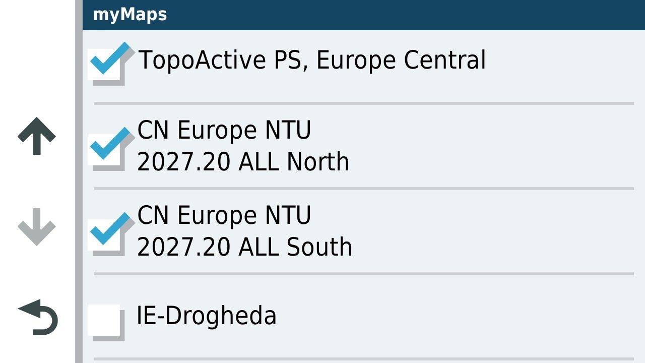
I'll delete the mapping from the SD card and have a go again with GPX 1.2. Unfortunately that might be a few weeks away as I go next week to have a cataract removed and will be off the road.....for everyone's safety

I had another go at simulating the route but obviously you can't simulate going off route just adding an element to the route before the first turn. As expected GPX 1.2 routed past the new addition directly to the next via point.
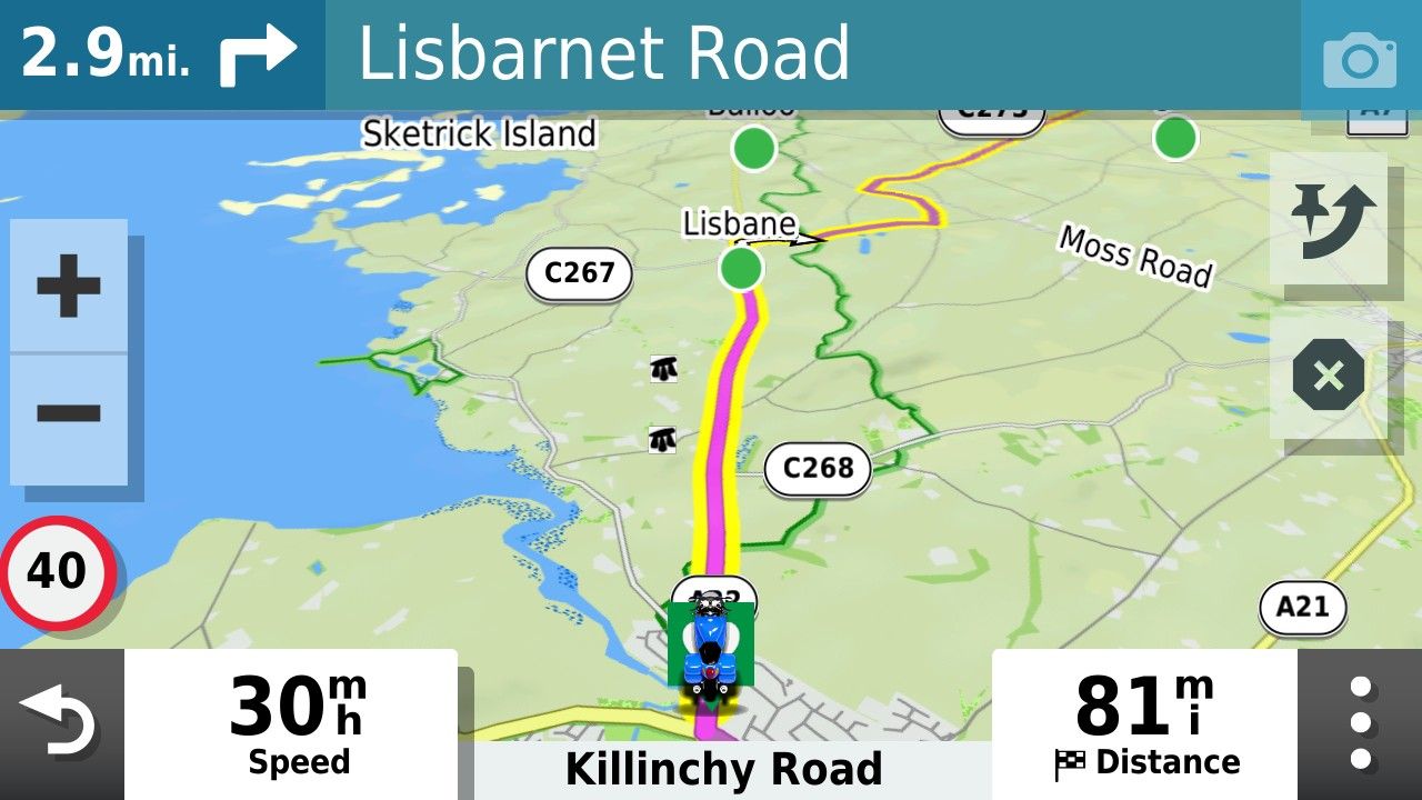
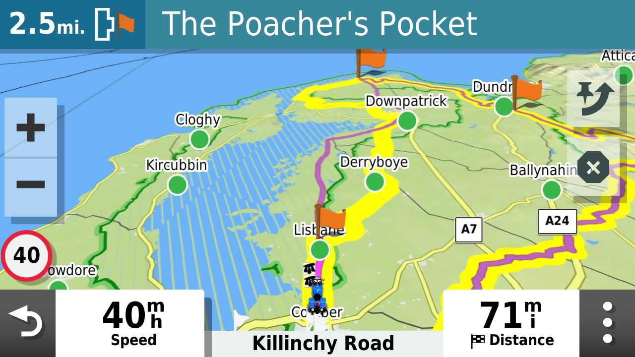
Whereas the GPX1.1 version of the file was able to deal with it.
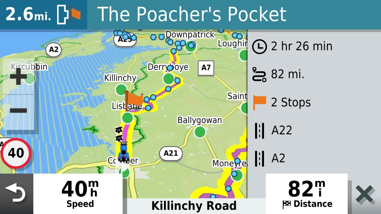
Thanks for checking that John. I look forward to having another go minus the OSM maps on the card......and when I'm safe to be let out!!
-
Thanks for that John its good to know that the XT is capable of navigating back to a GPX 1.2 route.
I tend to navigate in the opposite sort of way where I seek out the backroads and try to avoid the main roads and towns as much as possible. There's nothing I like more than riding up a road with grass growing up the Middle.
I had a look at the setup of my XT as stated earlier I haven't used it for actual navigation for over a year now preferring instead to use my phone connected to my Africa Twin's built in screen. The only thing that I can see that might have messed up the behaviour of the unit on test was the OSM mapping of Ireland I have on an SD card in the machine. This shouldn't mess up the rerouting if its disabled as it was on my XT but I think it should be eliminated from the inquiries.
I'll delete the mapping from the SD card and have a go again with GPX 1.2. Unfortunately that might be a few weeks away as I go next week to have a cataract removed and will be off the road.....for everyone's safety
I had another go at simulating the route but obviously you can't simulate going off route just adding an element to the route before the first turn. As expected GPX 1.2 routed past the new addition directly to the next via point.
Whereas the GPX1.1 version of the file was able to deal with it.
Thanks for checking that John. I look forward to having another go minus the OSM maps on the card......and when I'm safe to be let out!!
I had a look at the setup of my XT as stated earlier I haven't used it for actual navigation for over a year now preferring instead to use my phone connected to my Africa Twin's built in screen.
First of all, I wish for your eye procedure to go well.
After completing the XT 1.2 off-route recalculation and being returned to the route, I decided to go off-route further ahead, but this time chose not to recalculate when prompted, which triggered the route to pause. After meandering around for a couple of miles, I manually re-entered the route line further ahead and my XT route came back to life. This is my normal method for handling off-route situations.
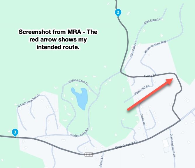
Then I hit the section of the route with the twisty section where HERE maps the road incorrectly.
 Because 1.2 is essentially following the Track of the MRA developed route, there was no alert for divergence. On the XT, it showed me riding the Track line where the road actually exists and then showed where the Track/Route converged up ahead. No drama, and no intervention. It's very slick.
Using 1.1 for this route in previous tests, this triggered an off-route alert that completely tripped up the MRA phone app running in parallel to my Garmin. The app tried to recalculate to the next waypoint but ended up in a loop where it was constantly trying to reroute me backwards. I had to stop and restart the app for it to continue.
When stuff like this happens, it just reinforces to me that the app is not yet ready for prime time. I admire the tenacity of the MRA Development team constantly chasing down errors and putting out fires, but it never seems to end. I'd like to feel that I have the option of using the phone app instead of my Garmin, but the confidence simply isn't there. I sincerely hope genuine app stability will somehow be achieved in the future.
-
I had a look at the setup of my XT as stated earlier I haven't used it for actual navigation for over a year now preferring instead to use my phone connected to my Africa Twin's built in screen.
First of all, I wish for your eye procedure to go well.
After completing the XT 1.2 off-route recalculation and being returned to the route, I decided to go off-route further ahead, but this time chose not to recalculate when prompted, which triggered the route to pause. After meandering around for a couple of miles, I manually re-entered the route line further ahead and my XT route came back to life. This is my normal method for handling off-route situations.
Then I hit the section of the route with the twisty section where HERE maps the road incorrectly.
Because 1.2 is essentially following the Track of the MRA developed route, there was no alert for divergence. On the XT, it showed me riding the Track line where the road actually exists and then showed where the Track/Route converged up ahead. No drama, and no intervention. It's very slick.Using 1.1 for this route in previous tests, this triggered an off-route alert that completely tripped up the MRA phone app running in parallel to my Garmin. The app tried to recalculate to the next waypoint but ended up in a loop where it was constantly trying to reroute me backwards. I had to stop and restart the app for it to continue.
When stuff like this happens, it just reinforces to me that the app is not yet ready for prime time. I admire the tenacity of the MRA Development team constantly chasing down errors and putting out fires, but it never seems to end. I'd like to feel that I have the option of using the phone app instead of my Garmin, but the confidence simply isn't there. I sincerely hope genuine app stability will somehow be achieved in the future.

@John-S-Parry Thanks very much for the update. You clearly showed the HUGE advantage that 1.2 has over 1.1. Quite simply the route is forced to follow the track.
Steve Jarrell
Western North Carolina USLifetime Routeplanner Gold & Navigation Next
2025 BMW R1300GS
2025 Can-Am Spyder
DMD T865-X 8" Tablet
Garmin XT3 -
@John-S-Parry Thanks very much for the update. You clearly showed the HUGE advantage that 1.2 has over 1.1. Quite simply the route is forced to follow the track.
Thanks very much for the update. You clearly showed the HUGE advantage that 1.2 has over 1.1. Quite simply the route is forced to follow the track.
It's been fun learning about 1.2, and understanding the pros/cons vs. 1.1
To your point, the advantages are many. Developing a route using MRA Routeplanner, and literally being guaranteed that it will import as designed into an XT device is gold. Much has been said about the Sync function in MRA providing WYSIWYG on the app. But that's not 100% true. Depending on off-line or on-line execution in the app, the route can recalculate differently. Ask me how I know.

If there is a notable downside to 1.2, it's that you no longer have shaping waypoints available for skipping during route execution. It seems many here are constantly skipping to change the original route during execution. And there are many posts about how users get in trouble using that function. It's not a downside for me personally, but for others.....
The other issue I've encountered is that 1.2 doesn't seem to be supported in Basecamp. Meaning, if I create a 1.2 GPX and import it into BC, it gets munched up. At least that was my early experience. I'll have to go back and try it again to be 100% sure.
Otherwise, 1.2 ahead....
-
It has been an interesting discussion, and thanks John for the good wishes.
Anyhow with regard to Garmin devices one thing I will say "and why I keep my XT mounted as a backup" is that the hardware itself is well made robust and reliable. These are all mine since 2004 and they are all in working order and all have been through some horrendously wet weather. Its unlikely that any of us will have a functional phone for that long.
![IMG_20260811_182836978_HDR_AE[1].jpg](/assets/uploads/files/1786470636876-img_20260811_182836978_hdr_ae-1.jpg)
The main reason I've ended up here is the disappointing software provided for the XT (Explore) by Garmin and the change to its routing algorithm which meant, that compared to the old devices, what you produced on Basecamp bears little relation to what you get on the XT unless you "pin" the route with lots of shaping points. I'm pretty happy with the MyRoute app routing program and navigation app with the exception of POI and track handling capabilities. But at least with phone based navigation you are not restricted to Garmin's poor software offering. A lesson I hope they learn before its too late.
-
Thanks very much for the update. You clearly showed the HUGE advantage that 1.2 has over 1.1. Quite simply the route is forced to follow the track.
It's been fun learning about 1.2, and understanding the pros/cons vs. 1.1
To your point, the advantages are many. Developing a route using MRA Routeplanner, and literally being guaranteed that it will import as designed into an XT device is gold. Much has been said about the Sync function in MRA providing WYSIWYG on the app. But that's not 100% true. Depending on off-line or on-line execution in the app, the route can recalculate differently. Ask me how I know.
If there is a notable downside to 1.2, it's that you no longer have shaping waypoints available for skipping during route execution. It seems many here are constantly skipping to change the original route during execution. And there are many posts about how users get in trouble using that function. It's not a downside for me personally, but for others.....
The other issue I've encountered is that 1.2 doesn't seem to be supported in Basecamp. Meaning, if I create a 1.2 GPX and import it into BC, it gets munched up. At least that was my early experience. I'll have to go back and try it again to be 100% sure.
Otherwise, 1.2 ahead....
@John-S-Parry "It's been fun learning about 1.2, and understanding the pros/cons vs. 1.1".
I agree completely. I think it's been a valuable learning experience for all of us that use MRA in conjunction with a Garmin device.
-
It has been an interesting discussion, and thanks John for the good wishes.
Anyhow with regard to Garmin devices one thing I will say "and why I keep my XT mounted as a backup" is that the hardware itself is well made robust and reliable. These are all mine since 2004 and they are all in working order and all have been through some horrendously wet weather. Its unlikely that any of us will have a functional phone for that long.
The main reason I've ended up here is the disappointing software provided for the XT (Explore) by Garmin and the change to its routing algorithm which meant, that compared to the old devices, what you produced on Basecamp bears little relation to what you get on the XT unless you "pin" the route with lots of shaping points. I'm pretty happy with the MyRoute app routing program and navigation app with the exception of POI and track handling capabilities. But at least with phone based navigation you are not restricted to Garmin's poor software offering. A lesson I hope they learn before its too late.
The main reason I've ended up here is the disappointing software provided for the XT (Explore) by Garmin and the change to its routing algorithm which meant, that compared to the old devices, what you produced on Basecamp bears little relation to what you get on the XT unless you "pin" the route with lots of shaping points. I'm pretty happy with the MyRoute app routing program and navigation app with the exception of POI and track handling capabilities. But at least with phone based navigation you are not restricted to Garmin's poor software offering. A lesson I hope they learn before its too late.
Wow, that's quite a collection of devices. Very nice.
Overall, your reasoning is fair. I personally did not enable Explore for either my XT or XT3 due to the disaster it creates for most users. It does nothing for you unless you want to buy into Garmin being an ecosystem across its devices. "Pinning" lots of shaping points is something I'm used to anyway since I lead rides and distribute GPX files to the other riders. You never know the routing preferences set up on other devices, so overloading shaping points is an absolute requirement.
MRA Routeplanner is the best route creation SW out there. I'm OK with BC, and it's remarkably capable for what it is. But Web based technology makes BC largely obsolete. The MRA Phone navigation piece?? I've tried to like it, but it doesn't speak to me the way an XT device does. It's another subject, but for me, phone HW isn't built for reliability in hot climates. I live/ride in the USA southwest, where phone overheating while running navigation is almost guaranteed 3-4 months of the year. Aside from phone HW limitations, an XT device is more capable than phone navigation SW at many levels. Again, another subject. What struck me most when going from my XT to an XT3 are the improvements to 3D Terrain map. The rendering is eye popping. It's looks like viewing from a Drone when riding through mountains and canyons. It's hard going back to the XT much less the MRA phone map.
Having said all this, I get that we all have different criteria and therefore end up with different setups. And there is nothing wrong with that.
-
Question for John.
when you create your routes in MRA do you save as 1.2 or 1.1 ?
As well as many shaping points do you add and via points? -
Question for John.
when you create your routes in MRA do you save as 1.2 or 1.1 ?
As well as many shaping points do you add and via points?
Question for John.
when you create your routes in MRA do you save as 1.2 or 1.1 ?
As well as many shaping points do you add and via points?Prior to this topic explaining 1.2, I used 1.1 exclusively. Now that I understand 1.2, I'll be using 1.2 moving forward. The only exception being when I create routes for others. Many of my riding friends use Basecamp for importing GPX files, and then transferring them to their devices. Basecamp doesn't work correctly with 1.2, so I'll use 1.1 for compatibility.
As far as shaping points, I add as many as are needed for the route to calculate correctly in a Garmin. I've found that in general, a moderately complex MRA route requires fewer shaping points to create than are needed on the Garmin side. Sometimes it's an iterative process of going back-and-forth between MRA and Garmin to make adjustments to get both in sync.
Via points are different. Because they're essentially stopping points, your route intent will dictate how many you create.
-
John S Parry referenced this topic on
-
@John-S-Parry "It's been fun learning about 1.2, and understanding the pros/cons vs. 1.1".
I agree completely. I think it's been a valuable learning experience for all of us that use MRA in conjunction with a Garmin device.
@John-S-Parry "It's been fun learning about 1.2, and understanding the pros/cons vs. 1.1".
I agree completely. I think it's been a valuable learning experience for all of us that use MRA in conjunction with a Garmin device.
Well, Well, Well. I wonder what sort of humble pie you'd recommend?
After having my right eye Cataract sorted last week and after several weeks without riding I thought I'd take a ride and try out my XT using GPX 1.2 without having alternative OSM maps loaded on the device (but not enabled). To my surprise, and delight, I was able to go off route and be routed back using prompted recalculation without the XT recalculating the remainder of the route, or recalculating the route to the next via point. As expected adding a detour to the route will force a recalculation to the next via point but a casual detour does not.
This makes the XT a bit more useful to me again as MRA routes will be displayed as designed rather than me having to check a GPX1.1 route against the track. Thanks folks for raising this subject and triggering me to revisit use of the XT.
-
@John-S-Parry "It's been fun learning about 1.2, and understanding the pros/cons vs. 1.1".
I agree completely. I think it's been a valuable learning experience for all of us that use MRA in conjunction with a Garmin device.
Well, Well, Well. I wonder what sort of humble pie you'd recommend?
After having my right eye Cataract sorted last week and after several weeks without riding I thought I'd take a ride and try out my XT using GPX 1.2 without having alternative OSM maps loaded on the device (but not enabled). To my surprise, and delight, I was able to go off route and be routed back using prompted recalculation without the XT recalculating the remainder of the route, or recalculating the route to the next via point. As expected adding a detour to the route will force a recalculation to the next via point but a casual detour does not.
This makes the XT a bit more useful to me again as MRA routes will be displayed as designed rather than me having to check a GPX1.1 route against the track. Thanks folks for raising this subject and triggering me to revisit use of the XT.
@Mzokk I have a LOT of favorites as I've had to eat a LOT of it over the years!
Hello! It looks like you're interested in this conversation, but you don't have an account yet.
Getting fed up of having to scroll through the same posts each visit? When you register for an account, you'll always come back to exactly where you were before, and choose to be notified of new replies (either via email, or push notification). You'll also be able to save bookmarks and upvote posts to show your appreciation to other community members.
With your input, this post could be even better 💗
Register Login








-
012178
-
 17363.5k
-
 05121
05121
-
 0526
0526
-
 0415
0415
-
0415
-
 0429
0429
-
 0936
0936