Tracking of routes.
-
Who of the users tracks all his routes and also takes photos on the road with the:
A. MRA Mobile App
B. MRA Navigation App
C. Both Apps
D. I don't track my routes.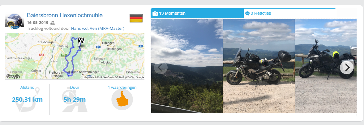
Garmin Zumo XT3/XT2/XT/BMW Connected Ride Navigator/Tourstart/ MyRouteapp (The App)/...
Een dag niet gelachen is een dag niet geleefd / Een route is net zo goed als deze uitgezet is. -
Who of the users tracks all his routes and also takes photos on the road with the:
A. MRA Mobile App
B. MRA Navigation App
C. Both Apps
D. I don't track my routes.@Hans-van-de-Ven-MRA-Master
Always, using both Apps.
Garmin Zumo XT3/XT2/XT/BMW Connected Ride Navigator/Tourstart/ MyRouteapp (The App)/...
Een dag niet gelachen is een dag niet geleefd / Een route is net zo goed als deze uitgezet is. -
@Hans-van-de-Ven-MRA-Master
Always, using both Apps.
@Hans-van-de-Ven-MRA-Master As explained in another post, I don't record the tracks. I would be keen doing it if I could register more data with my GPS. Now the track seems limited to the exact route. That doesn't help me much as memories are linked to time and stops.
-
I use oth: if Iˋm driving by route navigation on Navigation App, tracking runs in background.
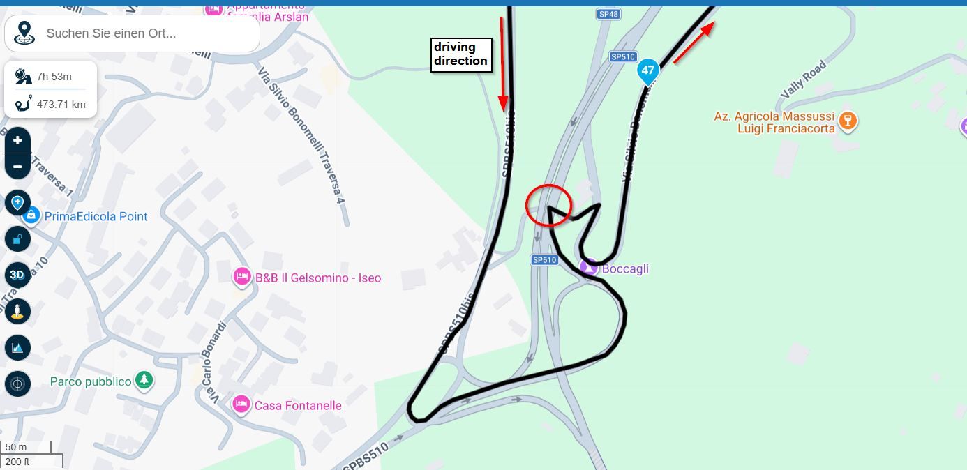
If Iˋm doing a free ride without navigation, then I do also a tracking, to know afterwards where i drove. In this situation, I use MRA App for tracking, because screen has more space for map. Because the navigation elements and icons are not needed (not visible on screen).
I use this simply to keep an overview during ride, where I am currently. In this use case I need a wider scale of map, but unfortunately, there is an automatic rescale to more detailed view. So, itˋs not possible with this detailed view, to keep ongoing anoverview.I take photos during ride with Navigation App or MRA App - result is the same.
But there is another great disadvantage at Navigation App: itˋs using only HEERE map. But tracking on this map is not helpful for bisycle rides or hitchhicking, because here you need more topo maps, to see if trackpoint is on right path. But HEERE map contains no small paths - only greater roads.
Generally, I would prefer Navigation App on my SmartPhone during bisycle rides or hitchhicking, because batterie has more capacity than battery of Navigation Device (which I use on my motorbike). But without topo map itˋs sense less!
-
Im trying to use both but when tracking and then take a photo/moment MRA will then not continue with the original track and prompts me to start a new track. there is no way to continue with the original track. Am i doing something wrong??
-
Im trying to use both but when tracking and then take a photo/moment MRA will then not continue with the original track and prompts me to start a new track. there is no way to continue with the original track. Am i doing something wrong??
Do you use the right button? Are you sure you don’t press the flag?
Garmin Zumo XT3/XT2/XT/BMW Connected Ride Navigator/Tourstart/ MyRouteapp (The App)/...
Een dag niet gelachen is een dag niet geleefd / Een route is net zo goed als deze uitgezet is. -
Do you use the right button? Are you sure you don’t press the flag?
@Hans-van-de-Ven-MRA-Master Yes I'm sure i have tried it a couple of times so far. I have now contacted support with the problem, thanks for your reply
-
Who of the users tracks all his routes and also takes photos on the road with the:
A. MRA Mobile App
B. MRA Navigation App
C. Both Apps
D. I don't track my routes.Haven’t tracked my routes yet, as normally I plan and design my routes on beforehand with MRA. For pictures I prefer to use my Nikon and for filming my Sony.
Recording with the MRA app would however be a good idea for unplanned tours, without a pre-set destination. Will keep this in mind!
KR,
Bert. -
I've not used it so far. I'm using Relive.cc for tracking with photo's. I like the animation.
Tracking with Relive.ccBecause I don't need the tracklog (I've got the complete route) Relive gives me a quick and dirty way to share what I've done.
-
B. I track my routes with the MRA Navigation app, but I haven't used it yet to take photos. I have a route I am taking tomorrow, and I plan to take pictures then. I am just starting to use MRA, by the way. So far, I love it.
-
I track with MRA Mob App and take pictures
-
I don't track routes, but (of course) make photos.
I would like to be able also to add these photos as moment in animation based on the waypoints, instead of a tracklog.
Is that possible ? -
I don't track anything! It's potentially incriminating evidence!!!
 No, I tend to either know where I'm going and not need sat nav, or I have planned a route, so have no need of tracking. I guess it has its uses, but in terms of importance as a feature, I'd rate it 2 or 3 out of 10.
I very, very rarely stop to take photos... Too busy enjoying riding.
-
I don't track routes, but (of course) make photos.
I would like to be able also to add these photos as moment in animation based on the waypoints, instead of a tracklog.
Is that possible ?At the moment I think you can only add “Moments” (Photos) to a Track Log not in the Animation.
I hope someone tells me I’m wrong in this instance
-
I don't track anything! It's potentially incriminating evidence!!!
No, I tend to either know where I'm going and not need sat nav, or I have planned a route, so have no need of tracking. I guess it has its uses, but in terms of importance as a feature, I'd rate it 2 or 3 out of 10.I very, very rarely stop to take photos... Too busy enjoying riding.
@PAD-0 said in Tracking of routes.:
I don't track anything! It's potentially incriminating evidence!!!
That’s why I always Vlog with 2 Cameras.

The huge Tiger 900 Rally Pro speedometer is the ultimate super grass. -
I don't track routes, but (of course) make photos.
I would like to be able also to add these photos as moment in animation based on the waypoints, instead of a tracklog.
Is that possible ?@Andre-Klap said in Tracking of routes.:
I don't track routes, but (of course) make photos.
I would like to be able also to add these photos as moment in animation based on the waypoints, instead of a tracklog.
Is that possible ?Yes it is possible on a pc. Open the route you wish to make an animation from. Click save as and choose GPX 1.1 (route, track, POI). This will save the route to your download folder.
Open your tracklogs in your MRA account and choose to add a new tracklog then choose the file you have just downloaded to upload as a new tracklog.
Once the tracklog is open, click on the track line where you would like to add your moments (photos) then make your animation.Always willing to help if I can.
Triumph Tiger 1200 XRT called Tina.
MRA Navigation Next and SilverFox BJ8 -
@Andre-Klap said in Tracking of routes.:
I don't track routes, but (of course) make photos.
I would like to be able also to add these photos as moment in animation based on the waypoints, instead of a tracklog.
Is that possible ?Yes it is possible on a pc. Open the route you wish to make an animation from. Click save as and choose GPX 1.1 (route, track, POI). This will save the route to your download folder.
Open your tracklogs in your MRA account and choose to add a new tracklog then choose the file you have just downloaded to upload as a new tracklog.
Once the tracklog is open, click on the track line where you would like to add your moments (photos) then make your animation.Nick in this instance I think Andre-Klap was asking if it could be done in the “standard” Route Planner animation not using Track Logs at all.
Also he mentioned that he does not record track logs he only takes photo’s.You don’t stop riding when you get old, you get old when you stop riding.
-
Nick in this instance I think Andre-Klap was asking if it could be done in the “standard” Route Planner animation not using Track Logs at all.
Also he mentioned that he does not record track logs he only takes photo’s.@Steve-Lynch Exactly, if you don’t record a tracklog, you can convert a route to a track to enable adding photos. You cannot add photos to a route.
-
@Hans-van-de-Ven-MRA-Master I will use A when I do track my route as I use a Zumo XT for Nav. Really liking the new Animation and 3D features and the fact that I can add photos to the track log either through the apps or manually after the event. However, it would be really great if this feature could utilise the picture metadata so that the location, time etc are used automatically instead of manually adding. Yes, I also want to have the choice of manually inserting photos or comment but the metadata use would, in my mind, be the easiest method to add picture moments. Just wondering if this is an aspect to be included downstream?
Hello! It looks like you're interested in this conversation, but you don't have an account yet.
Getting fed up of having to scroll through the same posts each visit? When you register for an account, you'll always come back to exactly where you were before, and choose to be notified of new replies (either via email, or push notification). You'll also be able to save bookmarks and upvote posts to show your appreciation to other community members.
With your input, this post could be even better 💗
Register Login-
016178
-
08101
-
018342
-
3747
-
0641
-
012201
-
08156
-
0345