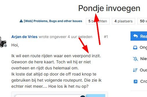
Pondje invoegen
-
Hoi,
Ik wil een route rijden waar een veerpond inzit. Gewoon de here kaart. Toch wil hij er niet overheen en rijdt dus helemaal om.
Ik loste dat altijd op door de off road knop te gebruiken bij het volgende routepunt. Die zie ik echter niet meer.... Hoe los ik het nu op?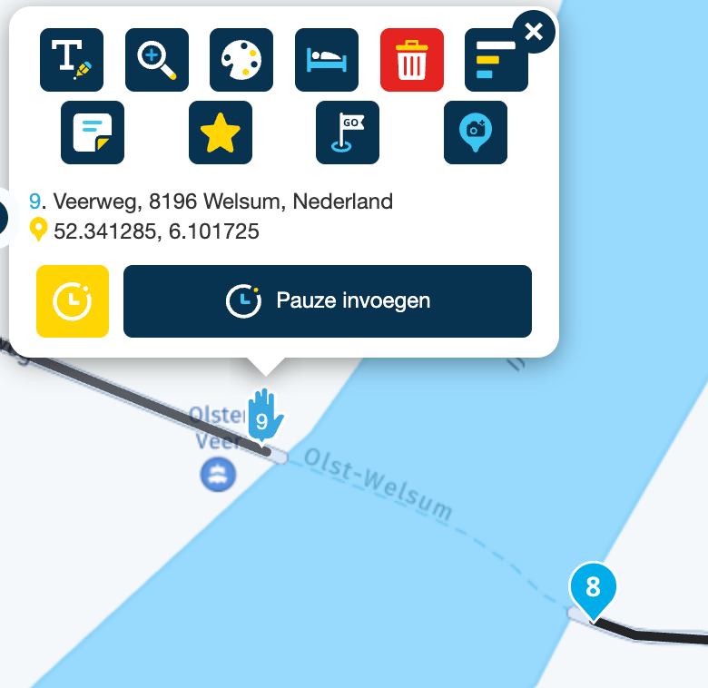
-
Hoi,
Ik wil een route rijden waar een veerpond inzit. Gewoon de here kaart. Toch wil hij er niet overheen en rijdt dus helemaal om.
Ik loste dat altijd op door de off road knop te gebruiken bij het volgende routepunt. Die zie ik echter niet meer.... Hoe los ik het nu op?@Arjan-de-Vries offraod-knop is er zeker nog wel. Geen idee wat dat veroorzaakt.... cookies?? Maar weet je ook zeker dat er in het Toolkit-menu achter de optie Vermijden geen vinkje staat achter Veerboten? Bij mij neemt hij wat ik ook doe altijd de pont behalve als ik veerboten vermijden aan heb gevinkt.
Het alternatief voor de knop off-road is om in het Toolkit-menu te kiezen voor Routeoptimalisatie > Snelste. In dat geval is de oversteek korter dan het omrijden dat hij nu doet.
🏍️ BMW K1600GT-P (2013) | Nolan N100-5 with Sena 30K
📱 iOS on iPhone 13 & 16 (mounted on Quadlock or AliExpress extention on BMW-cradle)
🚙 Apple CarPlay in VW T-Roc
💻 Routelab on MacBook Air & iMac (Tahoe & Ventura) -
De offroad optie is niet beschikbaar voor het eerste / laatste routepunt
-
@Arjan-de-Vries offraod-knop is er zeker nog wel. Geen idee wat dat veroorzaakt.... cookies?? Maar weet je ook zeker dat er in het Toolkit-menu achter de optie Vermijden geen vinkje staat achter Veerboten? Bij mij neemt hij wat ik ook doe altijd de pont behalve als ik veerboten vermijden aan heb gevinkt.
Het alternatief voor de knop off-road is om in het Toolkit-menu te kiezen voor Routeoptimalisatie > Snelste. In dat geval is de oversteek korter dan het omrijden dat hij nu doet.
@Rob-Verhoeff @rob-verhoeff je bedoelt waarschijnlijk dat je bij een pont kiest voor KORTSTE route. De standaard snelste route zorgt er immers voor dat je om moet rijden omdat bij zo’n pont er vanuit wordt gegaan dat het een half uur duurt.
Honda Goldwing GL1500,
Honda Silverwing GL 650
DMD2 T865X 8 inch Android tablet using MRA next for navigation
Garmin XT sold
Samsung S24FE mounted on a Quadlock and using Android Auto in my car -
@Rob-Verhoeff @rob-verhoeff je bedoelt waarschijnlijk dat je bij een pont kiest voor KORTSTE route. De standaard snelste route zorgt er immers voor dat je om moet rijden omdat bij zo’n pont er vanuit wordt gegaan dat het een half uur duurt.
@Marinus-van-Deudekom Ja, je hebt gelijk... tiepvoutje dat ik niet meer kan wijzigen.
Dit moet de tekst zijn:
Het alternatief voor de knop off-road is om in het Toolkit-menu te kiezen voor Routeoptimalisatie > Kortste. In dat geval is de oversteek sneller dan het omrijden dat hij nu doet.
-
Effe heel erg flauw...Pondje invoegen gaat via het mondje

Het pontje die je neemt is inderdaad geschikt voor gemotoriseerd verkeer, dat doe je dus wel goed.
En inderdaad is het beste om de route optimalisatie op Kortste te zetten.
Door deze optie op Snelste te laten staan wordt daadwerkelijk de snelste route berekend.
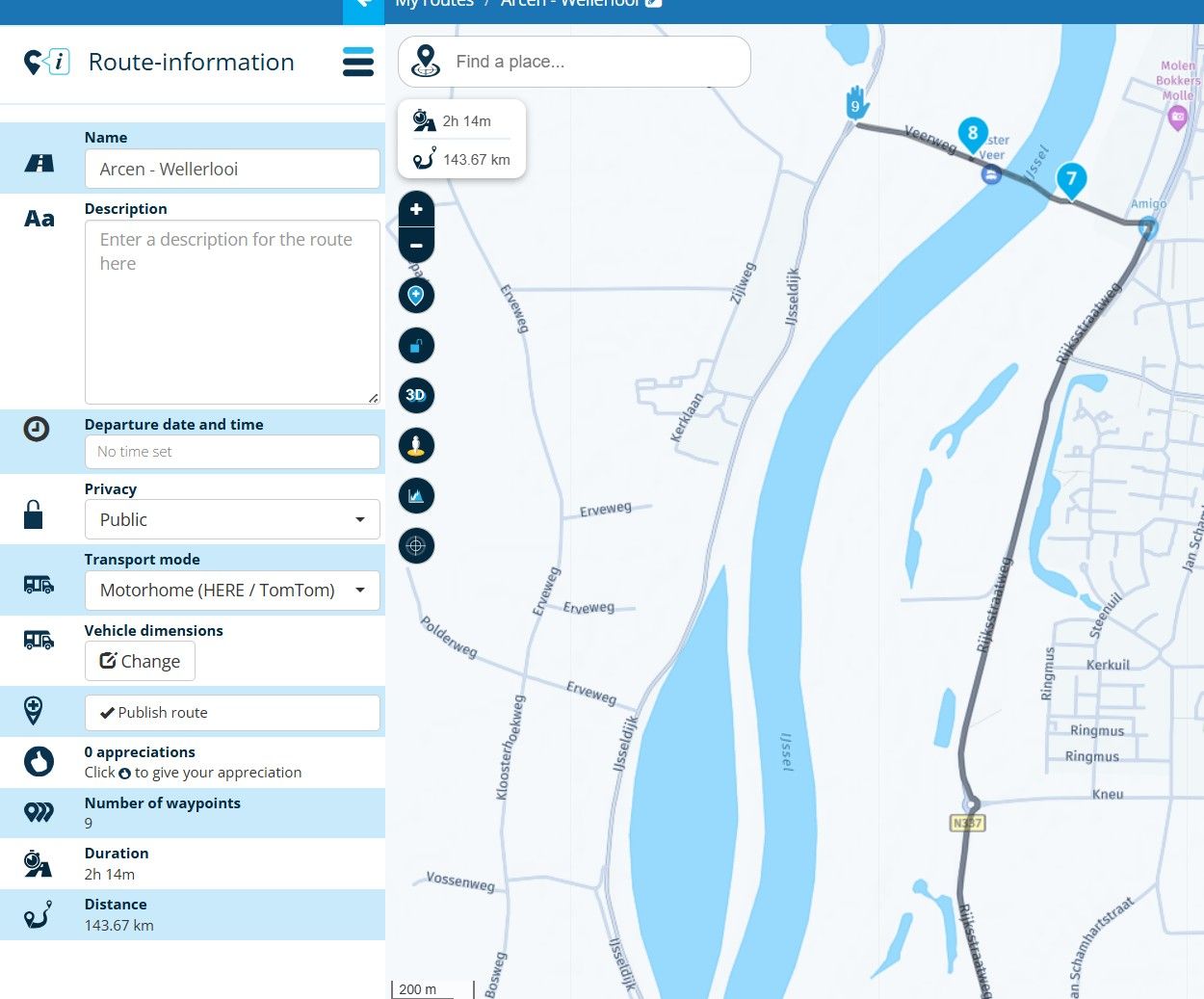
Dat betekende in jouw geval dus dat de route over een brug x-aantal kilometers van de pont vandaan (vanaf routepunt 8 naar routepunt 9) sneller is qua reistijd dan via het pontje oversteken.
-
Hoi,
Ik wil een route rijden waar een veerpond inzit. Gewoon de here kaart. Toch wil hij er niet overheen en rijdt dus helemaal om.
Ik loste dat altijd op door de off road knop te gebruiken bij het volgende routepunt. Die zie ik echter niet meer.... Hoe los ik het nu op?@Arjan-de-Vries
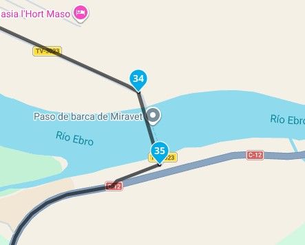
Change point 9 to a ShapingPoint -
@Rob-Verhoeff @rob-verhoeff je bedoelt waarschijnlijk dat je bij een pont kiest voor KORTSTE route. De standaard snelste route zorgt er immers voor dat je om moet rijden omdat bij zo’n pont er vanuit wordt gegaan dat het een half uur duurt.
@Marinus-van-Deudekom @rob-verhoeff @nomko That's not why. It's because he's marked point 9 as a viapoint. To finish, you place point 10, one meter ahead as a viapoint, and that's solved.. Regards.
Creator and administrator of the largest MRA groups.
- https://t.me/MRa_by_b0hd1
- https://www.myrouteapp.com/group/messages/7007
- YouTube: @demco17
- Ex-routexpert, current beta tester and MRA expert. Creator of tutorials, manuals, and MRA user trainer.
-
@Marinus-van-Deudekom @rob-verhoeff @nomko That's not why. It's because he's marked point 9 as a viapoint. To finish, you place point 10, one meter ahead as a viapoint, and that's solved.. Regards.
@b0hd1 Nope that's not correct. The Here map will see the crossing taking half an hour and that's why you have to use shortest route, not fastest. The fact that it's a Viapoint is not relevant
Honda Goldwing GL1500,
Honda Silverwing GL 650
DMD2 T865X 8 inch Android tablet using MRA next for navigation
Garmin XT sold
Samsung S24FE mounted on a Quadlock and using Android Auto in my car -
@b0hd1 Nope that's not correct. The Here map will see the crossing taking half an hour and that's why you have to use shortest route, not fastest. The fact that it's a Viapoint is not relevant
@Marinus-van-Deudekom But the point is that he wants to use the Ferry. If you set it as a shapingpoint, it will let you use the icon that the teammate mentioned.
Creator and administrator of the largest MRA groups.
- https://t.me/MRa_by_b0hd1
- https://www.myrouteapp.com/group/messages/7007
- YouTube: @demco17
- Ex-routexpert, current beta tester and MRA expert. Creator of tutorials, manuals, and MRA user trainer.
-
There's always more ways to get there and using the skipp button can do the trick but is not prefered. Placing the Viapoint at the start of the ferry would be 100% correct
Honda Goldwing GL1500,
Honda Silverwing GL 650
DMD2 T865X 8 inch Android tablet using MRA next for navigation
Garmin XT sold
Samsung S24FE mounted on a Quadlock and using Android Auto in my car -
There's always more ways to get there and using the skipp button can do the trick but is not prefered. Placing the Viapoint at the start of the ferry would be 100% correct
And when you arrive to the last stop after taking the ferry, you start a new route to follow your travel?
OffRoad button is the solution, but this can't be applied on LAST route point (which always is a viaPoint). If your stop is just on destination harbour, add a shapingpoint before it to convert it in NOT the last one, so OffRoad button could be activated and cross water as ferry does.
-
Weer een paar dingen geleerd!
Pond schrijf je met een T (wist ik wel..)
Handje heeft geef offroad knopje
Kortste route zou het idd kunnen zijn omdat bij een veerpont er tijd wordt gerekend.
Het is geregeld! -
Weer een paar dingen geleerd!
Pond schrijf je met een T (wist ik wel..)
Handje heeft geef offroad knopje
Kortste route zou het idd kunnen zijn omdat bij een veerpont er tijd wordt gerekend.
Het is geregeld!@Arjan-de-Vries, Een VIA punt kan zéker WEL als offroad punt gebruikt worden!
Alléén NIET als het het laatste punt is:
I am just an enthusiastic MRA user, and hope you will be one too!
Most motorcycle problems are caused by the nut that connects the handlebar to the saddle.
Check out RideSleepRepeat.eu, a biker community for sharing stays across Europe
-
@Marinus-van-Deudekom But the point is that he wants to use the Ferry. If you set it as a shapingpoint, it will let you use the icon that the teammate mentioned.
@Marinus-van-Deudekom But the point is that he wants to use the Ferry. If you set it as a shapingpoint, it will let you use the icon that the teammate mentioned.
When using the HERE map, selecting the fastest route optimisation option, the HERE map will calculate the fastest route from point A to point B. If the route from A to B using a bridge takes 40 minutes and it takes 60 minutes using a ferry to get from A to B then HERE will use the fastest option: 40 minutes via roads/bridges while this detoure takes also much more milages.
If you set route optimisation to Shortest, the HERE map will calculate the shortest route and not the fastest route. This means that getting from A to B using the ferry has lesser milages than taking the detoure over roads/bridges which takes lesser time than by ferry.
So, setting the optimisation option to Shortest will get you cross the river using the ferry.
Switching between soft waypoints (waypoint 8 in screenshot of Arjen) or hard waypoint (waypoint 9 in screenshot of Arjen) does not make any difference. Hard waypoints are waypoints you must pass to continue your route.
-
I tried something just for fun;
A route with three points, with the ferry between points 2 and 3. In this case, point 3 is also the endpoint.
Ik heb even iets geprobeerd;
Een route van drie punten met tussen 2 en 3 de veerpont. In dit geval is punt 3 ook het eindpunt.
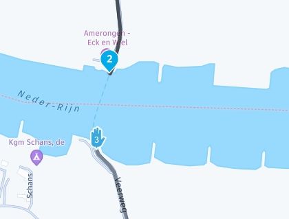
The route will then take you over the nearest bridge, back to the end point, point 3!
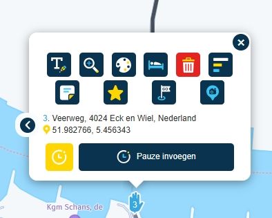
When you select point 3, you'll see that there is no off-road option.
De route wordt dan over de dichtstbijzijnde brug geleid, terug naar het eindpunt, punt 3!
Als je punt 3 oproept, zie je dat je geen Offroad mogelijkheid hebt.
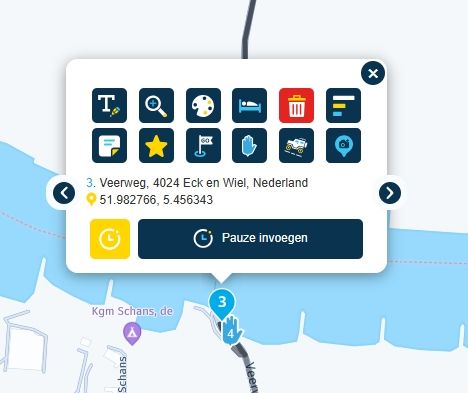
If you insert a new endpoint (point 4) right next to point 3, you’ll have that option again.
Door nu vlak bij punt 3 nog een punt 4 als nieuw eindpunt in te voegen krijg je deze mogelijkheid wel weer.
So if you select "off-road" for point 3, you'll see that the route follows the point perfectly.
En als je nu dus voor punt 3 offroad kiest, dan zie je dat de route netjes over de punt loopt.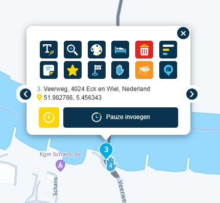
Problem solved!
Probleem opgelost! -
@Arjan-de-Vries, Een VIA punt kan zéker WEL als offroad punt gebruikt worden!
Alléén NIET als het het laatste punt is:
@Con-Hennekens Stand corrected!
-
HAHAHA raar. Als je in de route info motorhome of truck insteld gaat hij wel erover
R1250GS. Started with a Zumo 550, BMW nav IV, Carpe-iter and now Chigee met MRA app.
-
HAHAHA raar. Als je in de route info motorhome of truck insteld gaat hij wel erover
@Leike-Lodiers, Met een truck heb je een lagere snelheid, dus is de kans dat de omweg niet sneller is groter. Dat is niet raar, maar wiskunde
")
Hello! It looks like you're interested in this conversation, but you don't have an account yet.
Getting fed up of having to scroll through the same posts each visit? When you register for an account, you'll always come back to exactly where you were before, and choose to be notified of new replies (either via email, or push notification). You'll also be able to save bookmarks and upvote posts to show your appreciation to other community members.
With your input, this post could be even better 💗
Register Login-
7903.7k
-
017259
-
0443
-
0347
-
05134
-
737492
-
317982
-
03106