POI Label
-

Hello - !
I have been looking at some routes in the Library (thank you, everyone, who has contributed!) and cross-checking with my own planned routes.
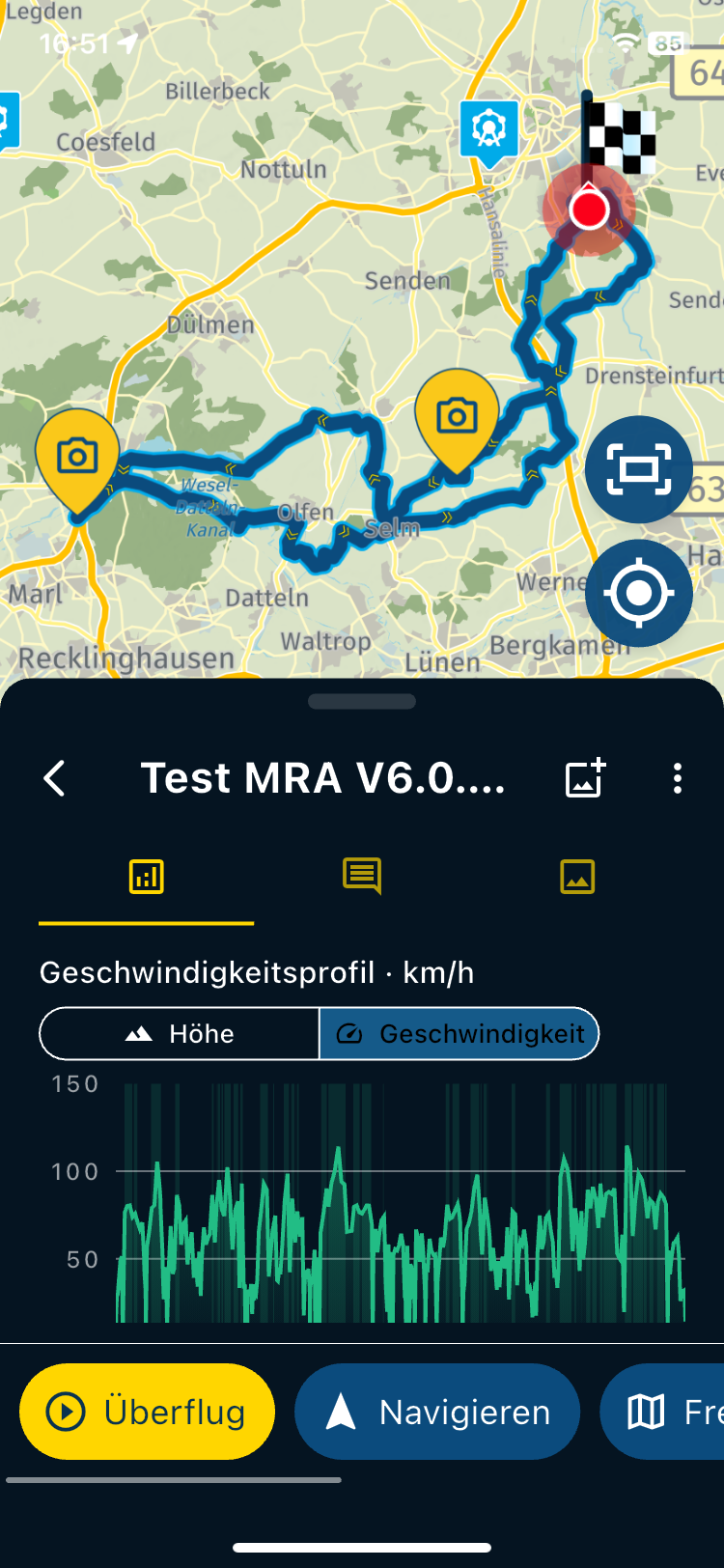
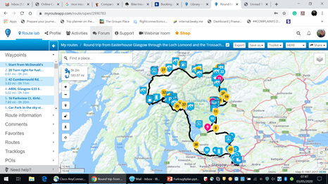
On some of the routes, the POI Label/Marker are still visible on and around the specific route only - Please see example -
How is this done please?
Thanks
Chris
-
Hello - !
I have been looking at some routes in the Library (thank you, everyone, who has contributed!) and cross-checking with my own planned routes.
On some of the routes, the POI Label/Marker are still visible on and around the specific route only - Please see example -
How is this done please?
Thanks
Chris

The POI are added to that specific route, you can add poi to your route via the poi menu on the left side, check the poi that you want to see and zoom in. Add them as poi not as rp
-
thank you ... been using this for ages and didn't realise you could do that .... !!
How does it appear on the satnav itself - just as a waypoint or a flag ???
also - seen this on several routes

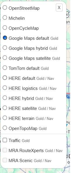
Can't seem to find it in the POI menu .. any ideas?
Thanks for your help
-
Ok ... I think I have answered both questions myself now !! (Der!!)
So, if the POI is added to the route - only as a waypoint at the moment I see) - if its slightly off the track - will the satnav need you to cross it ?? If so, that will be awkward for most POI's won't it ?
-
Ok ... I think I have answered both questions myself now !! (Der!!)
So, if the POI is added to the route - only as a waypoint at the moment I see) - if its slightly off the track - will the satnav need you to cross it ?? If so, that will be awkward for most POI's won't it ?
Hi Chris,
The satnav isn't responsing on the POI
These POI's

Are the one you added yourself.
-
Ok ... I think I have answered both questions myself now !! (Der!!)
So, if the POI is added to the route - only as a waypoint at the moment I see) - if its slightly off the track - will the satnav need you to cross it ?? If so, that will be awkward for most POI's won't it ?

@Chris-Tremain said in POI Label:
Ok ... I think I have answered both questions myself now !! (Der!!)
So, if the POI is added to the route - only as a waypoint at the moment I see) - if its slightly off the track - will the satnav need you to cross it ?? If so, that will be awkward for most POI's won't it ?
Hi Chris. When you add a POI from the POI library, a dialogue box pops up that asks if you want to add as a waypoint or POI. The default option is to add as a waypoint, always deselect this option and select Add as POI. This will just add the POI as a visual marker, if you leave it as a waypoint when adding, it will be used as a standard waypoint and become part of the route. When you add a custom POI to your route

this will only be added as a POI. Good luck and enjoy the route (one of mine )
) -
@Chris-Tremain said in POI Label:
Ok ... I think I have answered both questions myself now !! (Der!!)
So, if the POI is added to the route - only as a waypoint at the moment I see) - if its slightly off the track - will the satnav need you to cross it ?? If so, that will be awkward for most POI's won't it ?
Hi Chris. When you add a POI from the POI library, a dialogue box pops up that asks if you want to add as a waypoint or POI. The default option is to add as a waypoint, always deselect this option and select Add as POI. This will just add the POI as a visual marker, if you leave it as a waypoint when adding, it will be used as a standard waypoint and become part of the route. When you add a custom POI to your route
this will only be added as a POI. Good luck and enjoy the route (one of mine)
@Nick-Carthew Hai Nick,
Do you (with all your experience) find this a good approach? I would find it more logical to add it as waypoint to the route AND maintain it as a visual marker.
I would think that POI, and favorites, could not serve another purpose but to guide us to a certain point to visit, sleep, eat ?
What is your view on that?
It is not difficult, it is easy, it's a hobby
-
@Nick-Carthew Hai Nick,
Do you (with all your experience) find this a good approach? I would find it more logical to add it as waypoint to the route AND maintain it as a visual marker.
I would think that POI, and favorites, could not serve another purpose but to guide us to a certain point to visit, sleep, eat ?
What is your view on that?
@Drabslab MRA has no control of where the POIs within the MRA POI library are positioned. Sometimes they can be many metres from the road. This would obviously cause problems if they are used as a waypoint.
As a visual indicator, they can be used to highlight the Exact location of a museum or any other places of interest.
Hope this helpsAlways willing to help if I can.
Triumph Tiger 1200 XRT called Tina.
MRA Navigation Next and SilverFox BJ8 -
@Drabslab MRA has no control of where the POIs within the MRA POI library are positioned. Sometimes they can be many metres from the road. This would obviously cause problems if they are used as a waypoint.
As a visual indicator, they can be used to highlight the Exact location of a museum or any other places of interest.
Hope this helps
Good point!!!
About the position of an interest point compared to where the road is. I never thought of that aspect. I have seen POI always as a kind of library and extensions to favorites. -
Hi Chris,
The satnav isn't responsing on the POI
These POI's
Are the one you added yourself.
@Hans-van-de-Ven-MRA-Master Thank you !
-
@Chris-Tremain said in POI Label:
Ok ... I think I have answered both questions myself now !! (Der!!)
So, if the POI is added to the route - only as a waypoint at the moment I see) - if its slightly off the track - will the satnav need you to cross it ?? If so, that will be awkward for most POI's won't it ?
Hi Chris. When you add a POI from the POI library, a dialogue box pops up that asks if you want to add as a waypoint or POI. The default option is to add as a waypoint, always deselect this option and select Add as POI. This will just add the POI as a visual marker, if you leave it as a waypoint when adding, it will be used as a standard waypoint and become part of the route. When you add a custom POI to your route
this will only be added as a POI. Good luck and enjoy the route (one of mine)
@Nick-Carthew - Thanks Nick - seems great minds think alike !!
My route is almost identical, but I will bow to your expertise sir !
thanks for the tips
ct
-

There is another nice point: if you are using POI (no matter if from MRA, or your own) as Waypoint - and you are sharing your route with others - then the other people gets the POI also in the POI list.
I love it to share my routes in the Alps with my friends, to show them which Pass roads we will climb on our tour.
Hello! It looks like you're interested in this conversation, but you don't have an account yet.
Getting fed up of having to scroll through the same posts each visit? When you register for an account, you'll always come back to exactly where you were before, and choose to be notified of new replies (either via email, or push notification). You'll also be able to save bookmarks and upvote posts to show your appreciation to other community members.
With your input, this post could be even better 💗
Register Login-
 0938
0938
-
 5711.2k
-
 1331333
-
09328
-
1122.3k
-
0276
-
 0257
0257
-
 0222
0222