@Brian-McG @brian-mcg You're right. This has nothing directly to do with transferring files other than it being one of the pieces that ensure Zumos operate correctly as navigation devices. If that doesn't interest you, so be it.
BTW, Garmin GPS routing algorithms have changed over the years, pre-Zumo you could take a Basecamp route calculation to the bank in that it would 100% match when recalculated in the Garmin GPS. That's no longer the case. I'm surprised you didn't know this given your "mult-multi years" Garmin experience.
To the topic, this discussion has everything to do with:
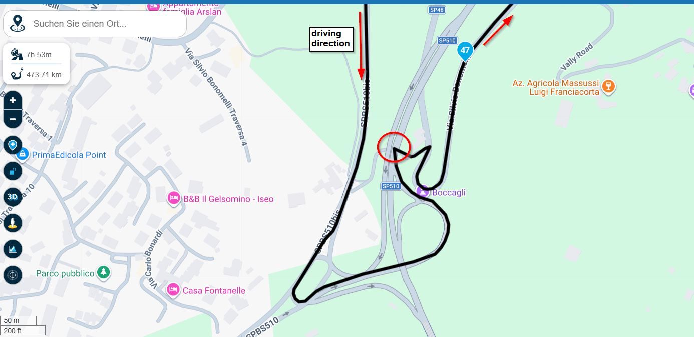
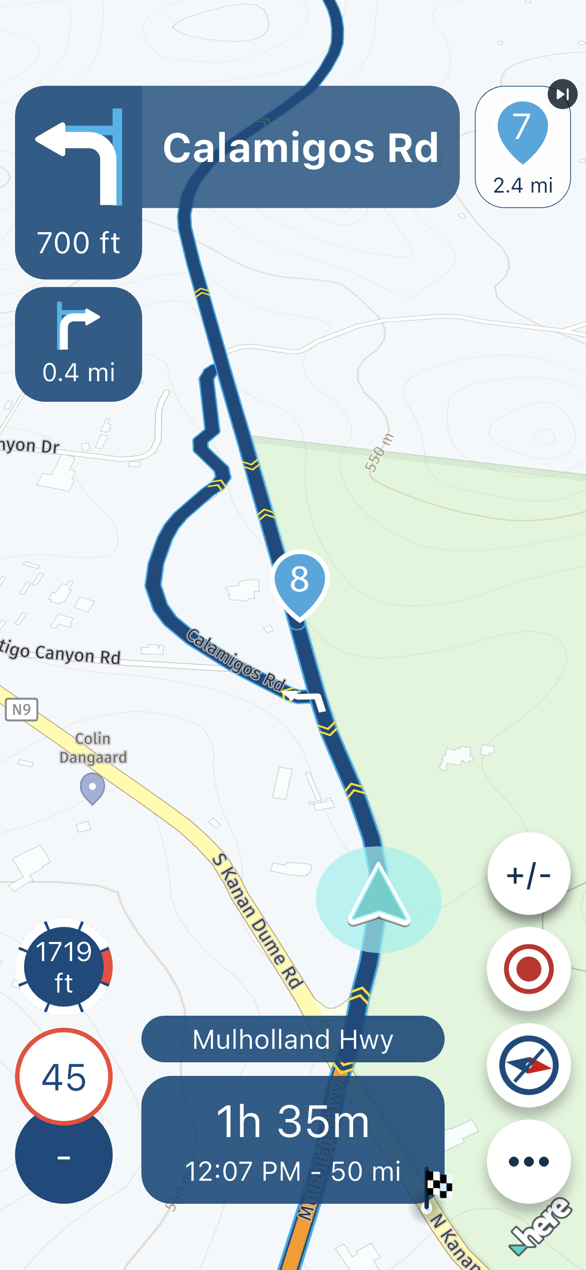
The HERE map not placing the road where it actually is.
The MRA app recognizing the map discrepancy, but the Web Routeplanner not showing any overt alert. Sync should actually mean Sync.
The MRA "Skip Waypoints automatically" enabled not working in this scenario.
I was able to dynamically enable the XT3 to successfully recalculate at WP#7, so what's with the blanket "advice not to enable the recalculate function is decades old"? Nothing is absolute, yet you're hanging your hat on it. Odd.
I'm trying to be transparent and reasonable, and I can say with complete honestly that the XT3 worked better than the MRA app in successfully routing the section from WP#7 to WP#8. If this had not been a verification test, and I was just routing with the XT3 (forgetting the app), I probably wouldn't have known there was a problem at all. I would have been on the straighter section on top of the mountain ridge before being able to look down at the route, and I wouldn't have seen that the XT3 handled the situation without any intervention.
Again, thank you for helping me unravel what happened. We obviously don't agree on some things, but I appreciate the input you provided.