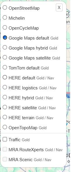
@Christian-Siegel, I think you are referring to this option then:
[image: b7d78cb1-9c02-4932-bd81-5db825eeaf61-image.png]
It's in the toolkit, English name would be something like "Waypoint placement button" (or similar).
I personally don't believe this is the right approach
But I'm slightly biased obviously.
I don't know to what email your initial ticket was sent but we've received your second message an hour ago successfully.
The first one (which is attached in the second email) never made it to us.
Your ticket will be responded to shortly.
Further communication will be done through the support portal.
@Bouke-Ent, Ja, dat is natuurlijk al een hilarisch fenomeen sinds de uitvinding van de spraaksynthese. Het zou misschien best aardig zijn als namen (eigenlijk de woorden in adressen) in de taal gesproken zou kunnen worden van het land waar je je bevindt. Maar ook dat roept complicaties op in landen waarvan je het schrift niet kent, of (dichter bij huis) in landen als België, en Luxemburg waar 3 talen worden gesproken.
@Ton-Machielsen
That's an interesting example!
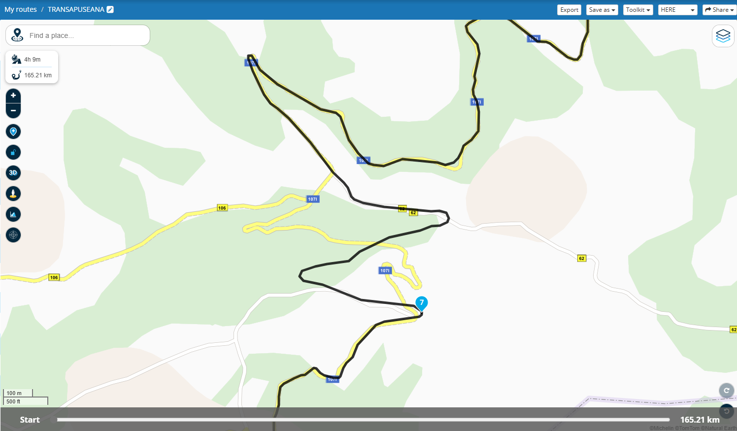
I did a quick check, but this route can be created with MRA using OSM (as Routing Engine) but not with HERE. Navigation with MRA NN should work (track navigation) with just a few sections where you must follow the "white line":
https://www.myrouteapp.com/en/social/route/10364286?mode=share
We definitely respect all opinions and I will personally always try to understand why people have a negative experience.
The problem was just that a lot of responses were given that weren't very constructive. Due to your absence no discussion was started and the thread was not very valuable.
I would greatly advice you to create a support ticket here: https://myrouteapp.com/support
We will definitely try to aid you where possible!
I will lock this thread as I don't think this is now the place to continue public discussion.
I won't remove the topic to ensure your opinion is still accessible.
Any valuable conclusions through a support ticket will be added here by me.
The forum admin should actually make it impossible for Google (bot) and other search engines to access this part of the forum. Then the topics can no longer be indexed.
@viktor-4
Hello,
I recently began using MRA Tourplanner and have been utilizing SYGIC GPS Navigation on my phones. I encountered issues with "curly" routes/tracks during transfers. I tried GPX versions 1.0, 1.1, and 1.2 but none yielded satisfactory results. Upon researching which map database SYGIC employs, I found it uses TomTom GPX 1.1. Consequently, saving the GPX file in this format resolved the "doodles" issue in SYGIC.
@Nick-Carthew said in Place names in the TomTom map:
@Christian-Schrenk “The more waypoints are set, the more accurately the route is transmitted.“ Local conditions like heavy traffic or road closures can affect your TT and maybe cause it to take a diversion. Placing more waypoints does not make the route more accurate. In fact, it multiplies the chances of an inaccurate route if all waypoints are not fully checked as previously mentioned. And as you said, it makes rejoining your original route difficult.
And the language used on the maps is out of the control of MRA like @Hans-van-de-Ven-RouteXpert said in a previous reply, but I think we have found you a solution.
Waypoints? You’re overthinking it. Let the map handle the drama.
@Willem-Nas
Open MyRoute-App
[image: f5021cd8-63c4-4615-80a5-e92b19809e06-Screenshot_20241128-154746.png]
Select routes and tracklogs
[image: 947b6c8e-3367-4a0f-b445-49fe670ac1da-Screenshot_20241128-154800.png]
Select the route that you want to send to your Zumo XT
[image: 51541232-c891-403a-a410-43ad166a3712-Screenshot_20241128-154826.png]
Hit the Download Arrow and chose file type I use GPX 1.1 and a track of the route
[image: d85ea25f-1d80-4c94-97d3-30ee8b93bb6c-Screenshot_20241128-154837.png]
Hit export.
[image: 3b775371-c570-48ca-8141-dde62685b66f-Screenshot_20241128-154848.png]
Hit Share
[image: fc363d49-d7f9-4d76-8e31-079f6579bb19-Screenshot_20241128-154855.png]
Hit Garmin Drive as the share app.
[image: 9c1fb97e-d098-4631-a079-d98d1a8b6352-Screenshot_20241128-154906.png]
It will indicate that it has received the file Hit send to send it to the Zumo
[image: 62a34115-cc9d-4842-9e39-46ba9edbbbec-Screenshot_20241128-154946.png]
Open the Zumo and Garmin Drive will connect and Calculate the route you just sent using Drive.
[image: 42803[1].png]
It will also show that it received the track of the route if you sent one.
[image: 43821[1].png]
Open Trip planner and start the route that you just sent/received
[image: 45350[1].png]
[image: 47772[1].png]
You can always display the track if you want also to make sure the route when calculated has not changed from what you planned.