Milage marker visibility on phone?
-
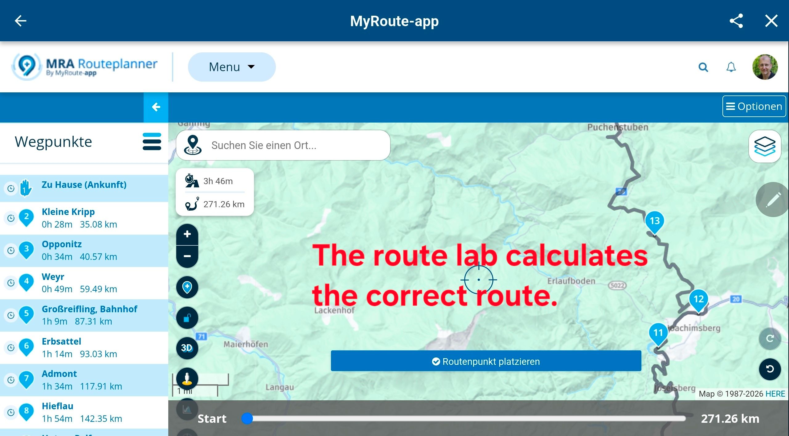
I have been using MRA for some time now and I very much enjoy its simplicity and ease of use. My question is this: Is it possible to plan a route on the computer and insert milage markers along the route that will then be visible as i follow the route on my phone? I find it would be very helpful to know how far along the route i am at any given point. I do know its possible to ad notes to the way points but those are not visible on the phone. If there is a way to do this that i am not aware of please let me know. If it is not possible, please consider adding this feature. Thanks, MikeD
-
I have been using MRA for some time now and I very much enjoy its simplicity and ease of use. My question is this: Is it possible to plan a route on the computer and insert milage markers along the route that will then be visible as i follow the route on my phone? I find it would be very helpful to know how far along the route i am at any given point. I do know its possible to ad notes to the way points but those are not visible on the phone. If there is a way to do this that i am not aware of please let me know. If it is not possible, please consider adding this feature. Thanks, MikeD
@Michael-Doherty-0 If you open the waypoint list during navigation, you can see how far you are along the route.
The skip button in your top right corner shows the upcoming waypoint. Search for that on in the list and you now know where you are.
-
It's visible at the bottom of the screen, right?
Or am I not really understanding the question?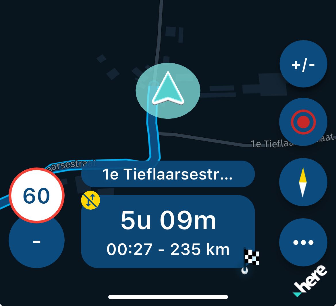
-
It's visible at the bottom of the screen, right?
Or am I not really understanding the question?@Jack-van-Tilburg that is the remaining distance to the destination when set to the flag, and otherwise to waypoint and or viapoint, imho ts asks about its current distance from the start?

In case TS wants a percentage or fraction, either method requires the total route distance for a calculation.
Manks bu'j te bange.
-
@Jack-van-Tilburg that is the remaining distance to the destination when set to the flag, and otherwise to waypoint and or viapoint, imho ts asks about its current distance from the start?
In case TS wants a percentage or fraction, either method requires the total route distance for a calculation.
@Stefan-Hummelink
I don't see the word 'percentage' in the question.
And when I know how far I still have to go, I also know how far I have gone.")
-
I have been using MRA for some time now and I very much enjoy its simplicity and ease of use. My question is this: Is it possible to plan a route on the computer and insert milage markers along the route that will then be visible as i follow the route on my phone? I find it would be very helpful to know how far along the route i am at any given point. I do know its possible to ad notes to the way points but those are not visible on the phone. If there is a way to do this that i am not aware of please let me know. If it is not possible, please consider adding this feature. Thanks, MikeD
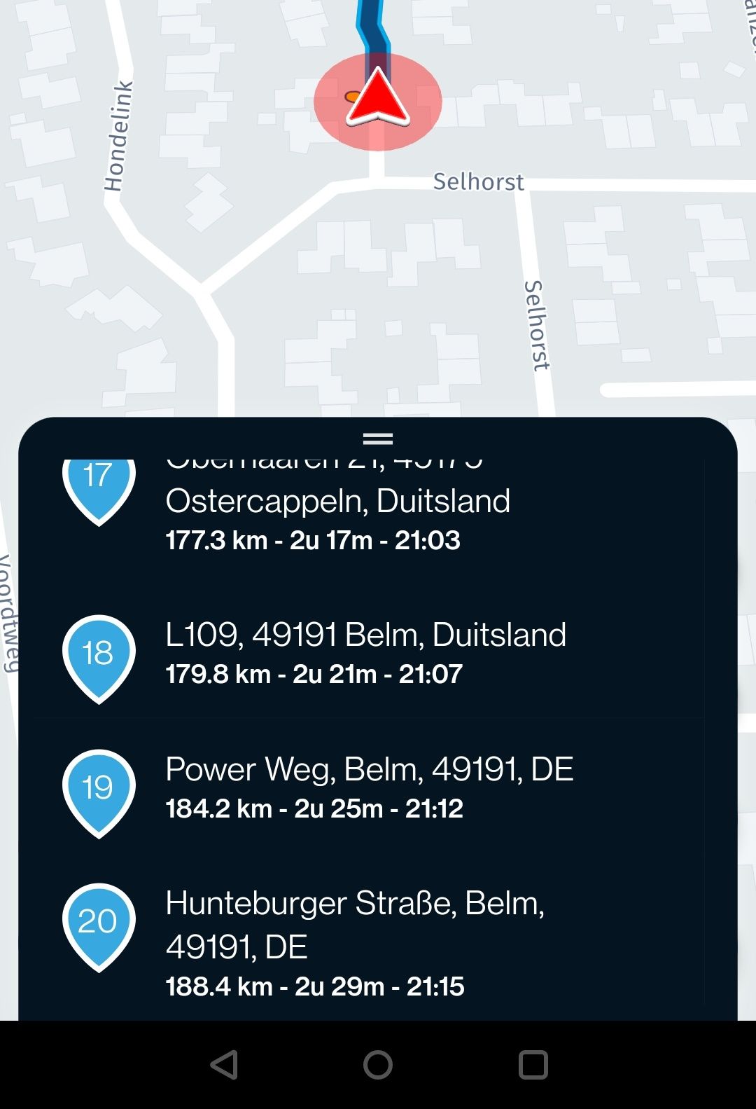
@Michael-Doherty-0 You could add a coloured route point (I would use pink) at 10 mile intervals and name them 10 miles, 20 miles and so on. You’ll see the pink route points and their name will appear and be announced as you approach them.
Always willing to help if I can.
Triumph Tiger 1200 XRT called Tina.
MRA Navigation Next and SilverFox BJ8 -
@Michael-Doherty-0 You could add a coloured route point (I would use pink) at 10 mile intervals and name them 10 miles, 20 miles and so on. You’ll see the pink route points and their name will appear and be announced as you approach them.
@Nick-Carthew won't be announced if the title includes any numbers.
2010 GL1800 Goldwing using Samsung Galaxy S20 5G Android 13.
-
@Stefan-Hummelink
I don't see the word 'percentage' in the question.
And when I know how far I still have to go, I also know how far I have gone.@Jack-van-Tilburg said in Milage marker visibility on phone?:
also know how far I have gone.
Only if you know the total distance of the route, and I never look at that when riding. I rely completely on my route preparations at home.
Manks bu'j te bange.
-
@Jack-van-Tilburg said in Milage marker visibility on phone?:
also know how far I have gone.
Only if you know the total distance of the route, and I never look at that when riding. I rely completely on my route preparations at home.
@Stefan-Hummelink said in Milage marker visibility on phone?:
I rely completely on my route preparations at home.
Me to!
But I also know how long the route I made is. -
@Nick-Carthew won't be announced if the title includes any numbers.
@Doug-Robinson unless there is a note / description!
-
@Doug-Robinson unless there is a note / description!
@Corjan-Meijerink Thanks. I read through all of the replies to my question and appreciate the feedback. My hope was that i was just missing something. Thank you all.
I my perfect world as i navigate using my android phone. Each waypoint (flag), i dropped along the route that i planed on my home computer, Instead of just seeing #1, #2, #3 etc. I would be able to see without having to touch the screen #25 (16.3 Mil.) This would make riding the type of routes i plan much easier.
Please keep this in mind for for possible future updates.
Thanks Again,
Mike D. -
@Doug-Robinson unless there is a note / description!
@Corjan-Meijerink, If you press a waypoint along the route, a window opens showing a picture when available, and the name plus the note for that waypoint. I think it would be fairly easy to add a line showing the distance the WP is from the start, and how far it is to the end.
@Michael-Doherty-0, I am most curious to why, with your specific routes, it is more important to know how far you are from the start, then from the finish?
Also I think when the setting "Show waypoint info" is on, it will display also the note in the top left infobox. if you are near it. You could use that, but I think any non-automatic method will not work, since deviations will always occur and the distance info is not accurate anymore.
Hello! It looks like you're interested in this conversation, but you don't have an account yet.
Getting fed up of having to scroll through the same posts each visit? When you register for an account, you'll always come back to exactly where you were before, and choose to be notified of new replies (either via email, or push notification). You'll also be able to save bookmarks and upvote posts to show your appreciation to other community members.
With your input, this post could be even better 💗
Register Login-
07112
-
0331
-
017373
-
010431
-
08186
-
0351.6k