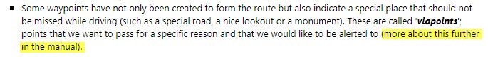
Alert when reaching a Viapoint
-
Hello @all
I want to get an alert when aproaching or arriving at a Viapoint.
Can anybody tell me where this is described ?
Thanks, gerry
-
Hello @all
I want to get an alert when aproaching or arriving at a Viapoint.
Can anybody tell me where this is described ?
Thanks, gerry
Hello Gerd,
Hello Gerd,
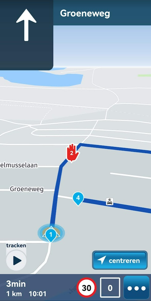
At the moment you only get an alert when you are approaching a viapoint in the Garmin Zumo models
Garmin Zumo XT3/XT2/XT/BMW Connected Ride Navigator/Tourstart/ MyRouteapp (The App)/...
Een dag niet gelachen is een dag niet geleefd / Een route is net zo goed als deze uitgezet is. -
Hello Gerd,
Hello Gerd,
At the moment you only get an alert when you are approaching a viapoint in the Garmin Zumo models
@Hans-van-de-Ven-MRA-Master
Thanks for your quick answer.This is very unsatisfying for me.
Imagine you are taking part in a photo rally and have the task of taking a photo at various points (communicated by coordinates). Without notification, you ride past these points because you don't know the points in advance.
I come from the Garmin devices and actually want to get away from them, but such basic functionality simply has to be covered.Thank you, greetings
gerry -
@Hans-van-de-Ven-MRA-Master
Thanks for your quick answer.This is very unsatisfying for me.
Imagine you are taking part in a photo rally and have the task of taking a photo at various points (communicated by coordinates). Without notification, you ride past these points because you don't know the points in advance.
I come from the Garmin devices and actually want to get away from them, but such basic functionality simply has to be covered.Thank you, greetings
gerryHi Gerry, what kind of navigation device do you use?
In MRA Navigation Next viapoints will give alerts when apporching. MRA Navigation Next is still under development and will be launchen early 2023Garmin Zumo XT3/XT2/XT/BMW Connected Ride Navigator/Tourstart/ MyRouteapp (The App)/...
Een dag niet gelachen is een dag niet geleefd / Een route is net zo goed als deze uitgezet is. -
Hi Gerry, what kind of navigation device do you use?
In MRA Navigation Next viapoints will give alerts when apporching. MRA Navigation Next is still under development and will be launchen early 2023@Hans-van-de-Ven-MRA-Master
I use a Carpe Iter Tablet (running Android)
https://carpe-iter.com/carpe-iter-pad/ -
@Hans-van-de-Ven-MRA-Master
I use a Carpe Iter Tablet (running Android)
https://carpe-iter.com/carpe-iter-pad/That's a nice device, do you use MRA Navigation or another app on it?
Garmin Zumo XT3/XT2/XT/BMW Connected Ride Navigator/Tourstart/ MyRouteapp (The App)/...
Een dag niet gelachen is een dag niet geleefd / Een route is net zo goed als deze uitgezet is. -
That's a nice device, do you use MRA Navigation or another app on it?
@Hans-van-de-Ven-MRA-Master
I want to use 'Navigation'
But if the functionality I have to have is not covered.....I there a possibilty to get the Beta Version of 'Next' ?
-
@Hans-van-de-Ven-MRA-Master
I want to use 'Navigation'
But if the functionality I have to have is not covered.....I there a possibilty to get the Beta Version of 'Next' ?
Navigation Next is still under development, there is no BETA version at this moment.
-
@Hans-van-de-Ven-MRA-Master
I want to use 'Navigation'
But if the functionality I have to have is not covered.....I there a possibilty to get the Beta Version of 'Next' ?
@Gerd-Heinzmann-0 The Beta version will be available to all who purchase Navigation Next in the presale or those who have an active Navigation Lifetime subscription.
We aim to have a first Beta available at the end of this month. As that point in time the feature set will obviously be limited.
-
Hello @all
I want to get an alert when aproaching or arriving at a Viapoint.
Can anybody tell me where this is described ?
Thanks, gerry
@Gerd-Heinzmann-0 said in Alert when reaching a Viapoint:
Hello @all
I want to get an alert when aproaching or arriving at a Viapoint.
Can anybody tell me where this is described ?
Thanks, gerry
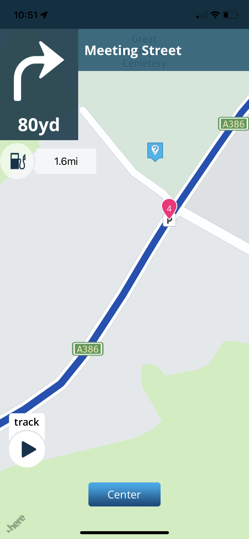
You could add a POI to act as a visual indication at each of your stops.
Always willing to help if I can.
Triumph Tiger 1200 XRT called Tina.
MRA Navigation Next and SilverFox BJ8 -
The better solution perhaps is for the navigation app to navigate to each of the stops (vias). Not the shapping points (although there are arguments to make this a selectable option). The stops (vias). That means that the distance/time to, next turn, etc. information is displayed for each via. The problem with an "alert" - assuming that it's momentary - is that it can be easily missed (paying attention to the road etc. vs. the nav device). If the nav app is navigating to the next stop (via) you're not going to miss it.
Right now, this is the main issue that has me still using CoPilotGPS as my main mobile nav app. Hopefully this gets addressed in Next.
-
@Gerd-Heinzmann-0 said in Alert when reaching a Viapoint:
Hello @all
I want to get an alert when aproaching or arriving at a Viapoint.
Can anybody tell me where this is described ?
Thanks, gerry
You could add a POI to act as a visual indication at each of your stops.
@Nick-Carthew said in Alert when reaching a Viapoint:
@Gerd-Heinzmann-0 said in Alert when reaching a Viapoint:
Hello @all
I want to get an alert when aproaching or arriving at a Viapoint.
Can anybody tell me where this is described ?
Thanks, gerry
You could add a POI to act as a visual indication at each of your stops.
Nick, that won't help.
The Photopoints can be a few meters beside the road. You might have to walk ie.100 m to get there.
Without an alert, you miss them.
-
The better solution perhaps is for the navigation app to navigate to each of the stops (vias). Not the shapping points (although there are arguments to make this a selectable option). The stops (vias). That means that the distance/time to, next turn, etc. information is displayed for each via. The problem with an "alert" - assuming that it's momentary - is that it can be easily missed (paying attention to the road etc. vs. the nav device). If the nav app is navigating to the next stop (via) you're not going to miss it.
Right now, this is the main issue that has me still using CoPilotGPS as my main mobile nav app. Hopefully this gets addressed in Next.
@Tim-Thompson said in Alert when reaching a Viapoint:
The better solution perhaps is for the navigation app to navigate to each of the stops (vias). Not the shapping points (although there are arguments to make this a selectable option). The stops (vias). That means that the distance/time to, next turn, etc. information is displayed for each via. The problem with an "alert" - assuming that it's momentary - is that it can be easily missed (paying attention to the road etc. vs. the nav device). If the nav app is navigating to the next stop (via) you're not going to miss it.
Right now, this is the main issue that has me still using CoPilotGPS as my main mobile nav app. Hopefully this gets addressed in Next.
Right Tim, for me this is not a crazy feature, nobody ever will need, for me this is essential

btw.: CoPilotGPS is no alternative, cause you can't import GPX files (as far as I know)
-
@Tim-Thompson said in Alert when reaching a Viapoint:
The better solution perhaps is for the navigation app to navigate to each of the stops (vias). Not the shapping points (although there are arguments to make this a selectable option). The stops (vias). That means that the distance/time to, next turn, etc. information is displayed for each via. The problem with an "alert" - assuming that it's momentary - is that it can be easily missed (paying attention to the road etc. vs. the nav device). If the nav app is navigating to the next stop (via) you're not going to miss it.
Right now, this is the main issue that has me still using CoPilotGPS as my main mobile nav app. Hopefully this gets addressed in Next.
Right Tim, for me this is not a crazy feature, nobody ever will need, for me this is essential
btw.: CoPilotGPS is no alternative, cause you can't import GPX files (as far as I know)
@Gerd-Heinzmann-0 said in Alert when reaching a Viapoint:
Right Tim, for me this is not a crazy feature, nobody ever will need, for me this is essential
Yes, as a geocacher I can understand that you would like compatibility for your game in your nav, but
@Gerd-Heinzmann-0 said in Alert when reaching a Viapoint:
such basic functionality simply has to be covered.
calling specific game compatibility "basic functionality" obviously is a bit misplaced.
I am just an enthusiastic MRA user, and hope you will be one too!
Most motorcycle problems are caused by the nut that connects the handlebar to the saddle.
Check out RideSleepRepeat.eu, a biker community for sharing stays across Europe
-
@Tim-Thompson said in Alert when reaching a Viapoint:
The better solution perhaps is for the navigation app to navigate to each of the stops (vias). Not the shapping points (although there are arguments to make this a selectable option). The stops (vias). That means that the distance/time to, next turn, etc. information is displayed for each via. The problem with an "alert" - assuming that it's momentary - is that it can be easily missed (paying attention to the road etc. vs. the nav device). If the nav app is navigating to the next stop (via) you're not going to miss it.
Right now, this is the main issue that has me still using CoPilotGPS as my main mobile nav app. Hopefully this gets addressed in Next.
Right Tim, for me this is not a crazy feature, nobody ever will need, for me this is essential
btw.: CoPilotGPS is no alternative, cause you can't import GPX files (as far as I know)
@Gerd-Heinzmann-0 said in Alert when reaching a Viapoint:
@Tim-Thompson said in Alert when reaching a Viapoint:
The better solution perhaps is for the navigation app to navigate to each of the stops (vias). Not the shapping points (although there are arguments to make this a selectable option). The stops (vias). That means that the distance/time to, next turn, etc. information is displayed for each via. The problem with an "alert" - assuming that it's momentary - is that it can be easily missed (paying attention to the road etc. vs. the nav device). If the nav app is navigating to the next stop (via) you're not going to miss it.
Right now, this is the main issue that has me still using CoPilotGPS as my main mobile nav app. Hopefully this gets addressed in Next.
Right Tim, for me this is not a crazy feature, nobody ever will need, for me this is essential
btw.: CoPilotGPS is no alternative, cause you can't import GPX files (as far as I know)
True... You can't import GPX files into CoPilotGPS. You either have to use an app to convert the GPX files to .trp or use a trip/route planner (for example - Furkot) that can export to .trp.
What CoPilotGPS will do is navigate to the stops. CoPilotGPS has it faults, but it's actually a pretty functional navigation app. Two display fields (displayed while navigating) are user configurable (on the fly) and can display - amongst other things - distance to next stop, ETA at next stop, time remaing until next stop.
I agree that this is an essentional functionality. The nav app needs to either navigate between stops (and/or shaping points) or have a notification/alert that manifest (in an unmistakenly noticeable fashion) well in advance (user configurable distance) and persist until the stop is reached.
-
@Gerd-Heinzmann-0 said in Alert when reaching a Viapoint:
Right Tim, for me this is not a crazy feature, nobody ever will need, for me this is essential
Yes, as a geocacher I can understand that you would like compatibility for your game in your nav, but
@Gerd-Heinzmann-0 said in Alert when reaching a Viapoint:
such basic functionality simply has to be covered.
calling specific game compatibility "basic functionality" obviously is a bit misplaced.
@Con-Hennekens said in Alert when reaching a Viapoint:
@Gerd-Heinzmann-0 said in Alert when reaching a Viapoint:
Right Tim, for me this is not a crazy feature, nobody ever will need, for me this is essential
Yes, as a geocacher I can understand that you would like compatibility for your game in your nav, but
@Gerd-Heinzmann-0 said in Alert when reaching a Viapoint:
such basic functionality simply has to be covered.
calling specific game compatibility "basic functionality" obviously is a bit misplaced.
I don't know where geocaching came from... But I can tell you after missing a couple of planned fuel stops out in BFE, you'll be cursing the nav app for such an obvious oversight in capability.
-
@Con-Hennekens said in Alert when reaching a Viapoint:
@Gerd-Heinzmann-0 said in Alert when reaching a Viapoint:
Right Tim, for me this is not a crazy feature, nobody ever will need, for me this is essential
Yes, as a geocacher I can understand that you would like compatibility for your game in your nav, but
@Gerd-Heinzmann-0 said in Alert when reaching a Viapoint:
such basic functionality simply has to be covered.
calling specific game compatibility "basic functionality" obviously is a bit misplaced.
I don't know where geocaching came from... But I can tell you after missing a couple of planned fuel stops out in BFE, you'll be cursing the nav app for such an obvious oversight in capability.
@Tim-Thompson said in Alert when reaching a Viapoint:
I don't know where geocaching came from... But I can tell you after missing a couple of planned fuel stops out in BFE, you'll be cursing the nav app for such an obvious oversight in capability.
Geocaching is a GPS game and came from the TS that was talking about photo rally which also is a GPS game. So I relate to GPS games
")
Concerning the fuel stops, I never plan those, so I also cannot miss them. I am sure there will be areas on this planet where it is worse, but I never found a fuel station to be more than about 10 to 15km away. My need for coffee is much more urgent than my need for fuel, and most of the times they are easily combined. And if you ride areas where it is worse, it is wise to check your gauge every gasstation you encounter, and don not drive to last liter
But it nice to know, like Hans said, alerts will be implemented in Next.
I am just an enthusiastic MRA user, and hope you will be one too!
Most motorcycle problems are caused by the nut that connects the handlebar to the saddle.
Check out RideSleepRepeat.eu, a biker community for sharing stays across Europe
-
@Tim-Thompson said in Alert when reaching a Viapoint:
I don't know where geocaching came from... But I can tell you after missing a couple of planned fuel stops out in BFE, you'll be cursing the nav app for such an obvious oversight in capability.
Geocaching is a GPS game and came from the TS that was talking about photo rally which also is a GPS game. So I relate to GPS games
Concerning the fuel stops, I never plan those, so I also cannot miss them. I am sure there will be areas on this planet where it is worse, but I never found a fuel station to be more than about 10 to 15km away. My need for coffee is much more urgent than my need for fuel, and most of the times they are easily combined. And if you ride areas where it is worse, it is wise to check your gauge every gasstation you encounter, and don not drive to last liter
But it nice to know, like Hans said, alerts will be implemented in Next.
Hi, as you might have noticed, I wrote 'for ME it is essential' !
I agree, if this feature has not the same relevance for you.My situation is, that I exactly know what I'm looking for. I had that feature (and many more that I miss in MRA) for example with Basecamp and BMW Navigator VI, but BMW Navigator is no longer reliably since the ghosting problem .
Now I look for new hardware and software that supports the features I need.
With the Carpe I found a good piece of hardware, now I need the software that supports my needs.Back to MRA and my question:
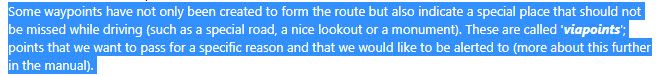
The Manual says:
All I want is, that what is already described, is implemented in the software!Regards
gerry -
Hi, as you might have noticed, I wrote 'for ME it is essential' !
I agree, if this feature has not the same relevance for you.My situation is, that I exactly know what I'm looking for. I had that feature (and many more that I miss in MRA) for example with Basecamp and BMW Navigator VI, but BMW Navigator is no longer reliably since the ghosting problem .
Now I look for new hardware and software that supports the features I need.
With the Carpe I found a good piece of hardware, now I need the software that supports my needs.Back to MRA and my question:
The Manual says:
All I want is, that what is already described, is implemented in the software!Regards
gerry@Gerd-Heinzmann-0, but it IS implemented in software. Maybe not audible, but it does show-up on the map and you can give it a special color to indicate it is a photo rally point. And like Hans says, it will get better in the Next version.
I am just an enthusiastic MRA user, and hope you will be one too!
Most motorcycle problems are caused by the nut that connects the handlebar to the saddle.
Check out RideSleepRepeat.eu, a biker community for sharing stays across Europe
-
Adding a POI not only gives a visual indication but like coloured route points that contain a note, if you touch a POI it will reveal its name which is customisable.
Hello! It looks like you're interested in this conversation, but you don't have an account yet.
Getting fed up of having to scroll through the same posts each visit? When you register for an account, you'll always come back to exactly where you were before, and choose to be notified of new replies (either via email, or push notification). You'll also be able to save bookmarks and upvote posts to show your appreciation to other community members.
With your input, this post could be even better 💗
Register Login-
7513.0k
-
013405
-
05118
-
037
-
0291
-
0258
-
0242
-
734449