How to create a route from a track that matches the track?
-
How to create a route from a track that matches the actual track? And this without manually comparing and checking and adding waypoints? I thought that's why we have computers!
-
How to create a route from a track that matches the actual track? And this without manually comparing and checking and adding waypoints? I thought that's why we have computers!
Kindly regards
ReinhardMontana 700i and Mac
-
@Reinhard-32 This is only the first part of the track->route process...
TS still had to "show" the original track underneath the "created" route and add or move waypoints to manually make the route equal to the track. The auto convert from route to track is never 100% accurate so one shall always perform some manual adjustments... Nevertheless, 80% of the work is done for ya this way.

Manks bu'j te bange.
-
@Reinhard-32 This is only the first part of the track->route process...
TS still had to "show" the original track underneath the "created" route and add or move waypoints to manually make the route equal to the track. The auto convert from route to track is never 100% accurate so one shall always perform some manual adjustments... Nevertheless, 80% of the work is done for ya this way.
@StefanHummelink Exactly my point. But I have a bunch of offroad tracks (TET trails) and then the route is not 80% accurate but 80% not accurate. And how hard can it be to just set the waypoints exactly on the track-line? No matter whether there is a tarmac road underneath!?
-
Or even better, why is there no possibility to load a track on the Android/iOS MRA app and navigate that one?
-
@StefanHummelink Exactly my point. But I have a bunch of offroad tracks (TET trails) and then the route is not 80% accurate but 80% not accurate. And how hard can it be to just set the waypoints exactly on the track-line? No matter whether there is a tarmac road underneath!?
@Martin-van-der-Linden Wow, you mentioning Offroad is a game changer!
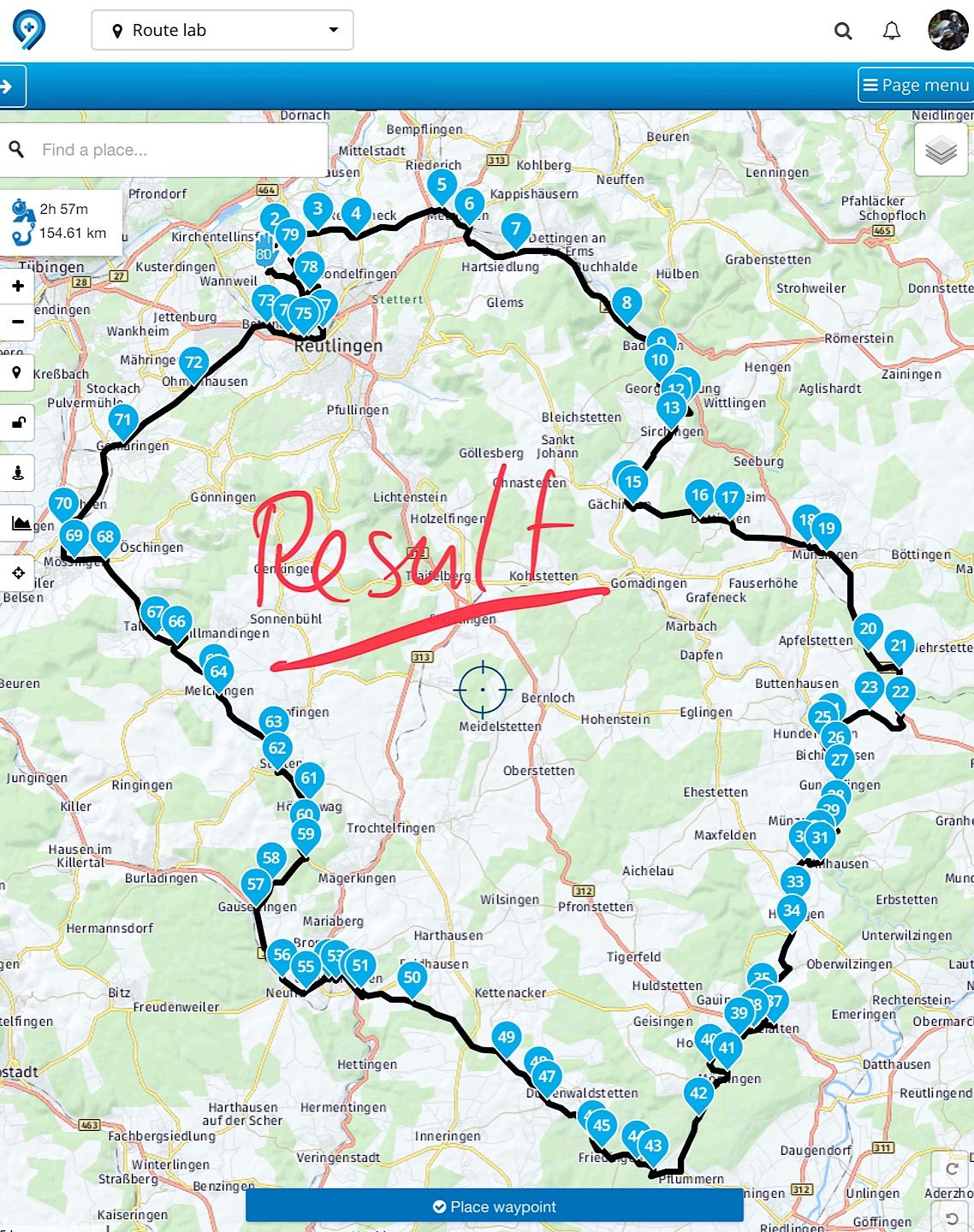
The algorithm tries to match your track with the roads that exist in the map used, that's how navigation on a map works...

Offroad is a very special aspect of the routeplanning, and I'm not sure if this type of routes/riding can be designed correctly in the maps available in MRA. Note that Offroad requires waypoints to be set to Offroad/Skip to correctly be an off-road waypoint.
Perhaps one of the more experienced riders and MRA specialists will respond here. @Hans-van-de-Ven-MRA-Master or perhaps @Nick-Carthew? These came up in my head straight away, definitely not saying others are not as experienced.

-
Or even better, why is there no possibility to load a track on the Android/iOS MRA app and navigate that one?
@Martin-van-der-Linden Because they are different apps with different purposes now. You need to realise that the MRA Nav app makes use of the Garmin Here map for navigation! A track may not exactly fit Garmin Here map for 100% so discrepancies are always applicable!
Maybe this'll become an functionality in future updates of the app.
-
I think MRA would need to implement a topographical map to make possible what you want. Then the need to bind waypoints to roads would not be there anymore, and a track could be split into segments that can be routed by what Garmin explains as "Direct route", so not binded by roads. You can make your waypoints unbinded by roads like this:
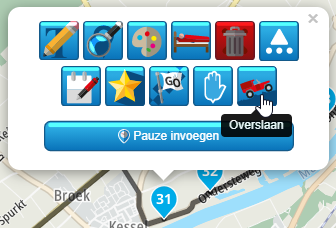
But that is more like intended to overcome situations where the routing engine fails to see the possibility of passage.
I am afraid that off-road navigation will need the use of specific apps like Osmand for the foreseeable future. -
I see, track navigation is a completely different thing from route navigation. Ijust found OsmAnd and installed it on my iPhone. It seems perfectly happy loading gpx tracks and let you navigate them. I will test it the coming weeks. Maybe MRA will be able to do so in the future too!

Hello! It looks like you're interested in this conversation, but you don't have an account yet.
Getting fed up of having to scroll through the same posts each visit? When you register for an account, you'll always come back to exactly where you were before, and choose to be notified of new replies (either via email, or push notification). You'll also be able to save bookmarks and upvote posts to show your appreciation to other community members.
With your input, this post could be even better 💗
Register Login-
7653.1k
-
019511
-
09107
-
05151
-
314881
-
115750
-
0116