construction of a path without logic and different from Maps
-
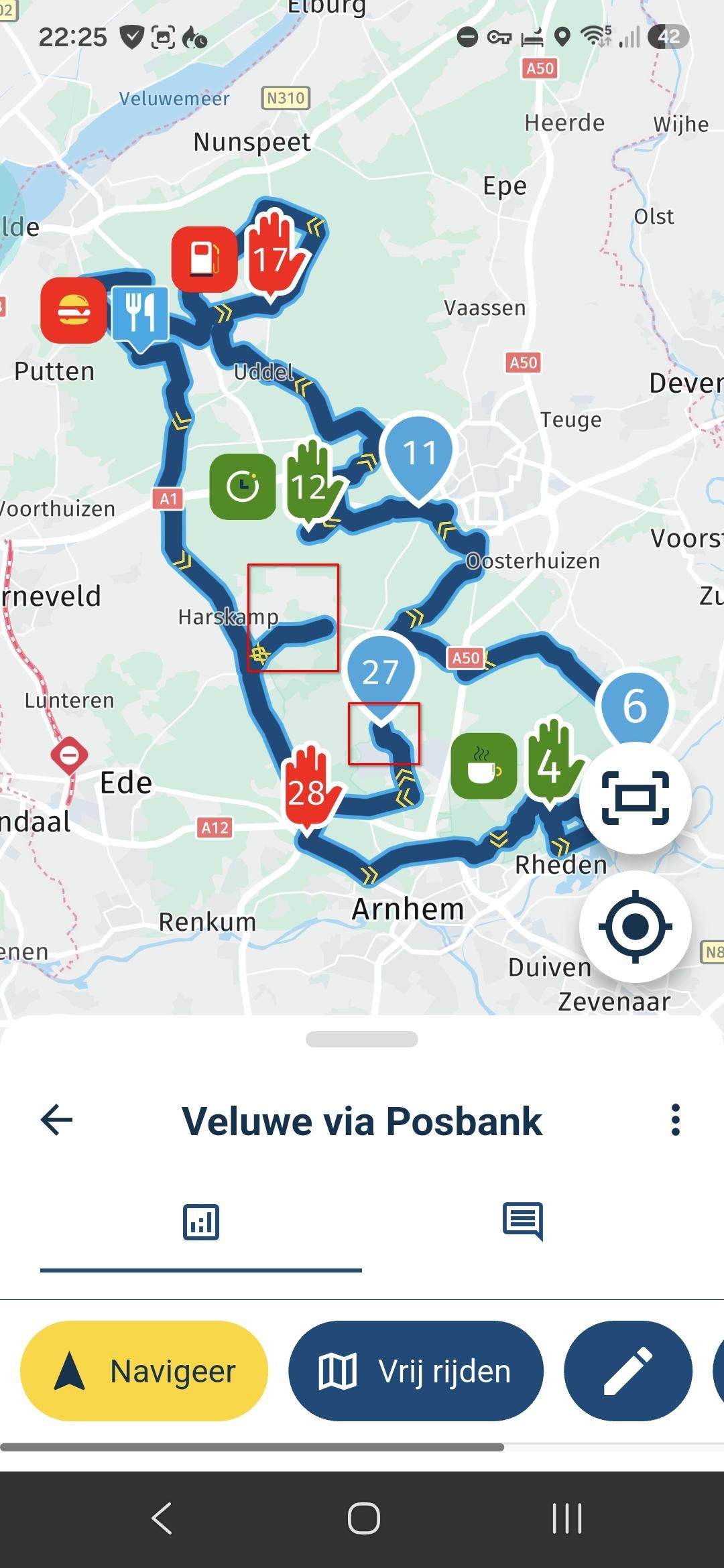
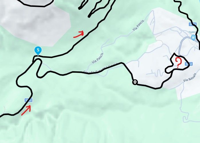
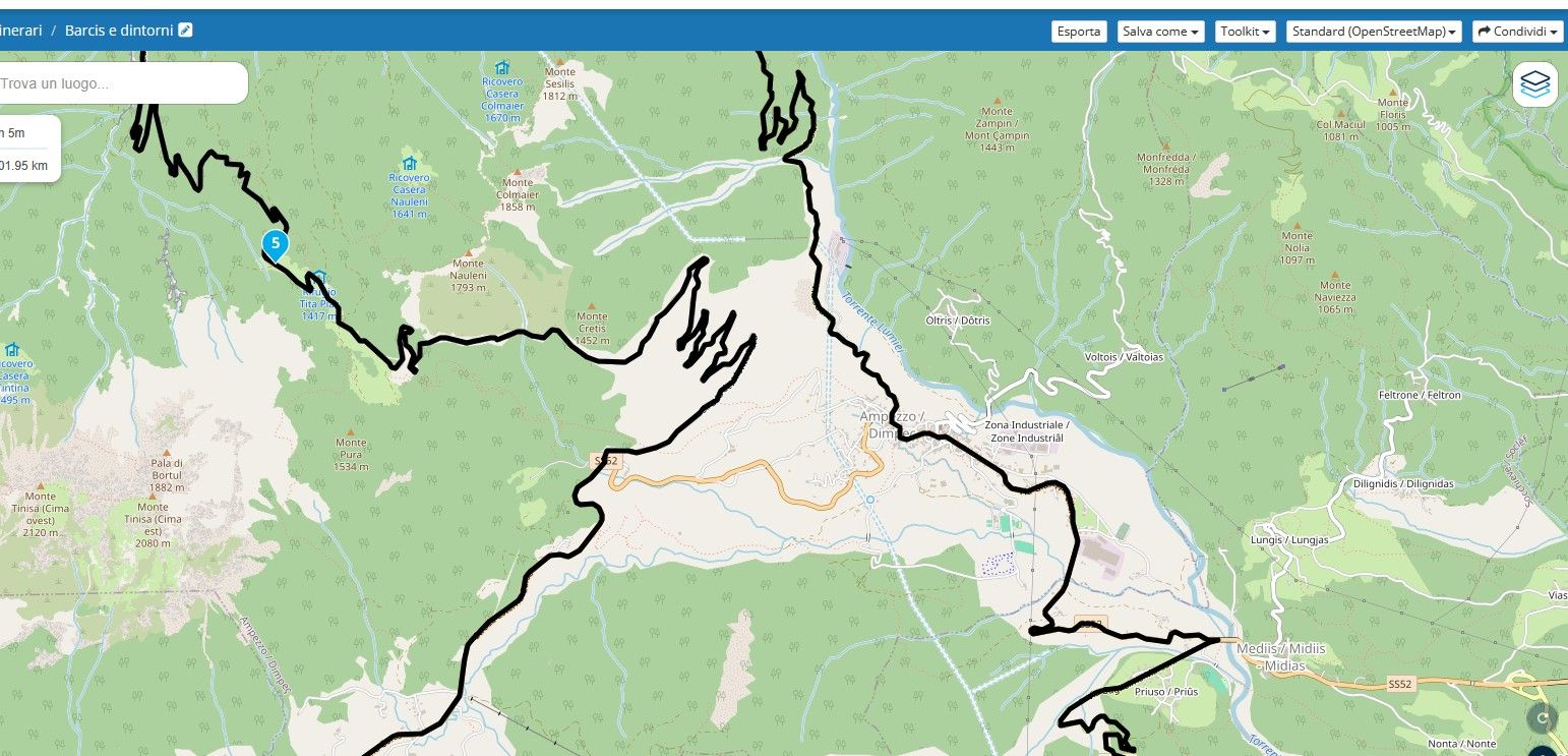
Buongiorno, capita spesso che quando si pianifica un percorso si creino deviazioni illogiche che non esistono con Google Maps, come potete vedere nei file allegati. Questo problema esiste in tutta Europa. Io uso le mappe Here per il Garmin Zumo XT2. Lo stesso problema si verifica quando si pianifica dall'app Android. C'è una soluzione a questo problema, perché è molto fastidioso percorrere diversi chilometri e poi dover tornare indietro per lo stesso percorso? Grazie mille. ![alt text]
-
MRA just wants to make sure you see all the good roads!
")
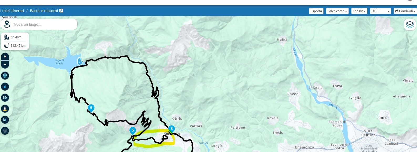
Share the link to the route and someone may be able to explain.2010 GL1800 Goldwing using Samsung Galaxy S20 5G Android 13.
-
@Giuseppe-Marino, It looks like at the crossing just before WP5 it is not allowed to turn left. I checked that with mapcreator though, and it looks like it is already corrected.
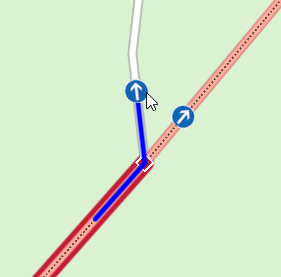
https://mapcreator.here.com/navlink:832838576/?l=46.4154,12.7650,18,normalI have no idea if there is a version difference or update schedule to which the MRA maps sync with HERE.
I am just an enthusiastic MRA user, and hope you will be one too!
Most motorcycle problems are caused by the nut that connects the handlebar to the saddle.
Check out RideSleepRepeat.eu, a biker community for sharing stays across Europe
-
MRA just wants to make sure you see all the good roads!
Share the link to the route and someone may be able to explain. -
@Giuseppe-Marino, It looks like at the crossing just before WP5 it is not allowed to turn left. I checked that with mapcreator though, and it looks like it is already corrected.
https://mapcreator.here.com/navlink:832838576/?l=46.4154,12.7650,18,normalI have no idea if there is a version difference or update schedule to which the MRA maps sync with HERE.
@Con-Hennekens Yes, I also like MRA and use it with my laptop during my motorcycle trips, but I've noticed that using the HERE map for planning often results in a lot of errors. While I'm riding, I notice the errors and almost always don't follow the navigator's absurd turns. Currently using Open Street Maps, however, it doesn't report the same errors as HERE. However, I need to try exporting a route created with OSM to GPX 1.1 on the ZUMO XT2 and see how it behaves, obviously disabling automatic recalculation. Thanks for your support.
-
I've done some tests. The best solution is to plan using Open Street Map (which doesn't show road errors like HERE) and export to gpx 1.2 instead of 1.1. Then, in my case, import only the route from the navigator and not the track so that the navigation also includes the list of points on the route that I've indicated as waypoints.
@Giuseppe-Marino
Hi Giuseppe, this is what I usually do. First, I plan using the here map, then I use the toolkit to compare it with TomTom and check the differences. This usually fixes those strange route deviations. -
@Giuseppe-Marino
Hi Giuseppe, this is what I usually do. First, I plan using the here map, then I use the toolkit to compare it with TomTom and check the differences. This usually fixes those strange route deviations.@Alex-reds Many thanks. I only have the Gold subscription on the Android app and not on the web portal, and I can't compare it with the TomTom maps

-
I've done some tests. The best solution is to plan using Open Street Map (which doesn't show road errors like HERE) and export to gpx 1.2 instead of 1.1. Then, in my case, import only the route from the navigator and not the track so that the navigation also includes the list of points on the route that I've indicated as waypoints.
@Giuseppe-Marino, I do not have such a bad experience with HERE at all, although I must admit that during our French Alps week, I noticed some strange situations where HERE thinks there is a road straight uphill, bypassing hairpin corners, which were not there in reality. So yes, every map has errors, seldomly the will have that all on the same spot I guess
")
The 1.2 version GPX is a non-official method that only shows you the VIA points. The route between those are formed as tracks. When you use the OSM maps for planning, and while navigating by HERE (you do not have a choice there, MRA Navigation is HERE only) you may be introducing other problems.
Gold subscriptions only exist on the web-planner. So if you claim to have Gold, you actually DO have the comparison tool available. If you do not have that available, you do NOT have the gold licence (not for the account you logged in with anyways).
I am just an enthusiastic MRA user, and hope you will be one too!
Most motorcycle problems are caused by the nut that connects the handlebar to the saddle.
Check out RideSleepRepeat.eu, a biker community for sharing stays across Europe
-
@Giuseppe-Marino, I do not have such a bad experience with HERE at all, although I must admit that during our French Alps week, I noticed some strange situations where HERE thinks there is a road straight uphill, bypassing hairpin corners, which were not there in reality. So yes, every map has errors, seldomly the will have that all on the same spot I guess
The 1.2 version GPX is a non-official method that only shows you the VIA points. The route between those are formed as tracks. When you use the OSM maps for planning, and while navigating by HERE (you do not have a choice there, MRA Navigation is HERE only) you may be introducing other problems.
Gold subscriptions only exist on the web-planner. So if you claim to have Gold, you actually DO have the comparison tool available. If you do not have that available, you do NOT have the gold licence (not for the account you logged in with anyways).
@Con-Hennekens Thanks for the reply. I'll do a road test in the next few days with a route created with OSM and then sent to the Zumo with GPX 1.2 on which I inserted the waypoint. I'll also try leaving the "route recalculation" option set to ASK to see how the Zumo XT2 behaves. As for the license on the portal, I have the BASIC one, while on the app I have the lifetime one, and this allows me to have the GOLD maps also on the web portal, but I can't make a comparison, but if my tests are good, the OSM ones, I'll continue like this. Since I travel a lot by motorcycle (an average of 30,000 km per year), I've had the opportunity to see many errors while navigating the routes created with the web planner, but I think these are due to the Here maps, but I'm not sure because I should have created the route directly on the Zumo, but during the trip, it's not always possible.

Hello! It looks like you're interested in this conversation, but you don't have an account yet.
Getting fed up of having to scroll through the same posts each visit? When you register for an account, you'll always come back to exactly where you were before, and choose to be notified of new replies (either via email, or push notification). You'll also be able to save bookmarks and upvote posts to show your appreciation to other community members.
With your input, this post could be even better 💗
Register Login-
011142
-
-436950
-
010172
-
1313230
-
0101.3k
-
08732
-
03103
-
0497