@Lenny-O
What a nice and clear story! I have my phone in an SP-Connect mount. This ensures it gets sufficient cooling from the airflow. (i.e., up to about 35 degrees; when it started heading towards 40 degrees, it really struggled, but I don't blame it for that)
I'm curious to hear the continuation of the story!
@white.mouse
Het is niet zo'n big issue.
Het viel me op en ben es gaan neuzen.
Maar zo mis je wel een mooi fotolocatie
Heb het ondertussen ook al gerapporteerd.
Het antwoord van @corjan-meijerink is een antwoord die alleen gegeven kan worden door iemand die last heeft van beperkende overtuiging waardoor deze persoon totaal niet flexibel kan zijn of de inhoud van de vraag door zijn eigen beperkte overtuiging. En dat werkt een forum alleen maar tegen...
@nomko oh nou moet je oppassen
@RetiredWingMan said:
@stuart-marritt when you stop, MRA navigation should be paused (stop navigation) and started again once you are ready to continue. The issue is that as you move around MRA thinks you are still navigating and gets confused with your movement. This is made worse with the Here map issue that spins the map around and sometimes causes the app to do recalculations.
I use a separate phone that is left on the bike.
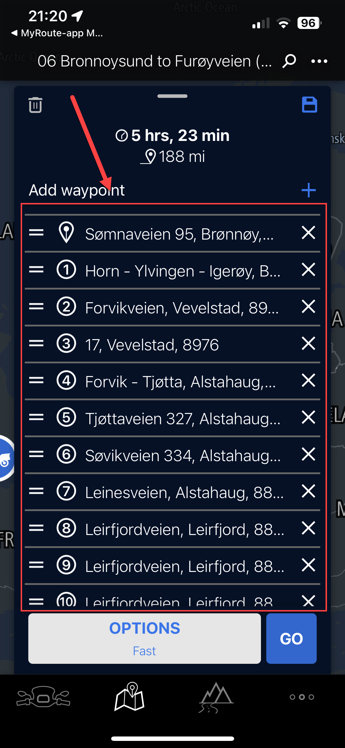
The others don't and we have never had this issue before
We haven't skipped any waypoints and we haven't got auto skip waypoints so why has it skipped 3 waypoints
@Peter-Schiefer the option in your account page is the "default" type that is used when you create a route
Once a route is created the vehicle type can be changed for each & every route
You just need to go to the "Route Information" section on the route & change the "Transport Mode" or "Travel Mode"
[image: 1781366215278-901dfa79-f125-43d5-9fe8-74ff86087ca7-image.jpeg]
In your scenario you would best not fiddle with the new feature, but skip to one or more route points to you liking. The answer to your last question is "no" (not yet anyway).
@Lenny-O I use an old phone that does not have a sim card for navigation. Routes Synced and maps downloaded when I have Wifi. Phone switched to "Offline" navigation. No issues at all though obviously I don't get live traffic data.
The Chigee never sends the signals to apps about the wonder wheel movement, so neither MRA nor any other app can react to you twisting the wheel. I’m not sure about Android Auto, but that’s how CarPlay works. It only communicates to the apps which buttons you’ve pressed/touched on the CarPlay screen itself.
The Chigee uses the wheel to move the selection box to the button you want to “press”, then nudging the wheel “touches” the highlighted button. All MRA sees is that you “touched” that onscreen button. It never sees that you rotated the wheel.