Exporting Route To Garmin
-
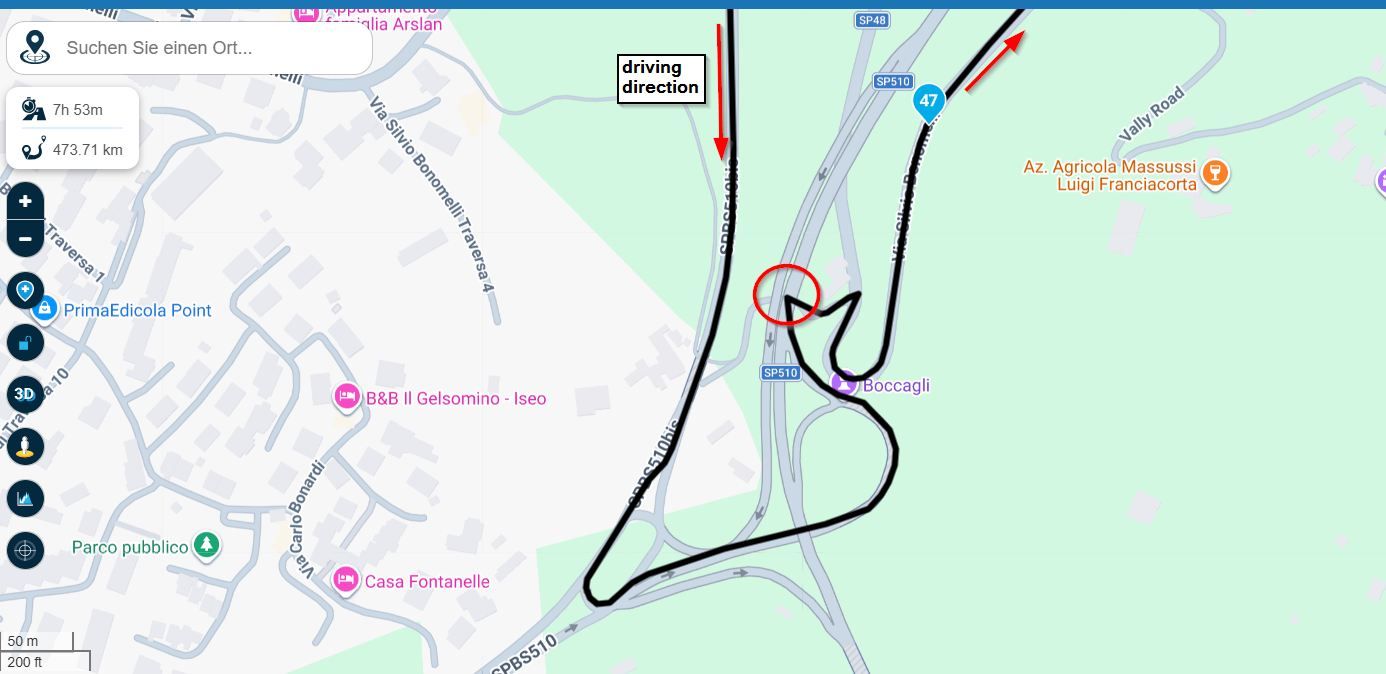
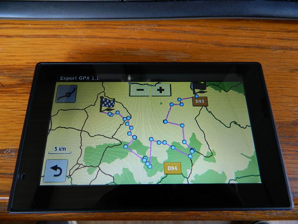
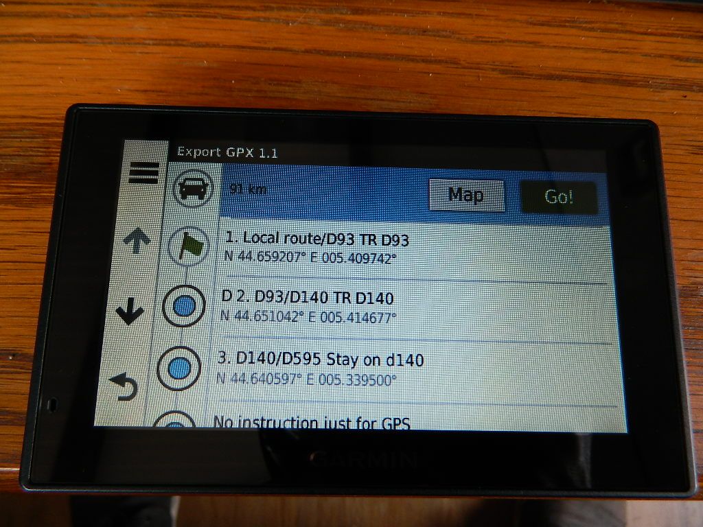
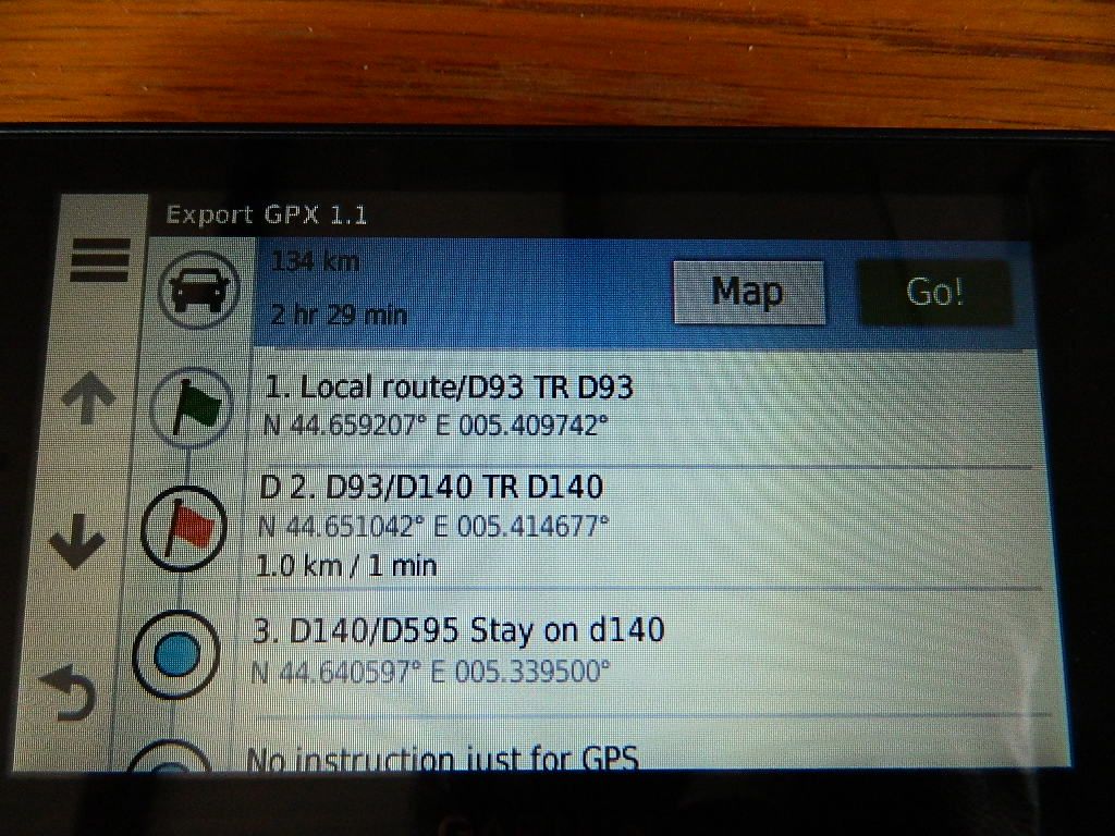
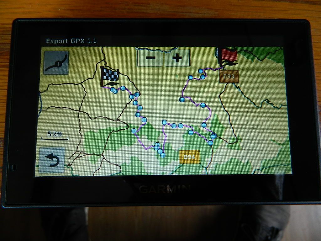
When exporting a GPX 1.1 route to my Garmin using the 'Export' button the results on the device are odd. Upon opening the route in the application/Trips option and navigating from there the route is shown in 'straight lines' NOT on the roads. However, if you return to the list of instructions and tap on the blue dot (shaping point I think) the Garmin recalculates the route and then when looking on the map the route follows the roads. If I export as a GPX 1.0 file my route is split into 2 (I suppose it's a GPX 1.0 limitation) but it does store the route as all waypoints (orange flags)
-
When exporting a GPX 1.1 route to my Garmin using the 'Export' button the results on the device are odd. Upon opening the route in the application/Trips option and navigating from there the route is shown in 'straight lines' NOT on the roads. However, if you return to the list of instructions and tap on the blue dot (shaping point I think) the Garmin recalculates the route and then when looking on the map the route follows the roads. If I export as a GPX 1.0 file my route is split into 2 (I suppose it's a GPX 1.0 limitation) but it does store the route as all waypoints (orange flags)
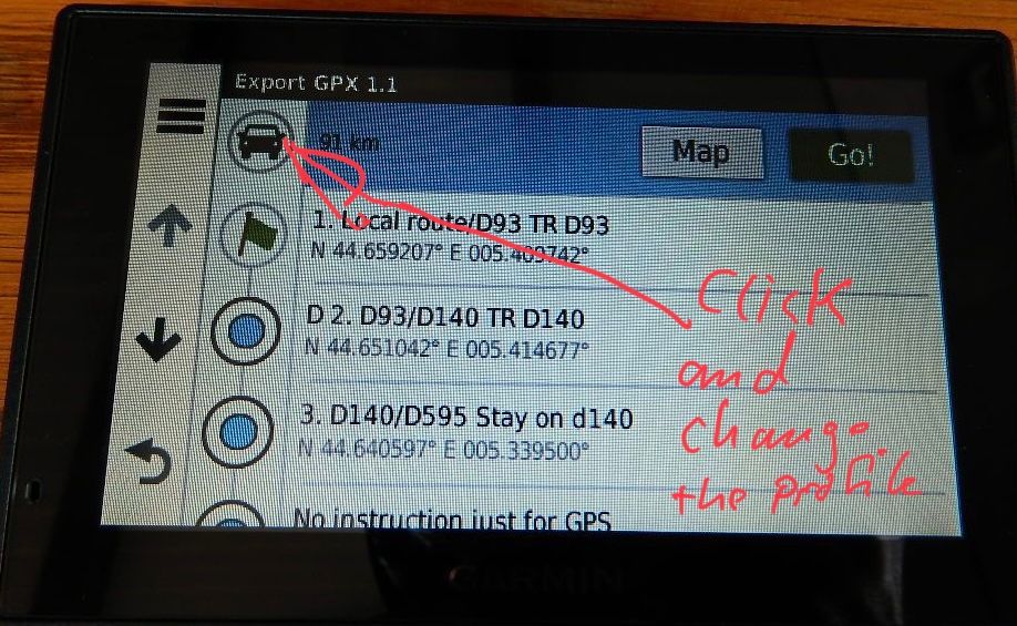
@Neil-Goodall You didn’t mention which device you’re using. If it is a ZumoXT than the GPX 1.1 (beta) is usefull. In other cases you can use th GPX 1.1 format. After importing the route into the Device it endet up with straight lines. Then click to the car symbol and change the profile. The route will calculated. After that click the symbol angain and switch back to the original profile. A recalculation starts again and the route will follow the streets..
-
Thanks for the suggestion Reinhard but this is a Garmin and the car symbol doesn't do anything when tapped.
-
Thanks for the suggestion Reinhard but this is a Garmin and the car symbol doesn't do anything when tapped.
@Neil-Goodall Ok, I have a ZumoXT and my suggestion was based on it.
But can you tab at the first waypoint symbol without alarm and change it to alarm visa versa ? That initiates a new calculation at my ZumoXT and maybe at your device as well.
Hello! It looks like you're interested in this conversation, but you don't have an account yet.
Getting fed up of having to scroll through the same posts each visit? When you register for an account, you'll always come back to exactly where you were before, and choose to be notified of new replies (either via email, or push notification). You'll also be able to save bookmarks and upvote posts to show your appreciation to other community members.
With your input, this post could be even better 💗
Register Login-
022224
-
08111
-
019377
-
5760
-
08171
-
0643
-
012211
-
0366