GPX Versions 1.1 vs 1.2 for Garmin Visually Explained
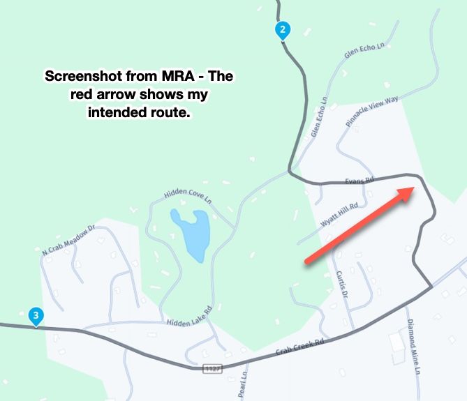
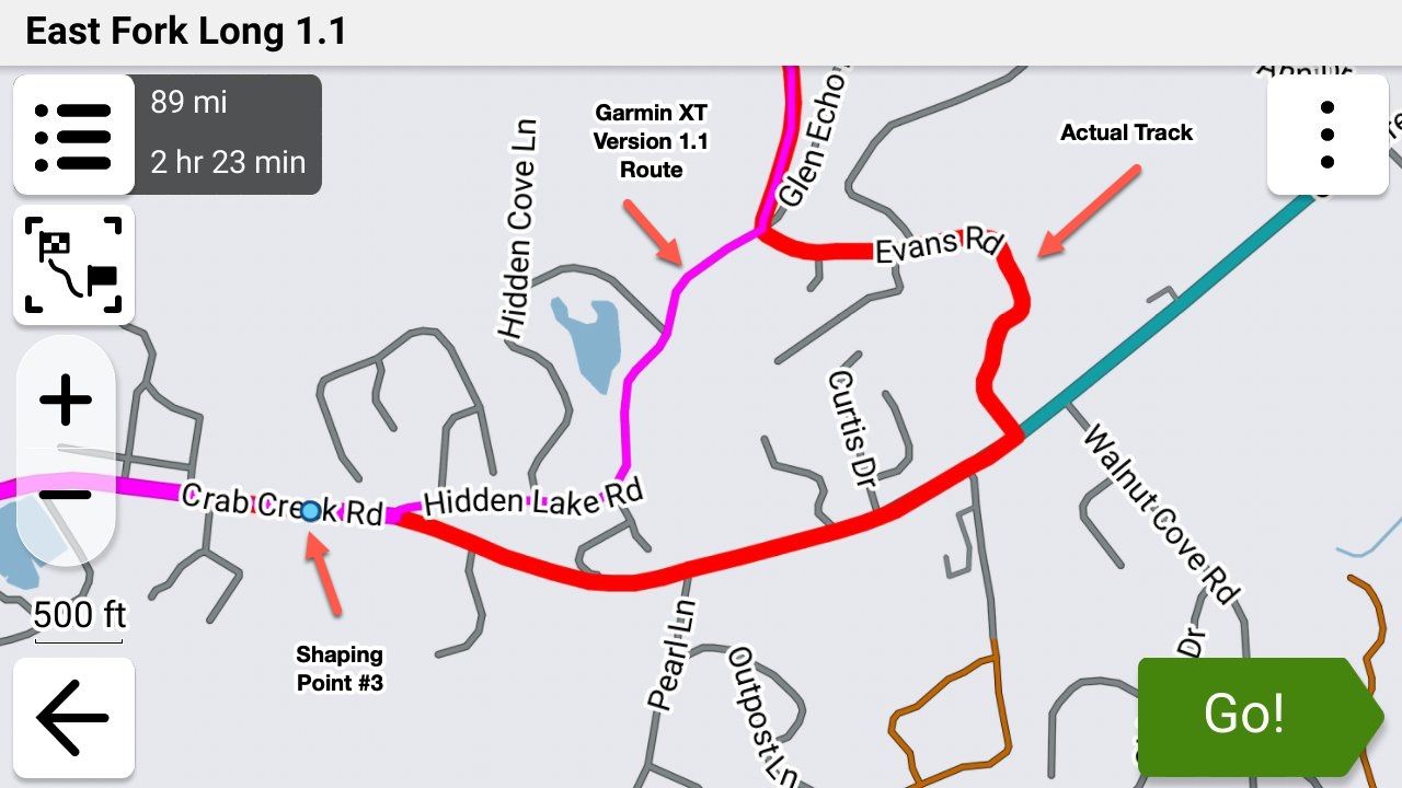
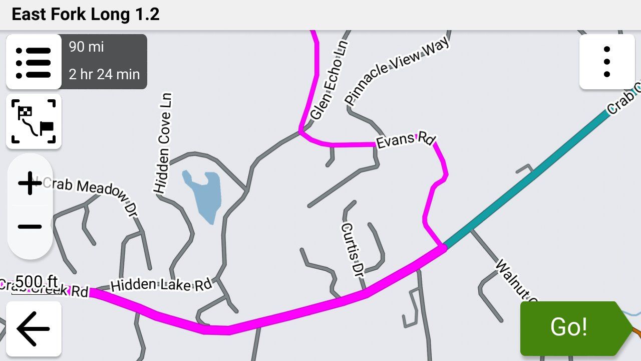
-
It has been an interesting discussion, and thanks John for the good wishes.
Anyhow with regard to Garmin devices one thing I will say "and why I keep my XT mounted as a backup" is that the hardware itself is well made robust and reliable. These are all mine since 2004 and they are all in working order and all have been through some horrendously wet weather. Its unlikely that any of us will have a functional phone for that long.

The main reason I've ended up here is the disappointing software provided for the XT (Explore) by Garmin and the change to its routing algorithm which meant, that compared to the old devices, what you produced on Basecamp bears little relation to what you get on the XT unless you "pin" the route with lots of shaping points. I'm pretty happy with the MyRoute app routing program and navigation app with the exception of POI and track handling capabilities. But at least with phone based navigation you are not restricted to Garmin's poor software offering. A lesson I hope they learn before its too late.

The main reason I've ended up here is the disappointing software provided for the XT (Explore) by Garmin and the change to its routing algorithm which meant, that compared to the old devices, what you produced on Basecamp bears little relation to what you get on the XT unless you "pin" the route with lots of shaping points. I'm pretty happy with the MyRoute app routing program and navigation app with the exception of POI and track handling capabilities. But at least with phone based navigation you are not restricted to Garmin's poor software offering. A lesson I hope they learn before its too late.
Wow, that's quite a collection of devices. Very nice.

Overall, your reasoning is fair. I personally did not enable Explore for either my XT or XT3 due to the disaster it creates for most users. It does nothing for you unless you want to buy into Garmin being an ecosystem across its devices. "Pinning" lots of shaping points is something I'm used to anyway since I lead rides and distribute GPX files to the other riders. You never know the routing preferences set up on other devices, so overloading shaping points is an absolute requirement.
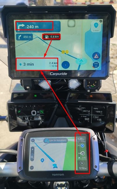
MRA Routeplanner is the best route creation SW out there. I'm OK with BC, and it's remarkably capable for what it is. But Web based technology makes BC largely obsolete. The MRA Phone navigation piece?? I've tried to like it, but it doesn't speak to me the way an XT device does. It's another subject, but for me, phone HW isn't built for reliability in hot climates. I live/ride in the USA southwest, where phone overheating while running navigation is almost guaranteed 3-4 months of the year. Aside from phone HW limitations, an XT device is more capable than phone navigation SW at many levels. Again, another subject. What struck me most when going from my XT to an XT3 are the improvements to 3D Terrain map. The rendering is eye popping. It's looks like viewing from a Drone when riding through mountains and canyons. It's hard going back to the XT much less the MRA phone map.
Having said all this, I get that we all have different criteria and therefore end up with different setups. And there is nothing wrong with that.
-
Question for John.
when you create your routes in MRA do you save as 1.2 or 1.1 ?
As well as many shaping points do you add and via points? -
Question for John.
when you create your routes in MRA do you save as 1.2 or 1.1 ?
As well as many shaping points do you add and via points?
Question for John.
when you create your routes in MRA do you save as 1.2 or 1.1 ?
As well as many shaping points do you add and via points?Prior to this topic explaining 1.2, I used 1.1 exclusively. Now that I understand 1.2, I'll be using 1.2 moving forward. The only exception being when I create routes for others. Many of my riding friends use Basecamp for importing GPX files, and then transferring them to their devices. Basecamp doesn't work correctly with 1.2, so I'll use 1.1 for compatibility.
As far as shaping points, I add as many as are needed for the route to calculate correctly in a Garmin. I've found that in general, a moderately complex MRA route requires fewer shaping points to create than are needed on the Garmin side. Sometimes it's an iterative process of going back-and-forth between MRA and Garmin to make adjustments to get both in sync.
Via points are different. Because they're essentially stopping points, your route intent will dictate how many you create.
-
John S Parry referenced this topic on
-
@John-S-Parry "It's been fun learning about 1.2, and understanding the pros/cons vs. 1.1".
I agree completely. I think it's been a valuable learning experience for all of us that use MRA in conjunction with a Garmin device.

@John-S-Parry "It's been fun learning about 1.2, and understanding the pros/cons vs. 1.1".
I agree completely. I think it's been a valuable learning experience for all of us that use MRA in conjunction with a Garmin device.
Well, Well, Well. I wonder what sort of humble pie you'd recommend?
After having my right eye Cataract sorted last week and after several weeks without riding I thought I'd take a ride and try out my XT using GPX 1.2 without having alternative OSM maps loaded on the device (but not enabled). To my surprise, and delight, I was able to go off route and be routed back using prompted recalculation without the XT recalculating the remainder of the route, or recalculating the route to the next via point. As expected adding a detour to the route will force a recalculation to the next via point but a casual detour does not.
This makes the XT a bit more useful to me again as MRA routes will be displayed as designed rather than me having to check a GPX1.1 route against the track. Thanks folks for raising this subject and triggering me to revisit use of the XT.
-
@John-S-Parry "It's been fun learning about 1.2, and understanding the pros/cons vs. 1.1".
I agree completely. I think it's been a valuable learning experience for all of us that use MRA in conjunction with a Garmin device.
Well, Well, Well. I wonder what sort of humble pie you'd recommend?
After having my right eye Cataract sorted last week and after several weeks without riding I thought I'd take a ride and try out my XT using GPX 1.2 without having alternative OSM maps loaded on the device (but not enabled). To my surprise, and delight, I was able to go off route and be routed back using prompted recalculation without the XT recalculating the remainder of the route, or recalculating the route to the next via point. As expected adding a detour to the route will force a recalculation to the next via point but a casual detour does not.
This makes the XT a bit more useful to me again as MRA routes will be displayed as designed rather than me having to check a GPX1.1 route against the track. Thanks folks for raising this subject and triggering me to revisit use of the XT.

@Mzokk I have a LOT of favorites as I've had to eat a LOT of it over the years!

-
@John-S-Parry "It's been fun learning about 1.2, and understanding the pros/cons vs. 1.1".
I agree completely. I think it's been a valuable learning experience for all of us that use MRA in conjunction with a Garmin device.
Well, Well, Well. I wonder what sort of humble pie you'd recommend?
After having my right eye Cataract sorted last week and after several weeks without riding I thought I'd take a ride and try out my XT using GPX 1.2 without having alternative OSM maps loaded on the device (but not enabled). To my surprise, and delight, I was able to go off route and be routed back using prompted recalculation without the XT recalculating the remainder of the route, or recalculating the route to the next via point. As expected adding a detour to the route will force a recalculation to the next via point but a casual detour does not.
This makes the XT a bit more useful to me again as MRA routes will be displayed as designed rather than me having to check a GPX1.1 route against the track. Thanks folks for raising this subject and triggering me to revisit use of the XT.
To my surprise, and delight, I was able to go off route and be routed back using prompted recalculation without the XT recalculating the remainder of the route, or recalculating the route to the next via point. As expected adding a detour to the route will force a recalculation to the next via point but a casual detour does not.
Congratulations on getting back on the bike. I hope the Cataract surgery went as expected.
In my mind, prompted recalculation is one of the strengths of the XTs. I'm glad you were able to experience that yourself.
-
John S Parry referenced this topic on
-
John S Parry referenced this topic on
-
John S Parry referenced this topic on
-
I am amazed that people are still persevering with Garmin’s!?

MRA to plan the route, put it straight on to my DMD tablet, never recalculated a route once… touch wood!!! I will never ever after so many ruined rides and too a certain extent holidays use Garmin again!
Great article though @steve-jarrell
-
I am amazed that people are still persevering with Garmin’s!?
MRA to plan the route, put it straight on to my DMD tablet, never recalculated a route once… touch wood!!! I will never ever after so many ruined rides and too a certain extent holidays use Garmin again!
Great article though @steve-jarrell
**I am amazed that people are still persevering with Garmin’s!?**
MRA to plan the route, put it straight on to my DMD tablet, never recalculated a route once… touch wood!!! I will never ever after so many ruined rides and too a certain extent holidays use Garmin again!
Great article though @steve-jarrell
Yes, Steve wrote a great article. I had previously done nothing with the GPX 1.2 format. Now it's my go-to unless I'm sharing routes with non-supported devices.
As far as "persevering", the Garmin XT2/XT3 units perform functions currently not available in the MRA app. Functions I wouldn't want to live without. The Garmin's can be difficult if you don't set them up correctly, and don't completely understand their behavior. That's why many give up and go to a more generalized phone app approach. Regardless, I'm glad that you've found happiness with MRA on your tablet. You've found something that works for you.
-
Thanks Steve that is all clear now.
On an out and return route in order not to have any problems when restarting the route is it best to put a few via points that you can use to get started in the right direction again, and if so how to you tell garmin to go to a selected via point?
@Simon-James-Hancock When you start a route on the Garmin it will ask you where you want to begin the route and it will show you all of the via points for you to choose from, and it will also give you a "Nearest Point" or something like that.
Bear in mind that it will calculate its own route from your current location to the via point that you select which may or may not be the same route that you had planned originally.
For example if you had via points A, B, C,D and E and you were between C and D and started the route and told it to start at D, the route that it calculates between your current location and D may be different than what you had originally planned between C and D. Once you get to D it will follow your route to E.
I always turn auto-recalculation off to keep the Garmin from modifying my route as much as possible.
If you definitely wanted to continue your original route exactly between C and D, I'd just make sure that my original track was visible.
Sorry this response is so late but I just noticed that I didn't submit it! Old timer's disease you know!!!
-
John S Parry referenced this topic
-
@Steve-Jarrell Hi Steve so you have been testing using a Garmin Zumo XT3 and I have been using an XT though no longer for routing. I have no issue with using GPX 1.2 over GPX 1.1 BUT think it is essential with the XT, at least, to turn off auto recalculation, if you use GPX 1.2.
In operation GPX 1.1 in MRA works in a similar way to routes created in Basecamp on the XT. I have 5 old Garmin units a 2004 Streetpilot 2610, a 2011 BMW Nav IV (Zumo 660) and A Zumo 340 and 390, as well as a Zumo XT Purchased in 2022. And started using Garmin Mapsource, and later Basecamp route planning software. I still use Basecamp for handling tracks, and Basecamp/Garmin POI loader for dealing with POI’s and the information contained therein, as basecamp does this, and MRA either doesn’t do it at all (track joining/splitting editing) or does it in a more limited way (POI handling). MyRoute app USP for me was being able to create/edit routes on the fly while on tour without having to carry a Windows device for using Basecamp my phone or an I pad would suffice. As the navigation app has developed this has become my primary navigation tool as its less of a faff quite frankly than using a “modern” Zumo and works well with the AA screen of my Africa Twin Adventure Sport.
For old Garmin units up until the Zumo 340/90 and the 590. The routing logic of Basecamp and the units matched closely meaning that if you had set Basecamp to route “Faster Time”, and had the same settings and avoidances set on the Garmin unit, then what you planned on Basecamp was more or less WYSIWYG with what instructions the unit produced for navigation.
I retired in 2022 and my wife bought me a Zumo XT as an “upgrade” from my beloved Zumo 340 and 390. (I still use these on my 2002 R1150GS). The Zumo XT has a lovely screen but the attendant online software “Explore” is poor and the routing logic drove me nuts until I sussed what was going on. The XT has a number of issues that still might not be fully resolved with the XT2 or XT3?- Routing logic…..Faster time now means faster roads. So, routes that would have been followed if transferred from basecamp to a Zumo 390 aren’t. Yellow track, magenta route.
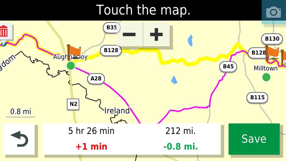
In this case it can be fixed by placing a shaping point on the B128. If using Basecamp or MRA for that matter many more shaping points are required to pin the route to the desired roads compared to the older units. I find this particularly irksome as Ireland is cris crossed by loads of minor roads that are my preferred routes.
-
The problem above makes the Zumo XT pretty useless as an A-B navigation device as it will go out of its way several miles and lots of time to get onto main roads (and traffic) to take you to your destination rather than take a more sensible route that MyRoute app, Google maps or waze would take you on. I live on the outskirts of Belfast and did a comparison of routes of all five of my Garmin devices and Google maps to route from Florence Court House about 100 miles away from where I live to home and only the Zumo XT routed me through Enniskillen and Central Belfast. Even the Streetpilot 2610 produced a better route.
-
The Zumo XT (intermittently) produces repeated U turns in imported routes if you skip a Via point (Flagged waypoint). To ensure that this does not happen you have to make each route you import “Saved” to fix the issue. This can be achieved by saving current route in the unit editing the hex file for the route or using third party software that does it for you.
-
If you are doing a long out and back route with different but close together roads make sure that you have at least a Waypoint at the farthest end of the route. This will stop the unit shortcutting the route if you have to recalculate. In the old units they tried to get you to the next shaping point in the direction of travel...if another shaping point is closer to the XT it will just cut off a big lump of the route if you recalculate. For example, in this route if you recalculated just before where the 1 is on the map it would cut off the rest of the route and take you to Hillsborough if it was all shaping points and no way points which have to be gone through.
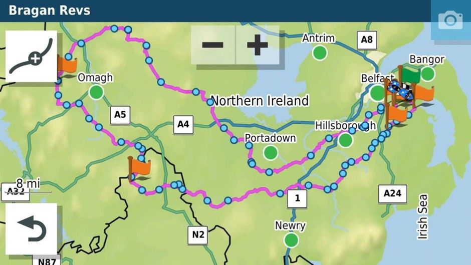
Anyhow enough of the history how did the XT get on with GPX 1.2. I have tried this previously and it had for me one big advantage, I could be lazy with my route planning and the XT would still follow the desired path. It also had a disadvantage that I had to set my recalculation as off or as prompted as any deviation from the route would mean that the points that shaped the route would be missed and it would take me to the next flagged waypoint or the end if the route was composed of shaping points.
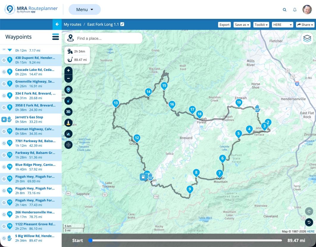
<iframe style="border:none;overflow:hidden" width="600" height="286" scrolling="no" frameborder="0" src="https://www.myrouteapp.com/embed/route/8385023?lang=en"></iframe>
I use this route a lot for testing it zig zags down lots of minor roads and across some more major ones hence the number of (shaping) waypoints. I think I may have used the route to test the expand function.
This is what it looked like as a GPX 1.2 on a Zumo XT. Track in yellow underneath.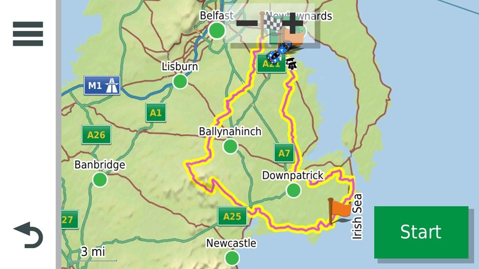
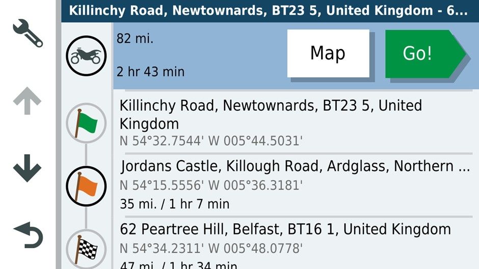
And what it would have looked like as a GPX1.1 with all the shaping points.
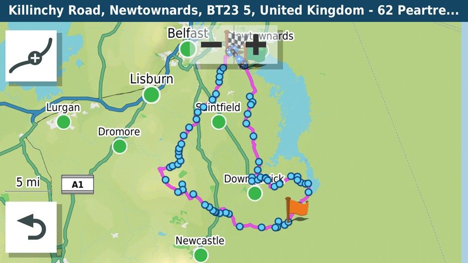
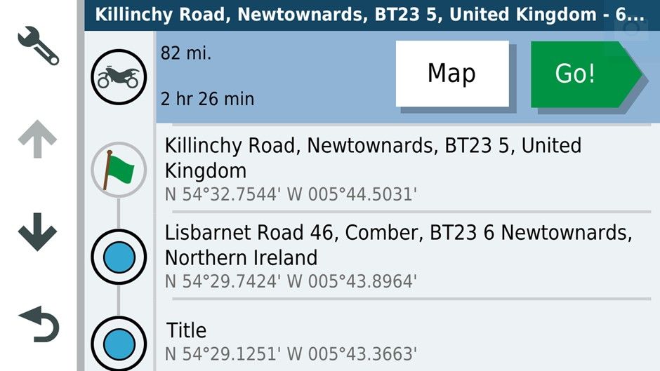
Oddly the GPX 1.1 format is showing a shorter Journey time.
I used the GPX 1.2 format. The only avoidance was unpaved roads.
Setting up on the road. As you can see both are saying 84 miles and I’m about 2 miles from the start of the route.
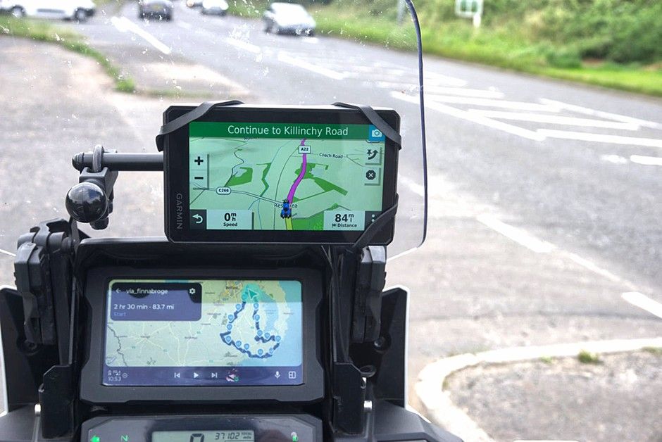
Passing the start point.
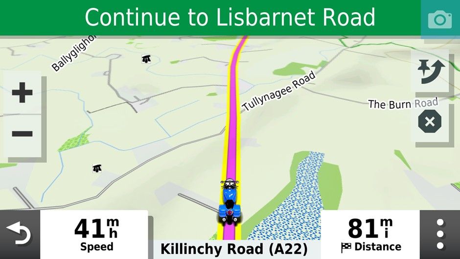
After I missed the first turn off on the route.
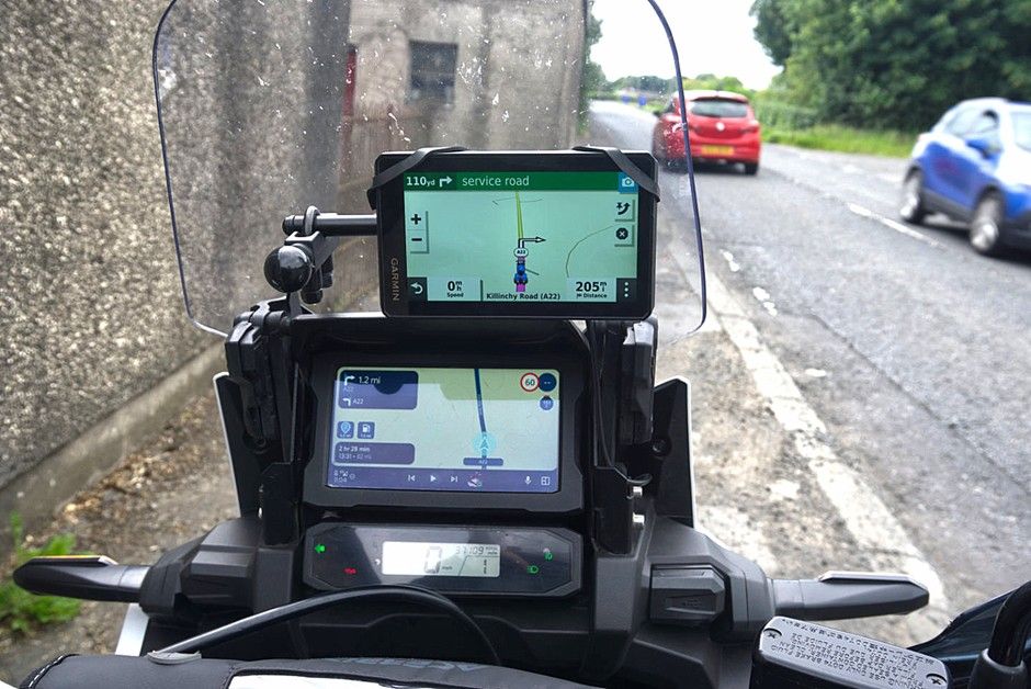
As you can see the route running on the AA screen is showing 82 miles and a left turn further up the road. The XT wants me to U turn and has recalculated the route at 205miles!! If I had loaded GPX1.1 I expect it would have behaved similarly to the routing app re-directing to the nearest shaping point.
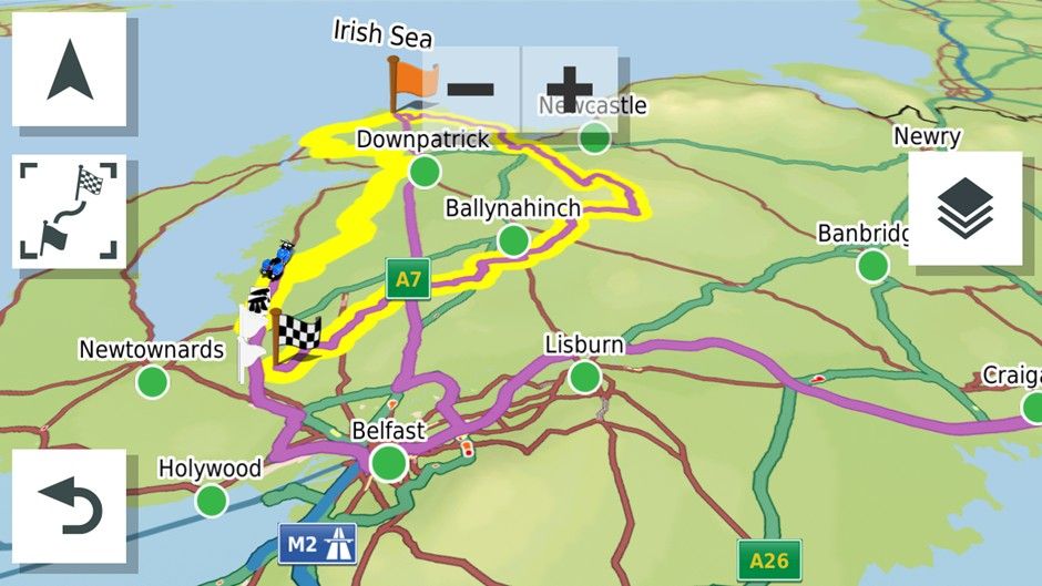
Inspecting the route at this point it had re-routed through the centre of Belfast and out west on the motorway then returning via the motorway through Saintfield and Downpatrick to the coffee stop at Ardglass then the rest of the GPX 1.2 route would nave been navigated as normal as long as you didn’t go off route and recalculate presumably.
I U turned as requested by the XT. Instead of following its directions I rejoined the Yellow Track line and the GPX 1.2 route on the XT then went down to 69 miles heading for the Flagged waypoint on the main roads while MRA rejoined the route and showed 79 miles. I thought I’d captured this but hadn’t
Anyhow I went off route again on a minor road as you might if it were blocked. Again 205 miles vs 74 with the reroute.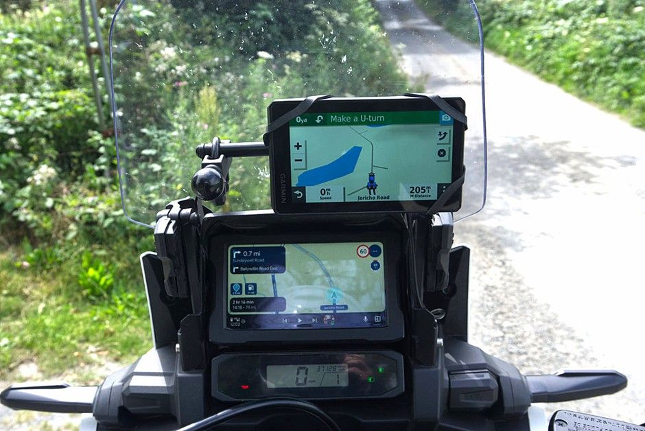
I U-Turned back toward the yellow track.
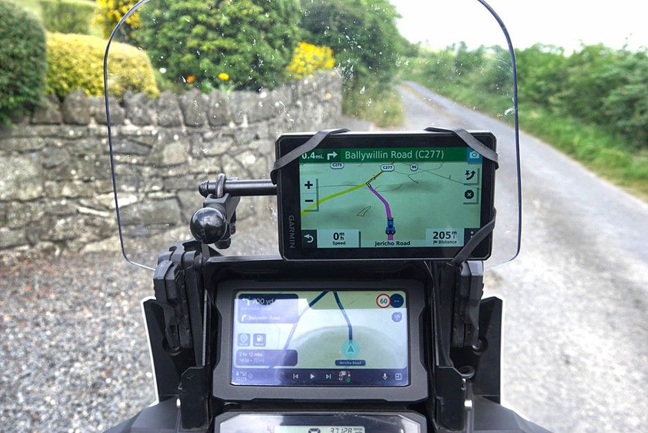
The correct route taken by MRA was the left turn. The GPX 1.2 file wanted to take me on a flight of fancy. Something I’ve always encountered with the Zumo XT and GPX 1.2. When I turned left the Zumo XT wanted to take me straight to the first waypoint via the fastest roads.
The conclusion for me is that a properly designed route downloaded as GPX 1.1 means that if you have to use auto recalculate you will get back to the planned route more easily than with GPX1.2. This was a bit of fun for me on roads I know. I wouldn’t have been so happy If I was on rural French or Spanish roads and had allowed the Zumo XT to recalculate with 5 or six riders relying on my navigation.
The other advantage of a carefully designed GPX1.1 route is of course that it is more easily shared with folks with a mix of navigation devices without the potential to create mayhem
It was interesting to revisit GPX 1.2
@Mzokk Great read and your ending about France is why I won't use it anymore!!!
Hello! It looks like you're interested in this conversation, but you don't have an account yet.
Getting fed up of having to scroll through the same posts each visit? When you register for an account, you'll always come back to exactly where you were before, and choose to be notified of new replies (either via email, or push notification). You'll also be able to save bookmarks and upvote posts to show your appreciation to other community members.
With your input, this post could be even better 💗
Register Login








-
 1011108
-
 2463.0k
-
 5251.1k
-
011287
-
 0542
-
 0534
-
 0532
-
0443