Problems with DIY POI Files
-
Hi,
I can't get the POIs displayed from a self-made POI file.I generated a CSV file like this:
51.225800,6.615499,"Am Schulzentrum Kaarst","Forum"Longitude, Latitude, “POI Name”, “Description (optional)”
Made sure that all information is separated by a comma.
I can import the file in MRA, choose a symbol, and when activated, nothing is displayed.
What is wrong?
-
when I tried it I had to zoom in on the map to see them.
-
when I tried it I had to zoom in on the map to see them.
@Herman-Veldhuizen said in Problems with DIY POI Files:
when I tried it I had to zoom in on the map to see them.
I know this. For control, I activated other POIs, to see the min. zoom factor.
-
Maybe someone with success, can sent me a csv file for testing.
Hardware
iPhone 12 pro (iOS 26.2.1)
iPad (7.Gen.) 18.7.3
Oukitel RT3 Pro (Andr. 14)
Wireless CarPlay mit (Elebest C650)
Wired CarPlay (SEAT Arona - 2021)
MRA Workshops in Deutsch sind hier zu finden -
I have one for Irish Photo Rally waypoints but I don't have enough privileges to upload it here.
-
@Jörgen, Found it!
You need to swap lat/lon")
The POI actually do import, on the other side of the globe...
(actually they don't, they are not valid coordinates)
Try this:6.615499,51.225800,"Am Schulzentrum Kaarst","Forum" -
Hi Con, you're a genius—how did you figure that out?
I never would have guessed that.
Why “Latitude, Longitude” in MRA?
That's a bug in MRA, right?
Google uses that format too—“Longitude, Latitude”By the way, my POIs where in the Arabian Sea, just off the coast of Somalia.
I would never have found that.
Hardware
iPhone 12 pro (iOS 26.2.1)
iPad (7.Gen.) 18.7.3
Oukitel RT3 Pro (Andr. 14)
Wireless CarPlay mit (Elebest C650)
Wired CarPlay (SEAT Arona - 2021)
MRA Workshops in Deutsch sind hier zu finden -
This is the case already for a long time...
It took me also some time to figure that one out.
In my POI conversion tool I even made a special "MRA CSV export" to deal with this.
I think it is by design as the GPX export is also the same -
Latitude / Longitude is the human friendly way.
Longitude / Latitude is the mathematically correct way.This isn't a bug. It's a poor design choice perhaps from very long ago.
But changing that now will cause more hassle than leaving it as is. -
Hi Con, you're a genius—how did you figure that out?
I never would have guessed that.
Why “Latitude, Longitude” in MRA?
That's a bug in MRA, right?
Google uses that format too—“Longitude, Latitude”By the way, my POIs where in the Arabian Sea, just off the coast of Somalia.
I would never have found that.@Jörgen, While I do not have a photographic memory whatsoever, I am a sucker for futile information...
While testing your POI line I remembered an earlier conversation about this, that makes it less futile information What your exercise reveals, is that CSV files are not the prefered way of exchanging POI (or anything really) because columns have no designation (top row with column names) and fields can be broken simply when they contain a , ...Why not use GPX instead?
I am just an enthusiastic MRA user, and hope you will be one too!
Most motorcycle problems are caused by the nut that connects the handlebar to the saddle.
Check out RideSleepRepeat.eu, a biker community for sharing stays across Europe
-
Latitude / Longitude is the human friendly way.
Longitude / Latitude is the mathematically correct way.This isn't a bug. It's a poor design choice perhaps from very long ago.
But changing that now will cause more hassle than leaving it as is.@Corjan-Meijerink said in Problems with DIY POI Files:
Latitude / Longitude is the human friendly way.
Longitude / Latitude is the mathematically correct way.This isn't a bug. It's a poor design choice perhaps from very long ago.
But changing that now will cause more hassle than leaving it as is.Maybe this should be mentioned in the manual.

-
By the way, I got the information from here:
https://forum.myrouteapp.com/topic/5496/poi-file-format/2?_=1775682028073
So therefore, it is also wrong and need to be changed.
-
@Jörgen, While I do not have a photographic memory whatsoever, I am a sucker for futile information...
While testing your POI line I remembered an earlier conversation about this, that makes it less futile information What your exercise reveals, is that CSV files are not the prefered way of exchanging POI (or anything really) because columns have no designation (top row with column names) and fields can be broken simply when they contain a , ...Why not use GPX instead?
@Con-Hennekens said in Problems with DIY POI Files:
Why not use GPX instead?
Just wanted to add some addresses from Google Maps, via Excel, into MRA.
This was the quickest way without using extra tools.Anyway, I know now how to.
Thanks!!!
Hardware
iPhone 12 pro (iOS 26.2.1)
iPad (7.Gen.) 18.7.3
Oukitel RT3 Pro (Andr. 14)
Wireless CarPlay mit (Elebest C650)
Wired CarPlay (SEAT Arona - 2021)
MRA Workshops in Deutsch sind hier zu finden -
@Con-Hennekens said in Problems with DIY POI Files:
Why not use GPX instead?
Just wanted to add some addresses from Google Maps, via Excel, into MRA.
This was the quickest way without using extra tools.Anyway, I know now how to.
Thanks!!!
@Jörgen if you had saved/exported a POI from MRA yopu could have inspected the file to get the format
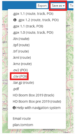
@Con-Hennekens CSV is the standard format for POI even MRA uses it to export
BlackView BV7100, Android 12
Navigate "Routes as Tracks" in Offline mode with Offline Maps
No Wifi, no internet, no interruptions, works well -
@Jörgen if you had saved/exported a POI from MRA yopu could have inspected the file to get the format
@Con-Hennekens CSV is the standard format for POI even MRA uses it to export
@Brian-McG, MRA uses GPX too. My point is that fields in a CSV have no designation. In GPX (which is XML) they do.
Hello! It looks like you're interested in this conversation, but you don't have an account yet.
Getting fed up of having to scroll through the same posts each visit? When you register for an account, you'll always come back to exactly where you were before, and choose to be notified of new replies (either via email, or push notification). You'll also be able to save bookmarks and upvote posts to show your appreciation to other community members.
With your input, this post could be even better 💗
Register Login-
71267.4k
-
19327
-
010420
-
027600
-
0280
-
021659
