I need help removing an unmovable loop from a track
-
Location: San Juan Mountain, Colorado on the Colorado BDR
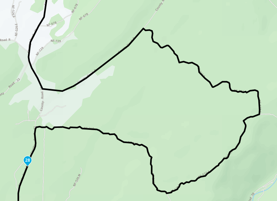
37.650937, -108.396950I'm wanting to use the COBDR route and make a few customized changes to the route so I first downloaded the .gpx file from the BDR site. I'm using the HERE map because it is much closer to the actual roads on the satellite imagery. The OpenStreetMap is unacceptable in many areas because it is so far off from the actual roads. The problem I'm having with the HERE map, and this is what I'm hoping to get some advice for, is the odd loop that MyRoute creates as shown on the attached image. No matter what I try it will not make the simple straight connection along the county road. It puts this loop in no matter what. I am a new user but I've tried everything in the toolkit and can't get this to work. If I switch over to OpenStreetMap it will draw it correctly in this section, but once again, OpenStreetMap is unacceptable in many other locations. If you know how to make the connection here on the HERE map, please let me know.
Thanks
-
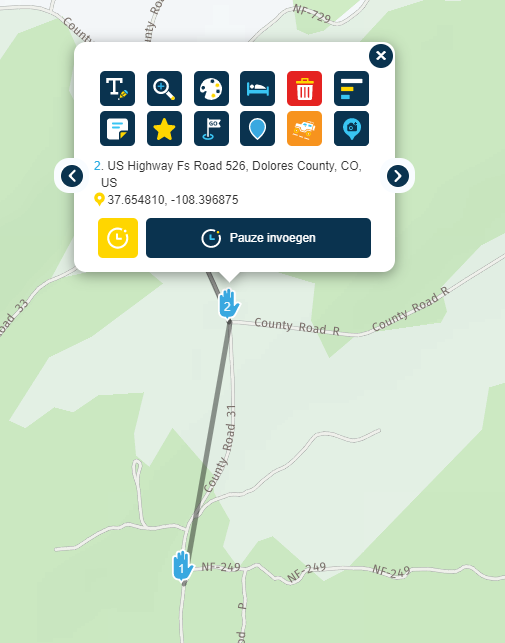
Location: San Juan Mountain, Colorado on the Colorado BDR
37.650937, -108.396950I'm wanting to use the COBDR route and make a few customized changes to the route so I first downloaded the .gpx file from the BDR site. I'm using the HERE map because it is much closer to the actual roads on the satellite imagery. The OpenStreetMap is unacceptable in many areas because it is so far off from the actual roads. The problem I'm having with the HERE map, and this is what I'm hoping to get some advice for, is the odd loop that MyRoute creates as shown on the attached image. No matter what I try it will not make the simple straight connection along the county road. It puts this loop in no matter what. I am a new user but I've tried everything in the toolkit and can't get this to work. If I switch over to OpenStreetMap it will draw it correctly in this section, but once again, OpenStreetMap is unacceptable in many other locations. If you know how to make the connection here on the HERE map, please let me know.
Thanks
@Kenneth-R-Odom-0
Hello @Kenneth-R-Odom-0 strange,
If I place the route points from North to South, the route is drawn on the Here map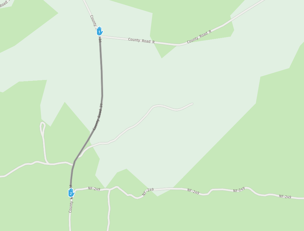
From South to North, a loop is indeed drawn on the Here map
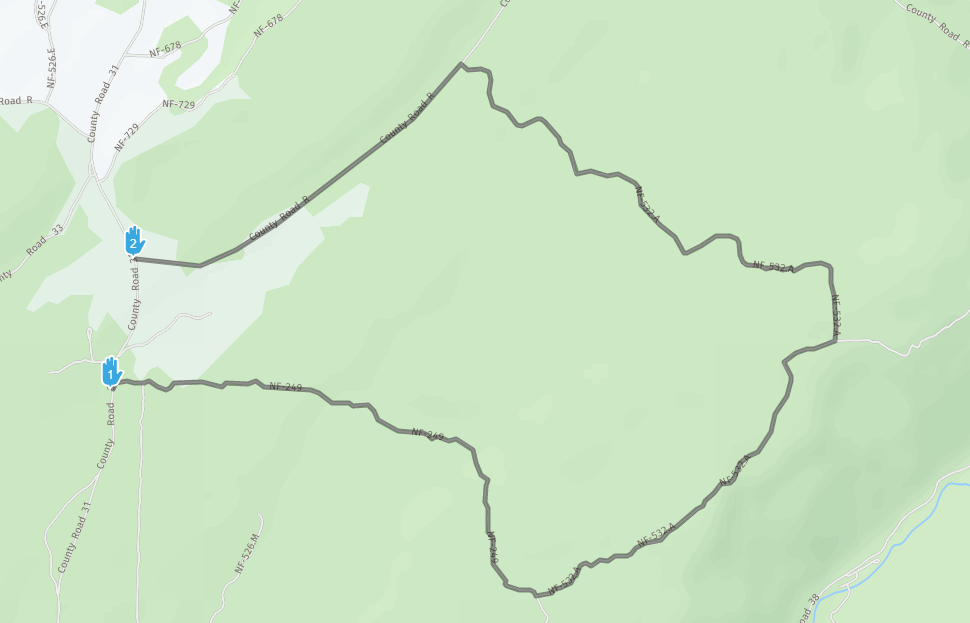
What you can do is:
Place waypoints from South to North exactly where the side roads connect to County Road 31. (I had to add 1 waypoint because you can't skip the last waypoint)
See the example pictures.
I can't figure out why, using the Here map, you can't go directly from North to South (No street view or traffic information).
There may be a closure in the route that prevents this from happening at the moment, and this information is not present in the OSM and TT map.
-
Yes! I can do what I need now. Thank you so much!
Hello! It looks like you're interested in this conversation, but you don't have an account yet.
Getting fed up of having to scroll through the same posts each visit? When you register for an account, you'll always come back to exactly where you were before, and choose to be notified of new replies (either via email, or push notification). You'll also be able to save bookmarks and upvote posts to show your appreciation to other community members.
With your input, this post could be even better 💗
Register Login-
034780
-
014212
-
0544
-
723223
-
04104
-
0244
-
0278
-
04153