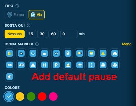
Suggestion: Enhance and Clarify GPX Export
-

Thanks, that's clear and it didn't come across as critical at all. You're right that it's mostly the wording.
We'll change the labels to say what goes in the file: the route as via and shaping points (route points in GPX terms), and "POIs (as GPX waypoints)". The "GPX 1.2" variant gets an honest name: GPX 1.1 with only the via points in the route and the road between them as route point extensions.
A route with via points, shaping points AND route point extensions is a good idea. We'd like to test how Garmin devices handle it before we offer it. Writing our waypoints as GPX waypoints as well is on the list too. One snag: if such a file is imported again, those waypoints come back as POIs. Which device or app would you use that with?
-

I fully agree - I mentioned this some time ago too. I believe the naming in MRA was in the beginning to keep it easy and simple for not experienced users.
But the time of simple in MRA has gone. In meantime MRA is one of the most powerful tools for route planning.
In this context, please let me add one more thing: also the import routine should be enhanced. If a gpx file contains a track, or route and (in MRA jargon) some POI - currently that would be ignored. Only the track or route will be imported.
But vor many events, that POI/<wpt> are important and needed!
It would be highly appreciated if they would be importer to. May not into the POI list - just to the route or track. That's enough, because it's the same, if you place manually a self declared POI into the route.If tis enhancement needs long time to develop, it would be helpful, if in meantime the import routine gives a message like: "the existing POI/<wpt>, the imported file contains, could not be imported too".
This gives the user a hint, he must be careful. -

Yes it is mostly terminology indeed. I agree with @guzzist, The import would be nicer if it was the reverse of the current export. Load a file, show what it contains, check which content you want to import. Multiple content at once.
-
Thanks, that's clear and it didn't come across as critical at all. You're right that it's mostly the wording.
We'll change the labels to say what goes in the file: the route as via and shaping points (route points in GPX terms), and "POIs (as GPX waypoints)". The "GPX 1.2" variant gets an honest name: GPX 1.1 with only the via points in the route and the road between them as route point extensions.
A route with via points, shaping points AND route point extensions is a good idea. We'd like to test how Garmin devices handle it before we offer it. Writing our waypoints as GPX waypoints as well is on the list too. One snag: if such a file is imported again, those waypoints come back as POIs. Which device or app would you use that with?

A route with via points, shaping points AND route point extensions is a good idea. We'd like to test how Garmin devices handle it before we offer it.
When Garmin imports a route which includes route point extensions, it does not recalculate the route - it preserves the MRA route, which is obviously a good thing. Unfortunately, if the route gets recalculated for any reason, the route point extensions are discarded so the route is calculated using only the via points. Having both the via and shaping points makes the recalculated route much closer to the original, of course.
Writing our waypoints as GPX waypoints as well is on the list too. One snag: if such a file is imported again, those waypoints come back as POIs.
I hadn't thought of that, but having import options aligned with the export options, as @guzzist and @motocon suggest would handle that.
Which device or app would you use that with?
A route generated from a track has only random locations as route points (aka waypoints) but if the route is generated from a track and gpx waypoints [which are on the track], then the gpx waypoints can become meaningful route points. I use this technique to generate good routes from tracks exported from Rever. For the US at least, Rever offers Butler Motorcycle Map overlays.
For any devices that work with tracks rather than routes, it might be nice to also have meaningful waypoints / POIs?
In general, having options for all possible combinations provides maximum flexibility for whatever the gpx file's destination device or software happens to be.
-
Not at the technical level that is going on throughout this thread but i had a problem a few weeks back (and potentially the same with tomorrow's route) in that i've used via points for the cafe and pub lunch stops but shaping points for the other markers.
Now Garmin is great if you switch it on from home and leave it on for the entire route but i found that when i turned it off and put it in my topbox, for a coffee stop, the only choice i had when turning it back on was the previous or next via point - one being this cafe and the other being home.
It would not let me select the next shaping point of which there were five before home.
I've just loaded the Cotswold route for tomorrow and i can see i have the same issue - the only way i can see to use the Garmin is to create a second route with all via points instead of shaping?
I'm waiting on a 360 mount for my quadlock so will then be able to run MRA from the phone but i like to run Garmin in parallel.
This is probably a me issue but where am i going wrong? i am exporting in 1.1 as per Nick's previous advice from last year so i know it's not that.
Triumph 1200 Rally Explorer (2023)
Google 8A with MRA mounted with a Quadlock
Garmin XT on Evotech
Cardo Packtalk Edge -
Not at the technical level that is going on throughout this thread but i had a problem a few weeks back (and potentially the same with tomorrow's route) in that i've used via points for the cafe and pub lunch stops but shaping points for the other markers.
Now Garmin is great if you switch it on from home and leave it on for the entire route but i found that when i turned it off and put it in my topbox, for a coffee stop, the only choice i had when turning it back on was the previous or next via point - one being this cafe and the other being home.
It would not let me select the next shaping point of which there were five before home.
I've just loaded the Cotswold route for tomorrow and i can see i have the same issue - the only way i can see to use the Garmin is to create a second route with all via points instead of shaping?
I'm waiting on a 360 mount for my quadlock so will then be able to run MRA from the phone but i like to run Garmin in parallel.
This is probably a me issue but where am i going wrong? i am exporting in 1.1 as per Nick's previous advice from last year so i know it's not that.
@martin.french601gmail.com
When you stop, put the zumo in standby, rather than power it off entirely. When you turn it back on, it will continue where you left off. If you have your zumo mount wired to switched power on the bike, it will do this automatically.If you do turn it off entirely, or otherwise stop the route navigation, then you need to start the route again. When starting a route, shaping points are not available as "next destinations", but in addition to the via points, there should be a "closest entry point" option. That will pick up the route from where you are.
-
Thanks SM - it was closest entry point that was trying to send me home. Normally i take the unit off the powered mount and put it straight in the box without switching it off.
I'll try again tomorrow to see what happens and i'll make a back up with via points just in case. -
Was your route a loop or out and back over the same roads? If so, split the route in two. The device is ultimately trying to get you to your destination. The closest entry point was probably near the end of your route, but if you just went from standby to back on, the route should continue without having to restart it so you should not have to select closest entry point.
-
It was a loop but to be honest i'd not put the two stops as via points, however i'd used a fair few shaping points to use the roads i wanted to travel.
We stopped for 15 minutes on the coast but the Garmin then ignored the shaping points to home (coastal) and brought us back in land.
I'll see how i fair tomorrow
-
Am i right in thinking it will automatically track as long as i start the route on MRA on my mobile? If not what do i need to do. i ask as it missed all 13 days of my trip in Portugal last year even though i used the route each day on the phone app.
-
We have drifted away from the [Web Beta] Suggestions and Discussions here. Maybe start a new thread in a more appropriate place with your experience tomorrow? You can also find lots of info on the zumo user forum.
Several factors may be at play - where you developed the route (MRA?), what you exported and how you imported (to zumo sd card, via tread app, ...?), what the route looks like (e.g. loop), whether you restarted the route with CEP or just let it continue, whether you followed the route entirely or went off-route, which model of zumo and whether software is latest version or older, ...
Hello! It looks like you're interested in this conversation, but you don't have an account yet.
Getting fed up of having to scroll through the same posts each visit? When you register for an account, you'll always come back to exactly where you were before, and choose to be notified of new replies (either via email, or push notification). You'll also be able to save bookmarks and upvote posts to show your appreciation to other community members.
With your input, this post could be even better 💗
Register Login-
01466
-
 01351
-
 01379
-
 0957
-
 011248
-
0836
-
 3970
-
 11080