Traffic situation and road bypasses
-
Previous weekend we went on a 3 day trip to visit the famous Italian Dolomiti Passes with our motorcycles. I created a seperate routes for each day prior to our departure. I had my android tablet with me just in case we did some corrections "on the fly". In general everything went more or less ok, no major errors or complications.
An issue I had was the general "avoid toll roads" and "avoid highways" because I wanted to avoid them just in Italy. I didn't want to avoid in in Slovenia, because I already have payed vignette for home country. But even if I could do this in MRA, I am unable to do this in Zumo XT also, so... I had both avoidance enabled and still went on Slovenian highway anyway. Garmin did a lot of recalculations... Not a big problem since I know my way around here, but the route timing was way off because MRA calculated time and distance for normal roads. So we were actually ahead of the schedule right from the start
")
A little bigger issue was when certain passes were closed. One pass was closed for that day only due to some cycling event. I understand that MRA and Garmin can't know this and therefore we had to do route corrections bellow the pass where the Police and the stop sign were.
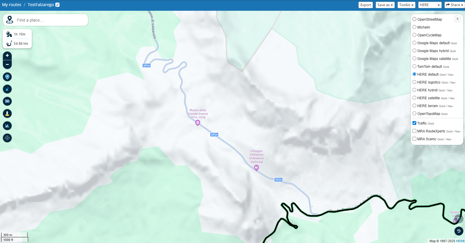
Another pass was closed due to road works and this is where I feel that an application upgrade is doable. We were trying to go from Cortina d'Ampezzo to San Cassiano through Falzarego pass. The MRA is trying to navigate us through southern bypass and never through shorter northern road. And we were wondering why?! I had Traffic info enabled but nothing was shown - so I guess that MRA knows that the road is unpassable, but it doesn't show us that. So we had to double check with google maps and yes, google maps does show unpassable road in a really user-friendly way.
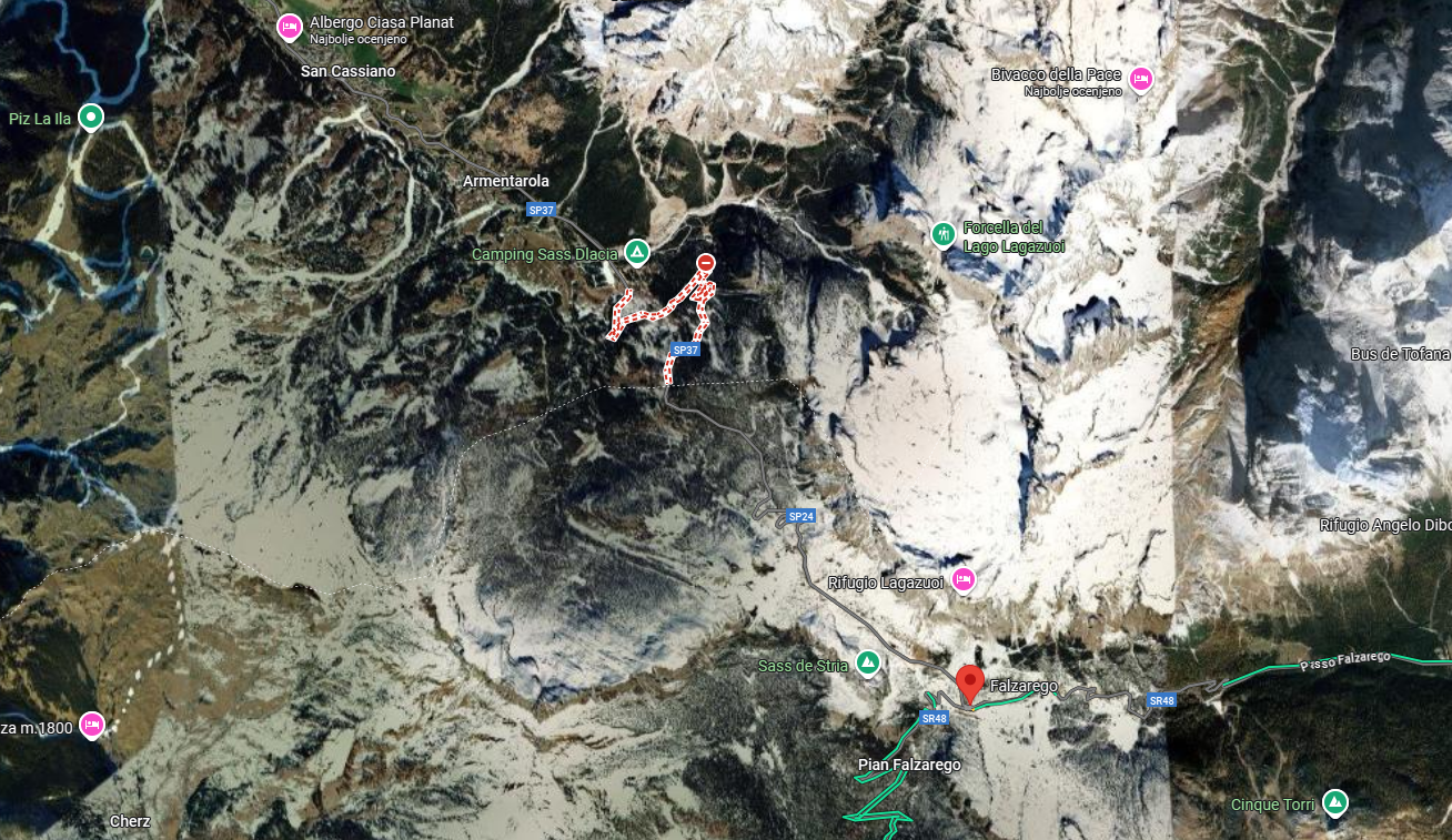
Some screens bellow - is there a way to make "road closed" marks more visible in the MRA?
Also is there a way to have "Traffic" always ON?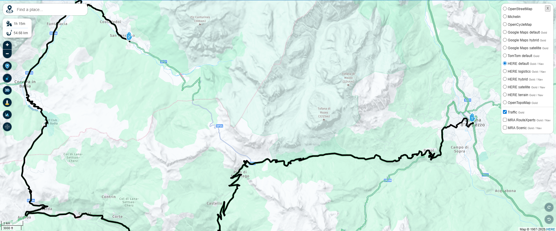
-
In your case I would have made a route in Slovenia until the border and in XT set highway "on" and in Italy from the border load a route for Italy and set in XT highway "off".
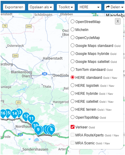
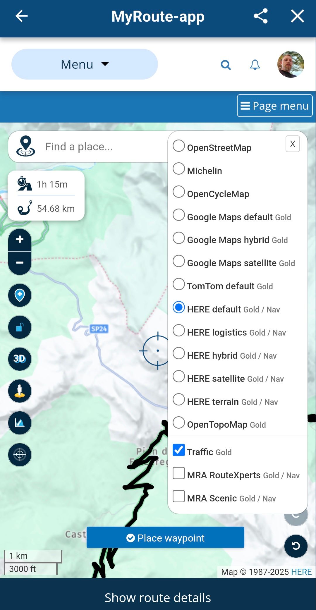
Alternativ: make the route in the MRA planner, set highway "on" and make your route (you will have to use a lot of shapingpoints in Italy). Than export the GPX 1.2 and set your recalculation "off". Your route will guide you as you planned it.If you, where in my screenshot it says "verkeer", enable traffic, you will see the closed roads.
Met andere apps maak je een route, met MRA componeer je een route!
Ducati Monster 1200 met Garmin Zümo XT
Fiat 124 Spider/Camper Dethleffs met Navigation-App op Samsung Tab Active4 Pro
MRA Lifetime Gold -
In your case I would have made a route in Slovenia until the border and in XT set highway "on" and in Italy from the border load a route for Italy and set in XT highway "off".
Alternativ: make the route in the MRA planner, set highway "on" and make your route (you will have to use a lot of shapingpoints in Italy). Than export the GPX 1.2 and set your recalculation "off". Your route will guide you as you planned it.If you, where in my screenshot it says "verkeer", enable traffic, you will see the closed roads.
@Lex.Kloet.RX Good idea about creating two separate routes to solve the highway problem.
About creating one route and using a lot of shaping points... I thought that the max suggested is about 40 shaping/via points, otherwise Garmin would have problems...
For Garmin XT I also always use GPX 1.1, since that was recomended. GPX 1.2 was said to be for the Zumo XT2 so I never tried it.But the most important:
If you, where in my screenshot it says "verkeer", enable traffic, you will see the closed roads.
Well... I have Traffic enabled and I don't see road closed. Check the screen I attached in the OP.
I do see that the MRA navigated me on the other road, but I don't see that that happened because of the closed road. -
@Lex.Kloet.RX Good idea about creating two separate routes to solve the highway problem.
About creating one route and using a lot of shaping points... I thought that the max suggested is about 40 shaping/via points, otherwise Garmin would have problems...
For Garmin XT I also always use GPX 1.1, since that was recomended. GPX 1.2 was said to be for the Zumo XT2 so I never tried it.But the most important:
If you, where in my screenshot it says "verkeer", enable traffic, you will see the closed roads.
Well... I have Traffic enabled and I don't see road closed. Check the screen I attached in the OP.
I do see that the MRA navigated me on the other road, but I don't see that that happened because of the closed road.@Boštjan-Kreutz said in Traffic situation and road bypasses:
Well... I have Traffic enabled and I don't see road closed. Check the screen I attached in the OP.
I had a similar issue on Sunday. I was returning from the Eifel area of Germany to the UK via the channel tunnel.
I took the suggested fastest route using the E40 in Belgium. Three times the motorway was closed with no warning, and worse for me, no suggested diversions.
OK, the first one I was using offline navigation so that could have been user error, but as I had to stop to figure out my own alternative route I switched my phone onto online, with all traffic settings turned on.
The next two closures again I got no warnings, and again even worse, no alternative directions.
This made for a very unpleasant journey as although I had allowed ample time for the suggested route I had to be at the tunnel before a certain time, and these diversions were eating into my safety margin.Does anyone have any ideas / suggestions why MRA did not route me around these second two closures.
-
@Boštjan-Kreutz said in Traffic situation and road bypasses:
Well... I have Traffic enabled and I don't see road closed. Check the screen I attached in the OP.
I had a similar issue on Sunday. I was returning from the Eifel area of Germany to the UK via the channel tunnel.
I took the suggested fastest route using the E40 in Belgium. Three times the motorway was closed with no warning, and worse for me, no suggested diversions.
OK, the first one I was using offline navigation so that could have been user error, but as I had to stop to figure out my own alternative route I switched my phone onto online, with all traffic settings turned on.
The next two closures again I got no warnings, and again even worse, no alternative directions.
This made for a very unpleasant journey as although I had allowed ample time for the suggested route I had to be at the tunnel before a certain time, and these diversions were eating into my safety margin.Does anyone have any ideas / suggestions why MRA did not route me around these second two closures.
@richard-3v just to be super clear, you were probably using MRA Next on your phone to navigate?
My case was not while navigating with Next, but while creating route in a MRA route editor. -
@Boštjan-Kreutz
Yes, that is correct. Sorry for causing confusion.
But I would still appreciate an answer from anyone with ideas. -
@Lex.Kloet.RX Good idea about creating two separate routes to solve the highway problem.
About creating one route and using a lot of shaping points... I thought that the max suggested is about 40 shaping/via points, otherwise Garmin would have problems...
For Garmin XT I also always use GPX 1.1, since that was recomended. GPX 1.2 was said to be for the Zumo XT2 so I never tried it.But the most important:
If you, where in my screenshot it says "verkeer", enable traffic, you will see the closed roads.
Well... I have Traffic enabled and I don't see road closed. Check the screen I attached in the OP.
I do see that the MRA navigated me on the other road, but I don't see that that happened because of the closed road.@Boštjan-Kreutz The XT has 29 viapoints as a maximum for one route (otherwise the route is split). Shapingpoints I don't know by heart, but many more.
Nope, 1.2 is for all Zumo's. It runs very well on the XT, when you have recalculation off.
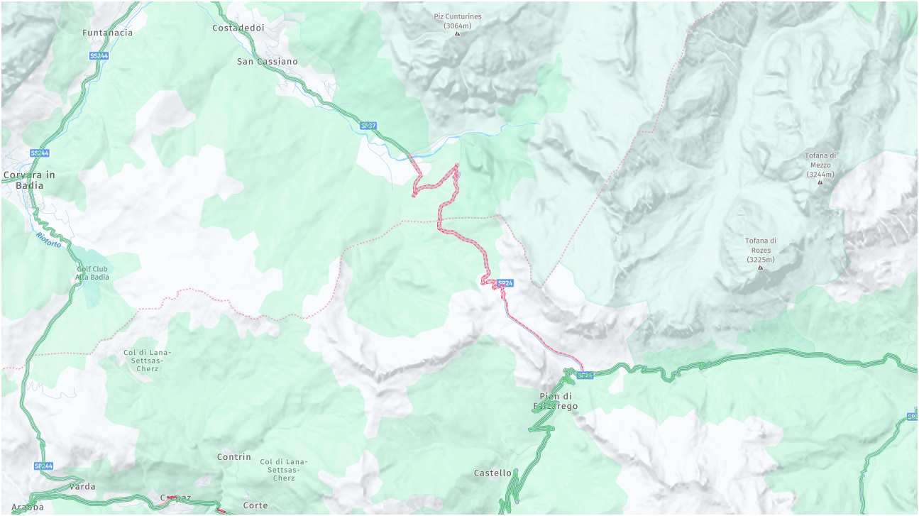
you have to zoom in a little bit more:
Met andere apps maak je een route, met MRA componeer je een route!
Ducati Monster 1200 met Garmin Zümo XT
Fiat 124 Spider/Camper Dethleffs met Navigation-App op Samsung Tab Active4 Pro
MRA Lifetime Gold -
Thank you so much for the explanation on max points and also about the export version... I am a new user and these kind of info is always welcome and I will for sure test that out when I get the next chance.
For the traffic info... I can zoom how much I want, and I don't get the display like yours. I checked to have traffic enabled and also checked all maps (for default I use HERE). I just don't get that red line. On Windows I use Chrome. But I also checked MRA app on my andorid phone, open my test route - still don't see that red line. I also created another new route... no red line... Could it be a location issue?
-
What kind of subscription do you have?
Met andere apps maak je een route, met MRA componeer je een route!
Ducati Monster 1200 met Garmin Zümo XT
Fiat 124 Spider/Camper Dethleffs met Navigation-App op Samsung Tab Active4 Pro
MRA Lifetime Gold -
What kind of subscription do you have?
@Lex.Kloet.RX I have a "MRA Routeplanner Gold Lifetime member", but I don't have NEXT navigation system subscription.
-
@Lex.Kloet.RX I have a "MRA Routeplanner Gold Lifetime member", but I don't have NEXT navigation system subscription.
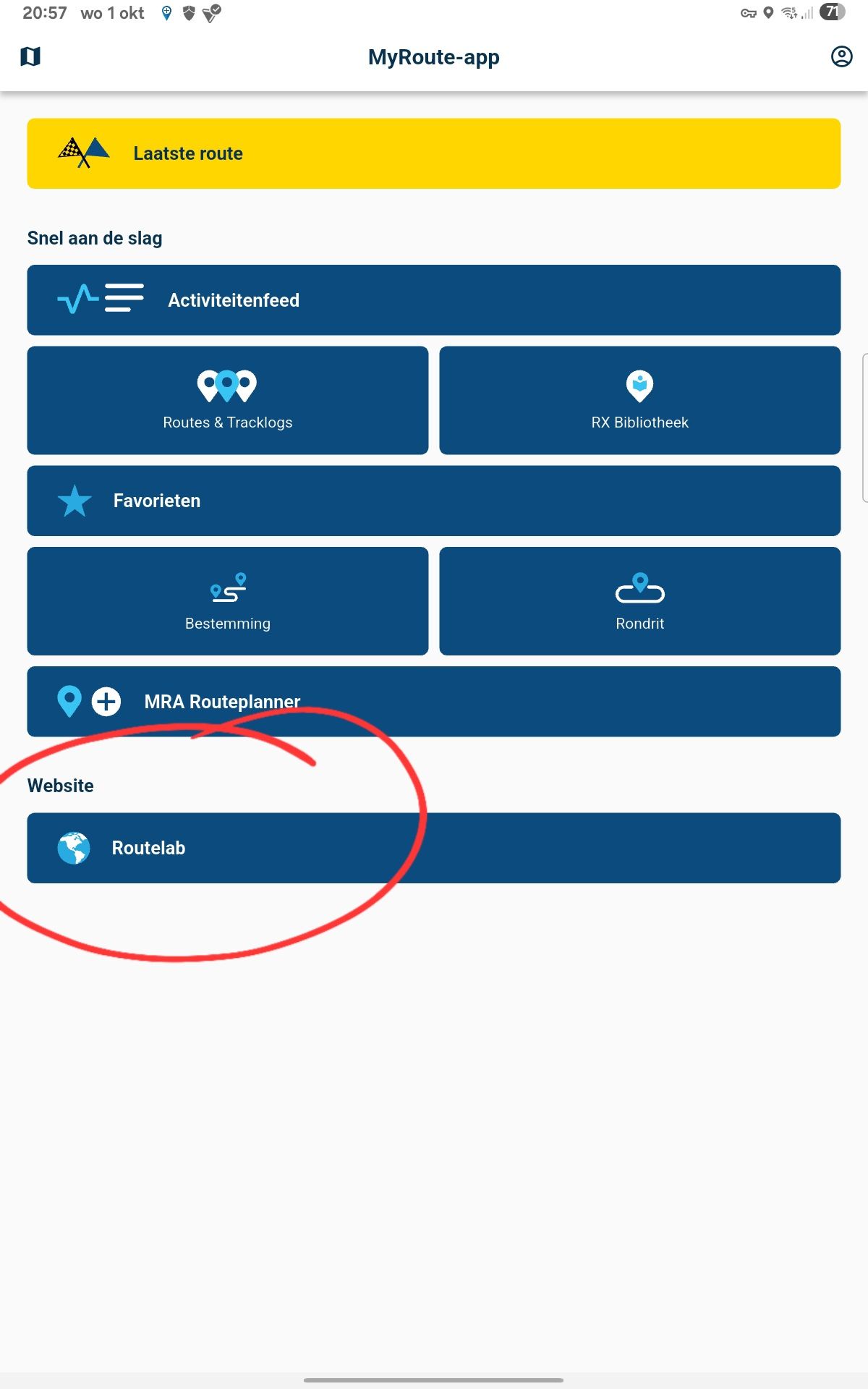
@Boštjan-Kreutz try to use the routelab in the app, instead of the MRA Routeplanner
Met andere apps maak je een route, met MRA componeer je een route!
Ducati Monster 1200 met Garmin Zümo XT
Fiat 124 Spider/Camper Dethleffs met Navigation-App op Samsung Tab Active4 Pro
MRA Lifetime Gold -
@Boštjan-Kreutz try to use the routelab in the app, instead of the MRA Routeplanner
@Lex.Kloet.RX Interesting.
I already did what you suggested yesterday and I attached the screen not showing red line. But I double checked now, on the android MRA app, option website-Routelab -> and now it shows the red line. How? Why?
I also tried opening on Windows Chrome browser, the same TestFalzarego route then yesterday, and now I also get red line on the web browser...I guess there was some sort of bug, or something else happened (perhaps some catched files), but I would really like to have this kind of road closures to be shown always and reliable. When I do planing it is really useful not to have to double check another SW or google maps to have crucial information at hand.
Anyhow, thanks for all your input. It was nevertheless a good learning experience.
-
Maybe a cache problem
-
@Boštjan-Kreutz The XT has 29 viapoints as a maximum for one route (otherwise the route is split). Shapingpoints I don't know by heart, but many more.
Nope, 1.2 is for all Zumo's. It runs very well on the XT, when you have recalculation off.
you have to zoom in a little bit more:
@Lex.Kloet.RX said in Traffic situation and road bypasses:
Shapingpoints I don't know by heart, but many more.
200
Hello! It looks like you're interested in this conversation, but you don't have an account yet.
Getting fed up of having to scroll through the same posts each visit? When you register for an account, you'll always come back to exactly where you were before, and choose to be notified of new replies (either via email, or push notification). You'll also be able to save bookmarks and upvote posts to show your appreciation to other community members.
With your input, this post could be even better 💗
Register Login-
71277.7k
-
112380
-
1550
-
029685
-
0292.0k
-
010443
-
0290
