Bulk Upload of POI's
-
@Dikke-Wim Somewhat less work than the method you describe

What method do you mean? I don't get it.
For me: the easier the better! -
-
OK - I got it.
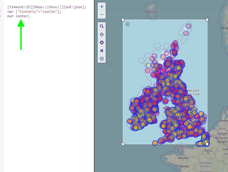
You need an out centre (instead of an out geom) to create a single node for ways/areas. This will generate waypoints for both types (nodes and ways) when exporting as GPX.
Here's the result
https://hidrive.ionos.com/lnk/LhseBgcKc
for the query:
Sorry for the confusion!
@Martin-Wilcke this is amazing never knew how to use this feature! It would be of great help if the MRA team @Corjan-Meijerink could make a YouTube tutorial on this.

-
I do not think @Greenham want to harvest POI's but to put his own POI's into MRA in bulk.
I use Excel to make them and then convert to GPX.
MRA only uses the description but If I load them into my Garmin I get the other fields also. I am now busy to find out how to bulk import a GPX into my little housemade tool.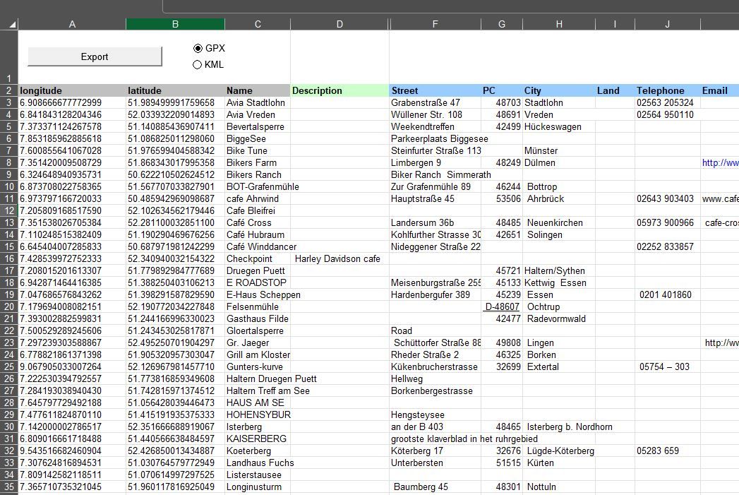
Yes this is what I am trying to do. Add my own POI's
"There is no problem so bad that you can't make it worse"
- Chris Hadfield (NASA Astronaut)
-
@Greenham said in Bulk Upload of POI's:
Yes this is what I am trying to do. Add my own POI's
As another member of this forum asked me the same because I replied here, I have been dusting off my 20 year old programming skills in Excel VBA
")
the today status of the tools is the following
-
Import simple POI GPX files into Excel
-
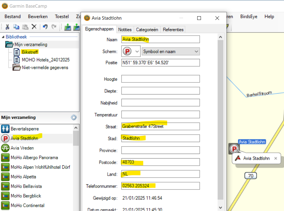
Edit the imported file and add Symbol, Description, Street, Phone etc for import into Garmin devices
-
Export the POI file to GPX format
-
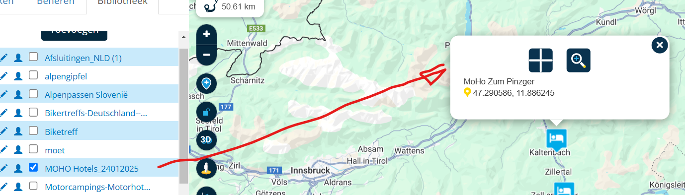
Double Click on the filled in row and the POI wil open in Google maps.
Excel file with Ribbon (KML does not work yet)
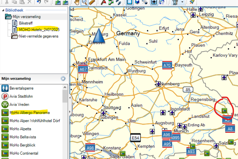
MOHO hotels GPX imported into Excel*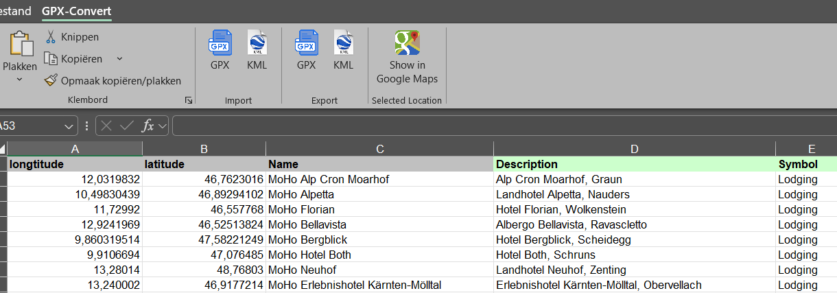
3rd Item in the list selected and button "Show in Google Maps" selected

Import in MRA from GPX file
Import in Basecamp with selected symbol
Data added in Excel and transferred to Garmin GPX, see also the different symbols in the same GPX
Send me your email in a PB and I send you the current file with the following status:
-
Made and only tested in Excel/Windows10
-
Error handeling is still poor in the progarmming
-
Program as is, it works on my system, not tested on other equipment.
-
Program is made in MS VBA and not tested in other programs.
regards,
Bert -
Hello! It looks like you're interested in this conversation, but you don't have an account yet.
Getting fed up of having to scroll through the same posts each visit? When you register for an account, you'll always come back to exactly where you were before, and choose to be notified of new replies (either via email, or push notification). You'll also be able to save bookmarks and upvote posts to show your appreciation to other community members.
With your input, this post could be even better 💗
Register Login-
220214
-
0886
-
2790
-
0749
-
04181
-
08337
-
0783
-
618500
