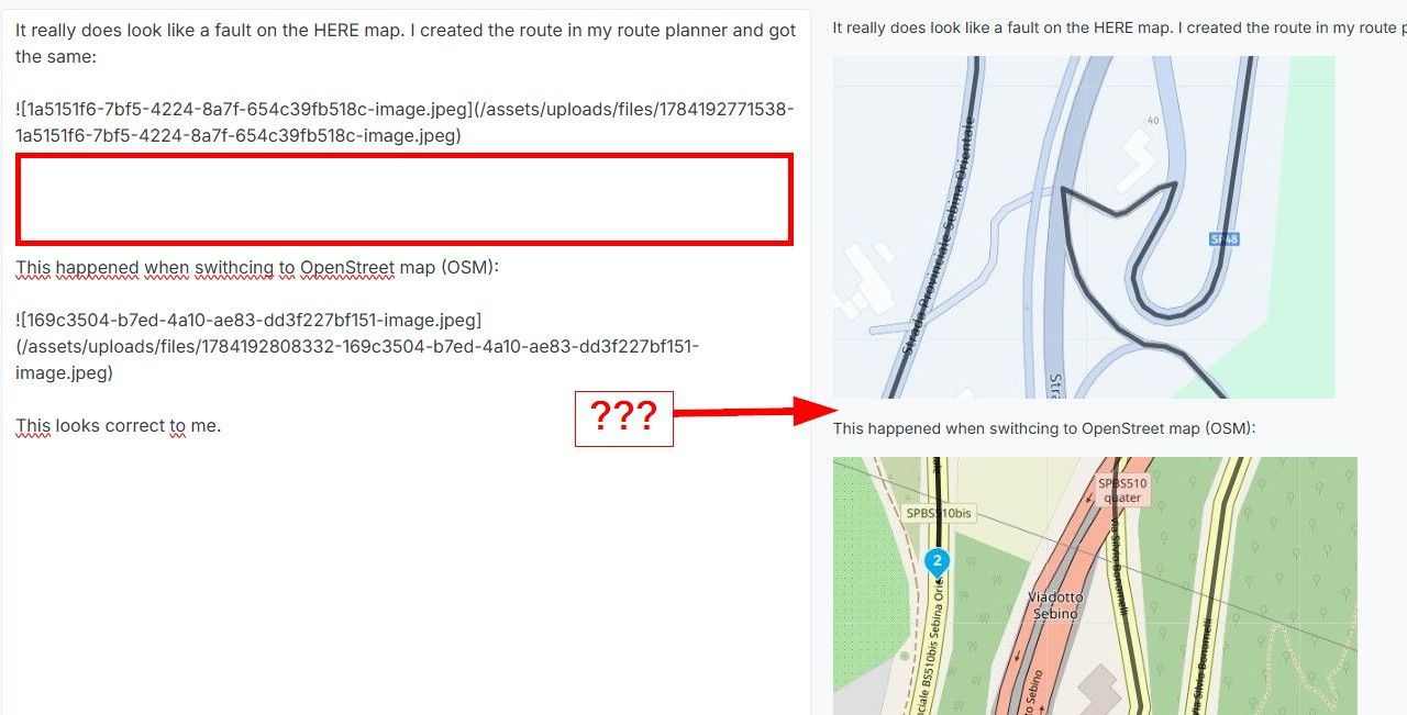
Which map is used for the initial route calculation?
-
Can anyone tell me which map is used for the initial route calculation? I mean the actual calculation, separate from the over-lay.
🏍️ Tiger: DMD Nor7e + SilverFox controller
🏍️ Bobber: iPhone 15 Pro + Quad Lock mount
🚗 Car: iPhone 15 Pro with wireless Apple CarPlay -
Can anyone tell me which map is used for the initial route calculation? I mean the actual calculation, separate from the over-lay.
@Bart-DM GraphHopper / OSM! Next week I’ll change this so that fastest routes use HERE as initial calculation for those with Gold / Navigation subscriptions.
This will resolve issues where long routes cannot be calculated and ensures that the initial route will also be available as navigable route.
Curvy routes always need to use GraphHopper / OSM for calculation. These are navigated with track navigation because of that
")
-
@Bart-DM GraphHopper / OSM! Next week I’ll change this so that fastest routes use HERE as initial calculation for those with Gold / Navigation subscriptions.
This will resolve issues where long routes cannot be calculated and ensures that the initial route will also be available as navigable route.
Curvy routes always need to use GraphHopper / OSM for calculation. These are navigated with track navigation because of that
@Corjan-Meijerink thx 4 the info!
Hello! It looks like you're interested in this conversation, but you don't have an account yet.
Getting fed up of having to scroll through the same posts each visit? When you register for an account, you'll always come back to exactly where you were before, and choose to be notified of new replies (either via email, or push notification). You'll also be able to save bookmarks and upvote posts to show your appreciation to other community members.
With your input, this post could be even better 💗
Register Login-
0884
-
09210
-
0431.1k
-
010310
-
0357
-
07232
-
0297.8k
-
0240