With MyRoute-App Mobile you can follow Off Road Routes
-
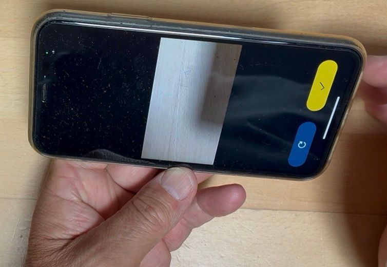
I am sure others have worked this out, MyRoute-App Mobile will allow you to follow off road routes.
You will need import as a Route-Track if you haven’t actually driven the route.
Do not try to “Edit Route-Track”.For those of you in the UK be careful as often Byways Open to All Traffic (BOATs) have Bridleways and Footpaths in the same location.
Here’s a few examples
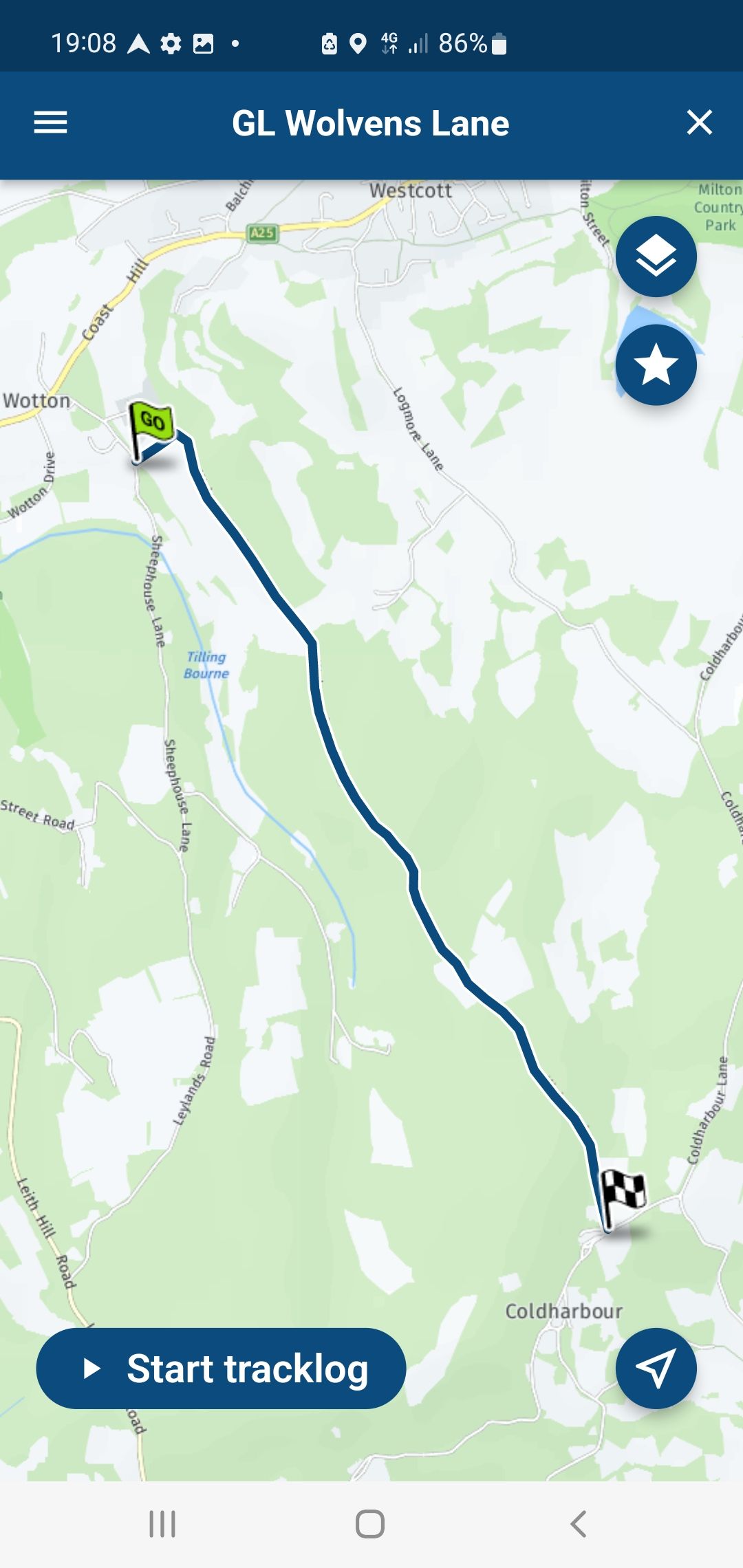
Surrey Hills: Wolvens Lane (Byway Open to All Traffic).
Plotted in the Ordanance Survey Maps App for accuracy.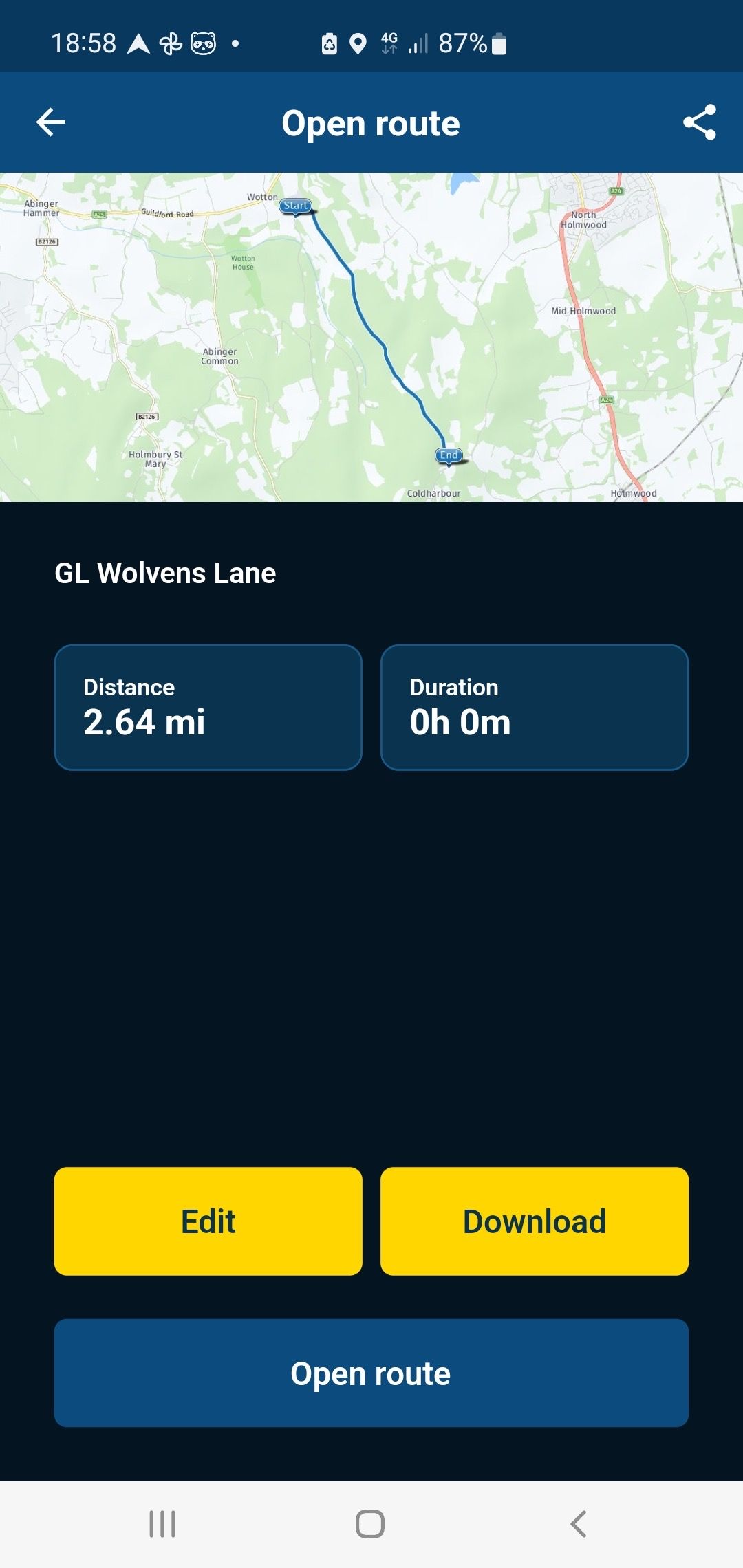
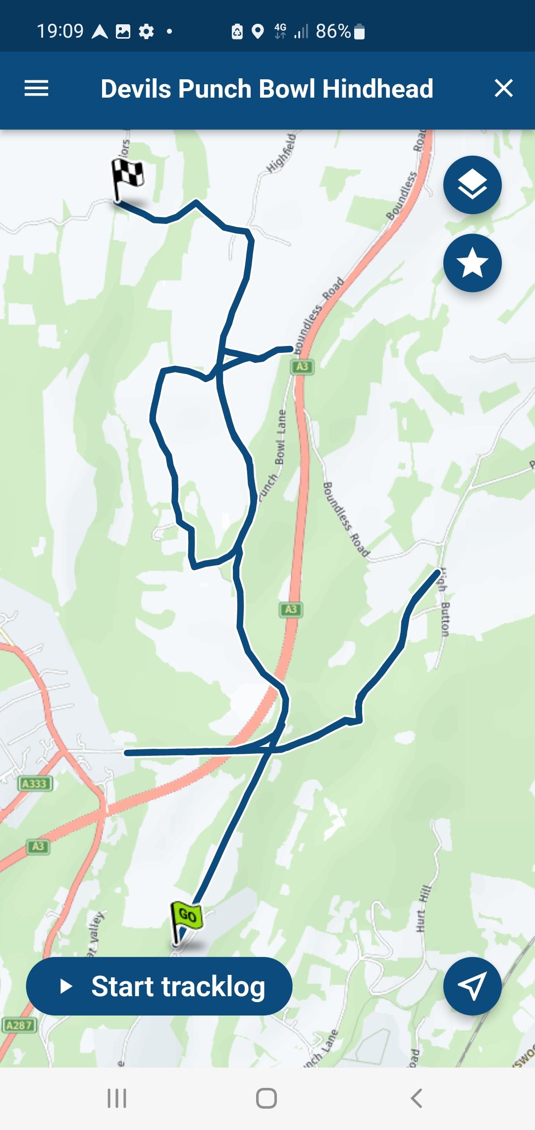
The Devils Punch Bowl Hindhead.
Plotted in the Ordanance Survey Maps App for accuracy. (Byway Open to All Traffic)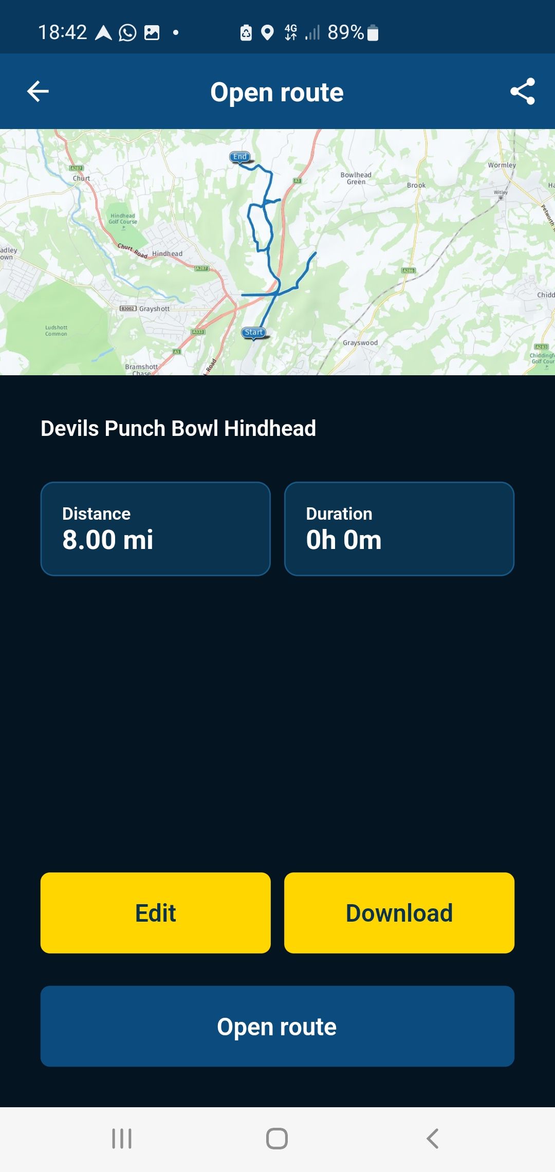
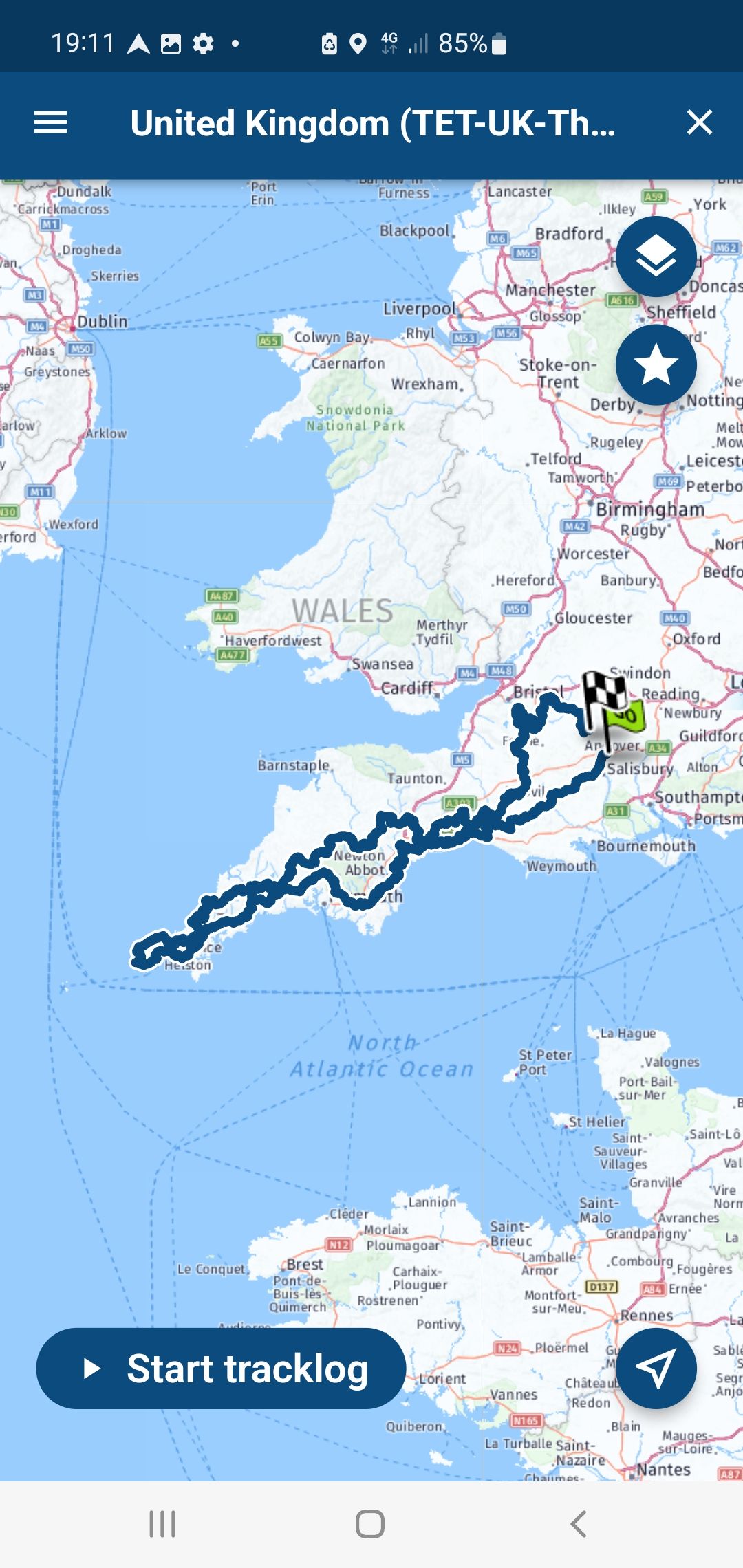
TET Great Western Trail.
Sourced from the TET Website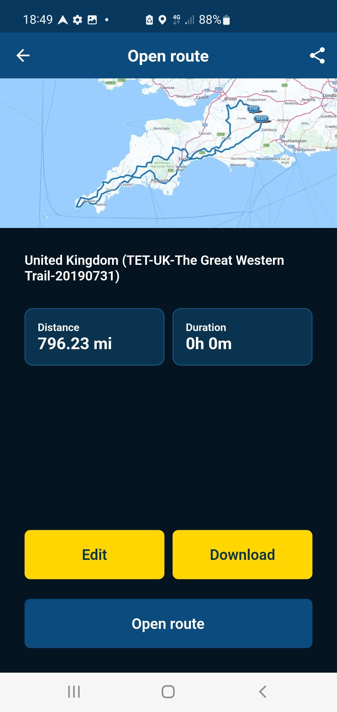
You don’t stop riding when you get old, you get old when you stop riding.
-
I am sure others have worked this out, MyRoute-App Mobile will allow you to follow off road routes.
You will need import as a Route-Track if you haven’t actually driven the route.
Do not try to “Edit Route-Track”.For those of you in the UK be careful as often Byways Open to All Traffic (BOATs) have Bridleways and Footpaths in the same location.
Here’s a few examples
Surrey Hills: Wolvens Lane (Byway Open to All Traffic).
Plotted in the Ordanance Survey Maps App for accuracy.The Devils Punch Bowl Hindhead.
Plotted in the Ordanance Survey Maps App for accuracy. (Byway Open to All Traffic)TET Great Western Trail.
Sourced from the TET WebsiteThanks Steve
Hello! It looks like you're interested in this conversation, but you don't have an account yet.
Getting fed up of having to scroll through the same posts each visit? When you register for an account, you'll always come back to exactly where you were before, and choose to be notified of new replies (either via email, or push notification). You'll also be able to save bookmarks and upvote posts to show your appreciation to other community members.
With your input, this post could be even better 💗
Register Login-
7673.1k
-
019513
-
09117
-
05155
-
314882
-
115753
-
0116