BMW Motorrad Connected app Question
-

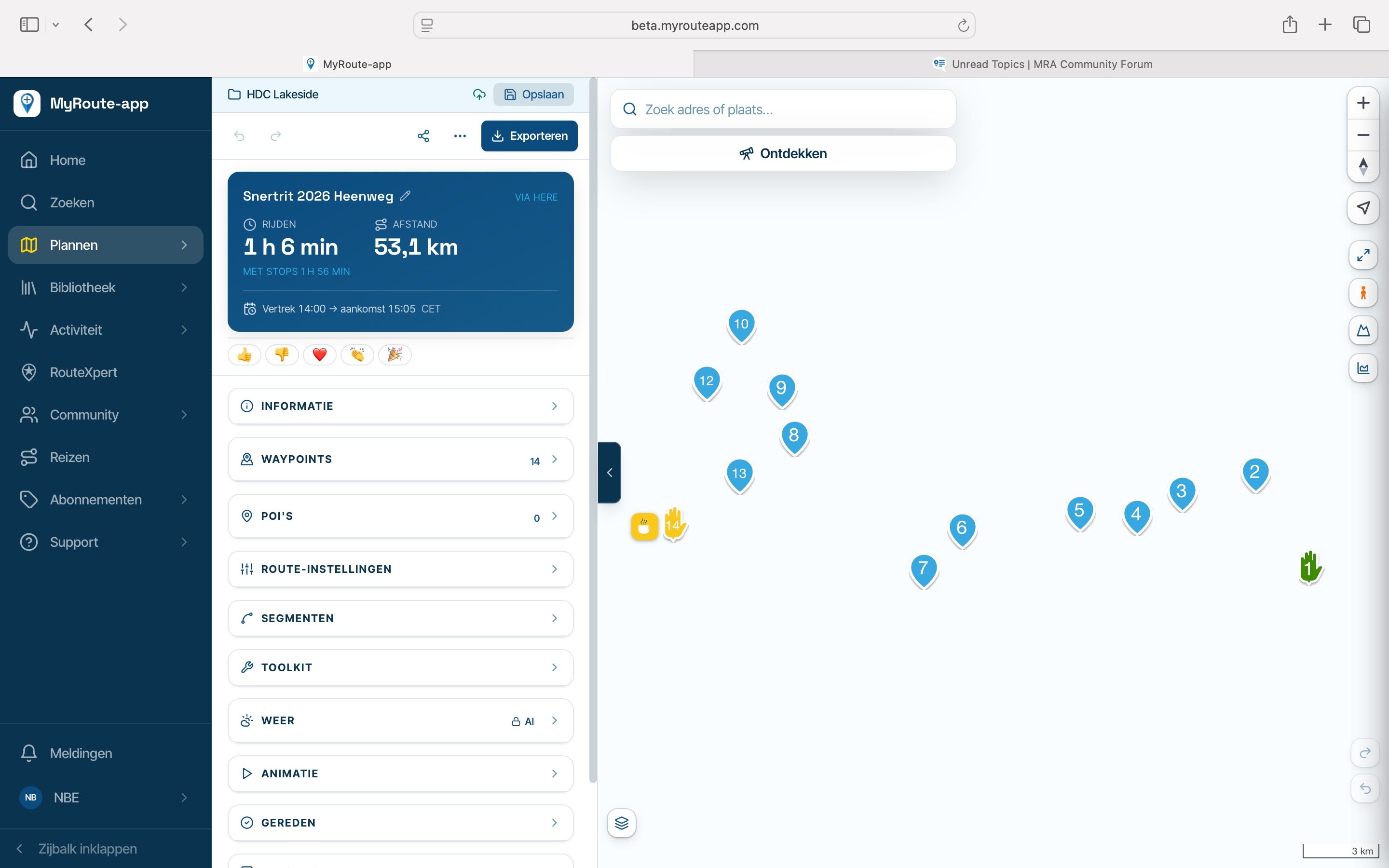
[Note: I posted the question below yesterday in the BMW Sport Touring forum website, but haven't received any replies yet. Since it involves the route I created in MyRoute, I'm hoping some folks here will help me out.]
Quick background: On my 1300 RT, I use the TFT, my Cardo, and my iPhone for navigation, music, MESH, phone, etc. With help from this forum and many test rides, I have everything working well. I have no desire to get a separate GPS unit to mount somewhere on my bars. I do the same with my H-D Road Glide. Both bikes are working out great, and I enjoy them both. The displays on the two bikes perform many of the same functions, but they certainly do them differently from each other!
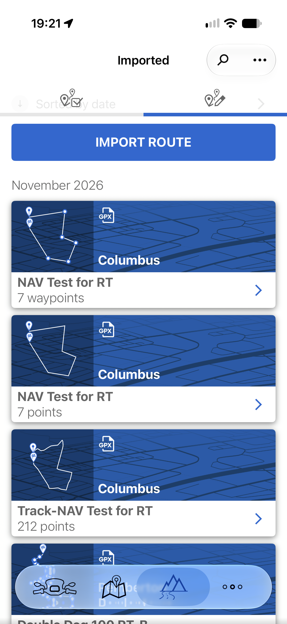
I'm fairly new to the BMW world, and I am trying to figure out the difference between two of the three routes that the Connected app creates when I bring over a gpx file from the MyRoute app. The attached screen shot shows the three files created from a test route I made. There are seven waypoints (I only used "shaping" points in MyRoute, not "via" points, which means I can skip a waypoint and not be forced back to it). The top route in BMW's Connected app shows the waypoints, and when I ride it and INTENTIONALLY skip a waypoint, the navigation does NOT treat it like a shaping point, but rather a via point and keeps pointing me back to it. I can solve this by using the Wonder Wheel and deleting that waypoint. The difference between the other two files is what is confusing me. The second shows 7 points in the description, and the third shows 212 points, but they both show a solid track with no waypoints, and they act the same when I ride the route. They both ignore the waypoint I skipped shortly after I go by it and correctly goes on to the next waypoint without any need for me to delete the missed waypoint. I do notice that the route diagram of the second file is a series of straight lines while the route diagram of the third file curves with the roads, but that did not seem to change the navigation commands the app was giving me.
My question: What is the functional difference between the "NAV Test for RT" file with 7 points, and the "Track-NAV Test for RT" file with 212 points? They seemed to behave the same way when I rode them today.
I do have the option to convert the MyRoute gpx file to any one, two, or all three versions, and then I select the one I want to use. So once I fully understand what the difference is between the three types of files, I will only import one of the three files.
Thanks for your time,
Sam
-

The ConnectedRide Navigator distinguishes between different types of navigation points. In particular, routes that have been created in an online route planning portal can therefore be imported in 3 different ways and used for different types of navigation:
Routing by waypoints:
"Waypoints" are hard destinations that must be travelled to explicitly during navigation. This means that you will be navigated to the next current waypoint until you have travelled to it exactly. You can use the "Skip waypoint" function Skip Waypoint Icon from the ConnectedRide Navigator to skip the current waypoint and navigate to the next waypoint. Here you can find out more.
Navigation by waypoints is particularly suitable if you want to explicitly follow the waypoints of your planned route, but want to select the routing criteria flexibly.Routing by anchor points / "Points":
"Anchor points" are soft destinations that define the course of the route but do not have to be travelled to explicitly.
Navigation by anchor points is particularly suitable if you want to roughly follow your planned route but deviate from it flexibly during the journey.Routing via a large number of anchor points:
Many anchor points in a row are soft destinations that do not have to be travelled to explicitly. This means that you can see your exact planned route on the Navigator – down to a few metres.
Navigation via many anchor points is particularly suitable if you want to follow your planned route to the exact metre (for example for off-road navigation). In the GPX format, this type of navigation is also called "tracks".(source BMW FAQ: What is the difference between waypoints and anchor points in the ConnectedRide Navigator?)
Hello! It looks like you're interested in this conversation, but you don't have an account yet.
Getting fed up of having to scroll through the same posts each visit? When you register for an account, you'll always come back to exactly where you were before, and choose to be notified of new replies (either via email, or push notification). You'll also be able to save bookmarks and upvote posts to show your appreciation to other community members.
With your input, this post could be even better 💗
Register Login-
 033239
-
 112173
-
 14291.6k
-
012100
-
 01080
-
412142
-
0976
-
0748