New beta! 4.3.4 (369) - massive navigation improvements
-
@Dave-J-0 does not seem too strange to be honest. You’re not near the start and it seems te finish is closest to you. Try turning off “start nearest point on track” or simply longpress anywhere on the first section of the track.
Waypoints only include the viapoints with the original number (as changing that into order would make you loose sense of the viapoint numbering).
Edit: after further investigation, the behavior is indeed not logic and is improved in a new beta / the release
") Thanks @Dave-J-0!
Thanks @Dave-J-0!@Corjan-Meijerink said in New beta! 4.3.4 (369) - massive navigation improvements:
Try turning off “start nearest point on track”
This was ‘off’ for the missing loop which is why I thought it strange. If I select this on then the full loop appears to be correct and shown.
Aware that the ‘route as track’ will only show vias but if i select ‘waypoints’ then i receive a white box:
Should this not show the info for the vias?
Great work, love what the MRA Team are doing.
Kind Regards. Help where I can.
Ducati Multistrada V4 Rally
iPhone 15 Pro
CHIGEE AIO-6 LTE
Google Pixel 6 Pro - mounted on SP Connect Plus
Ex Garmin XT2 and XT1 as well as Ex TomTom Rider User -
This sounds fantastic. My compliments for what you have done again.
I hope to be offered the new Beta version soon. Unfortunately, it is not yet available for Android.Dit klinkt fantastisch. Mijn complimenten voor hetgeen jullie weer verricht hebben.
Ik hoop de nieuwe Beta versie snel aangeboden te krijgen. Helaas is deze voor Android nog niet beschikbaar. -
Just installed on IOS. Does it mean that we are able now to plan route using tomotom routing in the planner and then navigate by track having info about waypoints etc? I would be great!
--
Regards
Staszek -
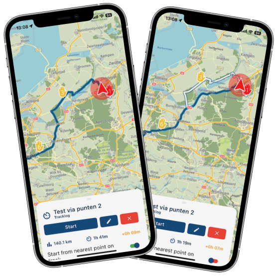
@Corjan-Meijerink Really liking the changes but I have been trying some different settings with routes that I have to run as tracks. Where I have a circular route, the track is very different to the route. An example for this route and is similar to a number of these training routes I use for Advanced Riding with the same problem although this is probably the worst example:
As a route:
Waypoint order as expected:
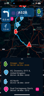
Change to route as track:
The track display showing the start now at the end with nothing else (white planned route):
Waypoint order has now changed:
Not what I was expecting and thought I should highlight here.
@Dave-J-0 I've improved this in a next beta update / the release
-
@Corjan-Meijerink said in New beta! 4.3.4 (369) - massive navigation improvements:
Try turning off “start nearest point on track”
This was ‘off’ for the missing loop which is why I thought it strange. If I select this on then the full loop appears to be correct and shown.
Aware that the ‘route as track’ will only show vias but if i select ‘waypoints’ then i receive a white box:
Should this not show the info for the vias?
Great work, love what the MRA Team are doing.
@Dave-J-0 Thanks for sharing, fixed this too!
-
Just installed on IOS. Does it mean that we are able now to plan route using tomotom routing in the planner and then navigate by track having info about waypoints etc? I would be great!
@Stanisław that's indeed correct however I'm slightly unsure why you'd want to do this
 Unless it's to use the TomTom scenic routing options and then preserve those by driving as track.
 -
Just installed on IOS. Does it mean that we are able now to plan route using tomotom routing in the planner and then navigate by track having info about waypoints etc? I would be great!
@Stanisław No, the app does not use the planning map from TomTom.
If you want to use the TomTom planning map, use the Compare route with HERE tool to ensure that your TomTom route is followed accurately by the HERE map.Always willing to help if I can.
Triumph Tiger 1200 XRT called Tina.
MRA Navigation Next and SilverFox BJ8 -
@Stanisław that's indeed correct however I'm slightly unsure why you'd want to do this
Unless it's to use the TomTom scenic routing options and then preserve those by driving as track.@Corjan-Meijerink Tomtom in general is better for paved roads then Here, I used it for years and I liked it. Maybe it is not so important in case of well planned trips but can be an interesting option. I will test it for sure - thank you!
-
@Stanisław No, the app does not use the planning map from TomTom.
If you want to use the TomTom planning map, use the Compare route with HERE tool to ensure that your TomTom route is followed accurately by the HERE map.@Nick-Carthew In case of track based navigation we could say that we can use the road planned in the MRA planner using Tomtom/Openstreet maps algorythm, moved to the MRA navigation as a track - am I wrong?
--
Regards
Staszek -
@Dave-J-0 Thanks for sharing, fixed this too!
@Corjan-Meijerink Thanks for this. Just wondering how adding additional stops (petrol, coffee) should show; I appear to be able to select a venue in CarPlay but this does not get added to track. I understand that I am navigating as a track but curious how these will be added to the existing track or will I be able to? On the iPhone, do not have the’Add Stop’ option.
Kind Regards. Help where I can.
Ducati Multistrada V4 Rally
iPhone 15 Pro
CHIGEE AIO-6 LTE
Google Pixel 6 Pro - mounted on SP Connect Plus
Ex Garmin XT2 and XT1 as well as Ex TomTom Rider User -
@Nick-Carthew In case of track based navigation we could say that we can use the road planned in the MRA planner using Tomtom/Openstreet maps algorythm, moved to the MRA navigation as a track - am I wrong?
@Stanisław said in New beta! 4.3.4 (369) - massive navigation improvements:
@Nick-Carthew In case of track based navigation we could say that we can use the road planned in the MRA planner using Tomtom/Openstreet maps algorythm, moved to the MRA navigation as a track - am I wrong?
Well according to Corjan, no you are not wrong so I stand corrected.
-
Hi everyone!

It has been over a month since the 4.3.3 beta was started

The wait has been worth it for sure as we have been cracking our heads to improve the core of our app. Obviously it's nice to create fun features but after all we are a navigation app so it also makes sense to improve the navigation itselfA lot of fundamental aspects have been improved beyond imagination
 With this update, the app will become your default go-to navigation app! I am extremely proud of the work Joost and I have accomplished
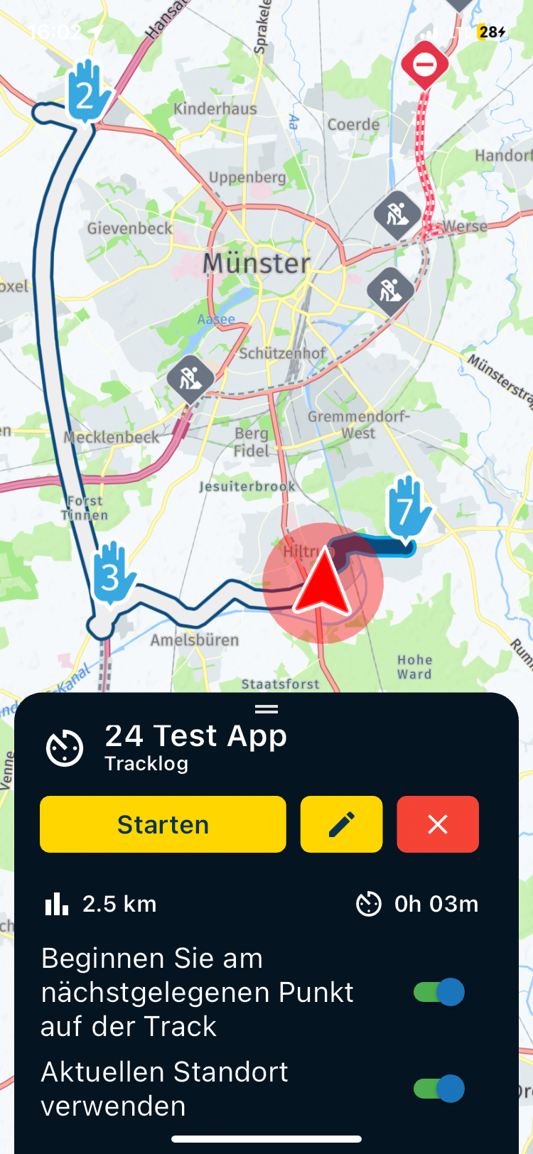
Track navigation
Yes, it existed. With that, most was said.
Generate a scenic route or roundtour and away you go!
Diverting from the route or losing an internet connection would result in major issues
Now not anymore!

Track navigation works completely offline! When you go offline (either by choice or chance) the track navigation will continue working and recalculating! There might be minor differences compared to the online calculation but you are warned about that. Besides that, the original calculation will always remain visible
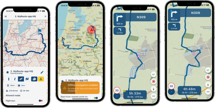
When you divert from your track, you will be redirected to the nearest logical point on the track. Yes, you might be sent back (depending on the location) but eventually (or immediately) you will be sent to another logical point on the track. Do you want to navigate to another section of the track? Just long press near the point where you want to rejoin!

Do you prefer navigating routes as track? Leave the already existing setting as you have it and away you go!
This works similar to the GPX 1.2 format on your Garmin.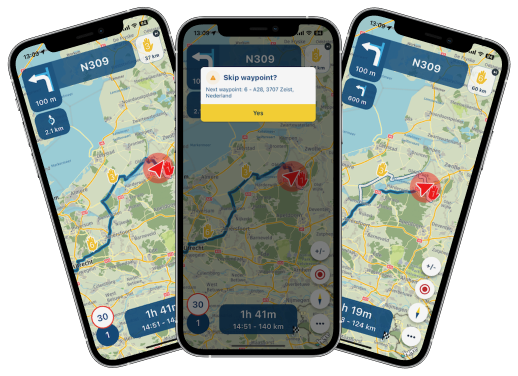
This means that even while navigating a track, you can skip your viapoints
How amazing is that! Because you are navigating a track, shapingpoints are obviously not included. After skipping a viapoint, the fastest route is calculated to the next viapoint 
When loading a track, you can now also change the setting to start from the nearest point on the track!
Long pressing near the point where you want to continue your track, also works before starting the navigation!
With this update, track navigation has been elevated to a level you could not have imagined. To be brutally honest, I have ridden a lot of routes as tracks and this might become my preferred method of navigating
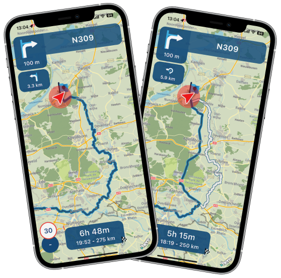
Dynamic routing
Whenever you're going from A to B, you often get into traffic and a faster route becomes available. When you've enabled traffic optimisation we will now continuously search for faster routes!
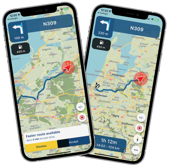
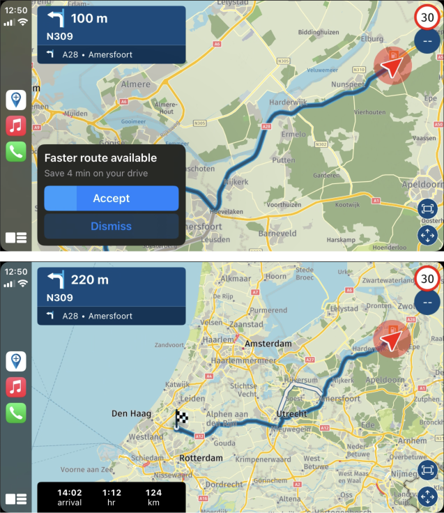
After accepting the new route (which will happen when you don’t decide within a certain time) you will still see the original route.
Traffic warnings
For all types of navigation, it is interesting to know if you are driving into traffic or pass an accident. Now that we are introducing the dynamic routing as explained above, it makes a lot of sense to also warn about traffic related events on your route.
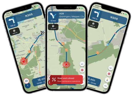
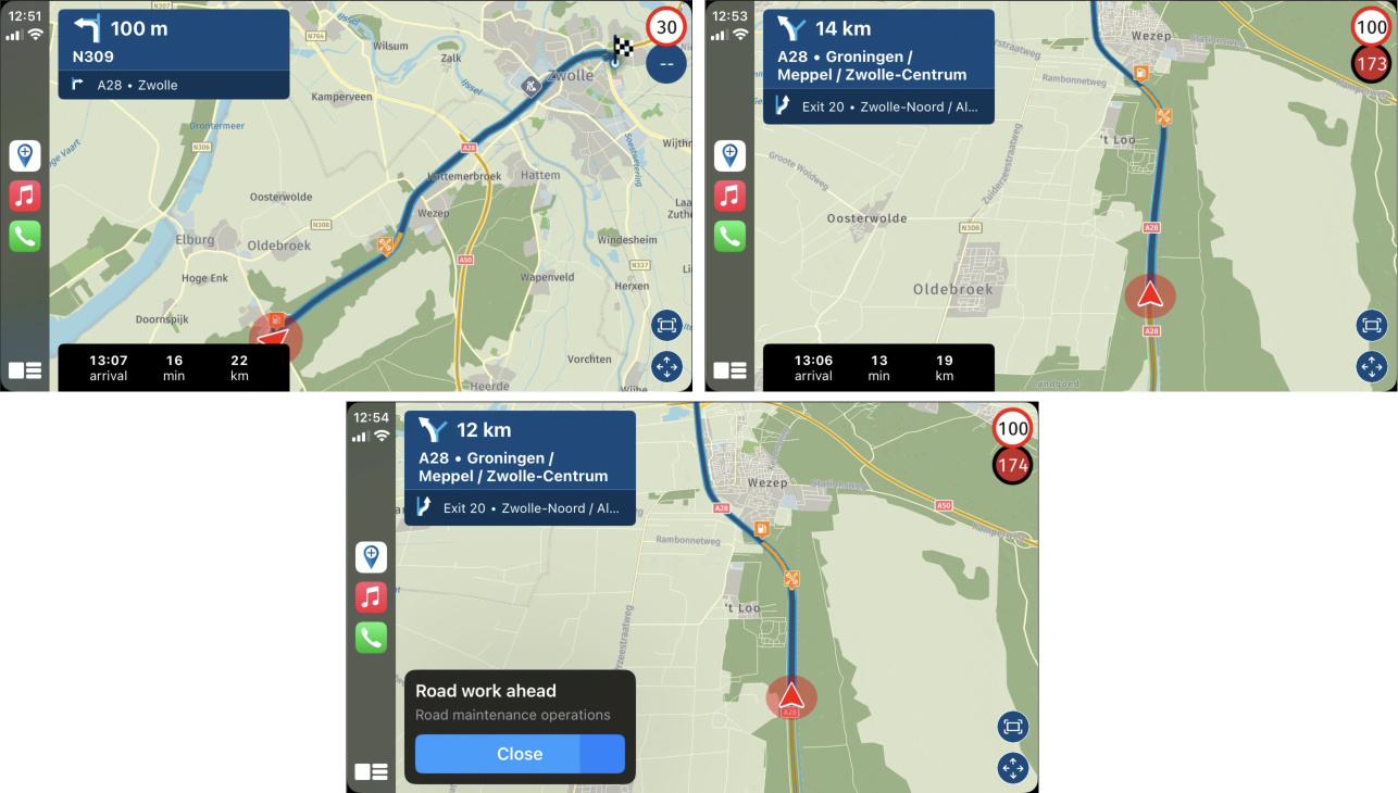
We will inform you about:
- Traffic flow delays (significantly queued traffic)
- Traffic incidents (accidents, closed lanes etc)
- Road work (known construction)
You can choose the enabled categories yourself from the settings.
When enabled we will show an icon on the map, update the line to show the length of the delay and push a visual / audio warning.If a faster alternative route is available, that will automatically be suggested too!
Destination reached
The amount of discussion on this topic on the forum has been incredible. Since the release of the app, people have different preferences regarding what the app should do when arriving at your destination.
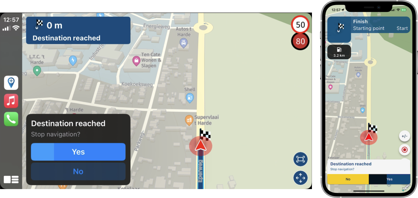
Now the app will prompt to stop navigation after reaching it.
The default setting is that navigation will stop.
You can disable this behavior. In that case, when no choice is made, it will continue navigating as it currently does.Updated settings
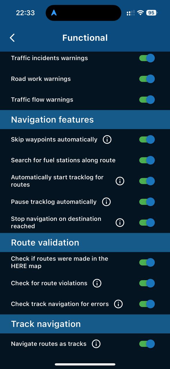
Check out all the updated settings and play around!
Most changes are within the functional settings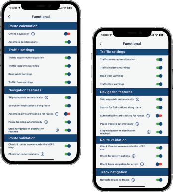
Automatic recalculations
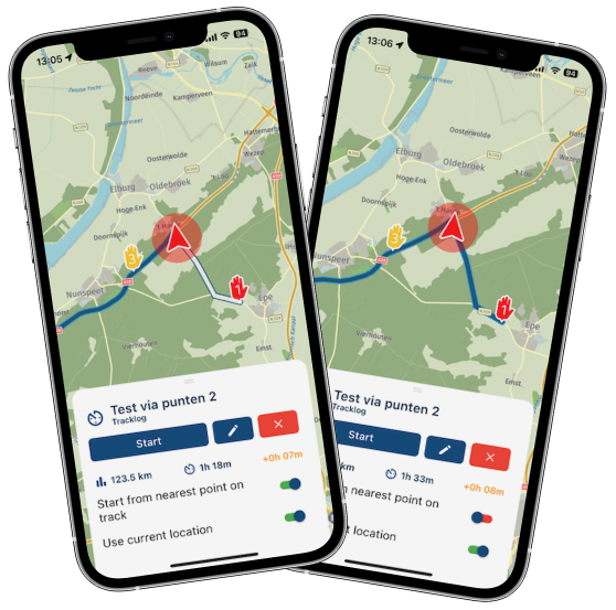
Garmin people will love this too! You can now turn off the automatic recalculations. This will force you to drive back to your route by yourself We will show the original route (as we always do) and stop actively guiding you back.Stop tracklog when stopping navigation
You can now make the tracklog pause when you stop navigating automatically. Saving is always up to youScaling improvement
Some people had very small icons / lines (especially on high resolution CarPlay / Android Auto devices) while using the app. We've improved the scaling behavior of these elements on different screen sizes. Besides that, in CP / AA the shown speed limit and current speed is increased in size for those big displays.Visual settings CarPlay / Android Auto
When you disable some visual elements from the settings, these are now also applied in CP / AA. Relevant ones are:- Speed limit
- Visual warnings
- Lane instructions
Position indicator size
You can now also increase / decrease the size of the position indicatorMinor improvements
- Better camera animations regarding tilt
- Back button behavior Android on home screen
- More waypoint information on skipping / resuming
- Position indicator not off screen when rotating phone anymore in some situations
- Improved shown original route data
- Slight changes to automatic waypoint skip algorithm
- Zoom level freedrive in CarPlay / Android Auto
What's next?
Well most of all, gathering your feedback and checking if everything works as expected. Besides that, the end of the year is approaching so not sure how much more massive things we will do before that
In this (and the last) updates we really try to focus on the core of the app. Previous updates had a lot of stability improvements and this one improves the navigational core of the app. My guess is, we will focus on any issues before releasing this and improving the stability furtherCheers,
Corjan@Corjan-Meijerink What great updates - I'll be able to use MRA for A to B now.
-
@Corjan-Meijerink Thanks for this. Just wondering how adding additional stops (petrol, coffee) should show; I appear to be able to select a venue in CarPlay but this does not get added to track. I understand that I am navigating as a track but curious how these will be added to the existing track or will I be able to? On the iPhone, do not have the’Add Stop’ option.
@Dave-J-0 Good find!
That should not be possible from CarPlay / Android Auto. The fact that it doesn't get added shows that too.I've made sure the button is hidden in the future beta update / release
-
This is one helluvan update!
Great work! -
Traffic warnings and reached destination pop ups are great and have worked well during use today. One little request, they disappear too quick and I find that I do not have time to read what the ‘pop up’ is saying if I am in a busy traffic environment. Personally, I could do with at least another five seconds (or configurable) before the pop up auto closes. Useful to know what others think.
Kind Regards. Help where I can.
Ducati Multistrada V4 Rally
iPhone 15 Pro
CHIGEE AIO-6 LTE
Google Pixel 6 Pro - mounted on SP Connect Plus
Ex Garmin XT2 and XT1 as well as Ex TomTom Rider User -
 undefined Corjan Meijerink referenced this topic on
-
Traffic warnings and reached destination pop ups are great and have worked well during use today. One little request, they disappear too quick and I find that I do not have time to read what the ‘pop up’ is saying if I am in a busy traffic environment. Personally, I could do with at least another five seconds (or configurable) before the pop up auto closes. Useful to know what others think.
@Dave-J-0 said in New beta! 4.3.4 (369) - massive navigation improvements:
Traffic warnings and reached destination pop ups are great and have worked well during use today. One little request, they disappear too quick and I find that I do not have time to read what the ‘pop up’ is saying if I am in a busy traffic environment. Personally, I could do with at least another five seconds (or configurable) before the pop up auto closes. Useful to know what others think.
I agree to that, it is too short.
I had it today, with traffic and roadworks and reaching destination. I like the update, great work.One question, why is an additional-added waypoint to a route, in red and a via point? According to route experts, a red WP is for detours or shortcuts.
Hardware
iPhone 12 pro (iOS 26.2.1)
iPad (7.Gen.) 18.7.3
Oukitel RT3 Pro (Andr. 14)
Wireless CarPlay mit (Elebest C650)
Wired CarPlay (SEAT Arona - 2021)
MRA Workshops in Deutsch sind hier zu finden -
@Dave-J-0 said in New beta! 4.3.4 (369) - massive navigation improvements:
Traffic warnings and reached destination pop ups are great and have worked well during use today. One little request, they disappear too quick and I find that I do not have time to read what the ‘pop up’ is saying if I am in a busy traffic environment. Personally, I could do with at least another five seconds (or configurable) before the pop up auto closes. Useful to know what others think.
I agree to that, it is too short.
I had it today, with traffic and roadworks and reaching destination. I like the update, great work.One question, why is an additional-added waypoint to a route, in red and a via point? According to route experts, a red WP is for detours or shortcuts.
@Jörgen said in New beta! 4.3.4 (369) - massive navigation improvements:
One question, why is an additional-added waypoint to a route, in red and a via point? According to route experts, a red WP is for detours or shortcuts.
RouteXperts use pink to indicate detours or shortcuts.
Red is used for stops, fuel, coffee, lunch etc etcAlways willing to help if I can.
Triumph Tiger 1200 XRT called Tina.
MRA Navigation Next and SilverFox BJ8 -
@Jörgen said in New beta! 4.3.4 (369) - massive navigation improvements:
One question, why is an additional-added waypoint to a route, in red and a via point? According to route experts, a red WP is for detours or shortcuts.
RouteXperts use pink to indicate detours or shortcuts.
Red is used for stops, fuel, coffee, lunch etc etc@Nick-Carthew You are right, my fault.
Anyway in my opinon, a added WP should be by default blue.Hardware
iPhone 12 pro (iOS 26.2.1)
iPad (7.Gen.) 18.7.3
Oukitel RT3 Pro (Andr. 14)
Wireless CarPlay mit (Elebest C650)
Wired CarPlay (SEAT Arona - 2021)
MRA Workshops in Deutsch sind hier zu finden -
@Nick-Carthew You are right, my fault.
Anyway in my opinon, a added WP should be by default blue.@Jörgen it's red because well...it's a stop
Makes it stand out as all your others might be blue already.
After passing or skipping it, it is removed from your route entirely.
I do not feel the need to change this. -
@Jörgen it's red because well...it's a stop
Makes it stand out as all your others might be blue already.
After passing or skipping it, it is removed from your route entirely.
I do not feel the need to change this.Hey Corjan, today I drove a test route with the car that was navigated offline as a tracklog.
Went very well

During the test I stopped the navigation on the way then started a completely new one to see how a navigation as a tracklog bypasses the remote location.
After checking the settings everything was as expected, the location was taken over and we went directly to the destination so everything is fine

Then at the end of the third offline start came an unexpected crash! I shared this as test beta feedback.
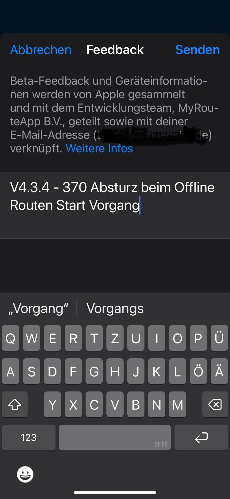
That's how the settings were!
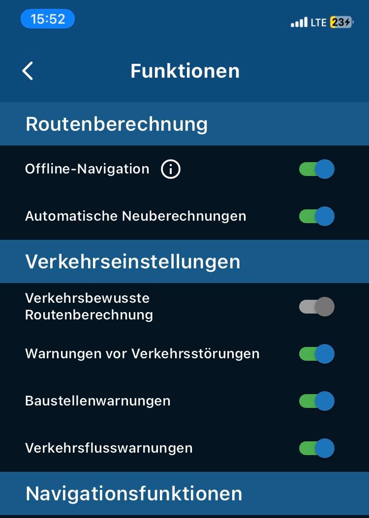
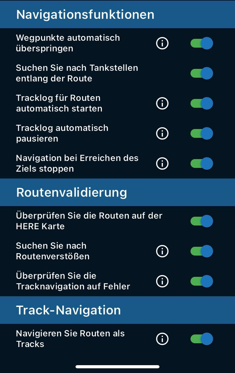
VG Hubert
Beta Test "Next App" dazu die Hardware .
iPad 9. Gen iOS 26.5.2/ iPhone 16e iOS 26.5.2/ Navi iPhone Xr iOS 18.7.9 / PC mit MS Win11 /❗️MyRoute-App im Cradel und Remotek-One❗️ Info zu MRA & Remotek One
Hello! It looks like you're interested in this conversation, but you don't have an account yet.
Getting fed up of having to scroll through the same posts each visit? When you register for an account, you'll always come back to exactly where you were before, and choose to be notified of new replies (either via email, or push notification). You'll also be able to save bookmarks and upvote posts to show your appreciation to other community members.
With your input, this post could be even better 💗
Register Login-
413176
-
018305
-
020542
-
05163
-
112302
-
0368
-
05110
-
3171.6k